

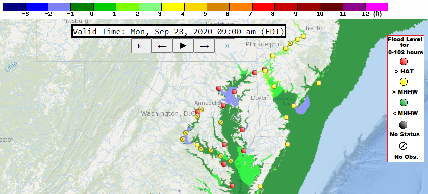
- Coastal Hazard Map
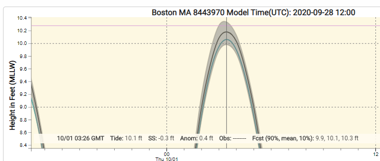
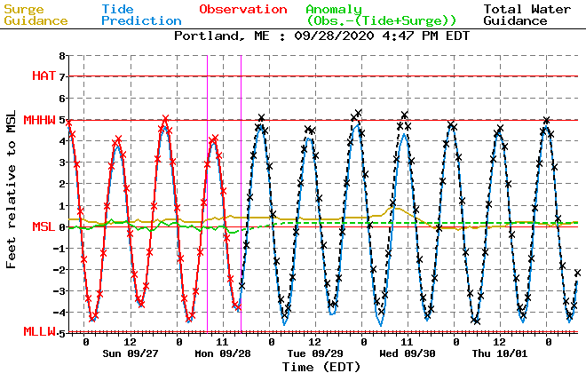
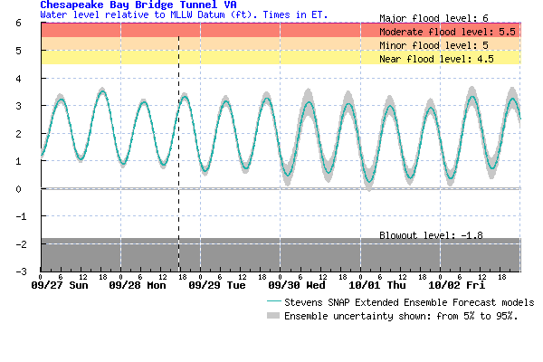
- Water Level Quicklook
- Inundation and Impact Resources
- Local Resources
- Forecast Display
High Tide Cycle
Display updated:

Coastal Hazard Overlays
Data Overlays
Total Water Level Forecast
Observed Wave Height
Total Water Level Forecast
Observed Wave Height
Major Flooding
Moderate Flooding
Minor Flooding
No Flooding
Status Unavailable
Forecasted Flood Level Guidance
 |
ETSS Storm Surge ModelThis product is experimental total water level model guidance for tide gauges. Water level guidance is for extra-tropical storms. |
 |
PETSS Storm Surge ModelThis product is experimental total water level probabilistic model guidance for tide gauges. Water level guidance is for extra-tropical storms. |
 |
ESTOFS Storm Surge ModelThis product is experimental total water level model guidance for tide gauges. Water level guidance is for extra-tropical storms. |
 |
Stevens Flood Advisory SystemThis product is experimental total water level probabilistic model guidance for tide gauges. |
National Ocean Service & USGS Resources
 |
NOS Tides & CurrentsHomepage to numerous coastal water level resources. |
 |
NOS Sea Level & Coastal Flooding InformationHomepage to national source for coastal inundation data and sea level trends. |
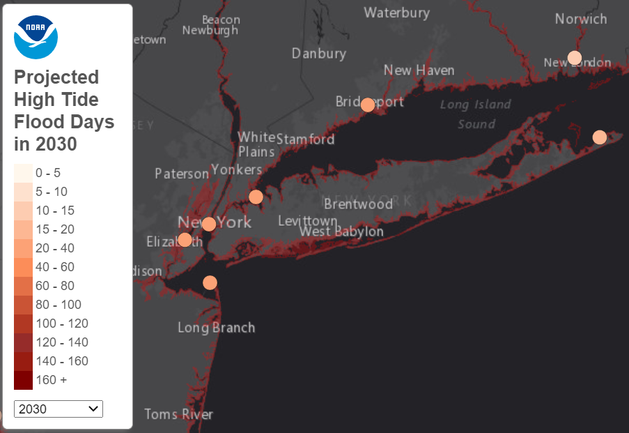 |
The State of High Tide FloodingInterface that displays "sunny day" flood occurrence along the U.S. coastline. Tool also displays potential future high tide flood days in the future. |
.PNG) |
NOS High Tide Flooding Bulletins & ReportsNOAA seasonal high tide bulletins show when regions around the nation may experience higher than normal tides. |
.PNG) |
USGS Coastal Change Hazards PortalInteractive portal to coastal change science and data for our Nation's coasts. |
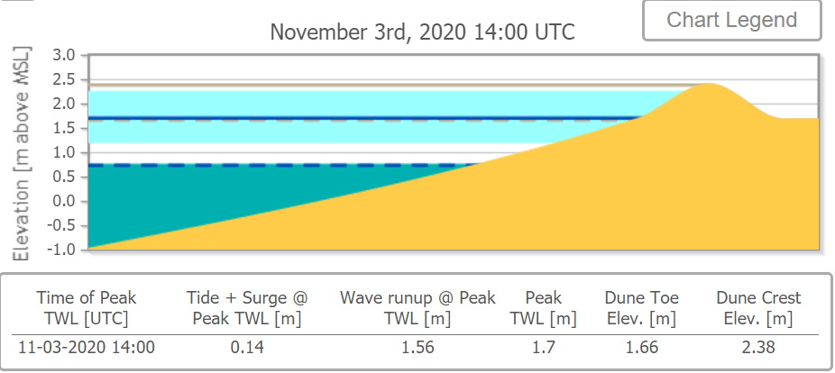 |
USGS Total Water Level & Coastal Change Forecast ViewerTool displays total water level forecasts and coastal change predictions along the U.S. coastline using local beach characteristics. This tool graphically displays dune erosion/overtopping potential. |
FEMA Coastal Flood Resources
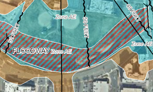 |
FEMA Flood MapsFEMA flood map service is the official public source for flood hazard information produced in support of the National Flood Insurance Program. |
 |
FEMA Coastal Flood RiskFEMA homepage for coastal flooding resources. Includes risk mapping, mitigation planning and flood insurance studies. |
 Follow us on YouTube