A slow-moving cold front combined with strong instability and plentiful moisture to initially produce isolated severe thunderstorms in and near the Laredo area during the early evening hours of March 18th. Eventually, the storms became better organized and formed into a squall line mainly over the southern half of South Texas. Once they organized, the line intensified and moved rapidly toward the coast. The following is a brief summary of how the event transpired.
The morning sounding at Corpus Christi on March 18th showed a morning cap in the mid levels, with turning of the winds with height (known as "wind shear") and a lot of potential instability. For thunderstorms to develop during the afternoon over South Texas (and areas just to the north), afternoon temperatures would have to reach the mid to upper 80s, unless additional forcing became available. This additional forcing occurred over South Central Texas, as well as the Sierra Madre (a mountain range in Eastern Mexico) during the late afternoon, as a weak upper level disturbance, easterly flow into the Mexican mountains (lifting the moisture), and a cold front began to impact western-most portions of Texas and the Sierra Madre. Also, by late afternoon, temperatures had reached 90 degrees in the city of Laredo. All of these influences resulted in thunderstorms developing out west in the late afternoon and early evening.
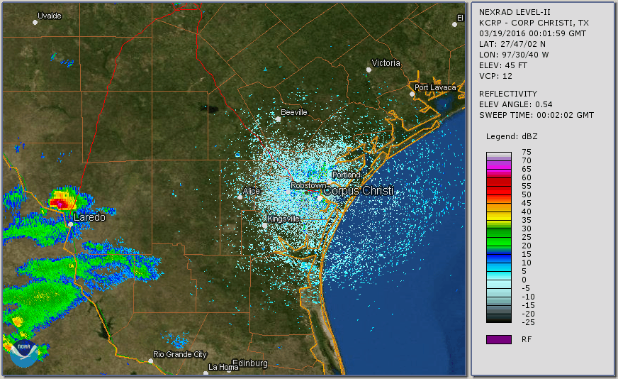
| KCRP Radar Loop - 701 PM CDT March 18 through 1001 AM CDT March 19, 2016 |
|---|
 |
The cap weakened just enough over Western Webb County (possibly due to the weak upper level support) to generate isolated severe thunderstorms, especially north of, and in the northern portions of the city of Laredo. Initially, only one storm formed just north of Laredo, but then the storm split into two storms, with the south-moving storm moving into the northern portions of Laredo. The storms produced quarter to golf-ball sized hail during their strongest times. One of the storm spotters on Mines Road just northwest of Laredo reported hail falling for around 40 minutes! Since the storms over Western Webb County showed very little movement at times, these storms produced very heavy rainfall. Doppler and coop observer rainfall amounts of 1 to more than 3 inches were noted over Western Webb County, some of which fell in less than 1 hour. However, no significant flooding was reported. You can see a time lapse of these storms in Western Webb County by clicking here.
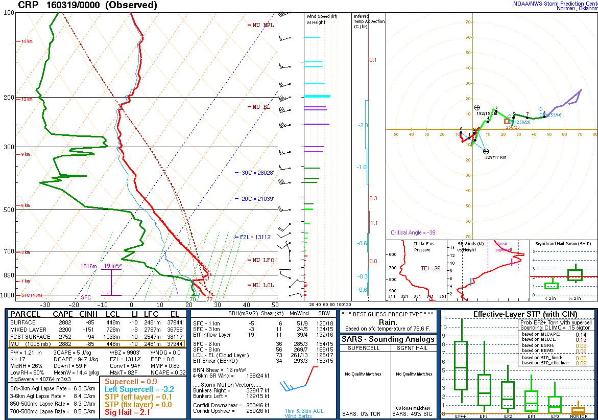
As the radar loop for the storms in Western Webb County showed, additional thunderstorms began to develop near (both east and west) the Rio Grande. These additional storms developed partly with the help of the aforementioned upper disturbance, but also due to the enhanced surface forcing due to outflow boundaries generated by the thunderstorms. On top of that, by mid evening the cold front began moving into northern portions of South Texas, bringing additional thunderstorms. As this happened, the storm over Webb County began to organize into a squall line around 10 PM. This organized line of thunderstorms was able to create an environment which could readily break the cap as the line moved east toward the coast, due largely in part to the much stronger surface forcing generated by the organized convection. As the cap broke, the strong instability (also known as "CAPE", or potential energy available in the atmosphere) was converted to kinetic energy in the form of winds. The weak mid level cap, as shown in the evening sounding at Corpus Christi was no match for the surface forcing the squall line was generating!
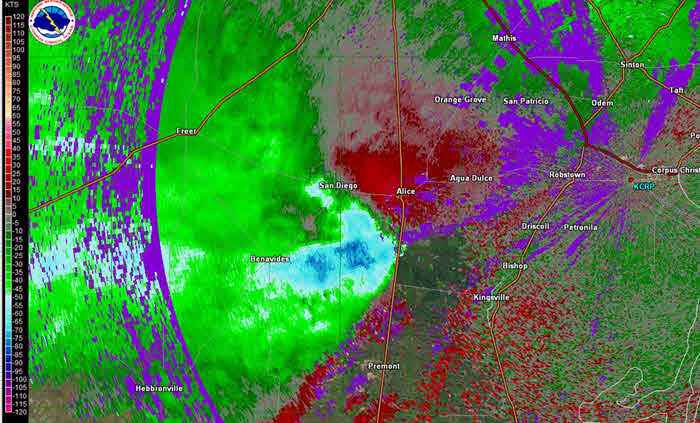
With the convection now more organized, the storms began to move rapidly east toward the Gulf of Mexico. There were still some strong to severe storms in La Salle, Goliad, and Victoria Counties through the late evening hours. Some of the initial severe weather reports included: winds of 67 mph observed by a fire weather station about 5 miles northeast of Victoria, very large trees down near Artesia Wells in La Salle County, and a 150 foot Internet Tower collapsing on a house about 10 miles northeast of Goliad. However, the main show was the ever-progressive squall line. The line moved rapidly through the remainder of the Southern Brush Country and Western Coastal Bend, producing winds estimated by Doppler radar between 60 to 85 knots (69 to 98 mph) over portions of Jim Wells and Duval Counties around 1140 PM, just a few thousand feet above the ground. The radar was showing a bow echo at the same time, a distinctive radar feature indicating strong, straight-line winds. Wind damage was reported in portions of Duval and Jim Wells County, as well as quarter-sized hail in Benavides (see storm reports section).
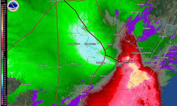
The squall line rapidly reached the southern coastal counties around midnight, and the coast around 1 AM. For a close-up view of the storms as they approached Corpus Christi and moved into the Gulf of Mexico, click here. The line moved through the western portions of Nueces and Kleberg Counties (including the city of Kingsville) shortly after midnight. Winds in excess of 60 mph and wind damage was reported in the western portions of these counties, including downed power poles, roof damage, and 18-wheelers blown over on U. S. Highway 77. Wind gusts of 68 mph were measured at the Corpus Christi International Airport at 1242 AM. By the time the storms reached the South Side and downtown area of Corpus Christi around 1 AM March 19, the radar was estimating a large area of strong winds between 60 and 80 knots (69 to 92 mph) less than 1000 feet above the ground! Reported wind gusts between 60 and 70 mph were common, with a gust of 78 mph reported at NAS Corpus Christi! Also, note from the previous velocity image that winds behind the main part of the squall line remained strong, with Doppler radar estimates of 50 to 60 knots near and west of the Corpus Christi Airport.
As the squall line moved through the coastal counties, additional reports of wind damage to power poles, trees and roofs in portions of Nueces, Kleberg and San Patricio Counties were received. Farther north, the storms were not as intense, but did produce winds between 45 and 57 mph over portions of Aransas, Calhoun, and Refugio Counties. This intense line finally reached the coast around 1 AM, then moved offshore. The line of storms continued to produce winds over the bays and the gulf waters anywhere between 40 mph to nearly 90 mph, the latter speeds recorded by offshore platforms around 80 feet tall.
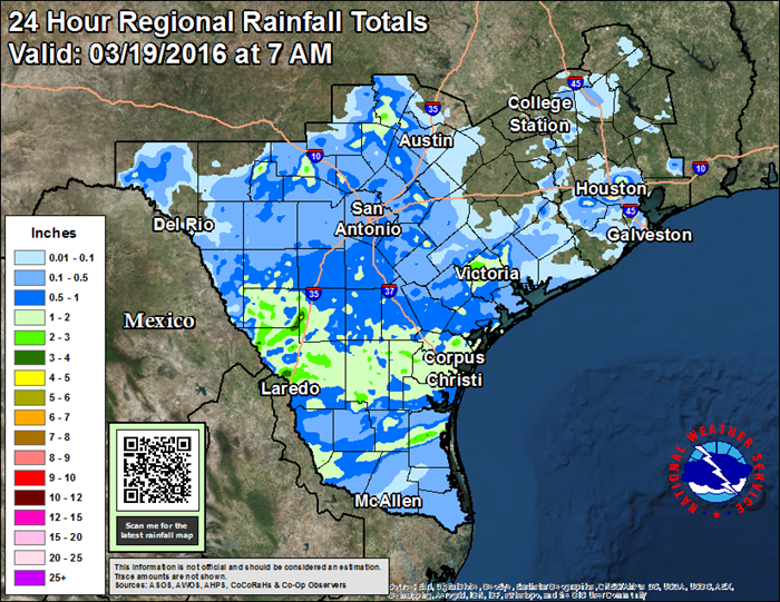
The 24-Hour rainfall map for the period ending 7 AM March 19 showed most of South Texas receiving at least 1/2 inch of rainfall, with scattered rainfall amounts of more than 1 1/2 inches. Portions of Webb, La Salle and Victoria Counties received between 2 1/2 to 4 inches of precipitation. No significant inland flooding was reported or observed, although the Oso Creek at Corpus Christi rose above the flood stage of 20 feet Saturday morning, crested around 21.5 feet Saturday afternoon, then fell below flood stage Saturday night.
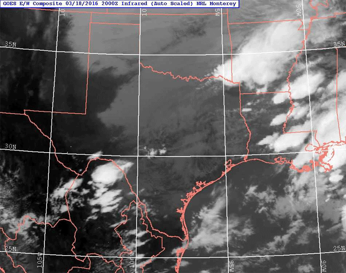 |
| Infrared Satellite Loop - 300 PM CDT March 18 through 1000 AM CDT March 19, 2016 |
|---|
PRELIMINARY LOCAL STORM REPORT...SUMMARY
NATIONAL WEATHER SERVICE CORPUS CHRISTI TX
1152 AM CDT SUN MAR 20 2016

..TIME...   ...EVENT...      ...CITY LOCATION...     ...LAT.LON...
..DATE...   ....MAG....      ..COUNTY LOCATION..ST.. ...SOURCE....
            ..REMARKS..

0800 PM     HAIL             11 NW LAREDO            27.65N 99.61W
03/18/2016  E0.75 INCH       WEBB               TX   TRAINED SPOTTER

            DIME TO PENNY SIZE HAIL REPORTED BY SPOTTER NEAR THE
            GREEN RANCH SUBDIVISION AND MINES ROAD.

0822 PM     HAIL             LAREDO                  27.90N 99.63W
03/18/2016  E0.75 INCH       WEBB               TX   TRAINED SPOTTER

            DIME TO PENNY SIZED HAIL LOOPE 20 AND SHILOH

0827 PM     HAIL             2 NW LAREDO             27.55N 99.51W
03/18/2016  M1.00 INCH       WEBB               TX   TRAINED SPOTTER

            MINES RD.

0830 PM     HAIL             3 N LAREDO              27.58N 99.48W
03/18/2016  E1.00 INCH       WEBB               TX   COCORAHS

            LINDENWOOD DR BEHIND UNITED MIDDLE SCHOOL

0844 PM     HAIL             5 NNW LAREDO            27.59N 99.53W
03/18/2016  E1.75 INCH       WEBB               TX   TRAINED SPOTTER

            GOLF BALL SIZED HAIL ACROSS THE NORTHWEST SIDE OF LAREDO.


1014 PM     TSTM WND DMG     5 S ARTESIA WELLS       28.21N 99.29W
03/18/2016                   LA SALLE           TX   PUBLIC

            PICTURES SUBMITTED FROM PUBLIC OF LARGE TO VERY LARGE
            TREES DOWN. ROOF DAMAGE ALSO REPORTED TO CHURCH. TIME
            ESTIMATED FROM RADAR.

1050 PM     TSTM WND DMG     10 NE GOLIAD            28.77N 97.27W
03/18/2016                   GOLIAD             TX   PUBLIC

            150 FT. INTERNET TOWER COLLAPSED ON HOUSE ALONG BEGO ROAD


1130 PM     TSTM WND DMG     SE BENAVIDES            27.59N 98.41W
03/18/2016                   DUVAL              TX   NWS STORM SURVEY

            LARGE HEALTHY TREE UPROOTED ALONG WITH OTHER TREES
            DOWNED. ROOF DAMAGE TO HOME.

1136 PM     HAIL             BENAVIDES               27.60N 98.41W
03/18/2016  E1.00 INCH       DUVAL              TX   PUBLIC

            PUBLIC REPORTED QUARTER SIZE HAIL IN BENAVIDES.

1139 PM     TSTM WND GST     5 NE VICTORIA           28.86N 96.92W
03/18/2016  M67.00 MPH       VICTORIA           TX   MESONET

            RAWS SITE MEASURED GUST OF 67 MPH. NOTE OB REPORTED AT
            0504 UTC. SITE ONLY REPORTS ONCE AN HOUR AND SEVERE GUST
            IS FOR PREVIOUS ENTIRE 60 MINUTE PERIOD. THUS...TIME IS
            ESTIMATED FROM RADAR VELOCITY.

1139 PM     TSTM WND DMG     1 S PALITO BLANCO       27.58N 98.19W
03/18/2016                   JIM WELLS          TX   NWS STORM SURVEY

            SCATTERED COVERAGE OF LARGE TREES DOWNED. ROOF DAMAGE TO
            HOMES.

1143 PM     TSTM WND DMG     1 N BEN BOLT            27.66N 98.08W
03/18/2016                   JIM WELLS          TX   NWS STORM SURVEY

            CARPORT PULLED FROM GROUND AND DESTROYED. LARGE STRONG
            FENCE DESTROYED. ESTIMATED WIND SPEEDS OF AROUND 70 MPH.

1145 PM     TSTM WND DMG     3 S ALICE               27.71N 98.07W
03/18/2016                   JIM WELLS          TX   EMERGENCY MNGR

            18-WHEELER FLIPPED ALONG HWY 281 AND FM 1930

1155 PM     HAIL             VICTORIA                28.82N 96.98W
03/18/2016  E0.25 INCH       VICTORIA           TX   LAW ENFORCEMENT

1201 AM     TSTM WND DMG     ALICE                   27.76N 98.07W
03/19/2016                   JIM WELLS          TX   TRAINED SPOTTER

            TREES DOWN IN ALICE ALONG CECILIA STREET

1203 AM     TSTM WND GST     ALICE                   27.76N 98.07W
03/19/2016  M64.00 MPH       JIM WELLS          TX   ASOS

1204 AM     TSTM WND DMG     2 NNW KINGSVILLE        27.53N 97.88W
03/19/2016                   KLEBERG            TX   EMERGENCY MNGR

            ROOF DAMAGE NEAR N ARMSTRONG AND AVE I. ROOF TO CAR PORT
            BLOWN OFF.

1206 AM     TSTM WND DMG     1 N KINGSVILLE          27.52N 97.86W
03/19/2016                   KLEBERG            TX   TRAINED SPOTTER

            LARGE TREE LIMBS DOWN

1207 AM     TSTM WND DMG     BISHOP                  27.58N 97.80W
03/19/2016                   NUECES             TX   PUBLIC

            LARGE TREES DOWN ON PROPERTY IN BISHOP

1208 AM     TSTM WND DMG     5 S AGUA DULCE          27.72N 97.91W
03/19/2016                   NUECES             TX   DEPT OF HIGHWAYS

            TXDOT STATED 14 POWER POLES DOWN ON FM 70 JUST SOUTH OF
            665.

1208 AM     TSTM WND DMG     RICARDO                 27.42N 97.85W
03/19/2016                   KLEBERG            TX   EMERGENCY MNGR

            ROOF DAMAGE TO BARN

1210 AM     TSTM WND DMG     DRISCOLL                27.67N 97.75W
03/19/2016                   NUECES             TX   NWS STORM SURVEY

            LARGE TREES DOWN. SEVERAL MODERATE TO POORLY CONSTRUCTED
            HOMES SUFFERED ROOF DAMAGE. ESTIMATED 60 TO 70 MPH WIND.


1225 AM     TSTM WND DMG     PETRONILA               27.67N 97.63W
03/19/2016                   NUECES             TX   NWS STORM SURVEY

            SEVERAL POWER POLES BLOWN DOWN FROM PETRONILA TO TIERRA
            GRANDE. MINOR ROOF DAMAGE TO PROPERTIES.

1240 AM     TSTM WND DMG     3 SE CORPUS CHRISTI     27.72N 97.39W
03/19/2016                   NUECES             TX   PUBLIC

            ROOF OF METAL BUILDING AT U-HAUL STORAGE FACILITY BLOWN
            ON NEIGHBORING HOUSE ON FRENCH DRIVE NEAR MT. VERNON DR.

1242 AM     MARINE TSTM WIND 3 NNW MALAQUITE BEACH   27.48N 97.32W
03/19/2016  M60.00 MPH       KLEBERG            TX   MESONET

            SOUTH BIRD ISLAND TCOON SITE MEASURED GUST TO 52 KNOTS.

1242 AM     TSTM WND GST     CORPUS CHRISTI          27.75N 97.42W
03/19/2016  M68.00 MPH       NUECES             TX   ASOS

1243 AM     TSTM WND DMG     6 WSW CORPUS CHRISTI    27.71N 97.51W
03/19/2016                   NUECES             TX   OFFICIAL NWS OBS

            LARGE TREE UPROOTED AT NWS CORPUS CHRSITI. WINDS
            ESTIMATED 65 TO 70 MPH.

1243 AM     TSTM WND GST     3 S CORPUS CHRISTI      27.71N 97.43W
03/19/2016  M66.00 MPH       NUECES             TX   ASOS

            66 MPH THUNDERSTORM WIND GUST RECORDED AT CABANISS FIELD.


1245 AM     MARINE TSTM WIND 5 ESE CORPUS CHRISTI    27.72N 97.34W
03/19/2016  M62.00 MPH       NUECES             TX   MESONET

            WEATHERFLOW MARINE SITE ALONG CORPUS CHRISTI BAY AT
            POENISCH PARK MEASURED GUST TO 54 KNOTS.

1245 AM     TSTM WND DMG     7 SW CORPUS CHRISTI     27.63N 97.37W
03/19/2016                   NUECES             TX   NWS STORM SURVEY

            SEVERAL POWER POLES DOWN AND MEDIUM SIZED TREES UPROOTED
            FROM INTERSECTION OF CR 26 AND FM 763...NORTH TO
            INTERSECTION OF FM 665 AND FM 763. DAMAGE TO HORSE SHEDS
            AS WELL.

1245 AM     TSTM WND GST     CORPUS CHRISTI          27.71N 97.29W
03/19/2016  E60.00 MPH       NUECES             TX   TRAINED SPOTTER

            60 MPH WINDS AND PENNY SIZE HAIL REPORTED BY SPOTTER AT
            WEBER AND GOLLIHAR.

1250 AM     TSTM WND GST     CC NAS                  27.69N 97.29W
03/19/2016  M62.00 MPH       NUECES             TX   ASOS

            KNGP ASOS

1254 AM     MARINE TSTM WIND 12 SSW MALAQUITE BEACH  27.30N 97.40W
03/19/2016  M67.00 MPH       KLEBERG            TX   MESONET

            BAFFIN BAY TCOON SITE MEASURED GUST OF 58 KNOTS.

1255 AM     TSTM WND GST     CC NAS                  27.69N 97.29W
03/19/2016  M66.00 MPH       NUECES             TX   ASOS

            KNGP ASOS

1256 AM     TSTM WND GST     CC NAS                  27.69N 97.29W
03/19/2016  M70.00 MPH       NUECES             TX   ASOS

            KNGP ASOS

0100 AM     MARINE TSTM WIND SSE PADRE BALLI PARK    27.58N 97.22W
03/19/2016  M55.00 MPH       NUECES             TX   MESONET

            BOB HALL PIER MEASURED PEAK GUST OF 48 KNOTS.

0103 AM     TSTM WND GST     CC NAS                  27.69N 97.29W
03/19/2016  M78.00 MPH       NUECES             TX   ASOS

            KNGP ASOS

0106 AM     MARINE TSTM WIND 2 NNW PADRE ISLES COUNT 27.63N 97.24W
03/19/2016  M63.00 MPH       NUECES             TX   MESONET

            PACKERY CHANNEL TCOON SITE MEASURED GUST OF 55 KNOTS.

0106 AM     MARINE TSTM WIND 2 SE FLOUR BLUFF        27.64N 97.29W
03/19/2016  M61.00 MPH       NUECES             TX   MESONET

            WEATHERFLOW SITE ALONG LAGUNA SHORES MEASURED GUST TO 53
            KNOTS.

0110 AM     TSTM WND DMG     DRISCOLL                27.67N 97.75W
03/19/2016                   NUECES             TX   LAW ENFORCEMENT

            DPS CORPUS CHRISTI REPORTS POWER POLES DOWN ALONG HIGHWAY
            77. ALSO...SEVERAL SEMI TRUCKS BLOWN OVER ON HIGHWAY 77.


0110 AM     TSTM WND DMG     SSE INGLESIDE           27.87N 97.21W
03/19/2016                   SAN PATRICIO       TX   TRAINED SPOTTER

            LARGE TREES UPROOTED

0112 AM     TSTM WND DMG     1 E INGLESIDE           27.88N 97.20W
03/19/2016                   SAN PATRICIO       TX   TRAINED SPOTTER

            ROOF DAMAGE TO CONOCO GAS STATION

0123 AM     TSTM WND DMG     2 NE MUSTANG ISLAND STA 27.70N 97.16W
03/19/2016                   NUECES             TX   FIRE DEPT/RESCUE

            POWER POLE SNAPPED WITH POWER LINE DOWN ON TEXAS HWY 361

0124 AM     MARINE TSTM WIND CORPUS CHRISTI          27.75N 97.42W
03/19/2016  E43.00 MPH       NUECES             TX   C-MAN STATION

            BOB HALL PIER REPORTS 37 KNOTS WIND GUSTS

0124 AM     MARINE TSTM WIND ARANSAS PASS            27.90N 97.15W
03/19/2016  E58.00 MPH       SAN PATRICIO       TX   SHIP

            MARINER ON BOARD VESSEL AT ARANSAS PASS

0125 AM     MARINE TSTM WIND 3 E PORTLAND            27.89N 97.27W
03/19/2016  M48.00 MPH       SAN PATRICIO       TX   MESONET

            MARINE MESONET ALONG LAQUINTA SHIP CHANNEL MEASURED GUST
            OF 42 KNOTS.

0125 AM     MARINE TSTM WIND 1 S PORTLAND            27.87N 97.32W
03/19/2016  M51.00 MPH       SAN PATRICIO       TX   MESONET

            WEATHERFLOW MARINE SITE ALONG CORPUS CHRISTI BAY NEAR
            PORTLAND MEASURED GUST TO 44 KNOTS.

0127 AM     MARINE TSTM WIND 2 S WALDRON FIELD       27.60N 97.30W
03/19/2016  M56.00 MPH       NUECES             TX   MESONET

            WEATHERFLOW HURRICANE SITE MEASURED GUST TO 49 KNOTS.

0130 AM     MARINE TSTM WIND 1 NNW PORT ARANSAS      27.84N 97.07W
03/19/2016  M57.00 MPH       ARANSAS            TX   MESONET

            PORT ARANSAS TCOON SITE MEASURED PEAK GUST OF 49 KNOTS.

0131 AM     TSTM WND GST     CC NAS                  27.69N 97.29W
03/19/2016  M60.00 MPH       NUECES             TX   ASOS

            KNGP ASOS

0135 AM     MARINE TSTM WIND 1 ESE ARANSAS PASS      27.90N 97.14W
03/19/2016  M60.00 MPH       SAN PATRICIO       TX   MESONET

            MARINE MESONET MEASURED PEAK GUST OF 52 KNOTS.

0154 AM     MARINE TSTM WIND 1 S ROCKPORT            28.02N 97.05W
03/19/2016  M45.00 MPH       ARANSAS            TX   OTHER FEDERAL

            ROCKPORT NOS MEASURED GUST OF 39 KNOTS.

0200 AM     MARINE TSTM WIND 1 E PORT ARANSAS        27.83N 97.05W
03/19/2016  M42.00 MPH       NUECES             TX   C-MAN STATION

            PTAT2 MEASURED PEAK GUST OF 37 KNOTS

0224 AM     MARINE TSTM WIND 2 WSW LAMAR             28.13N 97.03W
03/19/2016  M45.00 MPH       GMZ235             TX   OTHER FEDERAL

            COPANO EAST NOS/NERRS MEASURED GUST OF 39 KNOTS.

0235 AM     MARINE TSTM WIND 44 SE MATAGORDA ISLAND  27.83N 96.01W
03/19/2016  M86.00 MPH       GMZ275             XX   AWOS

            BRAZOS 133B PLATFORM MEASURED GUST OF 75 KNOTS.
            INSTRUMENT HEIGHT IS P0FT AGL.

0255 AM     MARINE TSTM WIND 45 SSE MATAGORDA ISLAND 27.73N 96.19W
03/19/2016  M84.00 MPH       GMZ275             XX   AWOS

            PLATFORM A85A MEASURED PEAK GUST OF 73 KNOTS. PLATFORM IS
            86 FT AGL.

0312 AM     MARINE TSTM WIND 12 E LAMAR              28.12N 96.80W
03/19/2016  M49.00 MPH       CALHOUN            TX   MESONET

            MATAGORDA ISLAND MEASURED GUST TO 43 KNOTS.
| Doppler Radar Velocities - 1141 PM CDT March 18 2016 |
|---|
 |
PUBLIC INFORMATION STATEMENT
NATIONAL WEATHER SERVICE CORPUS CHRISTI TX
745 AM CDT SAT MAR 19 2016

...WIND REPORTS PAST 12 HOURS...

LOCATION                     SPEED     TIME/DATE       LAT/LON
CORPUS CHRISTI NAS           78 MPH    0101 AM 03/19   27.70N/97.28W
CORPUS CHRISTI               68 MPH    1242 AM 03/19   27.78N/97.51W
5 ENE VICTORIA               67 MPH    1204 AM 03/19   28.86N/96.92W
ALICE INTERNATIONAL ARPT     64 MPH    1202 AM 03/19   27.74N/98.02W
4 ESE FLOUR BLUFF            63 MPH    0106 AM 03/19   27.63N/97.24W
1 SE FLOUR BLUFF             61 MPH    0106 AM 03/19   27.64N/97.29W
1 SSE ARANSAS PASS           60 MPH    0135 AM 03/19   27.90N/97.14W
10 SE CHAPMAN RANCH          60 MPH    0142 AM 03/19   27.48N/97.32W
ROBSTOWN                     60 MPH    1235 AM 03/19   27.78N/97.69W
7 SE ARANSAS PASS            57 MPH    0130 AM 03/19   27.84N/97.07W
3 S FLOUR BLUFF              57 MPH    0127 AM 03/19   27.60N/97.30W
REGIONAL AIRPORT             56 MPH    1147 PM 03/18   28.85N/96.92W
18 E LOYOLA BEACH            55 MPH    0100 AM 03/19   27.30N/97.40W
7 SE FLOUR BLUFF             54 MPH    0124 AM 03/19   27.58N/97.22W
3 S TELFERNER                53 MPH    1200 AM 03/19   28.78N/96.83W
5 W FLOUR BLUFF              53 MPH    0124 AM 03/19   27.65N/97.39W
3 WNW CORPUS CHRISTI         52 MPH    0115 AM 03/19   27.72N/97.34W
PORTLAND                     52 MPH    0125 AM 03/19   27.87N/97.32W
COTULLA-LASALLE COUNTY AIRPO 49 MPH    0108 AM 03/19   28.46N/99.22W
15 ENE FULTON                49 MPH    0312 AM 03/19   28.12N/96.80W
3 NW VICTORIA                46 MPH    1139 PM 03/18   28.85N/97.02W
NAVAL AUXILARY LANDING FIELD 45 MPH    0203 AM 03/19   27.90N/98.05W
ARANSAS COUNTY AIRPORT       45 MPH    0157 AM 03/19   28.09N/97.04W
1 NE LAREDO                  43 MPH    0954 PM 03/18   27.55N/99.47W
9 SE ARANSAS PASS            43 MPH    0200 AM 03/19   27.83N/97.05W
4 ENE SEADRIFT               41 MPH    0227 AM 03/19   28.41N/96.63W
PORT LAVACA                  41 MPH    1240 AM 03/19   28.65N/96.68W
3 SW BEEVILLE                38 MPH    0115 AM 03/19   28.37N/97.78W
1 E VICTORIA                 36 MPH    1154 PM 03/18   28.83N/96.95W
1 SSE KAMAY                  36 MPH    1214 AM 03/19   28.60N/96.73W
1 N INGLESIDE                35 MPH    0143 AM 03/19   27.89N/97.20W
2 NW SEADRIFT                35 MPH    0224 AM 03/19   28.41N/96.71W
3 N GEORGE WEST              30 MPH    0106 AM 03/19   28.37N/98.12W
1 N INEZ                     29 MPH    0537 AM 03/19   28.90N/96.78W
8 WSW PALACIOS               28 MPH    0519 AM 03/19   28.65N/96.36W
7 SW PORTLAND                28 MPH    0100 AM 03/19   27.79N/97.40W
8 SE MAGNOLIA BEACH          28 MPH    0255 AM 03/19   28.44N/96.42W
PORT LAVACA                  27 MPH    0509 AM 03/19   28.62N/96.63W
2 NW GOLIAD                  25 MPH    0350 AM 03/19   28.70N/97.41W
1 WNW BEEVILLE               24 MPH    0115 AM 03/19   28.41N/97.76W
5 ENE ROBSTOWN               22 MPH    0710 AM 03/19   27.84N/97.59W
3 NNW SCHROEDER              22 MPH    0548 AM 03/19   28.84N/97.24W
10 W FULTON                  22 MPH    0400 AM 03/19   28.08N/97.20W
5 WNW CHOKE CANYON           21 MPH    0540 AM 03/19   28.54N/98.39W
3 NW VICTORIA                19 MPH    0457 AM 03/19   28.86N/97.02W
1 WSW VICTORIA               15 MPH    1119 PM 03/18   28.81N/97.00W

OBSERVATIONS ARE COLLECTED FROM A VARIETY OF SOURCES WITH VARYING
EQUIPMENT AND EXPOSURE. NOT ALL DATA LISTED ARE CONSIDERED OFFICIAL.
| Doppler Radar Velocities - 1256 AM CDT March 19 2016 |
|---|
 |

COCORAHS PRECIPITATION REPORTS
THESE REPORTS ARE CONSIDERED SUPPLEMENTAL AND UNOFFICIAL
VALUES ARE FOR THE PREVIOUS 24 HOURS ENDING AROUND 7 AM LOCAL TIME

.B CRP 0319 C DH07/PP/SF/SD/SW
:
:COCORAHS PRECIPITATION REPORTS IN SOUTH TEXAS
:
:                                               SNOW   SNOW  WATER
:                                        PCPN   FALL  DEPTH  EQUIV
:
TXAR08  : ARANSAS PASS 6.1 NNW     *   : 1.42 /  MM /   MM /   MM
TXRF05  : AUSTWELL 0.2 ESE         *   : 0.36 /  MM /   MM /   MM
TXRF02  : AUSTWELL 0.3 ESE         *   : 0.29 /  MM /   MM /   MM
TXBEE18 : BEEVILLE 9.0 S           *   : 0.56 /  MM /   MM /   MM
TXGD16  : BEEVILLE 12.6 NNE        *   : 0.28 /  MM /   MM /   MM
TXLO05  : CHOKE CANYON DAM NORTH SI*   : 0.90 /  MM /   MM /   MM
TXNU38  : CORPUS CHRISTI 4.8 W     *   : 0.89 /  MM /   MM /   MM
TXNU40  : CORPUS CHRISTI 6.5 WSW   *   : 0.60 /  MM /   MM /   MM
TXNU04  : CORPUS CHRISTI 8.0 WNW   *   : 2.06 /  MM /   MM /   MM
TXNU15  : CORPUS CHRISTI 9.1 NW    *   : 1.25 /  MM /   MM /   MM
TXMCM05 : CROSS 1.7 NNW            *   : 0.66 /  MM /   MM /   MM
TXLS03  : DILLEY 17.9 ESE          *   : 0.73 /  MM /   MM /   MM
TXWB08  : EL CENIZO 2.5 NNE (JUAREZ*   : 0.51 /  MM /   MM /   MM
TXWB23  : FREER 29.5 WSW           *   : 1.00 /  MM /   MM /   MM
TXLO02  : GEORGE WEST 0.1 WSW      *   : 0.61 /  MM /   MM /   MM
TXLO11  : GEORGE WEST 2.9 E        *   : 0.57 /  MM /   MM /   MM
TXLO12  : GEORGE WEST 8.0 NE       *   : 0.46 /  MM /   MM /   MM
TXLO16  : GEORGE WEST 11.3 S       *   : 0.55 /  MM /   MM /   MM
TXGD06  : GOLIAD 0.4 NW            *   : 0.31 /  MM /   MM /   MM
TXGD03  : GOLIAD 2.4 SE            *   : 0.10 /  MM /   MM /   MM
TXGD12  : GOLIAD 11.5 N            *   : 0.09 /  MM /   MM /   MM
TXKL02  : KINGSVILLE 6.5 SSE       *   : 0.84 /  MM /   MM /   MM
TXWB47  : LAREDO 2.5 N             *   : 0.18 /  MM /   MM /   MM
TXWB41  : LAREDO 8.4 NNW           *   : 1.63 /  MM /   MM /   MM
TXJW05  : ORANGE GROVE 4.3 SW      *   : 1.57 /  MM /   MM /   MM
TXJW03  : ORANGE GROVE 8.1 WNW     *   : 1.00 /  MM /   MM /   MM
TXSP18  : PORTLAND 1.3 NW          *   : 0.84 /  MM /   MM /   MM
TXRF08  : REFUGIO 1.0 NNW          *   : 0.46 /  MM /   MM /   MM
TXAR05  : ROCKPORT 0.6 N           *   : 1.40 /  MM /   MM /   MM
TXAR07  : ROCKPORT 1.3 WSW         *   : 1.37 /  MM /   MM /   MM
TXAR06  : ROCKPORT 3.0 NNW         *   : 0.95 /  MM /   MM /   MM
TXCLH09 : SEADRIFT 0.6 E           *   : 0.16 /  MM /   MM /   MM
TXCLH15 : SEADRIFT 4.9 ENE         *   : 0.18 /  MM /   MM /   MM
TXLO13  : THREE RIVERS 8.6 NNE     *   : 0.33 /  MM /   MM /   MM
TXMCM04 : TILDEN 16.0 NNW          *   : 0.95 /  MM /   MM /   MM
TXVC04  : VICTORIA 1.3 E           *   : 1.03 /  MM /   MM /   MM
TXVC10  : VICTORIA 1.6 W           *   : 1.40 /  MM /   MM /   MM
TXVC08  : VICTORIA 3.7 NNW         *   : 2.05 /  MM /   MM /   MM
TXVC03  : VICTORIA 11.9 SE         *   : 0.01 /  MM /   MM /   MM
TXGD15  : WESER 1.9 NW             *   : 2.18 /  MM /   MM /   MM
:
.END
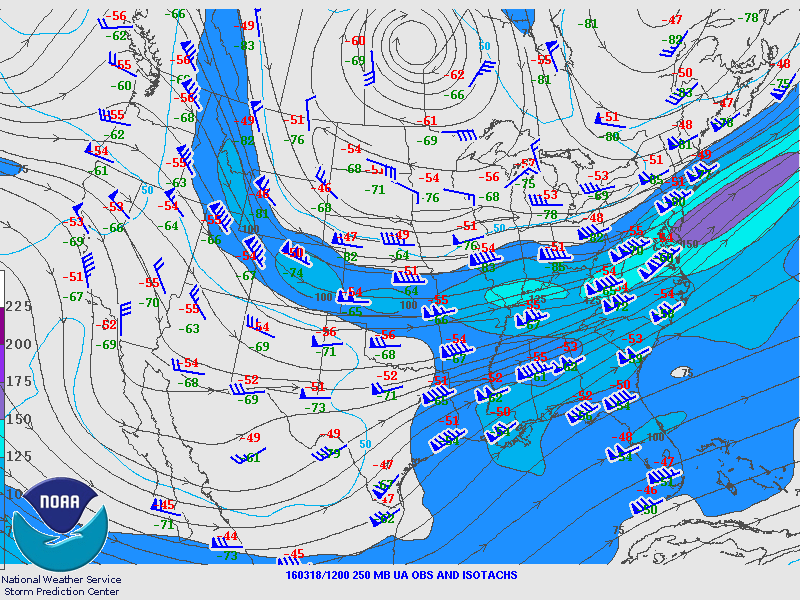
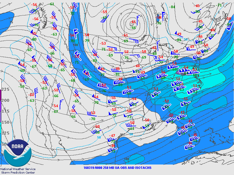
| 250 MB - 12Z 03/18 | 250 MB - 00Z 03/19 |
|---|---|
 |
 |
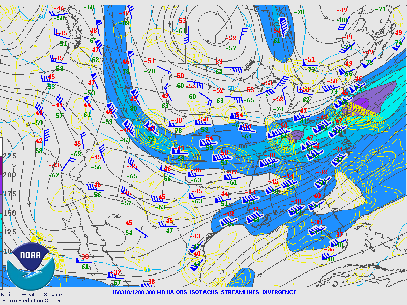
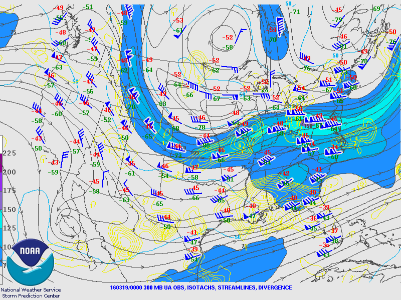
| 300 MB - 12Z 03/18 | 300 MB - 00Z 03/19 |
 |
 |
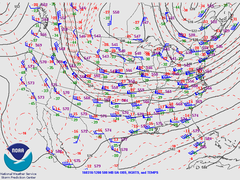
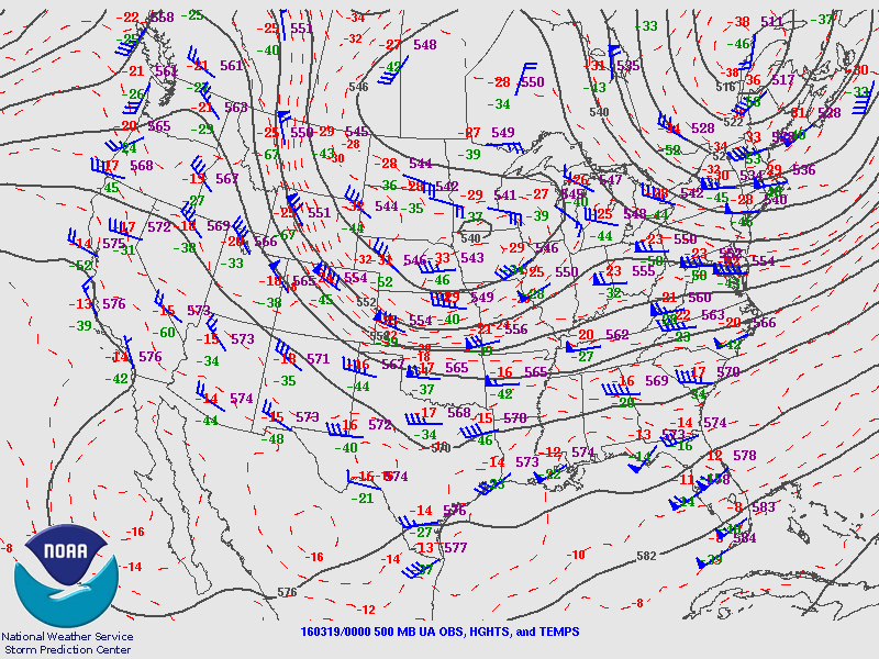
| 500 MB - 12Z 03/18 | 500 MB - 00Z 03/19 |
 |
 |
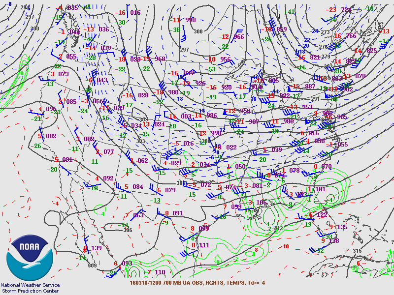
| 700 MB - 12Z 03/18 | 700 MB - 00Z 03/19 |
 |
 |
| 850 MB - 12Z 03/18 | 850 MB - 00Z 03/19 |
 |
 |
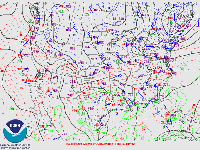
| 925 MB - 12Z 03/18 | 925 MB - 00Z 03/19 |
 |
 |
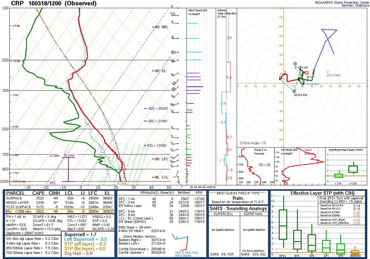
| KCRP SKEWT - 12Z 03/18 | KCRP SKEWT - 00Z 03/19 |
 |
 |


 Follow us on YouTube