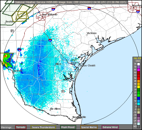
During the late evening of March 19th, 2012 and the early morning hours of March 20th, a severe squall line developed across South and South-Central Texas. This squall line developed due to a strong upper level low pressure system located across the southern Rockies and a surface low pressure area and cold front moving across South Texas. Due to the strong winds aloft and an unstable airmass, conditions were ripe for severe storms with the main threat being from damaging winds.
As the squall line neared the town of George West, a downburst embedded within the line produced winds between 60 and 80 mph. Radar images indicated winds just above the surface of approximately 86 mph at the time of the downburst. A metal roof, several telephone poles and numerous large tree limbs were damaged from these straight-line winds in George West.
The squall line continued to move eastward across the remainder of South Texas through the early morning hours. Although it weakened as it moved into the Coastal Bend and Gulf waters, there were still reports of winds between 40 and 50 mph behind the squall line.
Rainfall totals averaged around 1-2 inches across the northern portions of the Coastal Bend and Brush Country.
..TIME...   ...EVENT...      ...CITY LOCATION...     ...LAT.LON...
..DATE...   ....MAG....      ..COUNTY LOCATION..ST.. ...SOURCE....
            ..REMARKS..

0327 AM     TSTM WND GST     GEORGE WEST             28.33N 98.12W
03/20/2012  E80 MPH          LIVE OAK           TX   NWS STORM SURVEY

            NWS STORM SURVEY CONCLUDED A DOWNBURST OCCURRED IN GEORGE
            WEST WITH WINDS ESTIMATED BETWEEN 60-80 MPH. THE MOST
            SIGNIFICANT DAMAGE OCCURRED ALONG AND EAST OF HWY 281
            BETWEEN CROCKETT AND BURLESON ST. A METAL ROOF WAS BLOWN
            OFF OF TWO MOTELS...LARGE BAY DOORS BLOWN OUT OF
            MAINTENANCE FACILITY...SEVERAL POWER POLES WERE
            DOWN...NUMEROUS LARGE TREE LIMBS AS WELL AS SIGNS AND
            FENCE POSTS. DAMAGE PATH WAS 2 1/2 MILES WIDE AND 1 1/2
            MILES IN LENGTH. ALL DEBRIS WAS BLOWN IN AN ESE
            DIRECTION.


 Follow us on YouTube