Click on images to enlarge
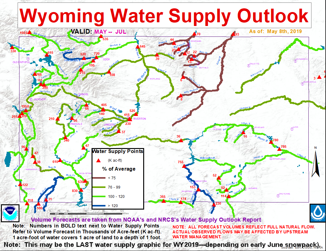

May 2019 precipitation totals across Wyoming averaged 100 to 130 percent of average. Precipitation numbers varied between 150 percent of normal over the Snake and Upper Green River Drainages (west to west central Wyoming) to near 100 percent of average over the Big Horn River Basin (north central Wyoming). Current water year (October 2018 - May 2019) precipitation across Wyoming is averaging 105 to 125 percent of average. Mountain snowpack across Wyoming was 90 to 120 percent of median. Snowpack water numbers and/or SWEs were the highest across basins in western and southern Wyoming, varying between 110 to 150 percent of median. SWEs across watersheds in north central Wyoming were 70 to 90 percent of median.
Above normal snowmelt streamflow volumes are still expected across several major basins across Wyoming, including the Shoshone, Upper Bear, Upper North Platte, and Laramie Watersheds. Several rivers and creeks along the Tongue and Powder River Basins are predicted to have near normal streamflow volumes. Total reservoir capacity across Wyoming was 75 to 100 percent. Reservoir storages across Wyoming were above average.
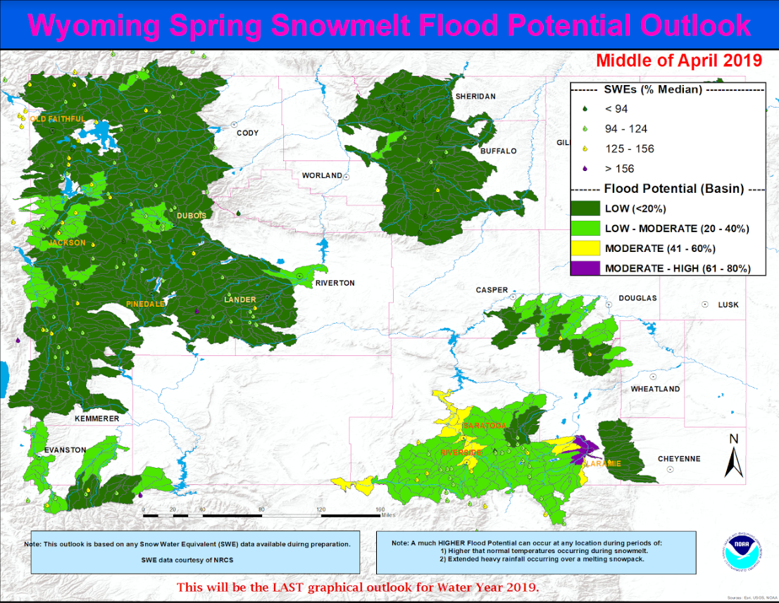
This outlook is based on various diverse hydrological factors such as snow water equivalents (SWEs) in the mountain snowpack, basin morphology (i.e. how basins respond to snowmelt runoff), antecedent soil moisture, biological/physical factors (bark beetle kill/spruce blight/fire burn scars), low elevation snow depths, and likely temperature and precipitation trends during the late spring and early summer.
HIGHLIGHTS:
…...Moderate to High potential for snowmelt runoff flooding is predicted along the lower portions of the Laramie Watershed (near Laramie) and lower portions of the Upper North Platte River Basin (near Saratoga).
…...Moderate potential for snowmelt runoff flooding is predicted along lower portions of the Little Snake Watershed (near Dixon and Baggs)...
...Most other headwater basins across Wyoming can expect a Low potential for flooding due to snowmelt runoff...
******************************
Other hydrological information for Wyoming can be found at the NOAA hydrology website:
http://www.weather.gov/riw/
Monthly Wyoming Hydrologic Summary and Graphics:
(updated monthly around the 15th of every month)
http://www.weather.gov/media/
Wyoming Drought Information Page:
(updated at least once a month)
http://www.weather.gov/riw/
Wyoming Graphical Water Supply Outlook:
(updated by the 10th of every month—January-June)
http://www.weather.gov/images/
Wyoming Average Precipitation by Basin:
(updated monthly)
http://www.weather.gov/
Wyoming Spring Snowmelt Runoff Flood Potential Graphic:
(updated around the 25th of the month---February-May)
http://www.weather.gov/images/
Current and Forecast Wyoming Streamflows and/or River Stages:
http://water.weather.gov/
http://water.weather.gov/
http://waterdata.usgs.gov/


 Weather Story
 Weather Map
 Local Radar
 Follow us on YouTube