National Weather Service United States Department of Commerce


Tornadoes - Nature's Most Violent Storms
 
Description

Tornadoes are violently rotating columns of air, extending from a thunderstorm, which are in contact with the ground. Tornadoes develop when wind variations with height support rotation in the updraft. As seen below, tornadoes come in different sizes, many as narrow rope-like swirls, others as wide funnels.

 
rope tornado wide tornado

Across the Plains, tornadoes can be seen from miles away. However, in the southeast, and especially Georgia, tornadoes are often hidden in large swaths of rain and hail, making them very difficult to see and even more dangerous. Visibility is often affected by terrain constraints in Georgia as well.

As stated before, tornadoes come in different shapes and sizes. They are ranked using the Enhanced Fujita scale. The majority of tornadoes which occur are classified as a weak tornado. Usually a weak tornado will last for just a few minutes and have wind speeds of 100 mph or less. Some tornadoes intensify further and become strong or violent. Strong tornadoes last for twenty minutes or more and may have winds of up to 200 mph, while violent tornadoes can last for more than an hour with winds between 200 and 300 mph! These violent tornadoes are rare in occurrence.

Formation Ingredients

The key atmospheric ingredients that lead to tornado potential are instability - warm moist air near the ground, with cooler dry air aloft and wind shear - a change in wind speed and/or direction with height. An unstable airmass promotes the development of strong updrafts, while wind shear will further increase the strength of the updraft, and promotes the rotation from which tornadoes are produced.

All thunderstorms have the potential to produce tornadoes, but the type of storm that is most commonly tornadic is the supercell. This very severe, long-lived thunderstorm contains circulation aloft (mesocyclone) that grows upward through the storm and downward toward the ground. When conditions are favorable, tornadoes will be produced. Supercells may produce strong, violent tornadoes, or several tornadoes over a period of several hours. The two most recent major supercell outbreaks in north or central Georgia was during the Palm Sunday Tornadoes of March 27,1994 and the Southeast Tornado Outbreak of April 27-28, 2011.

Detection

Our WSR-88D Doppler radar can detect the circulation associated with a tornado producing thunderstorm. Once the circulation is identified, a warning is issued. However, Doppler radar is not perfect, because it can only indicate rotation aloft, and does not indicate what may be happening on the ground. This is where our storm spotters come in. Only feedback from someone in the area can confirm whether the radar signature is associated with a tornado.

North and Central Georgia Tornado History

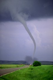
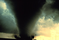
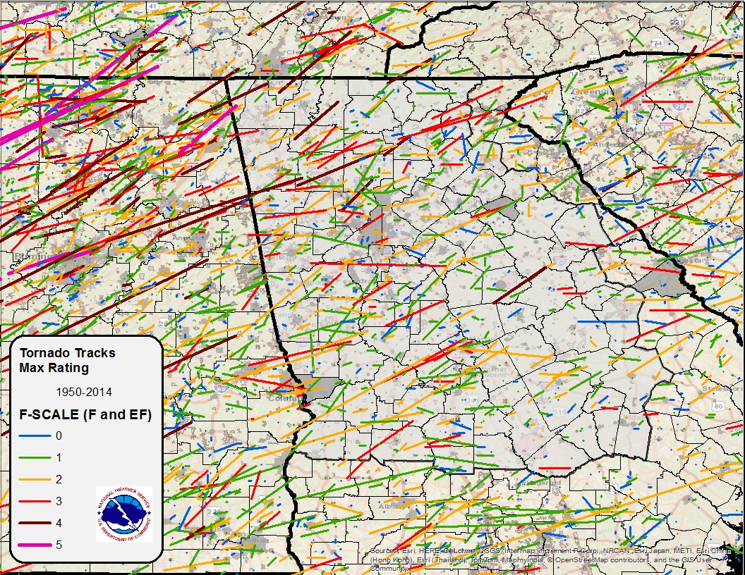
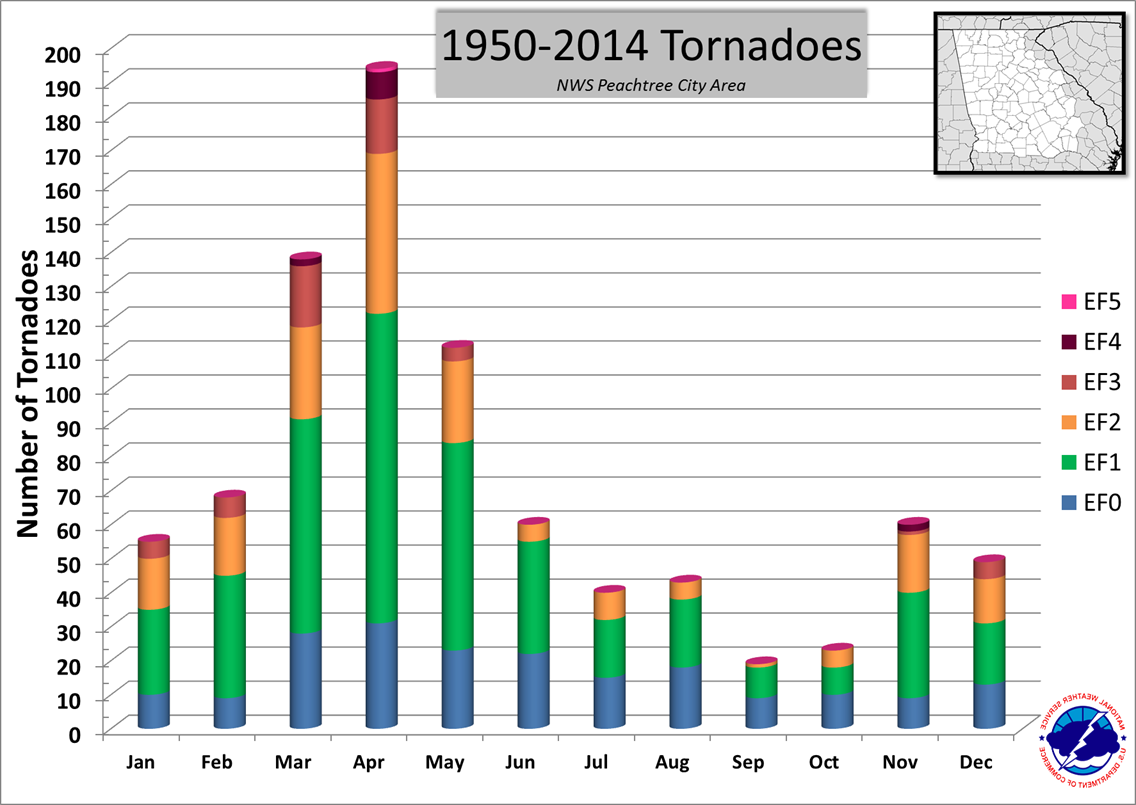
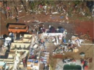
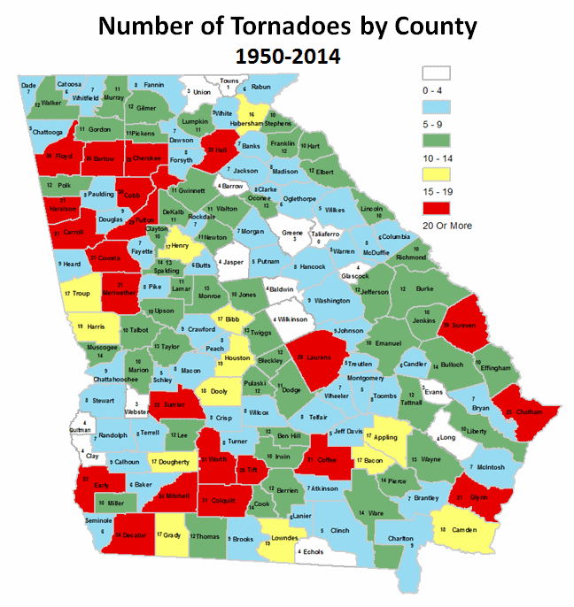
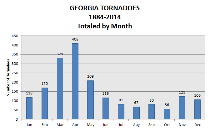
Georgia has experienced almost all strengths of tornadoes, ranging from EF-0 to EF-4. Although the state has never experienced an EF-5, it does not mean it can't happen! The below graphics depict both past track and strength of north and central Georgia tornadoes.

North and Central Georgia Tornado Tracks 1950-2014

Number of Tornadoes by Month 1950-2014

North and Central Georgia Tornado Tracks
(1950-2014)

Number of Tornadoes by Month
Across North and Central Georgia
 (1950-2014)

Note: Although one EF-5 tornado is shown in the images above, it was an EF-5 in Alabama that weakened as it moved into Georgia. No EF-5 tornadoes have occurred in Georgia.
 
Safety Information

It is important to have a safety plan before you need to act. Tornadoes can develop rapidly so be prepared to act quickly! The preparedness guide for thunderstorms, tornadoes and lightning suggests the following safety rules for tornadoes:

  • Move to an underground shelter, basement or safe room.
  • If the above is not available, more to a small, windowless interior room or hallway on the lowest level.
  • Abandon mobile homes and go to the nearest sturdy building or shelter immediately.
  • If you are caught outdoors and a basement or sturdy building is unavailable:
    • Immediately get into a vehicle, buckle your seat belt and try to drive to the closest sturdy shelter.
    • If flying debris occurs while you are driving, pull over and park. Now you have the following options as a last resort:
      • Stay in your vehicle with the seat belt on. Put your head down below the windows, covering it with your hands and a blanket if possible.
      • If you can safely get noticeably lower than the level of the roadway, exit your car, and lie in that area, covering your head with your hands.
The tornado damage from Coweta county, shown below, is an example of the importance of moving into an interior room. In this case, all of the outside walls were destroyed.
Coweta County Tornado