Cooler and Mostly Dry Apart From Light Mountain Snow Across the North
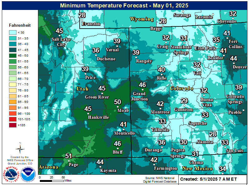
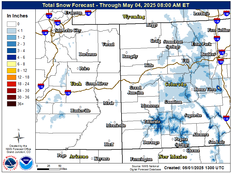
Daytime highs will remain well below normal today under continued cool, northwesterly flow aloft. A weak disturbance will brush the Continental Divide late today which will bring increased clouds and isolated to scattered snow showers to the northwest and west-central Colorado mountains through Thursday morning. Accumulations will be light with generally 1 to 5 inches expected. Elsewhere, expect continued dry conditions with passing mid and high level clouds.
High pressure will build overhead late Thursday and continuing on Friday with daytime highs warming back to near or slightly above seasonal normals in response. Conditions will remain dry through Saturday before the next disturbance begins to impact the region on Sunday and continuing into the new work week.
Please stay tuned to the latest forecast by visiting www.weather.gov/gjt.
Forecast High Temperatures Today

Forecast Low Temperatures Tonight
Forecast Snowfall Totals
Latest Weather Map


 Follow us on YouTube