|
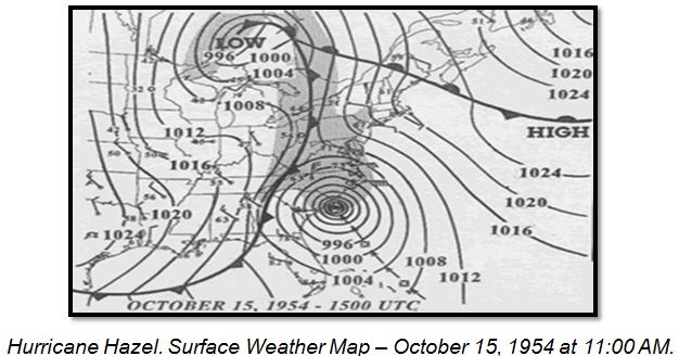
followed by a northwestward turn on the 14th. Hazel turned north and accelerated on October 15, making landfall as a Category 4 hurricane near the North  Carolina-South Carolina border. Carolina-South Carolina border.
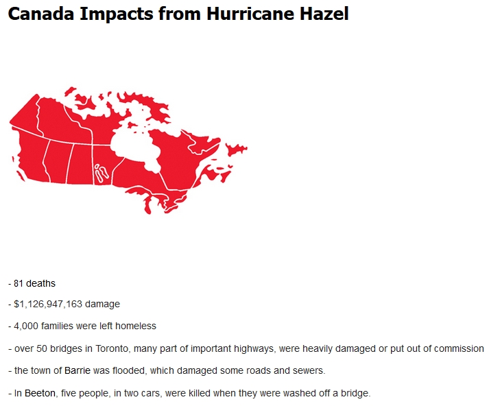
Subsequent rapid motion over the next 12 hours took the storm from the coast across the eastern United States into southeastern Canada as it became extratropical. High winds occurred over large portions of the eastern United States. Myrtle Beach, South Carolina reported a peak wind gust of 106 mph, and winds were estimated at 130 to 150 mph along the coast between Myrtle Beach and Cape Fear, North Carolina. Washington, DC reported 78 mph sustained winds, and peak gusts of over 90 mph occurred as far northward as inland New York state. A storm surge of up to 18 ft inundated portions of the North Carolina coast. Heavy rains of up to 11 inches occurred as far northward as Toronto, Canada resulting in severe flooding.
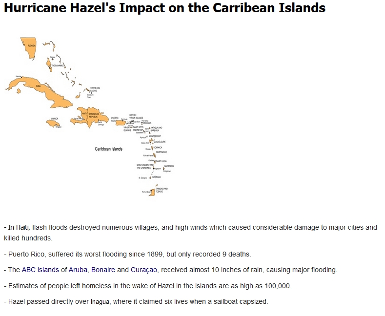
Hazel was responsible for 95 deaths and $281 million in damage in the United States, 100 deaths and $100 million in damage in Canada, and an estimated 400 to 1000 deaths in Haiti.
Credit: National Hurricane Center
Mid-Atlantic Inland Flood Impacts from Hazel
|


 Coastal Flood
  Follow us on YouTube