Damage Path (Click to enlarge):
Tornado Information:
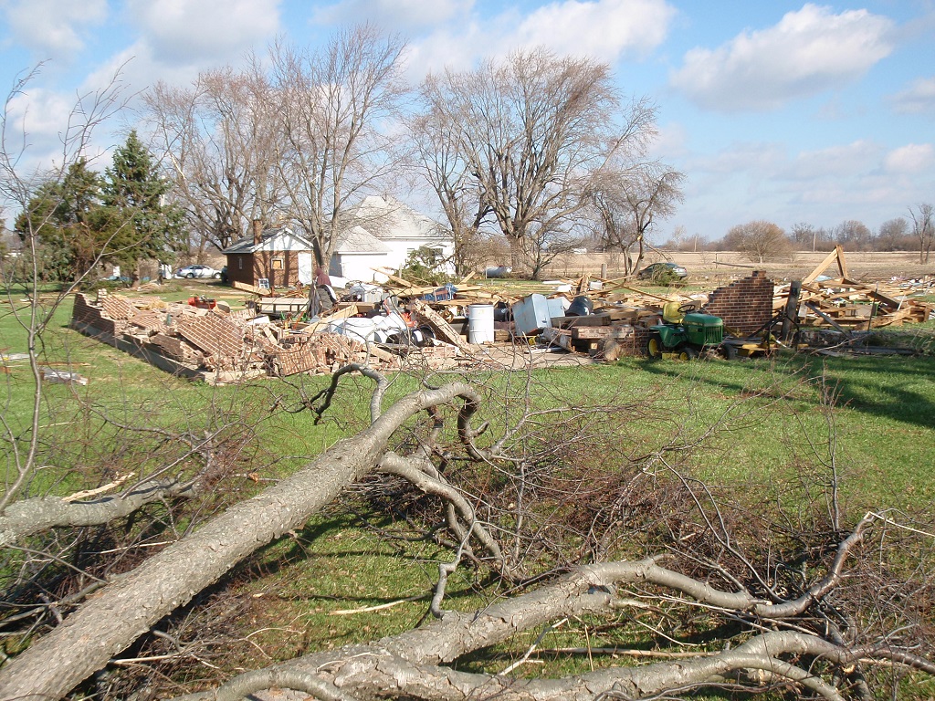
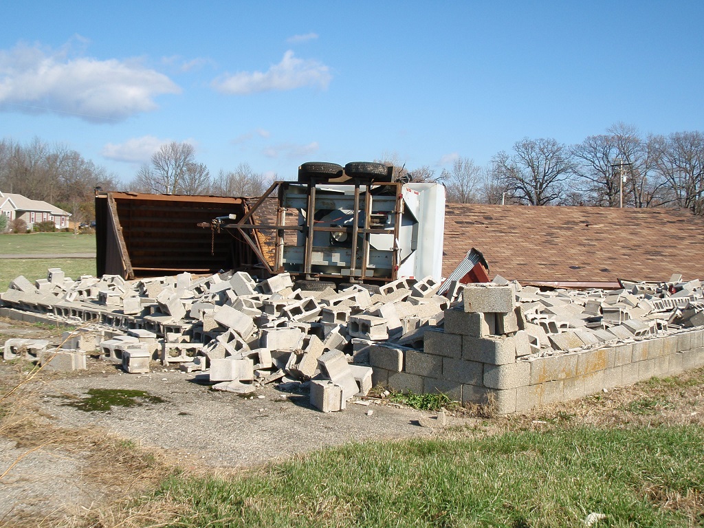
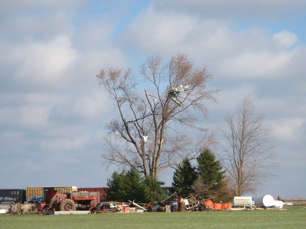
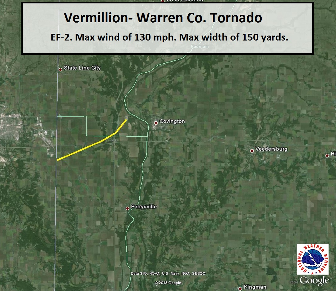
RATING: EF-2 ESTIMATED PEAK WIND: 130 MPH PATH LENGTH /STATUTE/: 6 MILES PATH WIDTH /MAXIMUM/: 150 YARDS FATALITIES: 0 INJURIES: 0 START DATE: NOVEMBER 17 2013 START TIME: 222 PM EST START LOCATION: 0.5 MILES W/SW OF RILEYSBURG START LAT/LON: 40.1453/-87.4356 END DATE: NOVEMBER 17 2013 END TIME: 226 PM EST END LOCATION: 2 MILES WEST OF COVINGTON END_LAT/LON: 40.1017/-87.5307 THE TORNADO DEVELOPED ALONG THE ILLINOIS-INDIANA STATE LINE JUST WEST OF RILEYSBURG. A CHURCH WAS PUSHED OFF ITS FOUNDATION WITH EXTERIOR WALLS COLLAPSED IN RILEYSBURG. A TRAIN CAR WAS ALSO PUSHED OFF RAILROAD TRACKS IN RILEYSBURG. A COUPLE MOBILE HOMES WERE COMPLETELY DESTROYED TO THE WEST OF COVINGTON. |
Radar Imagery: (Click to enlarge)
 |
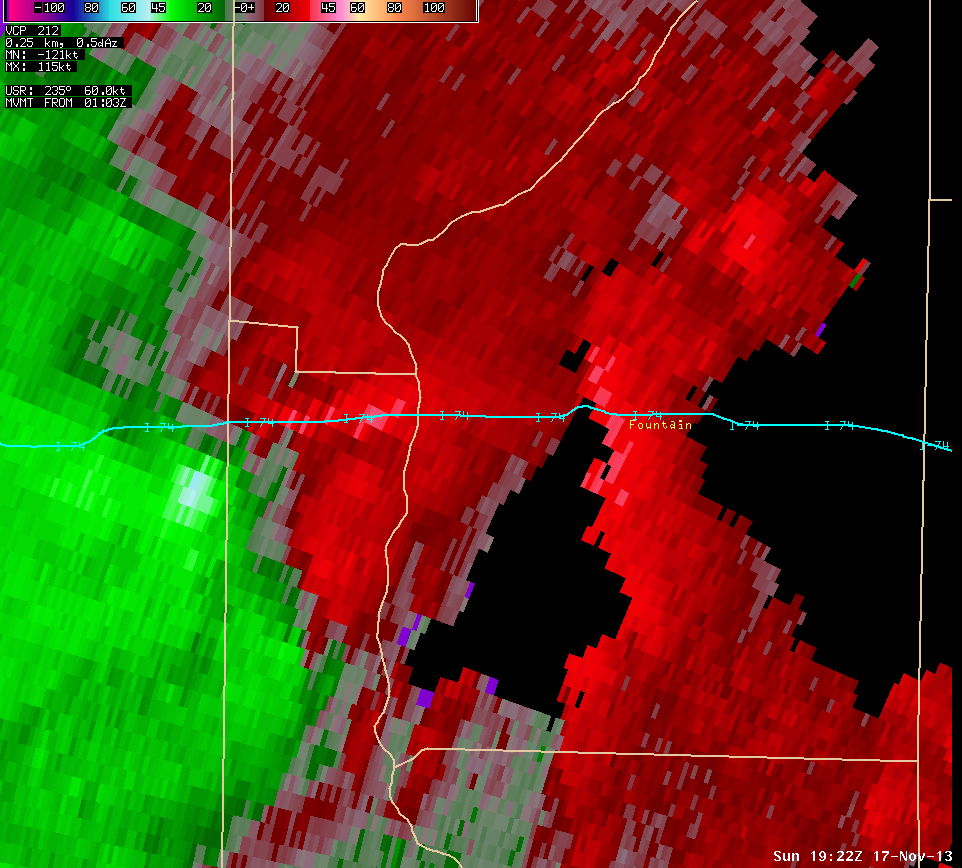 |
| Radar image from 2:22 PM centered across northern Vermillion and western Fountain Counties. | Storm Relative Motion image from 2:22 PM for the same area. Radar is off to the south east of this location. Green indicates winds toward the radar while reds indicate winds away from the radar. |
Damage Pictures (click to enlarge):
 |
 |
|
|
|
||


 Follow us on YouTube