Overview
|
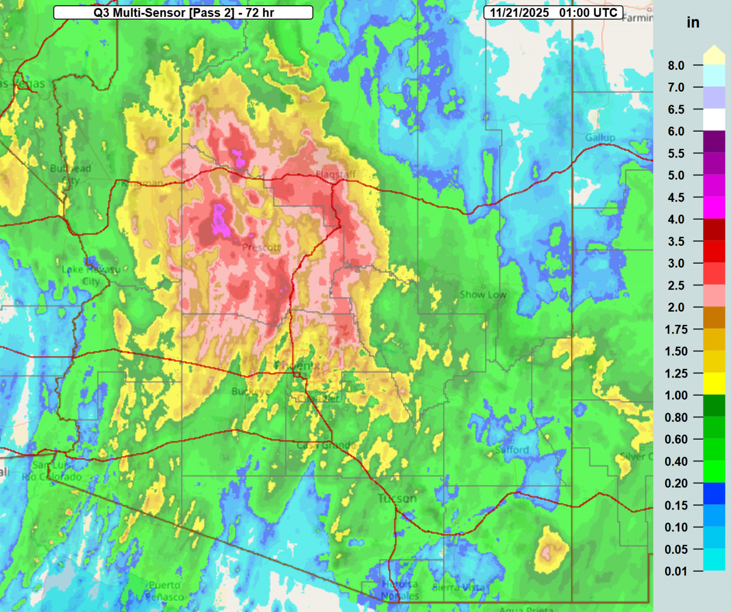
Between the evening of November 17th and the evening of the 20th, a slow-moving upper-level low progressed across the region, bringing scattered to widespread moderate to heavy rainfall and isolated thunderstorms. Most of the rain and impacts fell/occurred on the 18th and 19th, with much of central Arizona receiving rainfall totals of 1.00-2.50" and some areas receiving 3+ inches. This rainfall led to instances of flash flooding and flows in normally dry creeks and washes. |
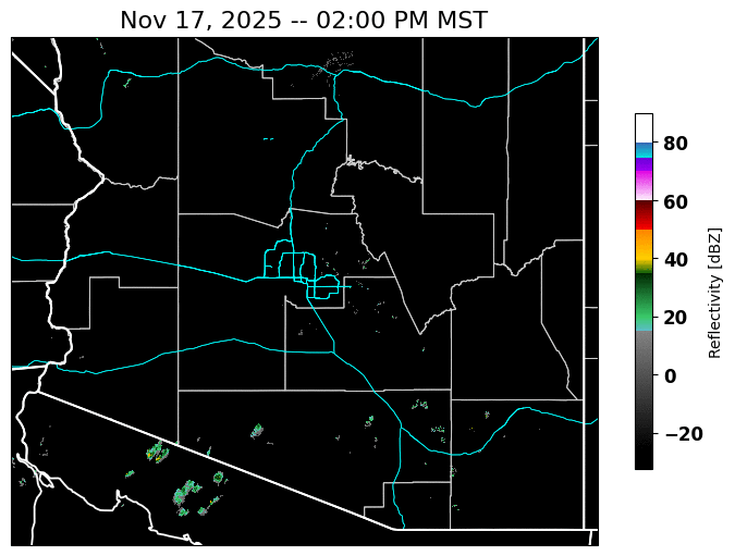 76-hour radar mosaic from 2 PM MST Nov 17th to 6 PM MST Nov 20th |
Rainfall & Flooding
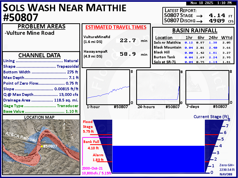
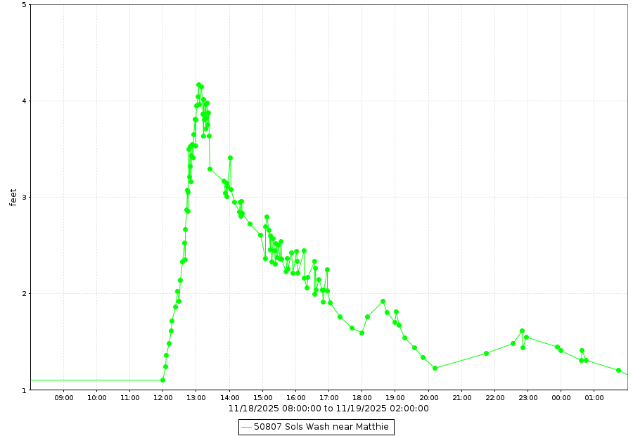
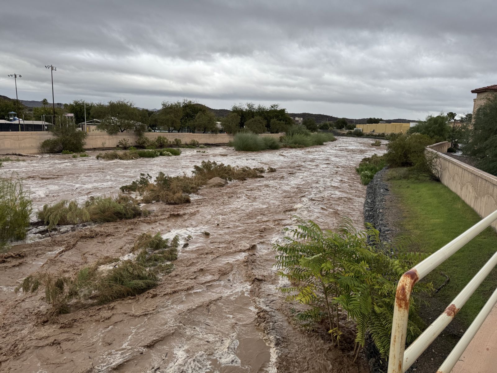
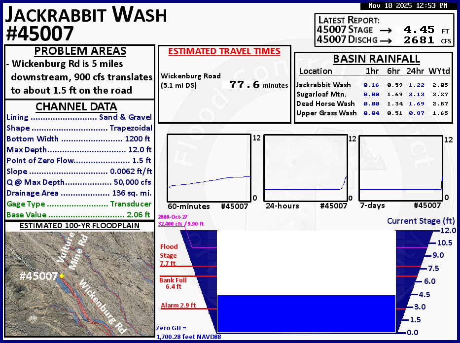
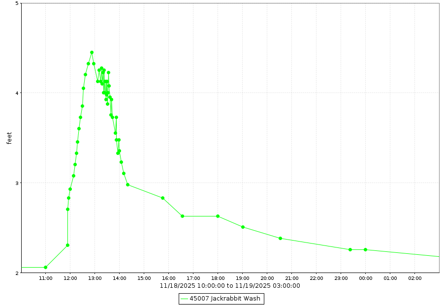
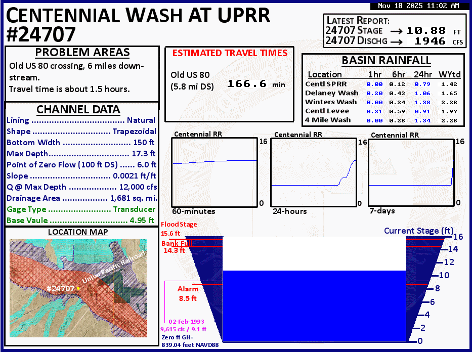
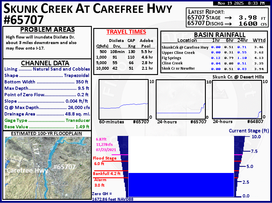
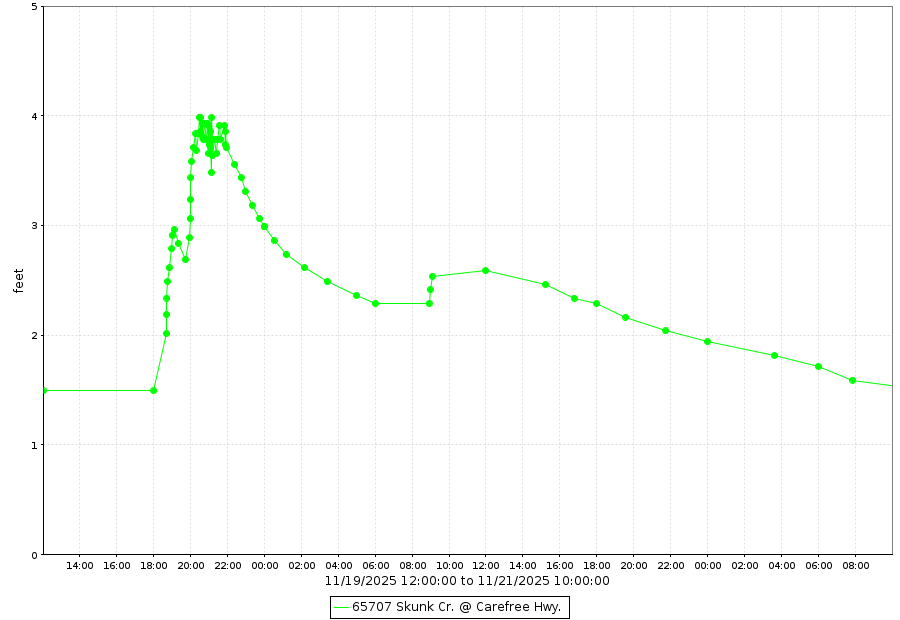
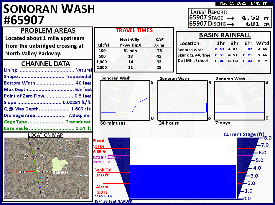
Scattered to widespread rain fell from the evening of the 17th through the afternoon of the 20th, but most of the rain fell on the 18th and 19th. Northern Maricopa County, and points northward, received the highest rainfall totals, with 1.00-2.50+ inches falling across much of the area. Multiple rounds of rain and higher rain rates in thunderstorms resulted in instances of flash flooding. Several streamflow gauges across the Flood Control District of Maricopa County's (FCDMC) network exceeded designated alarm stages and a couple gauges in far north Phoenix reached bank full. Anytime floodwaters reach alarm stage, downstream and/or upstream flooding impacts usually occur, most often in the form of flooded low water crossings. See several of the gauges that exceeded alarm stage in the images below. With each wash shown there were roads closed due to flooding. There were also several swift water rescues, including on Sols Wash in Wickenburg, on Sonoran Wash in far north Phoenix, on Desert Hills Wash just south of Carefree Hwy in north Phoenix, on Fourmile Wash in Tonopah, and on Tiger Wash in western Maricopa County.
Rainfall
 |
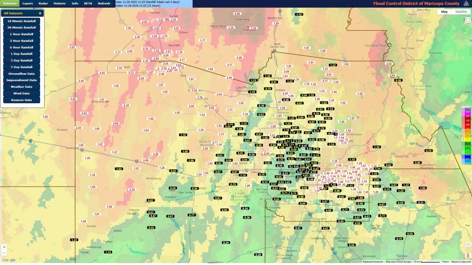 |
| 3-day radar estimated rainfall. Source: MRMS | 3-day observed rainfall totals across the FCDMC gauge network, with radar estimates underlaid. Credit: FCDMC |
Streamflow Gauges
 |
 |
 |
| Sols Wash near Matthie gauge at peak flow and stage. Source FCDMC | Sols Wash near Matthie hydrograph. Source: FCDMC | Sols Wash at Tegner St in Wickenburg. Credit: Brian Eisenhauer on X |
 |
 |
 |
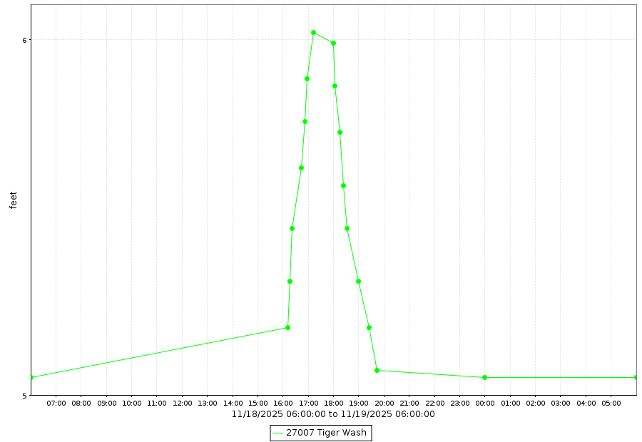 |
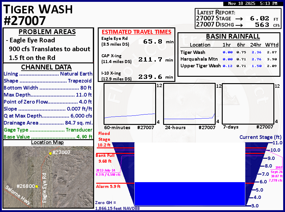
| Jackrabbit Wash gauge at peak flow and stage. Source FCDMC | Jackrabbit Wash hydrograph. Source: FCDMC | Tiger Wash gauge at peak flow and stage. Source FCDMC | Tiger Wash hydrograph. Source: FCDMC |
 |
 |
 |
 |
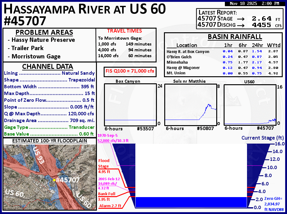
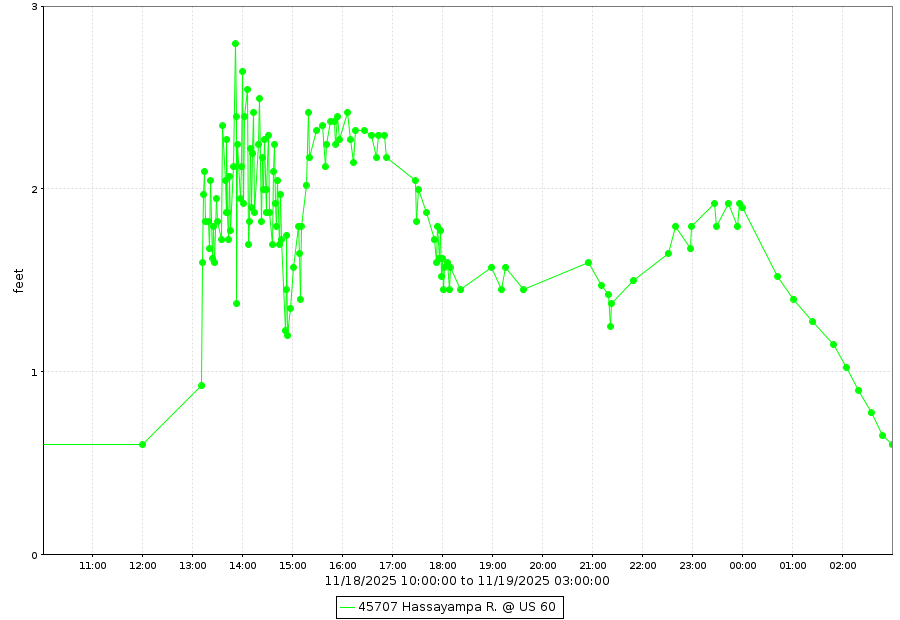
| Hassayampa River @ US-60 gauge at peak flow and stage. Source FCDMC | Hassayampa River @ US-60 hydrograph. Source: FCDMC | Centennial Wash @ UPRR gauge at peak flow and stage. Source FCDMC | Centennial Wash @ UPRR hydrograph. Source: FCDMC |
 |
 |
 |
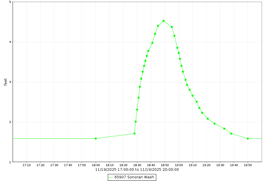 |
| Skunk Creek @ Carefree Highway gauge at peak flow and stage. Source FCDMC | Skunk Creek @ Carefree Highway hydrograph. Source: FCDMC | Sonoran Wash gauge at peak flow and stage. Source FCDMC | Sonoran Wash hydrograph. Source: FCDMC |
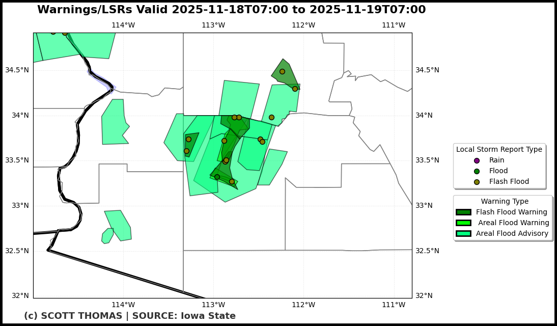
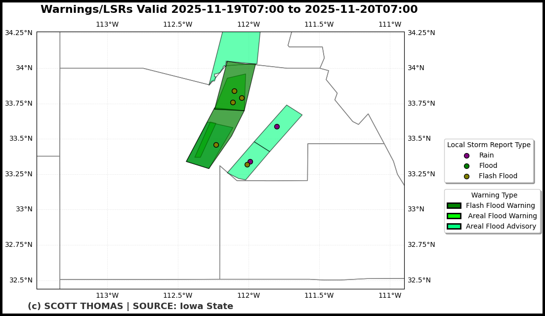
Flash Flood & Flood Warnings and Storm Reports
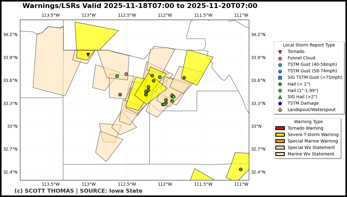
A total of 6 Flash Flood Warnings (FFW), 5 Flood Warnings (FLW), & 12 Flood Advisories (FLS) were issued by NWS Phoenix on Nov 18th and 19th. A total of 15 flash flood LSRs were sent out, along with 1 flood LSR.
 |
 |
 |
| FFWs, FLWs, & FLSs on Nov 18th, with LSRs. | FFWs, FLWs, & FLSs on Nov 19th, with LSRs. | Flash Flood and Flood LSRs on Nov 18th & 19th. Source: IEM LSR App |
Hail & Wind
Hail
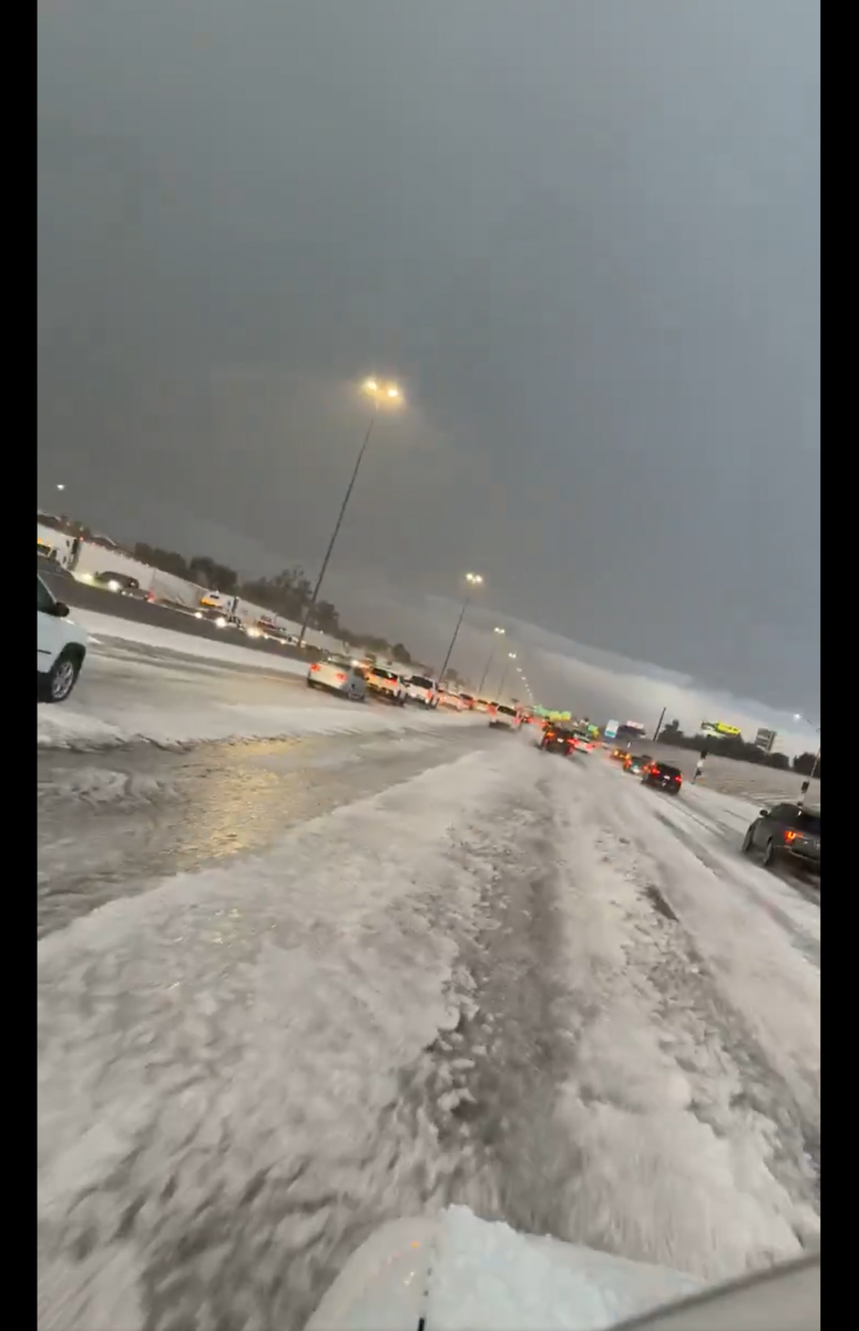
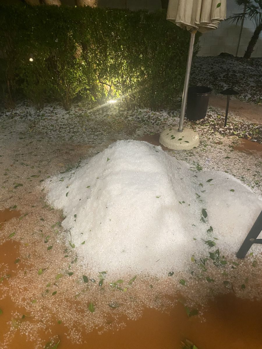
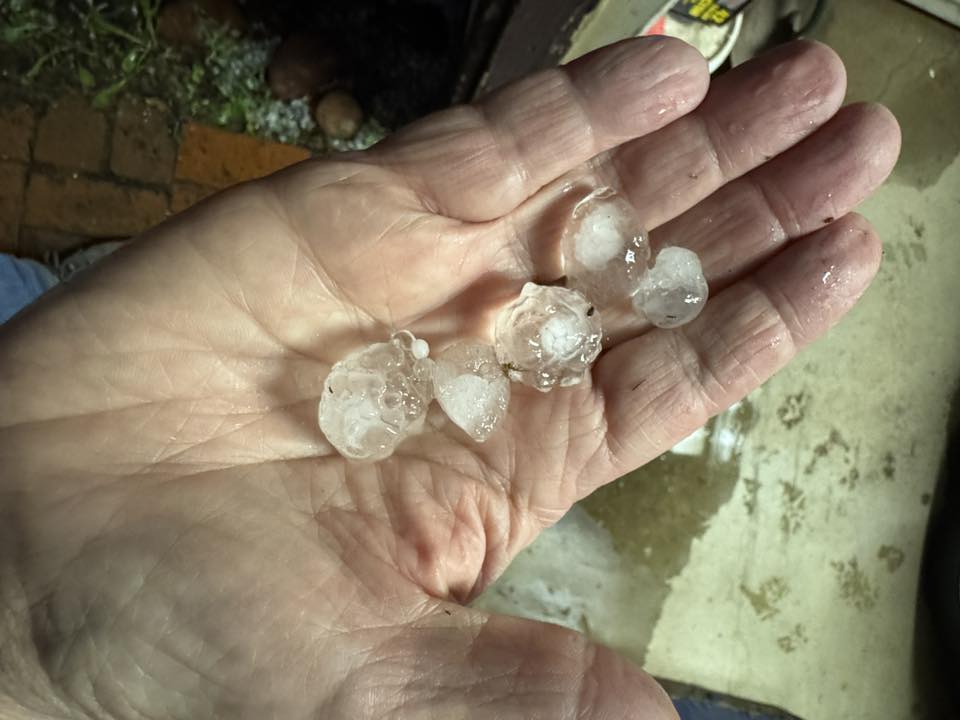
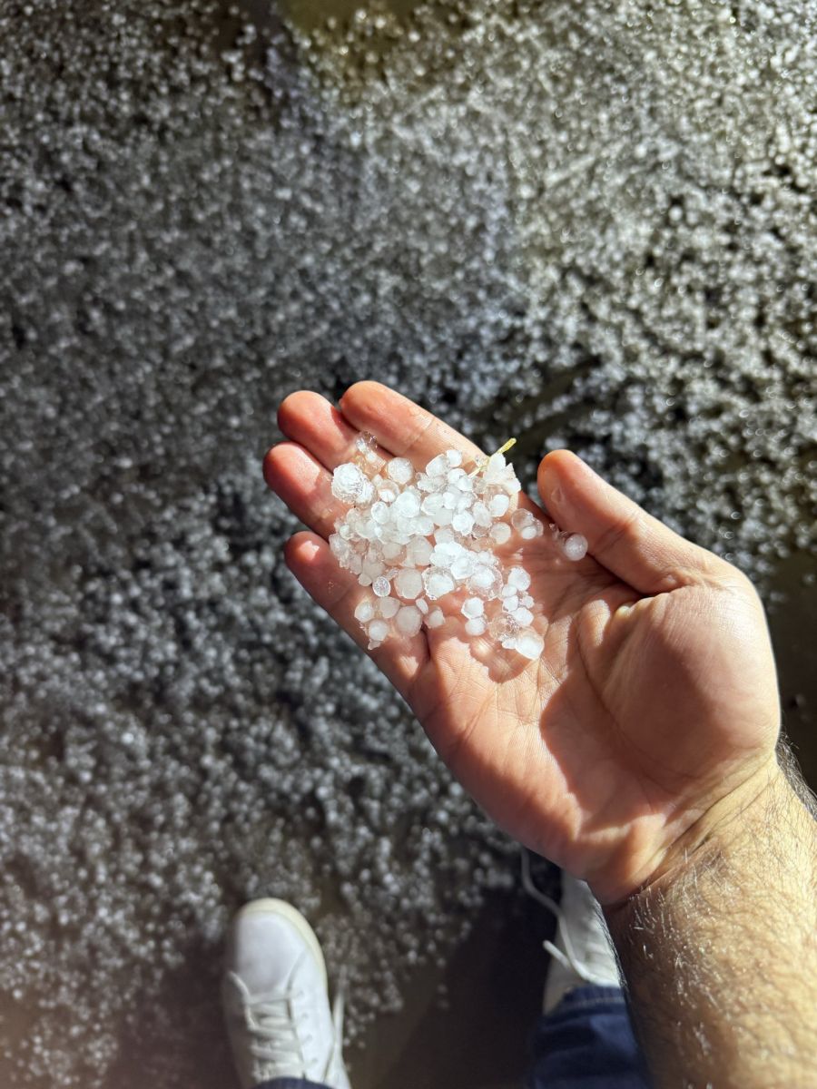
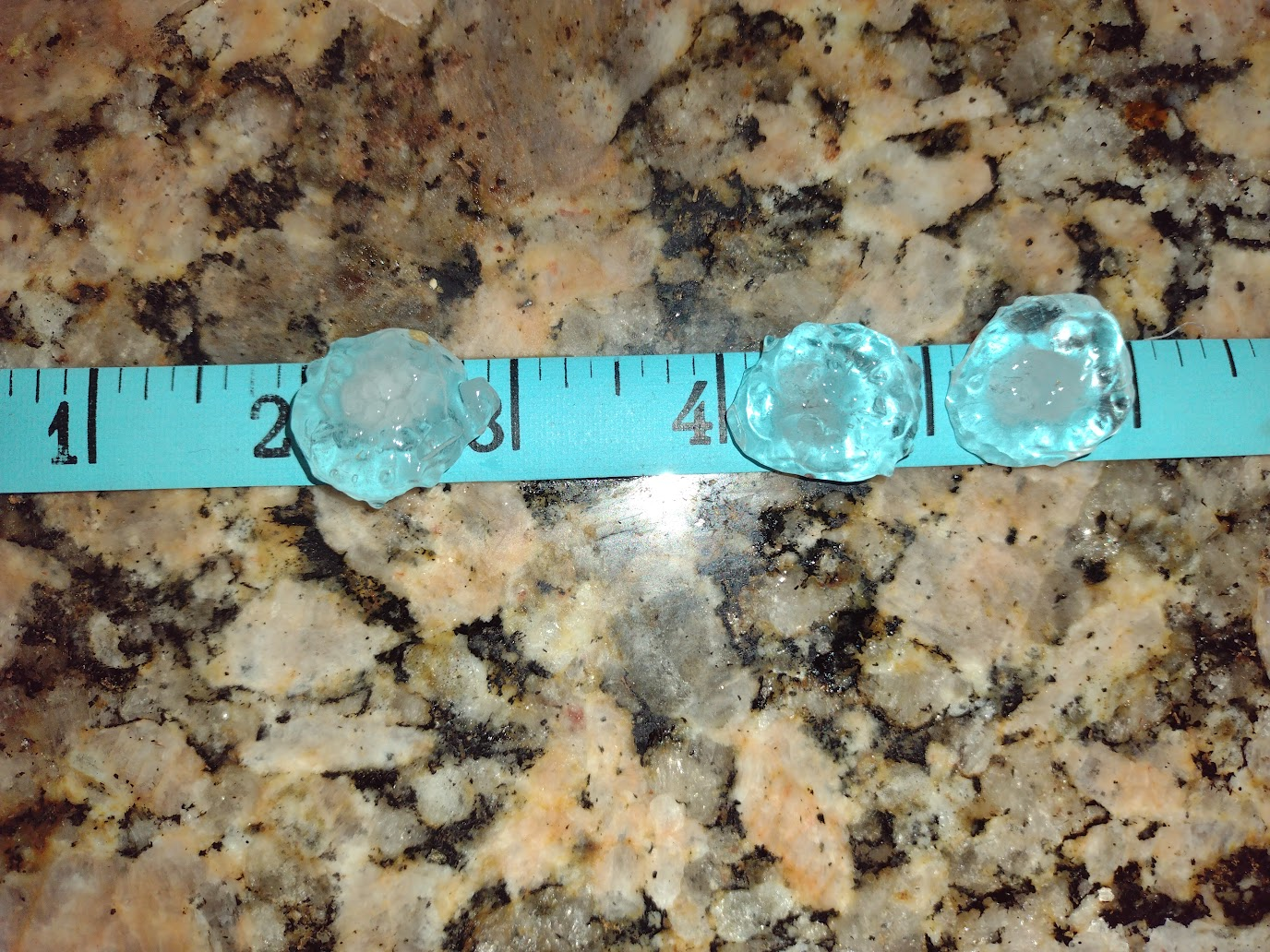
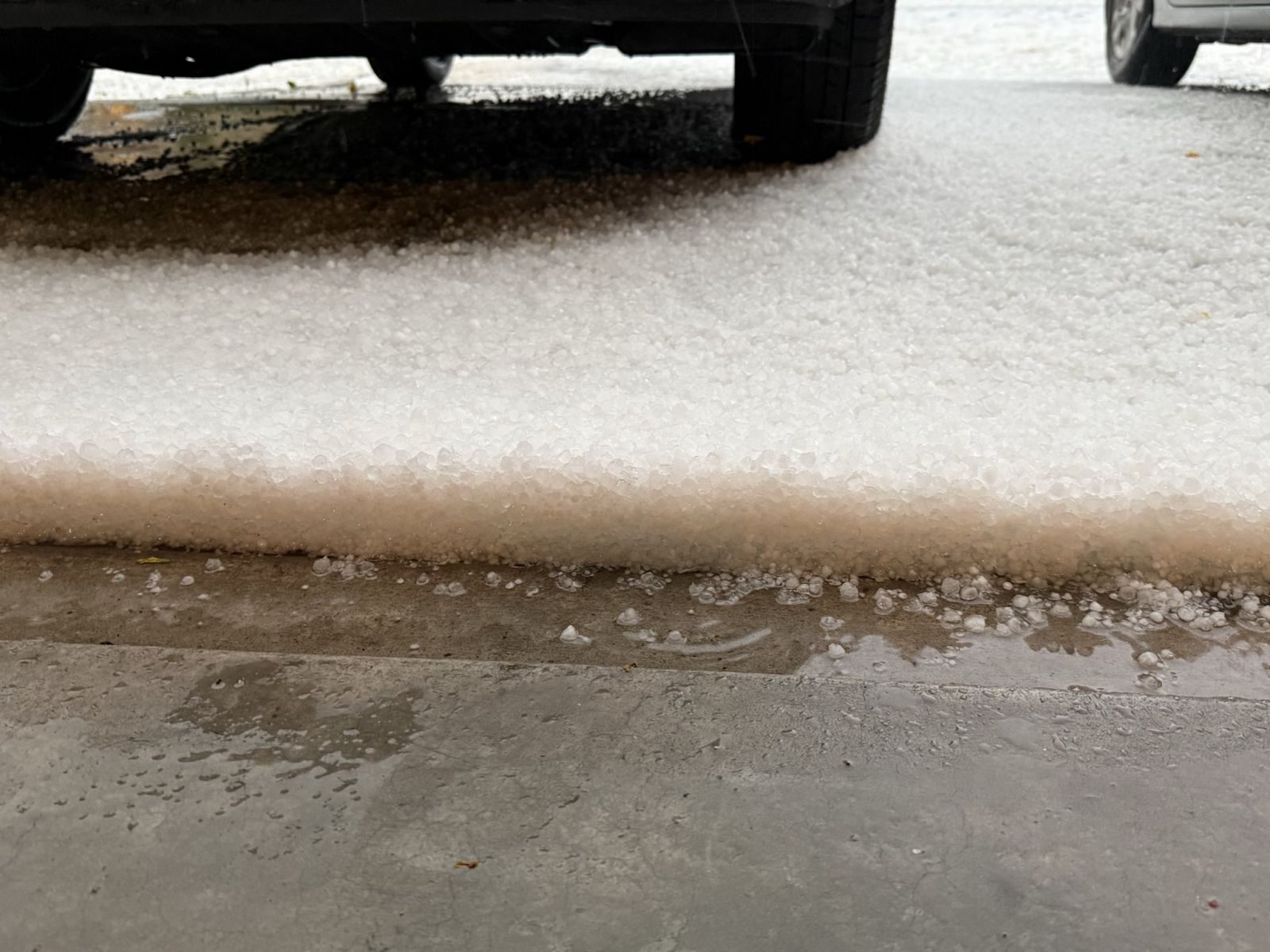
Most thunderstorms that developed produced at least small hail and the strongest/severe storms produced accumulating small and/or large damaging hail up to quarter to golf ball size. The two supercells that moved through parts of Phoenix in the late afternoon and evening of the 19th produced the most impactful hail. The first of the two storms produced a lot of accumulating small hail in the Tolleson area, with several inches of hail on I-10 at 75th Ave. There was also a partial roof collapse at Desert Sky Mall that may have at least been partially due to the weight of the accumulated hail and rain water. The second storm, that moved through the Ahwatukee area and up through Tempe, also produced accumulating hail, including on Loop 202 between 24th St and 40th St. The largest hail stones were also observed with the second storm. Along Loop 202 there was a report of 1" diameter hail (quarter-sized) and a couple reports of 1.75" diameter hail (golf ball-sized). The golf ball-sized hail did lead to some car dents.
 |
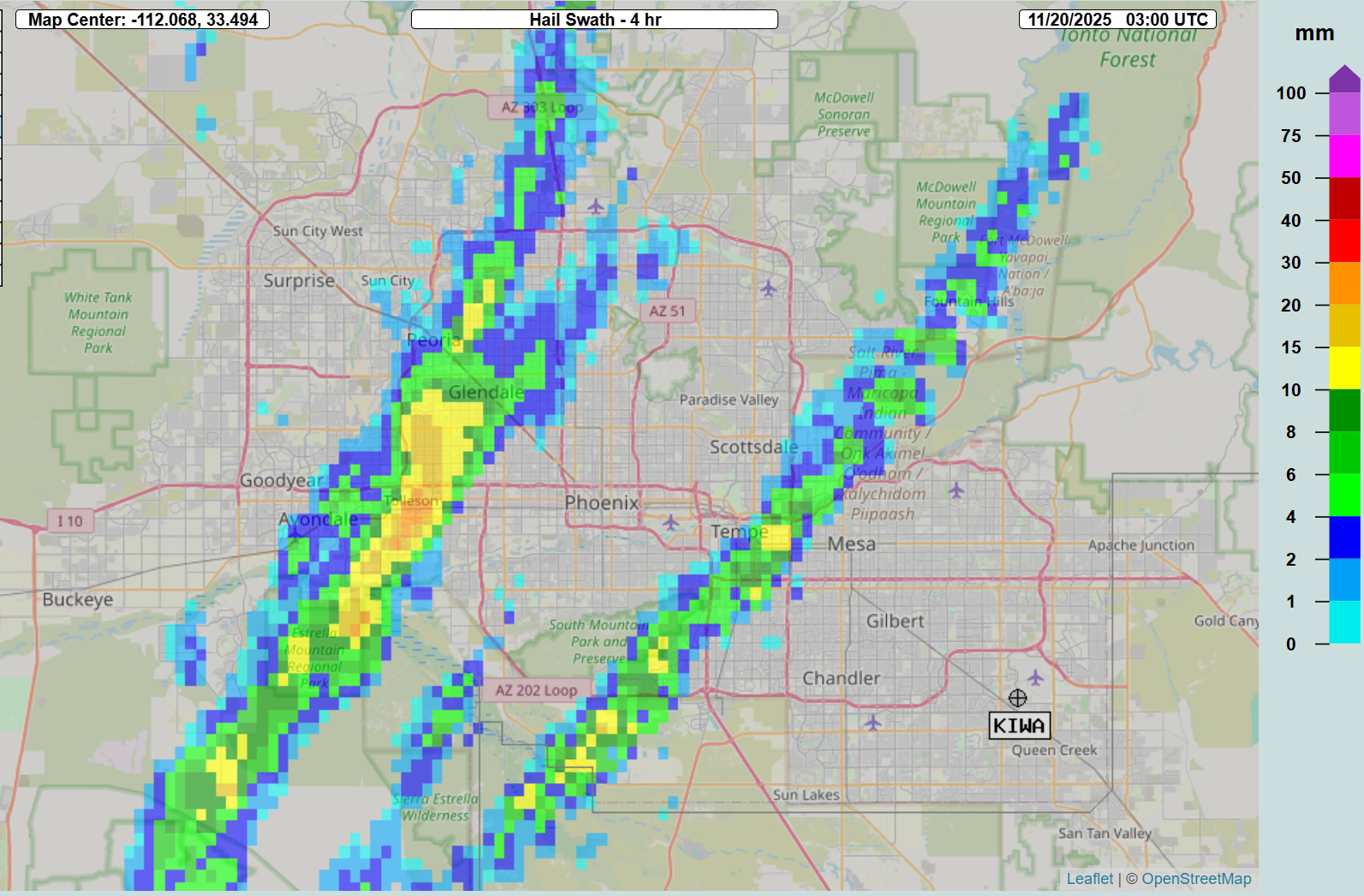 |
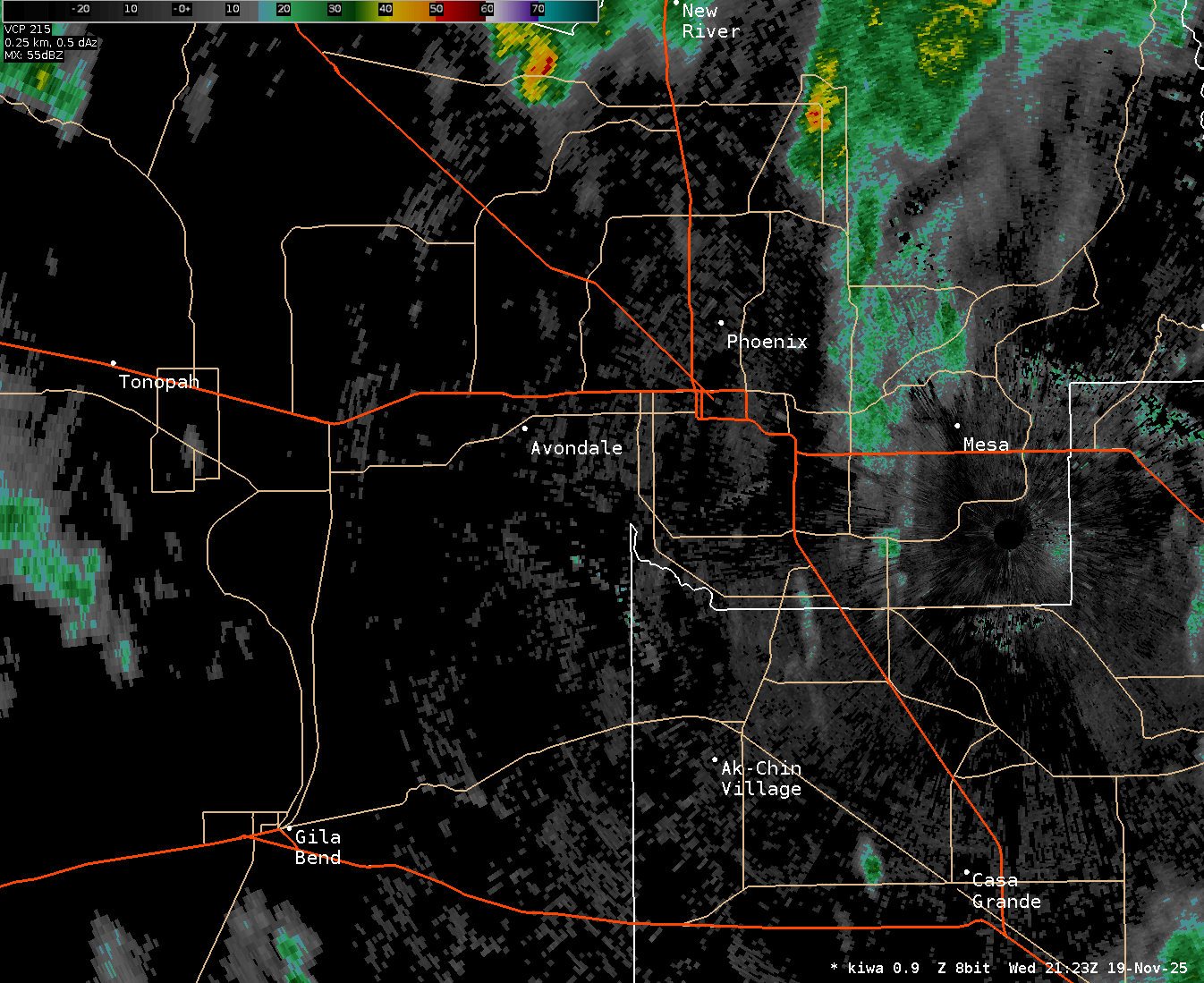
| Radar loop of the two supercell thunderstorms that moved through the Phoenix area in the afternoon of the 19th. Both storms developed south of Gila Bend, with the first then tracking through Tolleson and Glendale while the second tracked through Ahwatukee and Tempe. Source: KIWA WSR-88D radar 0.9 degree reflectivity | 4-hour hail swath Multi-Radar Multi-Sensor (MRMS) product ending at 8 PM MST (03:00 UTC) on Nov 19th. This graphic shows the track of the hail-producing supercells and the radar estimated max hail size in millimeters. |
 |
 |
 |
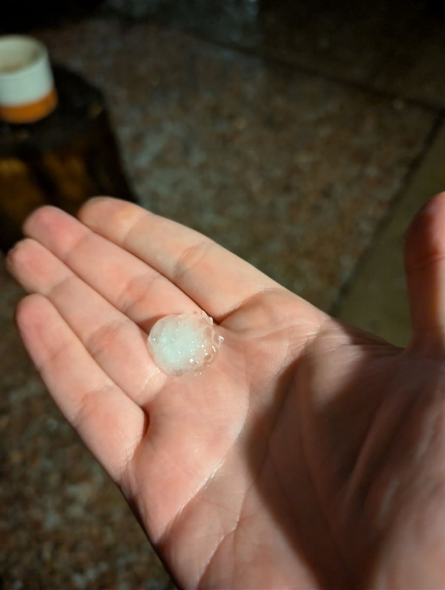 |
| Accumulated hail on I-10 near 75th Ave on Nov 19th. Credit: Luke Mishler on X | A pile of small hail in Ahwatukee on Nov 19th. Credit: Jill Chasson on X | Hail near Loop 101 and Southern Ave in Tempe on Nov 19th. Credit Lynne Senzek on Facebook | Nickel-sized hail stone near Broadway Rd and McClintock Dr in Tempe on Nov 19th. Credit: Jon Hay on X |
 |
 |
 |
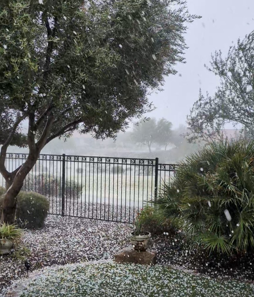 |
| Small hail in Ahwatukee on Nov 19th. Credit: @LaughingNm on X | Quarter-sized hail stones near Loop 101 & US-60 in Tempe. Credit: NWS Phoenix Meteorologist | Hail accumulation in Tolleson on Nov 19th. Credit: Kristin McGann on X | Accumulating hail in the West Valley on Nov 18th. Credit: @rhdegarmo on X |
Wind
The environment was not ideal for severe wind gusts (>58 mph) with this system. Highest thunderstorm wind gusts measured were around 35-45 mph around the greater Phoenix area. A large dead tree was toppled in North Phoenix and there were a couple of reports on the Salt River Project outage map of downed power lines in Central Phoenix and Glendale likely associated with the supercell thunderstorm that moved through on Nov 19th. Given the saturated looser grounds, it does not always take severe winds to cause tree and power pole damage.
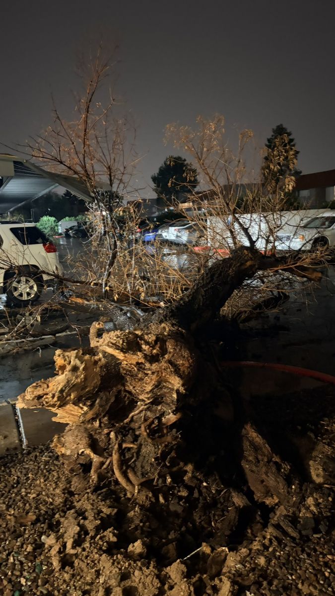 |
| Large dead tree toppled in North Phoenix, near 7th St and Grovers Ave, on Nov 19th. Credit: @SouthwestWX on X |
Severe Thunderstorm Warnings and Storm Reports
A total of 5 Severe Thunderstorm Warnings (SVR) & 26 Special Weather Statements (SPS) were issued by NWS Phoenix on Nov 18th and 19th. A total of 19 hail LSRs were sent out, with 3 severe hail (>1") LSRs, and 1 wind LSR was sent.
 |
 |
| SVRs and SPSs on Nov 18th & 19th, with LSRs. | Hail LSRs and one Wind LSR on Nov 18th & 19th. Source: IEM LSR App |
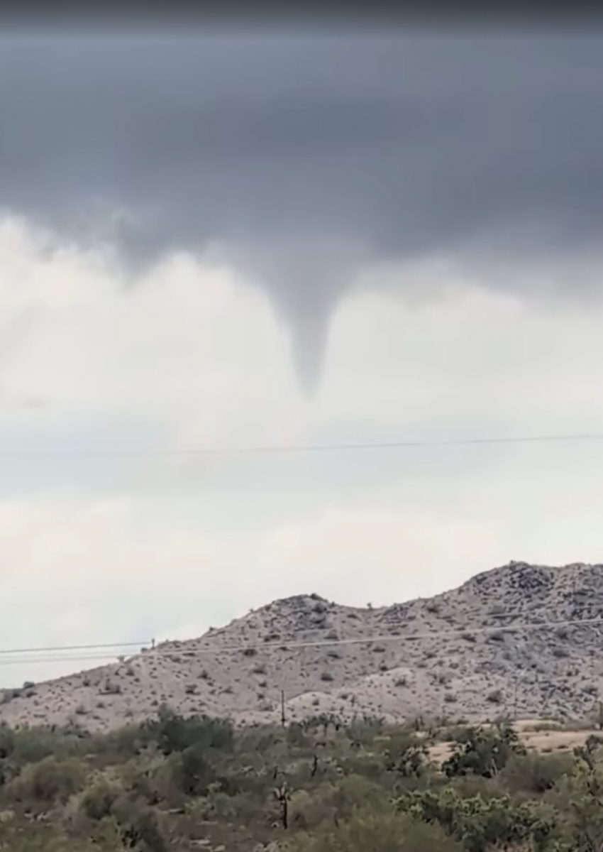
Tornado & Funnel Clouds
Forepaugh, AZ Tornado
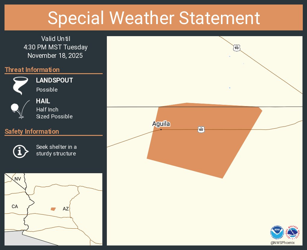
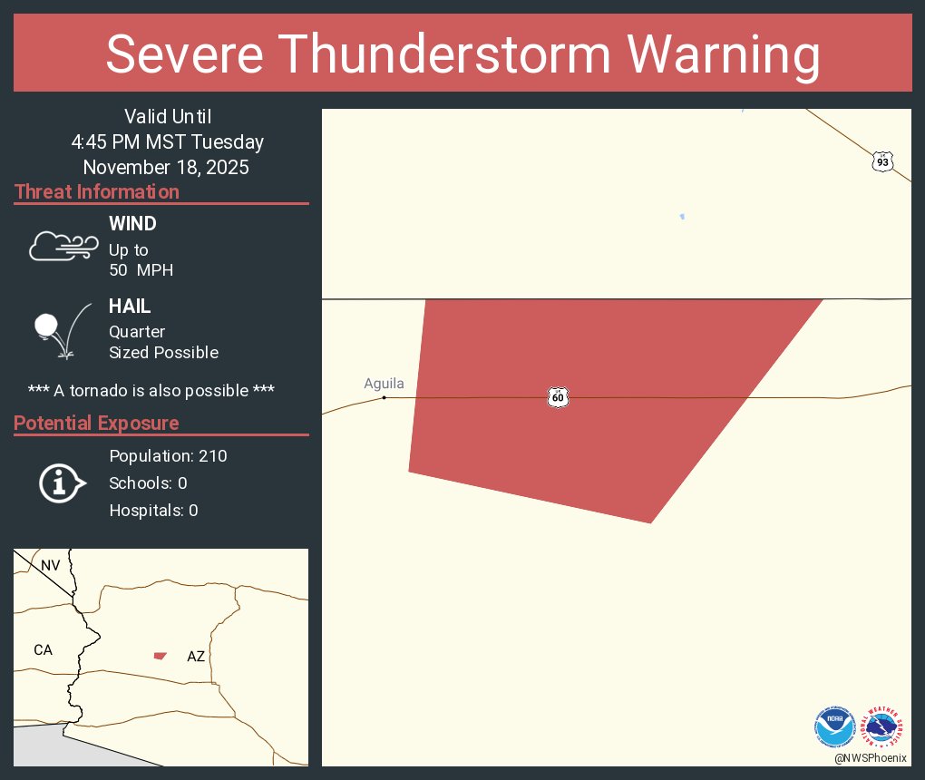
In the afternoon of Nov 18th, a supercell thunderstorm developed in northwest Maricopa County and tracked northeastward, passing over US-60 just east of Aguila and west of Wickenburg. The storm more specifically passed through a small rural community named Forepaugh and as it was passing through, a tornado briefly touched down and caused a small amount of damage. A virtual damage survey was conducted by NWS Phoenix meteorologists nearly a week after the event, assessing photos, a video, and weather radar. Photos showed damage consistent with an EF-0 tornado with winds estimated between 65-85 mph.
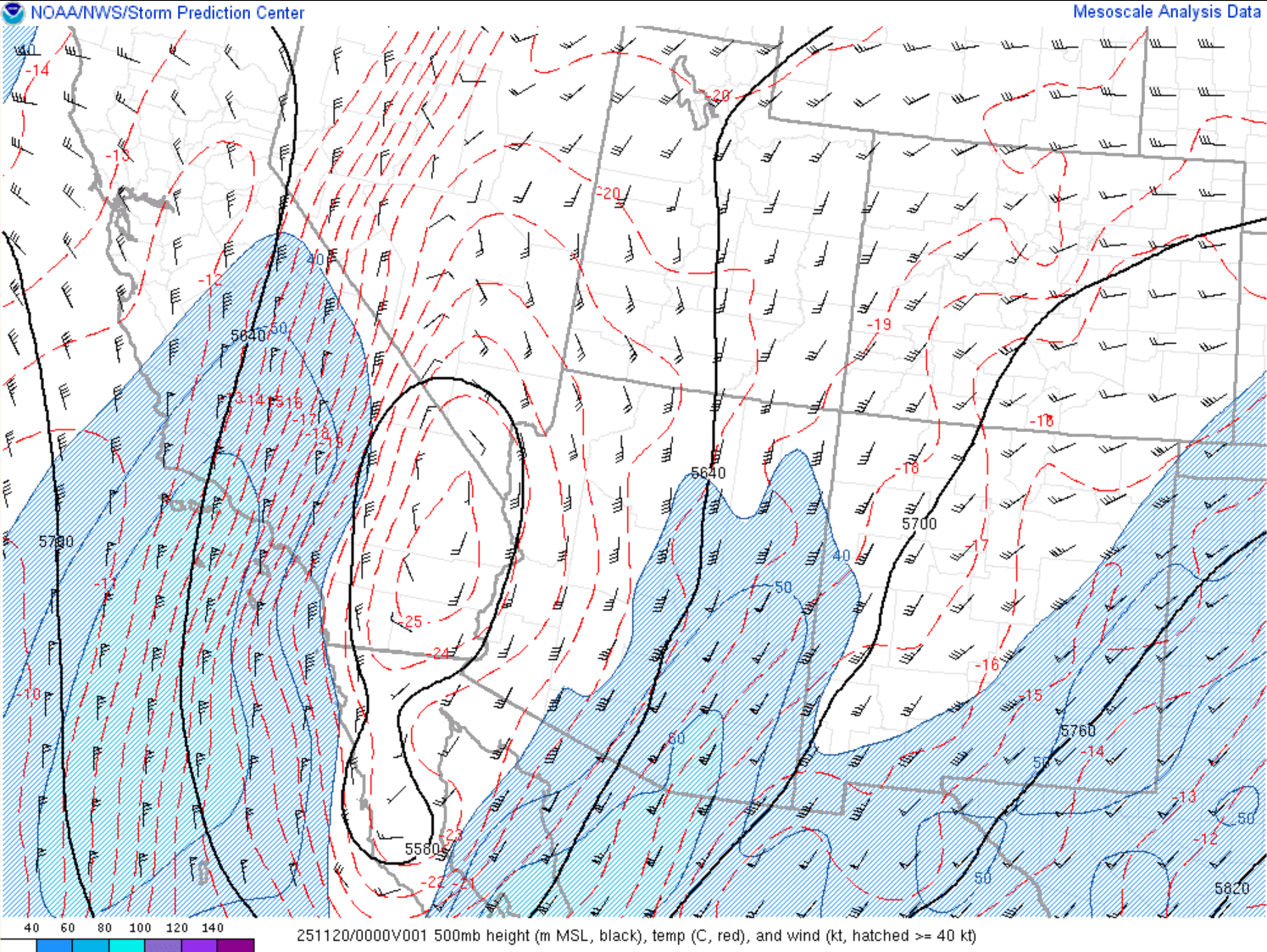
A Special Weather Statement (SPS) was issued and followed shortly after by a Severe Thunderstorm Warning (SVR) for the supercell. Both products indicated the potential for a tornado, with the SPS mentioning landspout possible and the SVR including a tornado possible tag. The decision to include the tornado possible mention was due to the observed radar characteristics and environmental parameters. The Phoenix radar (KIWA) showed a storm with motion deviant from the mean flow (south to north), which is indicative of a rotating storm. Storm relative motion (SRM), with the 0.5 degree radar tilt (lowest tilt), also showed a rotational signature, with inbound velocities (green color) next to outbound velocities (red colors). The SRM sampled rotational velocity values mostly around 25-30 kts. These samples were at around 7500-8000 ft above the ground, given the Phoenix radar is 90 miles away from Forepaugh and the radar beam rises the further it gets from the radar. Any tornado vortex signatures with this tornado would have been below the radar beam height, especially considering the Lifting Condensation Level (LCL), or roughly the cloud base, was around 2500 ft. In these situations, with the radar limitation, where there is not high enough confidence to issue a tornado warning, meteorologists rely on timely eye-witness reports.
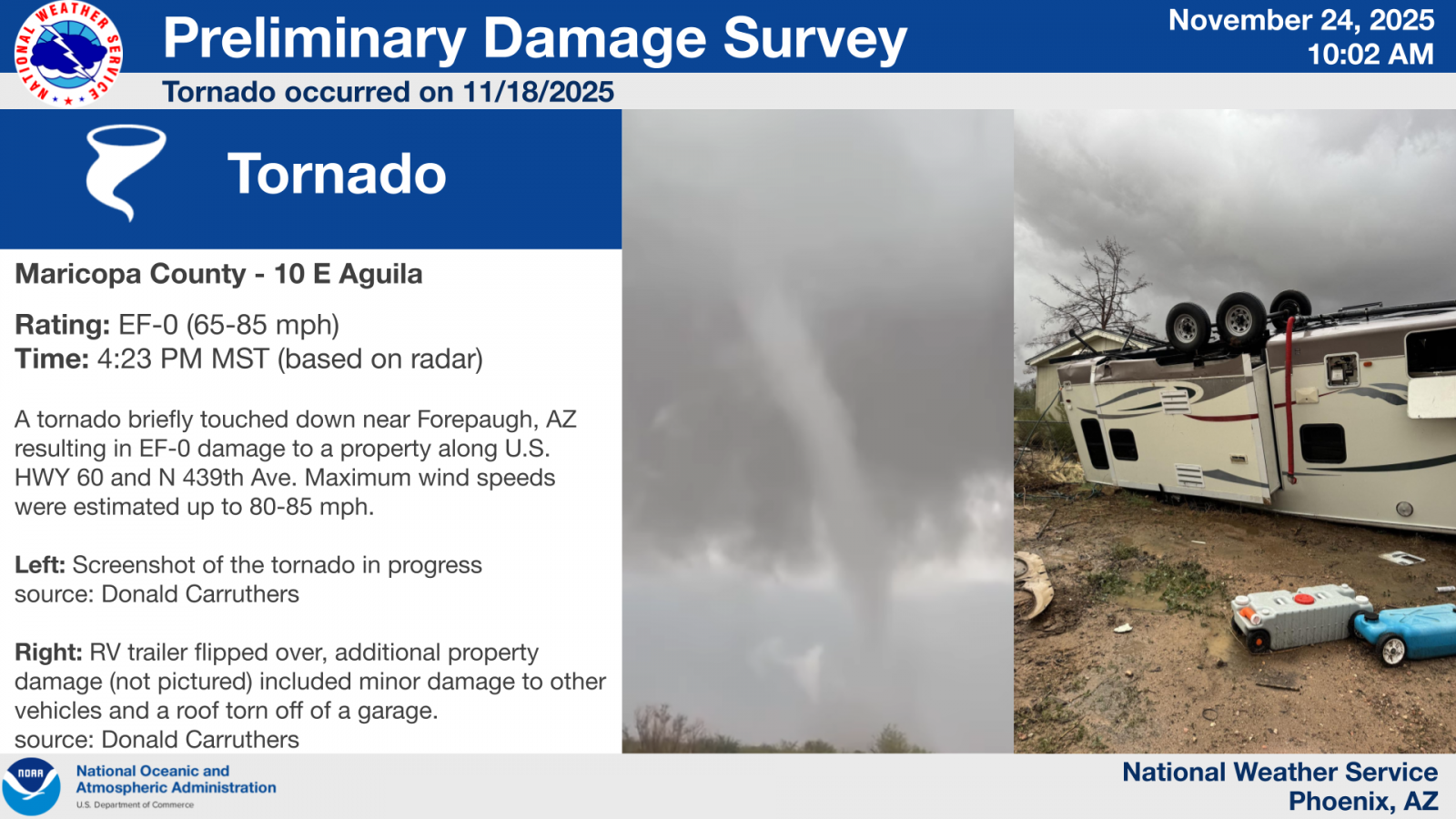 |
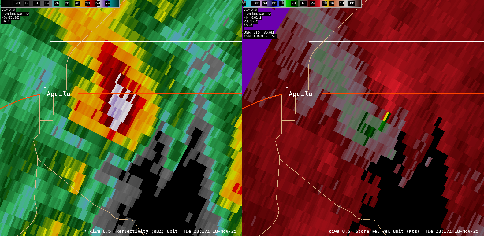 |
| Damage Survey graphic put together by NWS Phoenix for the Forepaugh tornado. | Single two-panel radar image, from the Phoenix radar (KIWA) of the tornado-producing supercell thunderstorm at 4:17 PM MST (23:17Z), around the time the tornado touched down. The left panel is 0.5 degree reflectivity and the right panel is 0.5 degree SRM. |
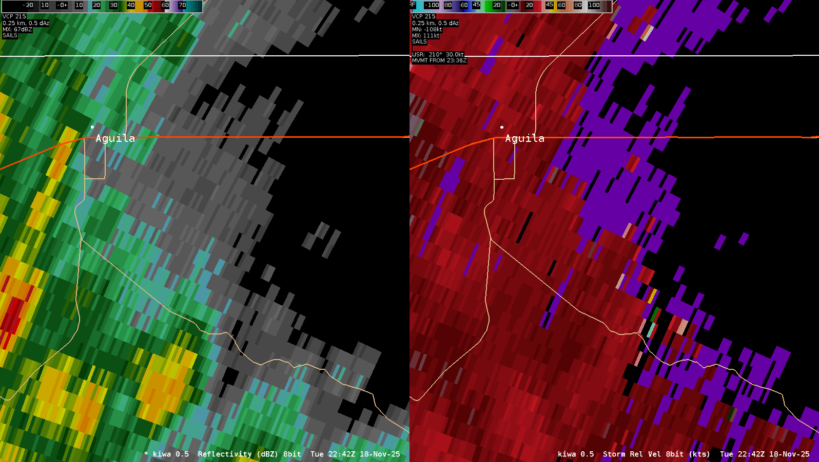 |
| Radar loop of the tornado-producing supercell thunderstorm. The loop shows a two-panel view from the Phoenix radar (KIWA), where the left panel is 0.5 degree reflectivity and the right panel is 0.5 degree SRM. |
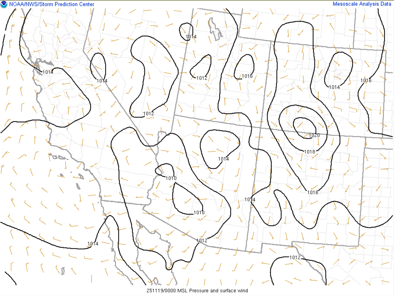
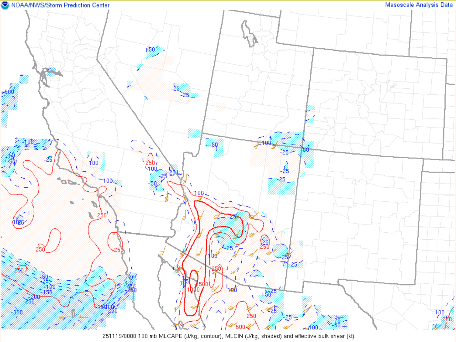
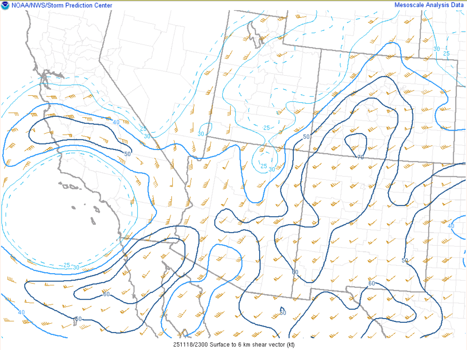
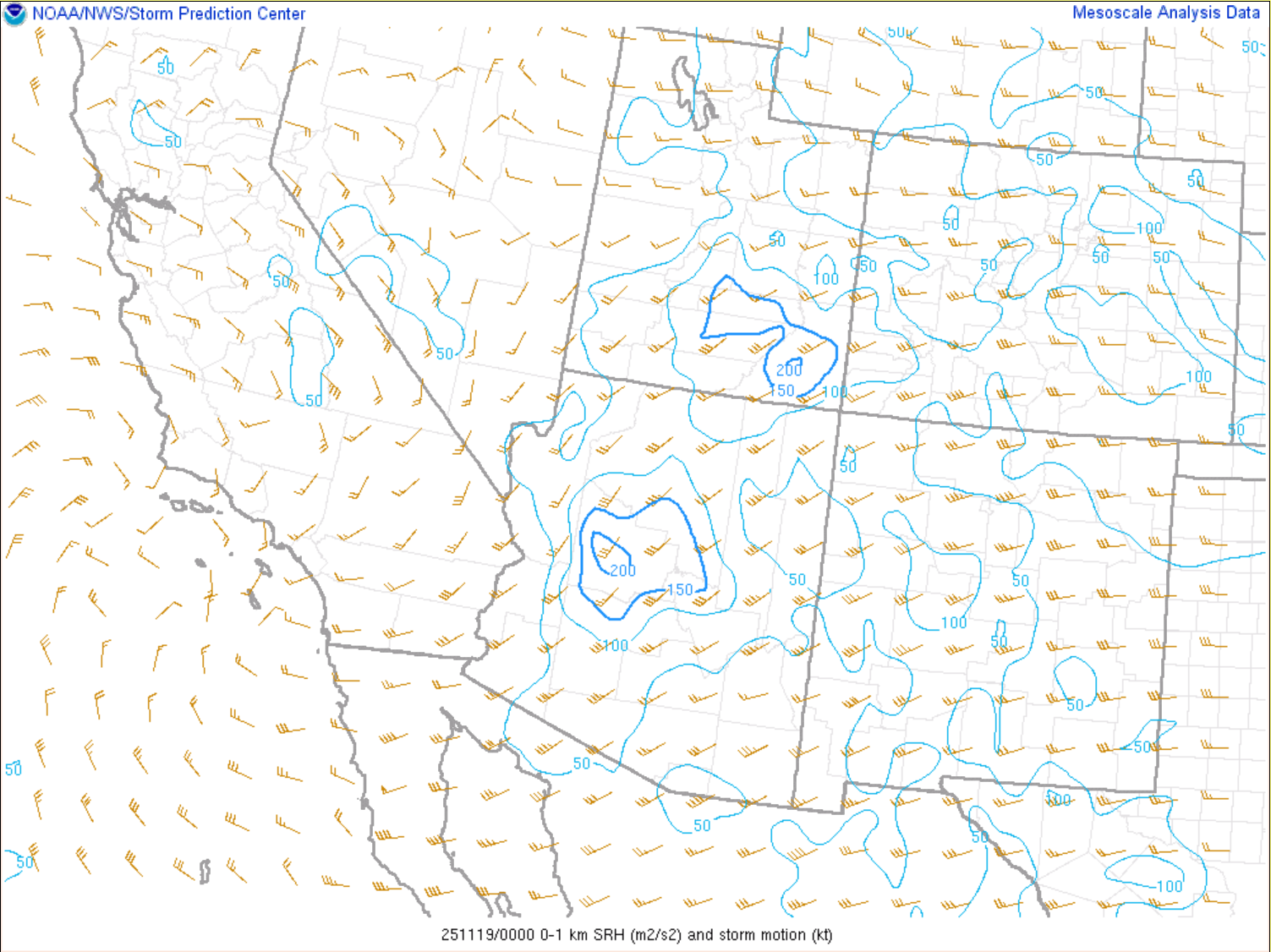
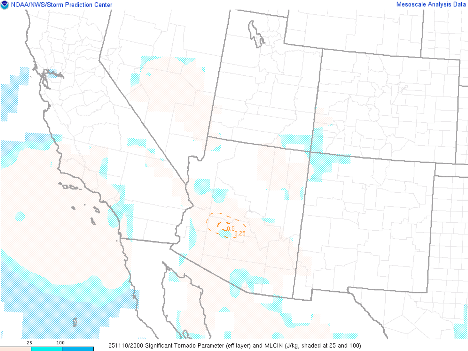
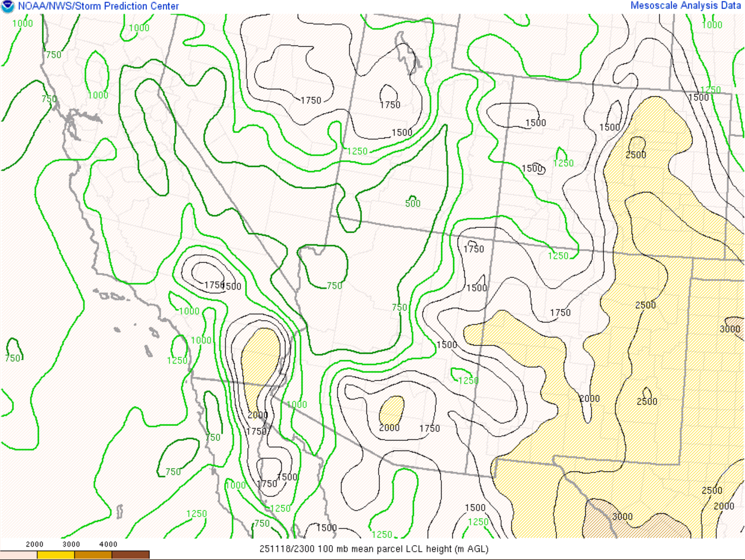
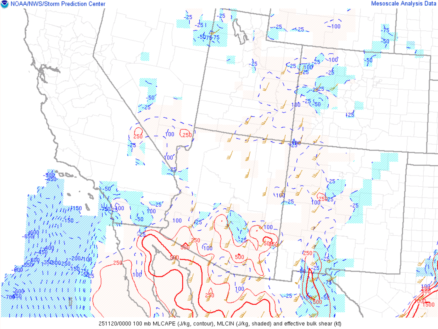
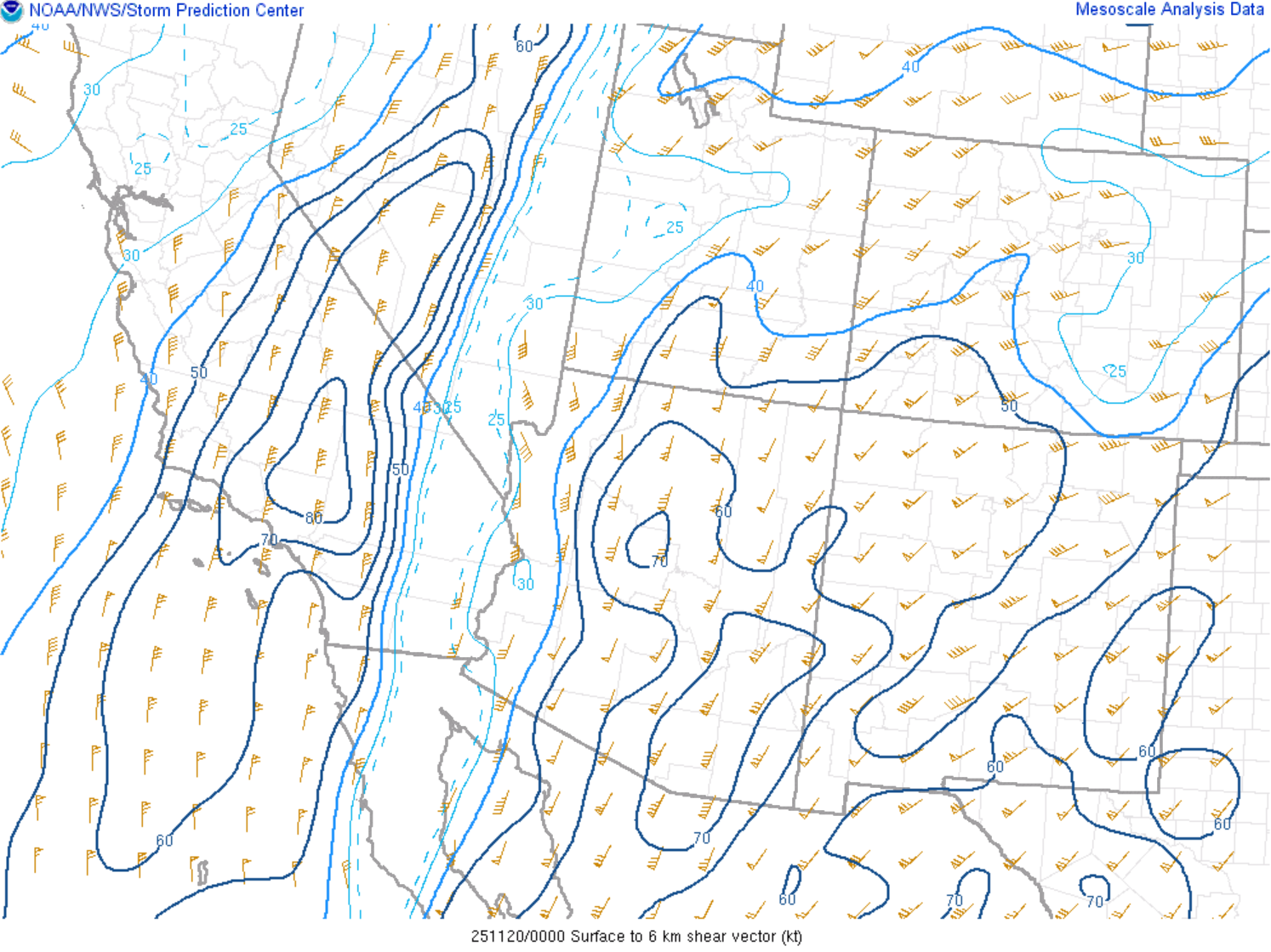
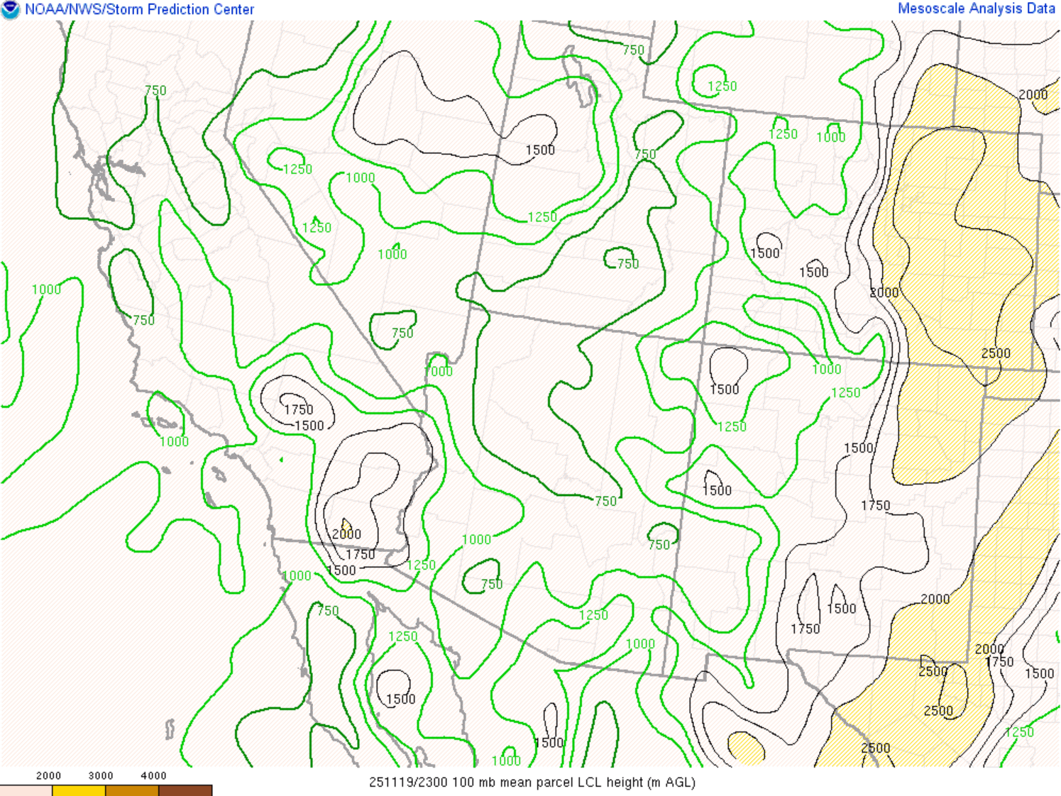
Supercellular tornadoes do not occur very often in the lower deserts of Arizona. The last confirmed tornado from a supercell in the NWS Phoenix county warning area was on September 23, 2019 (event summary). There were also confirmed tornadoes from a quasi-linear convective system (QLCS), or squall line, in 2019, on November 28-29 (event summary). One of the main reasons supercellular tornadoes are rare in the lower deserts is that it is difficult to get ideal environmental conditions in the lowest couple thousand feet of the surface and have low-LCLs or low cloud bases. Supercell thunderstorms often form during the transition seasons each year, usually in October and November, when cold Pacific troughs move through and increase the wind shear magnitudes to levels supportive for supercells (0-6km bulk shear >40 kts is a good proxy for supercells). While the supercells often form, their cloud bases are still most often around 5000-7000 ft above the ground, which is not ideal for tornadoes, and the surface vorticity and low level shear (0-1km shear) is usually too weak for a tornado. One other environmental parameter referenced for tornado potential is 0-1km storm relative helicity (SRH), which describes the corkscrew spin in the lowest layer of the atmosphere. Values around 150 m2/s2 and greater are ideal for tornadoes. Looking at the environmental analysis data for Nov 18th, in the Environment tab, you will see 0-1km SRH was near 150 m2/s2 in northwest Maricopa County. LCL height was around 750m or ~2500 ft, which is quite low for the lower deserts and more ideal for tornadoes. Additionally, 0-3km mixed layer CAPE (MLCAPE) was high, around 125 J/kg, and coincided with higher magnitudes of surface vorticity. So, the environmental ingredients, albeit still very marginal, were in place for the Forepaugh tornado.
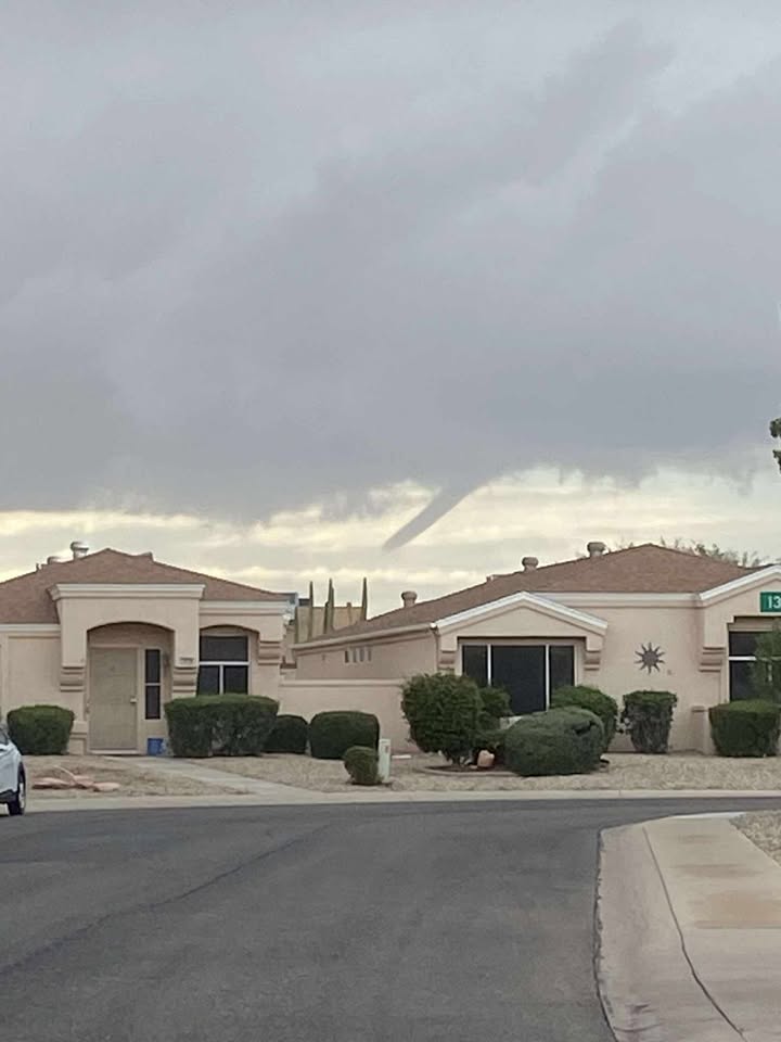
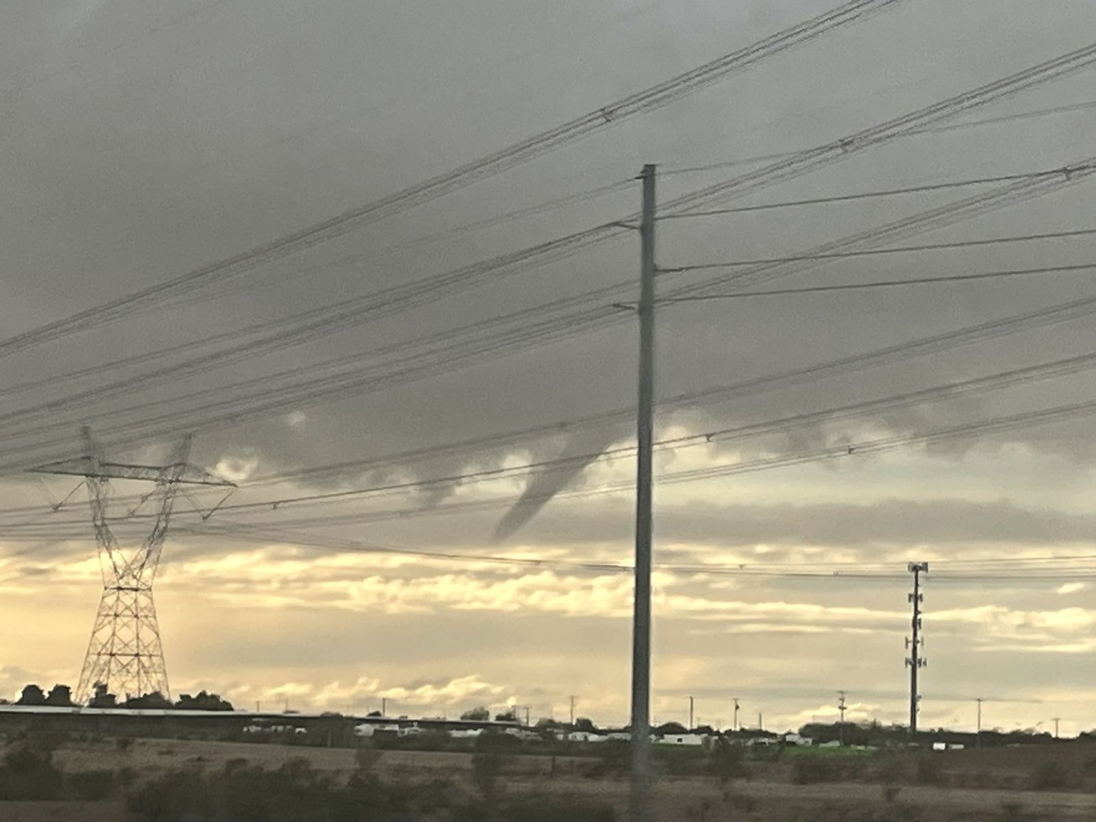
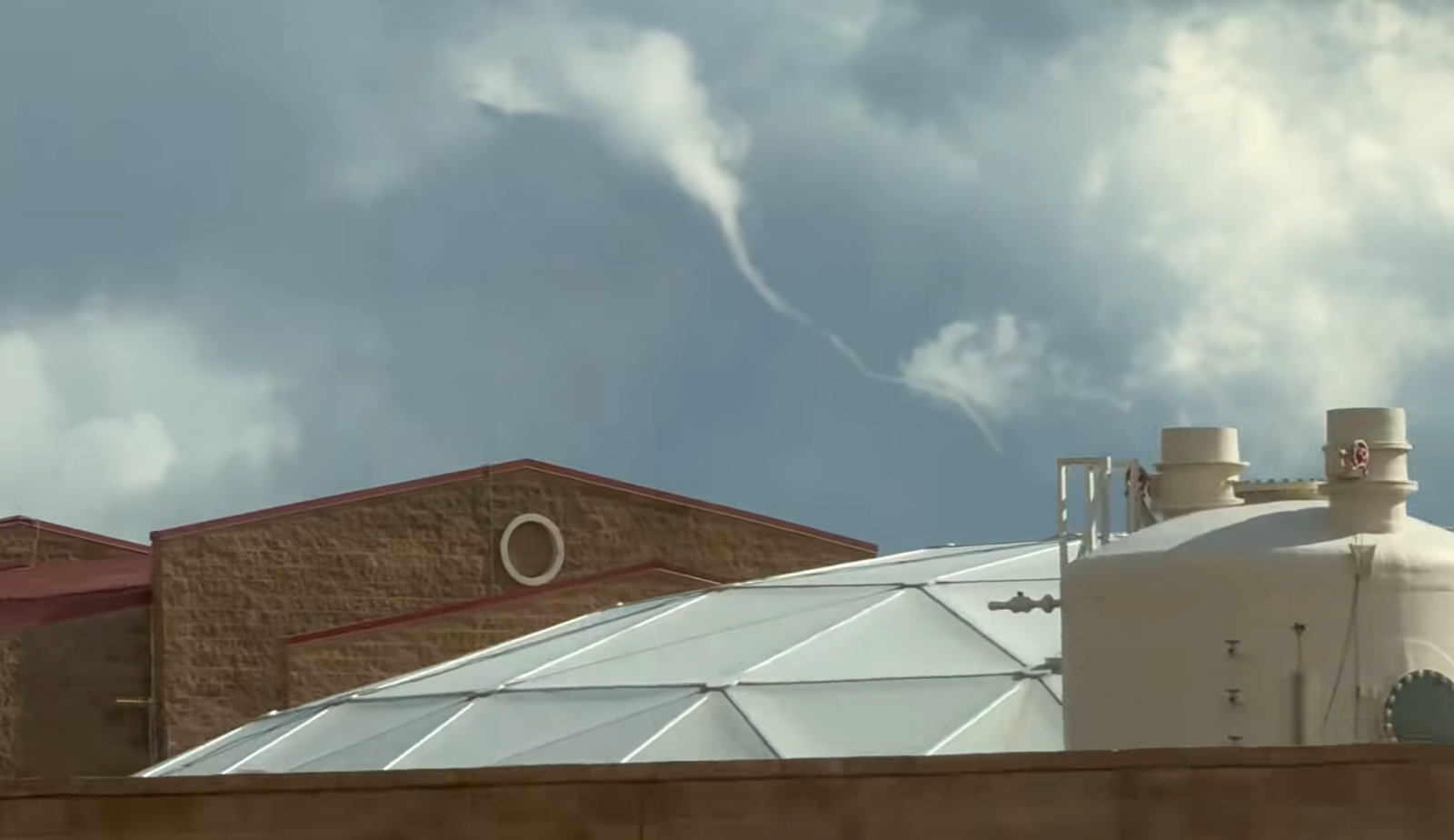
Funnel Clouds
 |
 |
 |
 |
| Funnel cloud viewed from Sun City West on Nov 19th. Same funnel as the image to the right. Credit: Carrie Johnson on Facebook | Funnel cloud viewed from Surprise, near the US-60 and Loop 303, on Nov 19th. Same funnel as the image to the left. Credit: Watts Brooks on X | Funnel cloud viewed from near the Loop 101 & 202 interchange in Mesa on Nov 20th. Credit: Alan Helton | Funnel cloud west of Buckeye on Nov 19th. Credit: Greg Ahlborn |
Warning Products and Reports
 |
 |
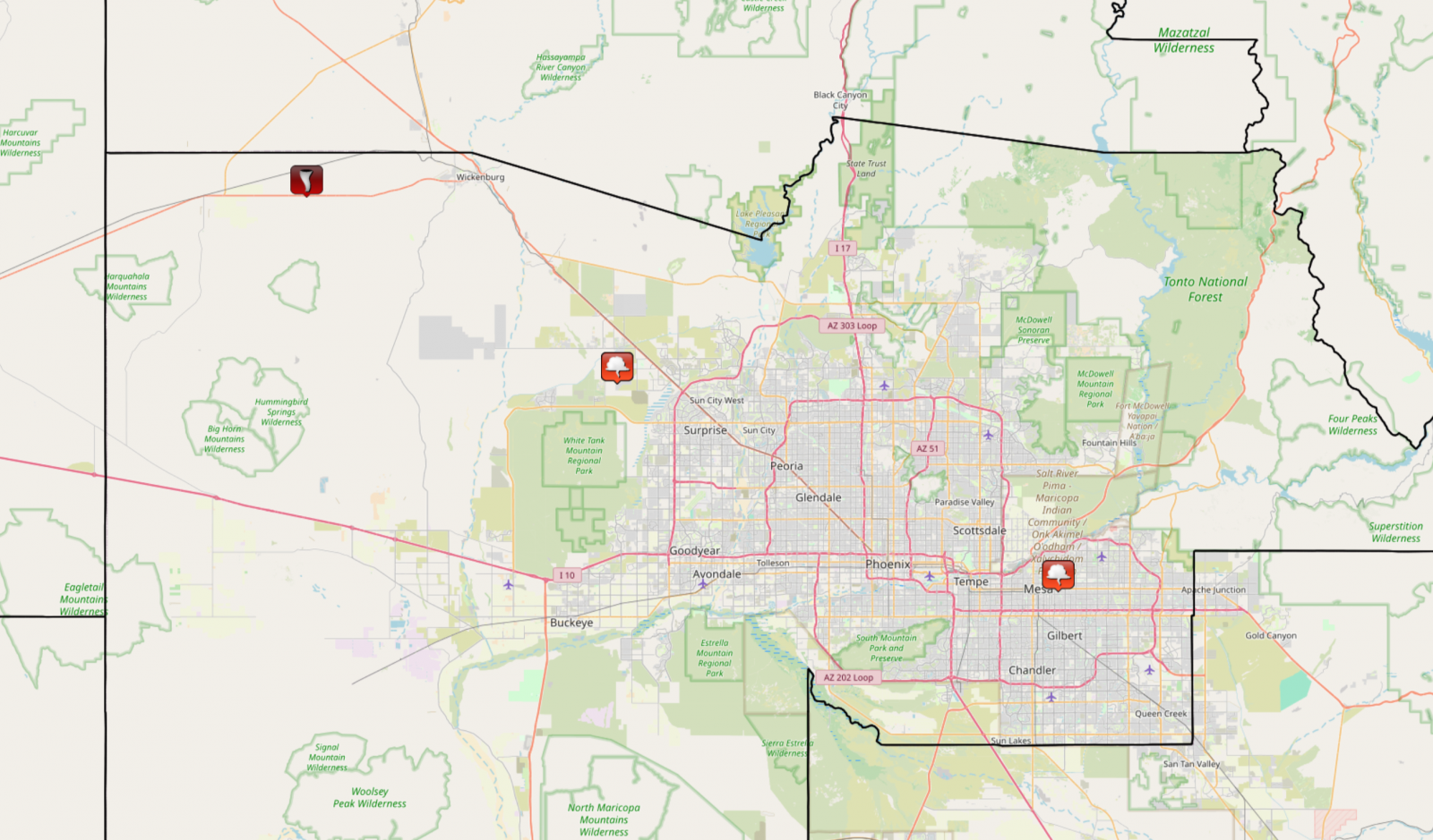 |
| Special Weather Statement issued at 4:14 PM MST for half-inch diameter hail and potential for a landspout. | Severe Thunderstorm Warning issued at 4:18 PM MST for quarter size hail and included a tornado possible tag. | Map showing the locations of the one tornado LSR and two funnel cloud LSRs. Source: IEM LSR App |
Environment
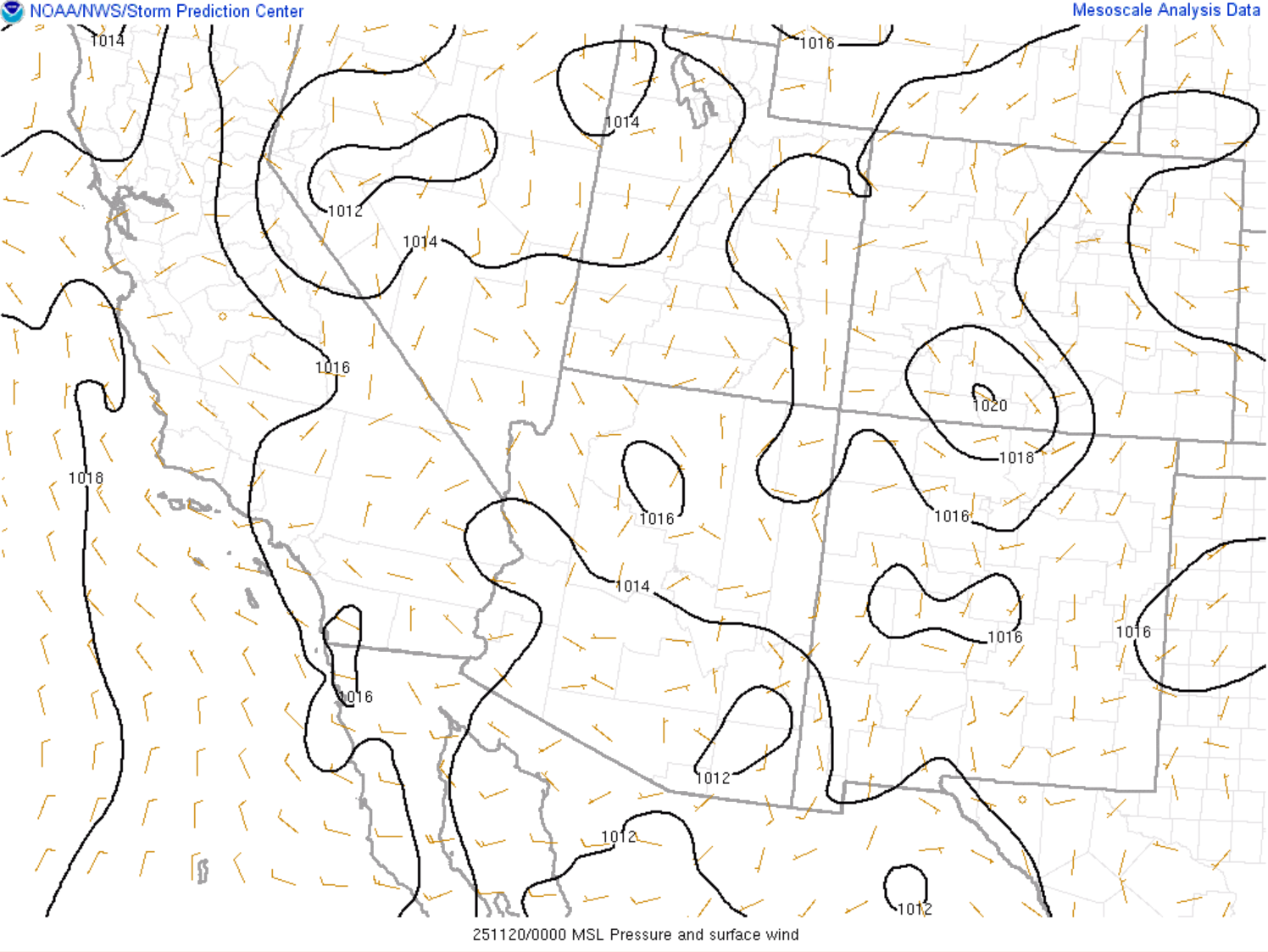
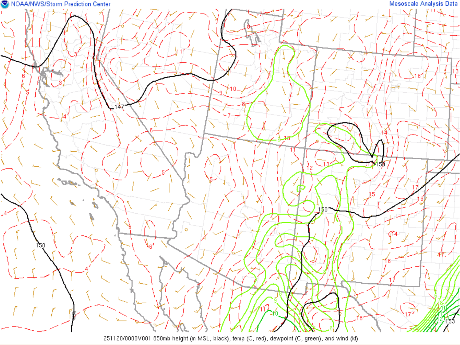
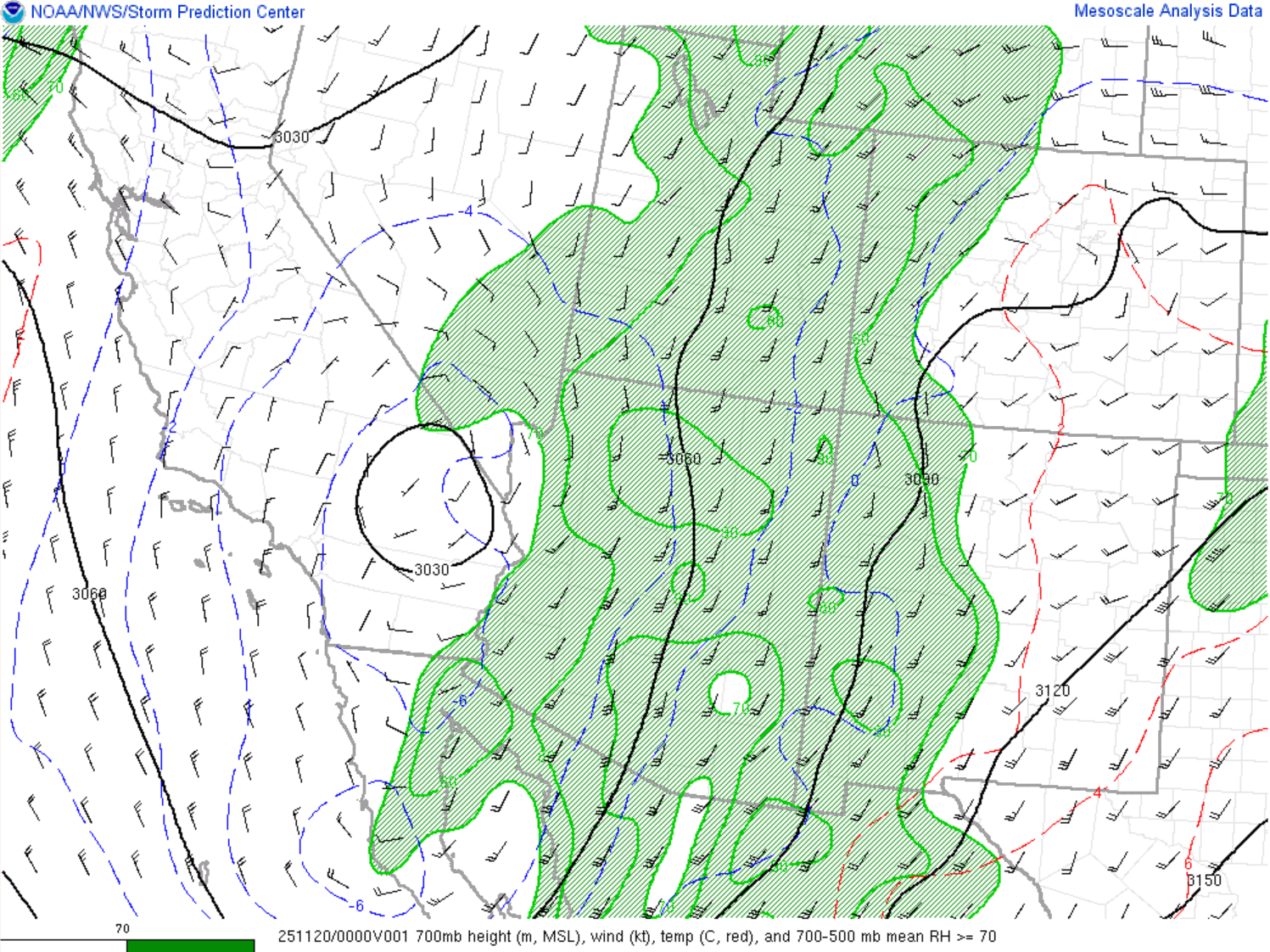
November 18 Environment
Synoptic analysis
 |
 |
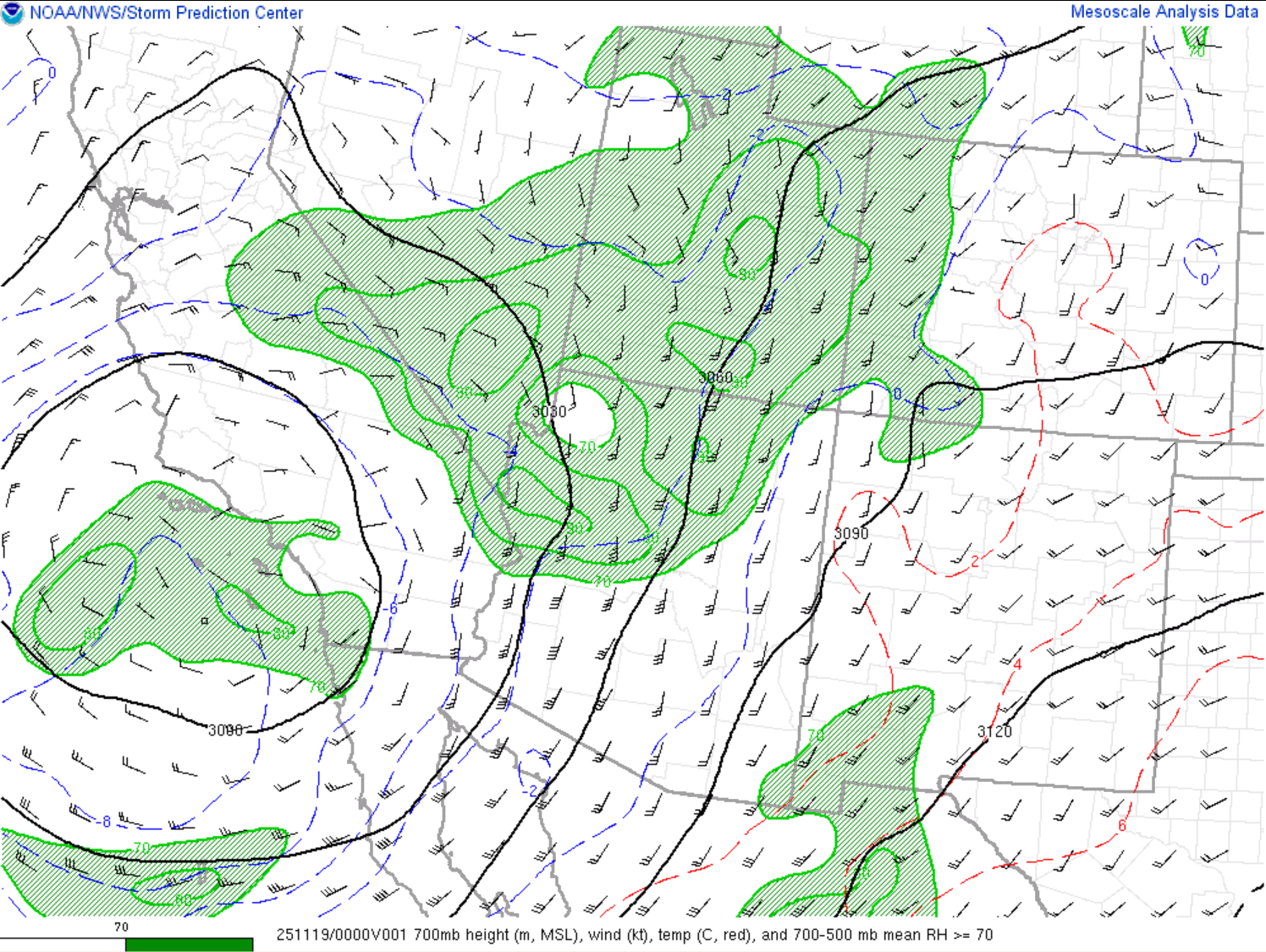 |
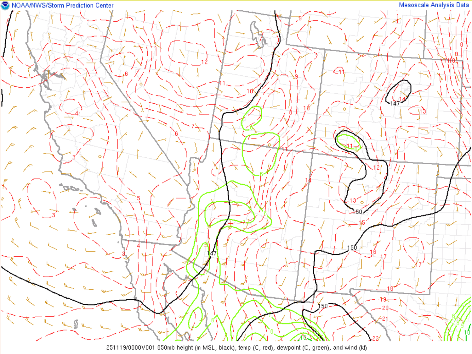
| Mean sea level pressure and surface wind. Valid 0000Z Nov 19. Source: SPC Mesoscale Analysis | 850mb analysis. Valid 0000Z Nov 19. Source: SPC Mesoscale Analysis | 700mb analysis. Valid 0000Z Nov 19. Source: SPC Mesoscale Analysis |
 |
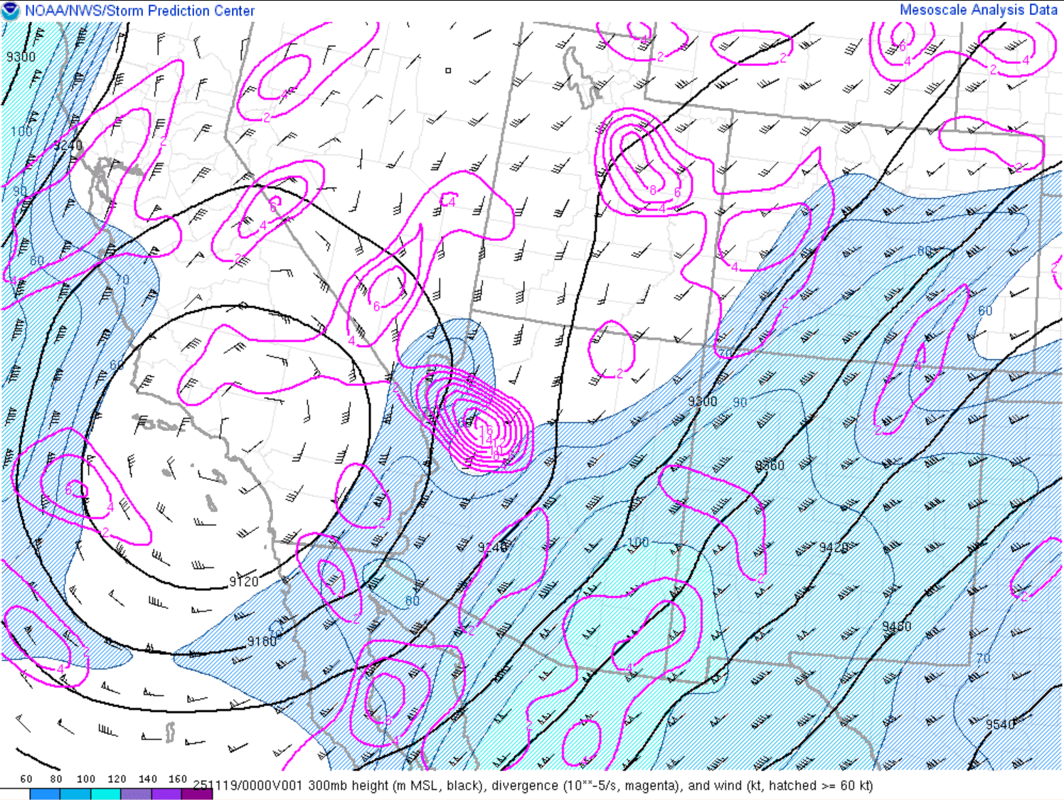 |
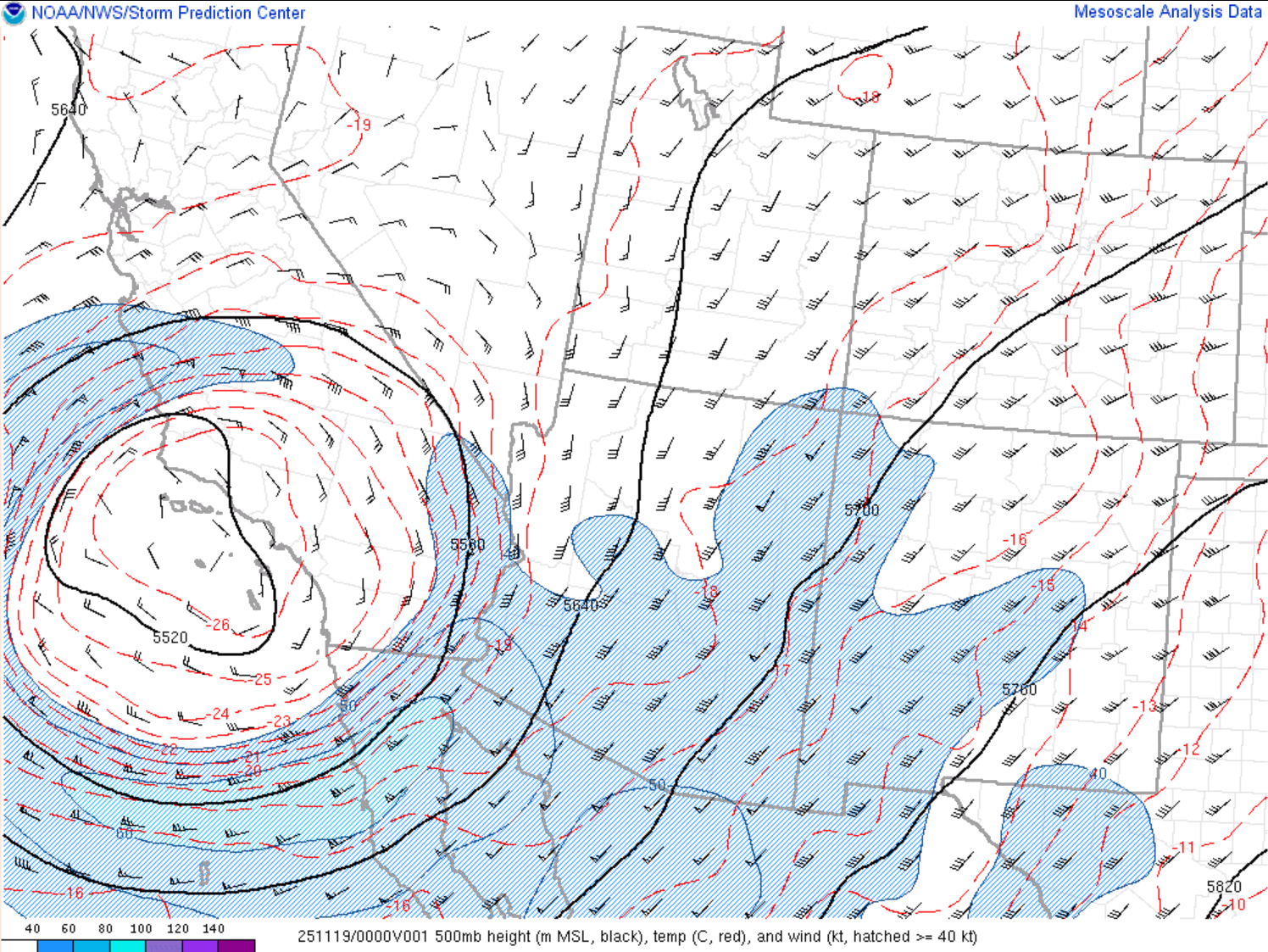
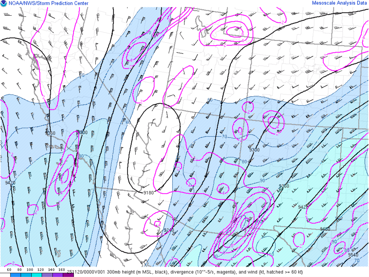
| 500mb analysis. Valid 0000Z Nov 19. Source: SPC Mesoscale Analysis | 300mb analysis. Valid 0000Z Nov 19. Source: SPC Mesoscale Analysis |
Instability and Wind Shear
 |
 |
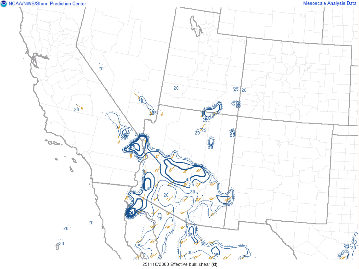 |
| Mixed-layer CAPE. Valid 0000Z Nov 19. Source: SPC Mesoscale Analysis | 0-6km bulk shear. Valid 2300Z Nov 18. Source: SPC Mesoscale Analysis | Effective bulk shear. Valid 2300Z Nov 18. Source: SPC Mesoscale Analysis |
 |
 |
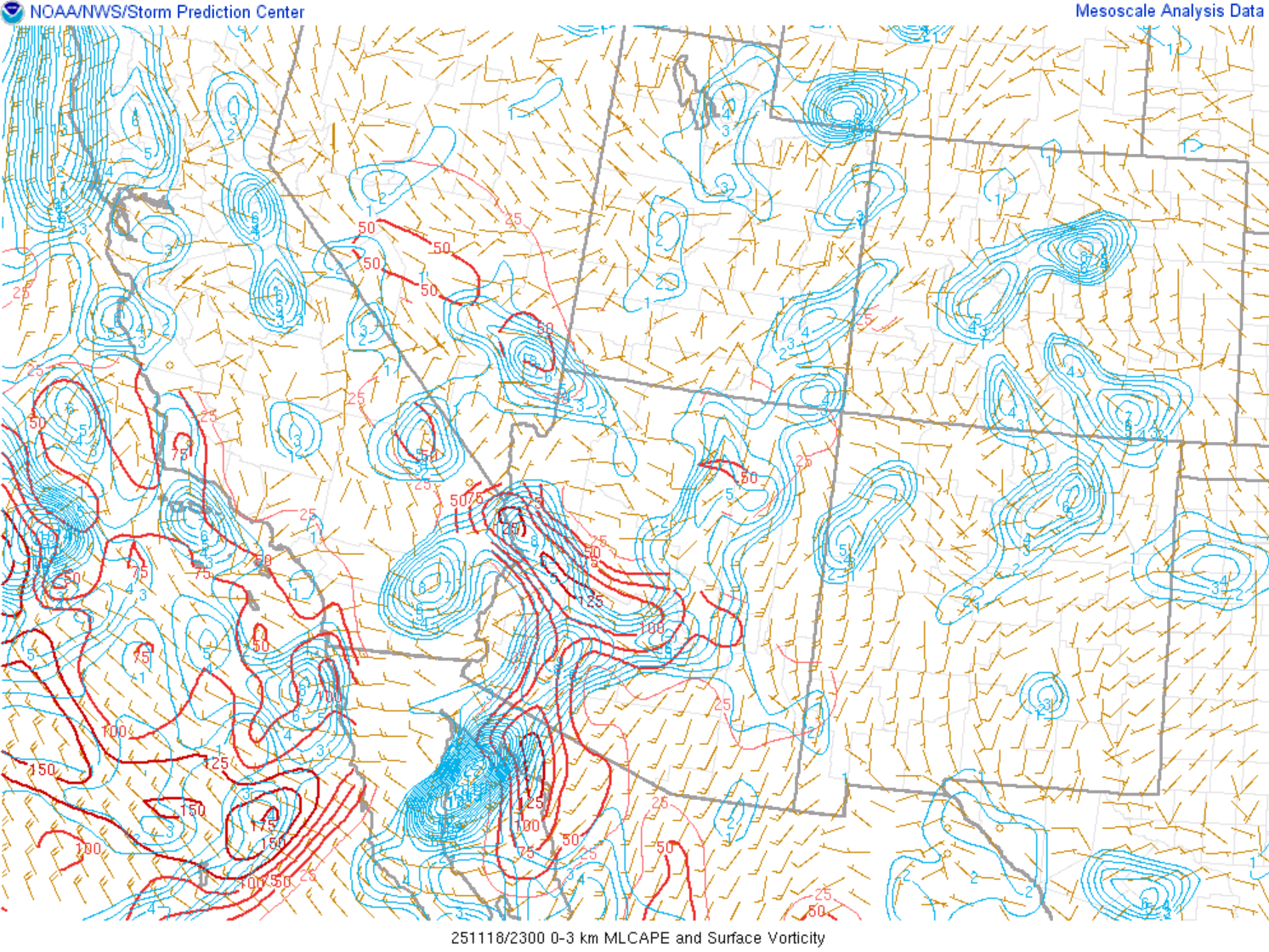 |
| 0-1km storm relative helicity. Valid 2300Z Nov 18. Source: SPC Mesoscale Analysis | Significant tornado parameter. Valid 2300Z Nov 18. Source: SPC Mesoscale Analysis | Surface vorticity & 0-3km mixed-layer CAPE. Valid 2300Z Nov 18. Source: SPC Mesoscale Analysis |
Additional environmental data
 |
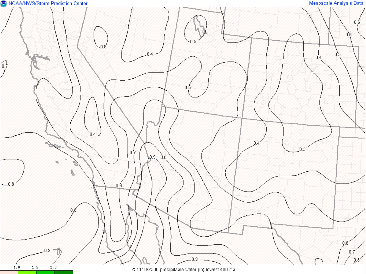 |
| LCL height. Valid 2300Z Nov 18. Source: SPC Mesoscale Analysis | Precipitable water. Valid 2300Z Nov 18. Source: SPC Mesoscale Analysis |
November 19 Environment
Synoptic analysis
 |
 |
 |
| Mean sea level pressure and surface wind. Valid 0000Z Nov 20. Source: SPC Mesoscale Analysis | 850mb analysis. Valid 0000Z Nov 20. Source: SPC Mesoscale Analysis | 700mb analysis. Valid 0000Z Nov 20. Source: SPC Mesoscale Analysis |
 |
 |
| 500mb analysis. Valid 0000Z Nov 20. Source: SPC Mesoscale Analysis | 300mb analysis. Valid 0000Z Nov 20. Source: SPC Mesoscale Analysis |
Instability and Wind Shear
 |
 |
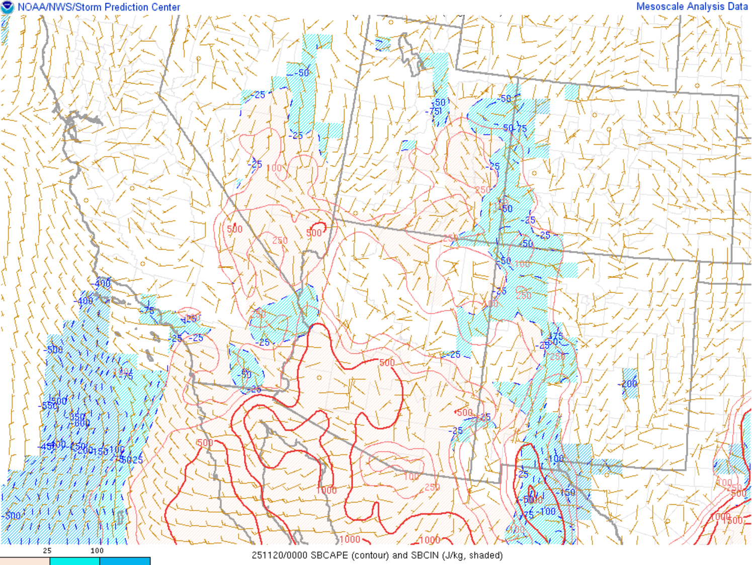 |
| Mixed-layer CAPE. Valid 2300Z Nov 19. Source: SPC Mesoscale Analysis | 0-6km bulk shear. Valid 0000Z Nov 20. Source: SPC Mesoscale Analysis | Surface-based CAPE. Valid 0000Z Nov 20. Source: SPC Mesoscale Analysis |
Additional environmental data
 |
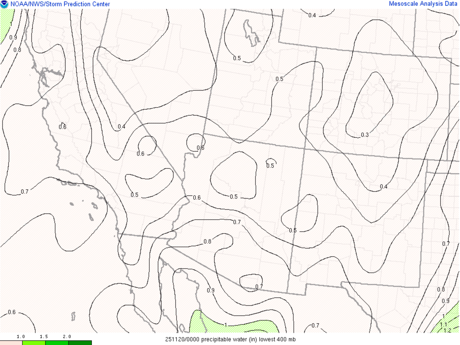 |
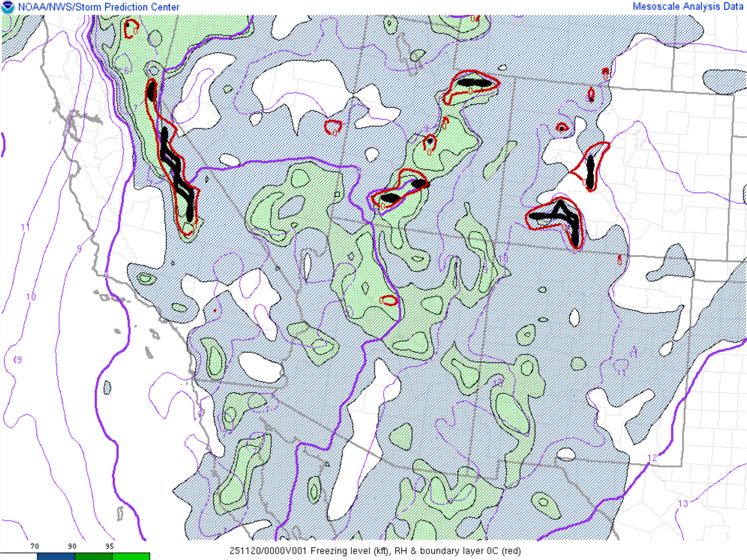 |
| LCL height. Valid 2300Z Nov 19. Source: SPC Mesoscale Analysis | Precipitable water. Valid 0000Z Nov 20. Source: SPC Mesoscale Analysis | Freezing level. Valid 0000Z Nov 20. Source: SPC Mesoscale Analysis |
Forecast
WPC Excessive Rainfall Outlook (ERO)
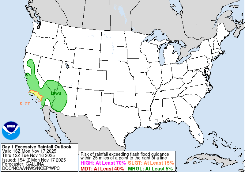 |
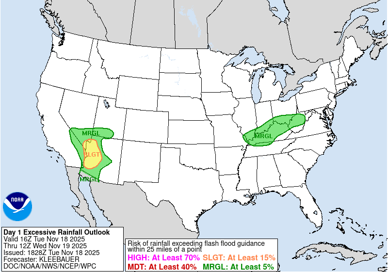 |
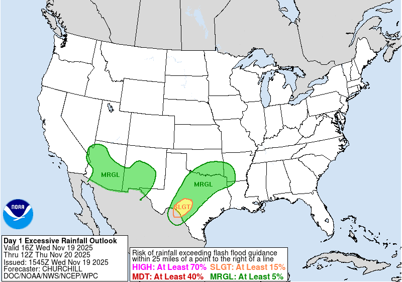 |
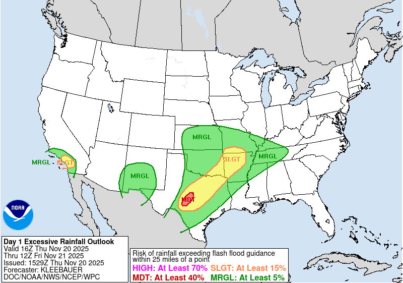 |
| Nov 17th Day 1 16Z ERO | Nov 18th Day 1 16Z ERO | Nov 19th Day 1 16Z ERO | Nov 20th Day 1 16Z ERO |
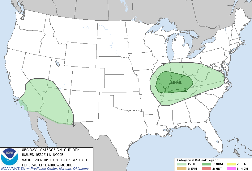
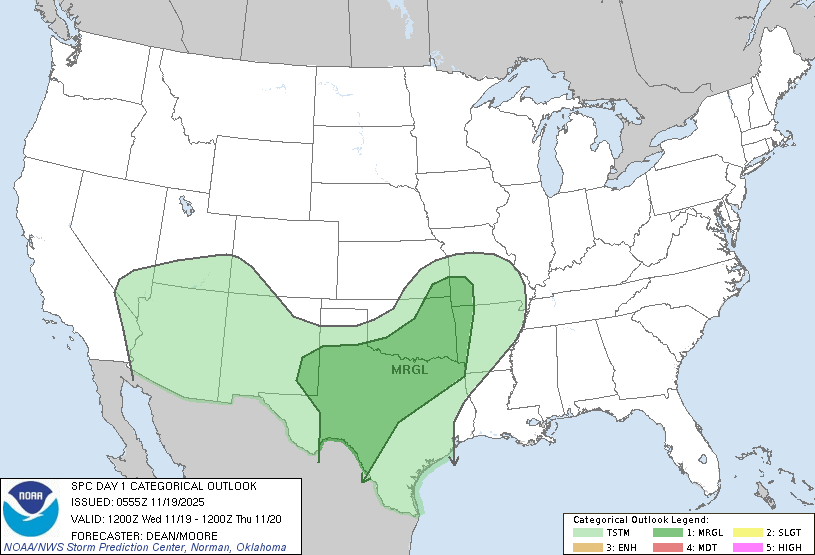
SPC Convective Outlook
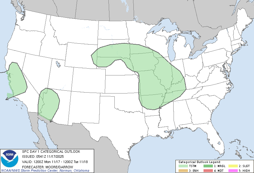 |
 |
 |
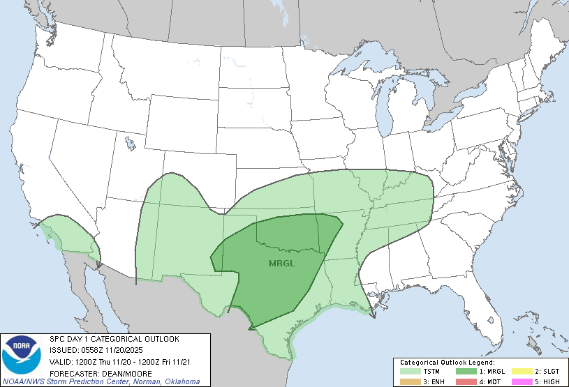 |
| Nov 17th Day 1 12Z Outlook | Nov 18th Day 1 12Z Outlook | Nov 19th Day 1 12Z Outlook | Nov 20th Day 1 Outlook |
NWS Phoenix Social Media & Weather Story Graphics
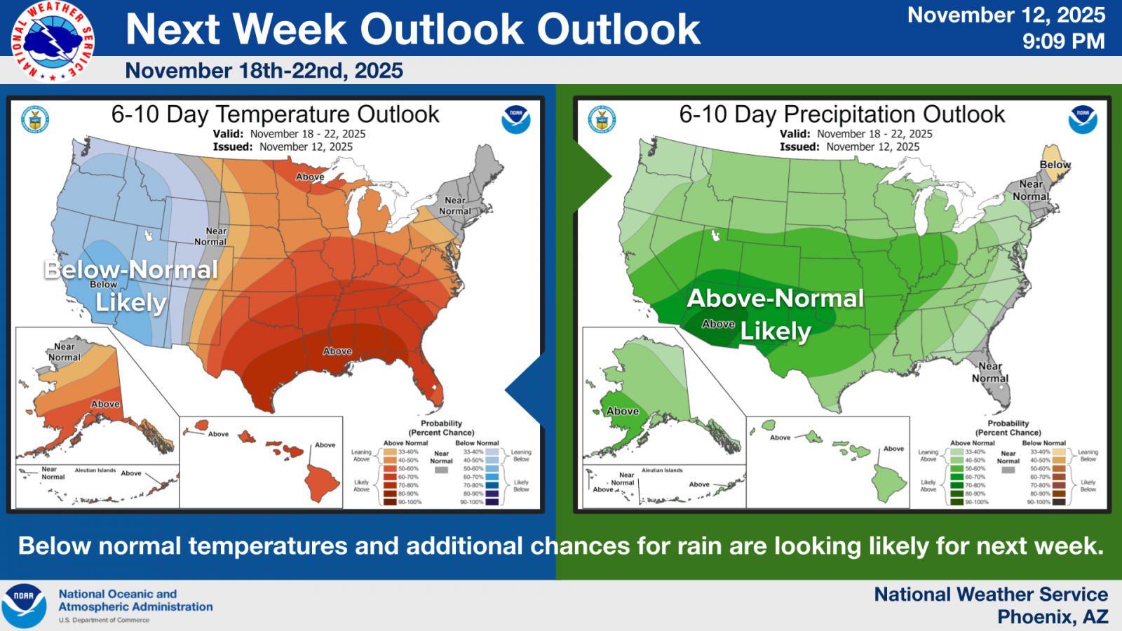 |
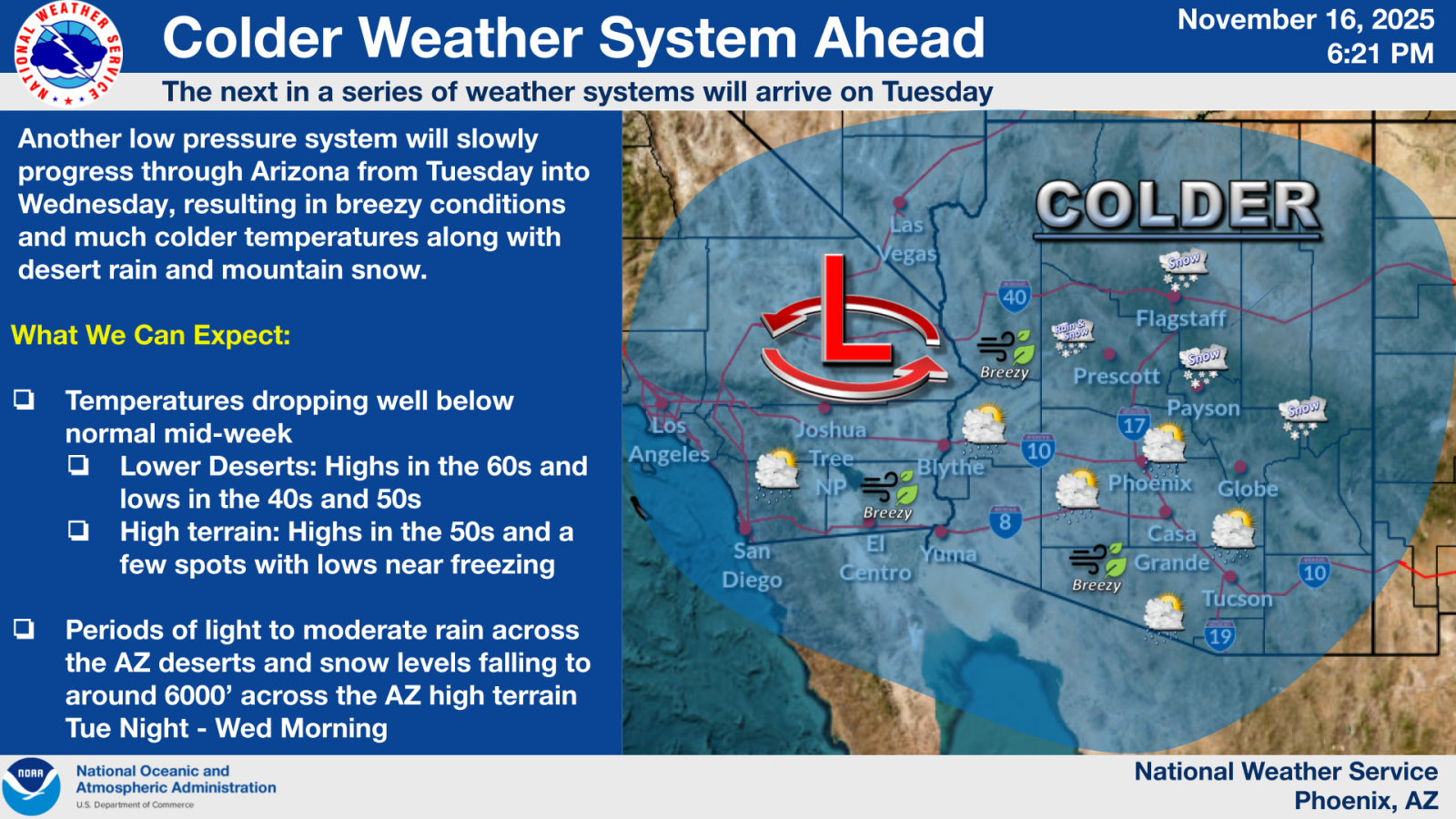 |
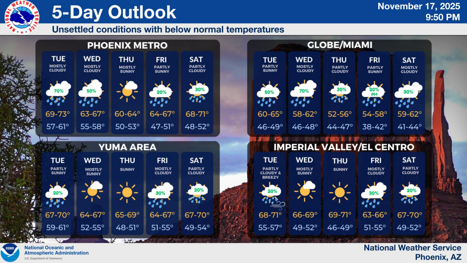 |
| Climate Prediction Center Outlook graphic advertising high odds for above normal precipitation. Posted on Nov 12th | Outlook graphic about the incoming cold and wet weather system. Posted on Nov 16th. | 5-Day weather outlook, including high rain chances for the Phoenix and Globe/Miami areas. Posted on Nov 17th. |
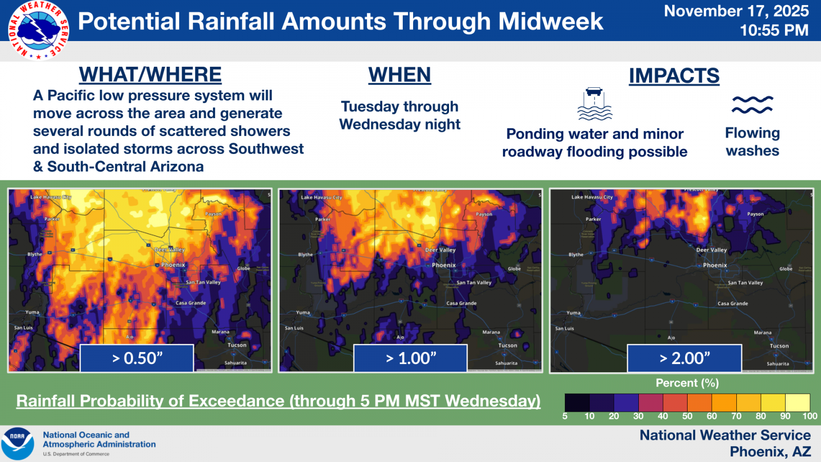 |
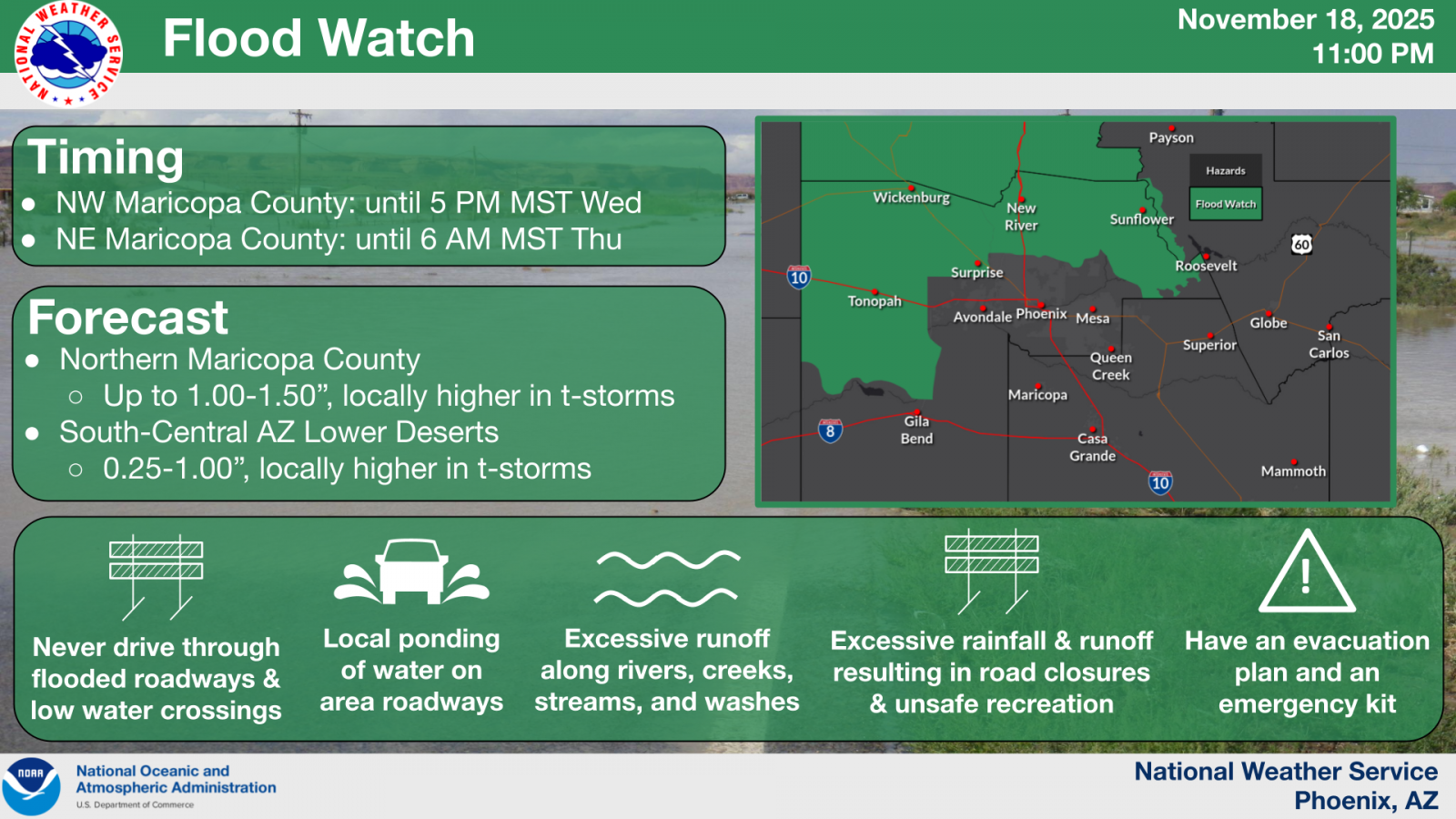 |
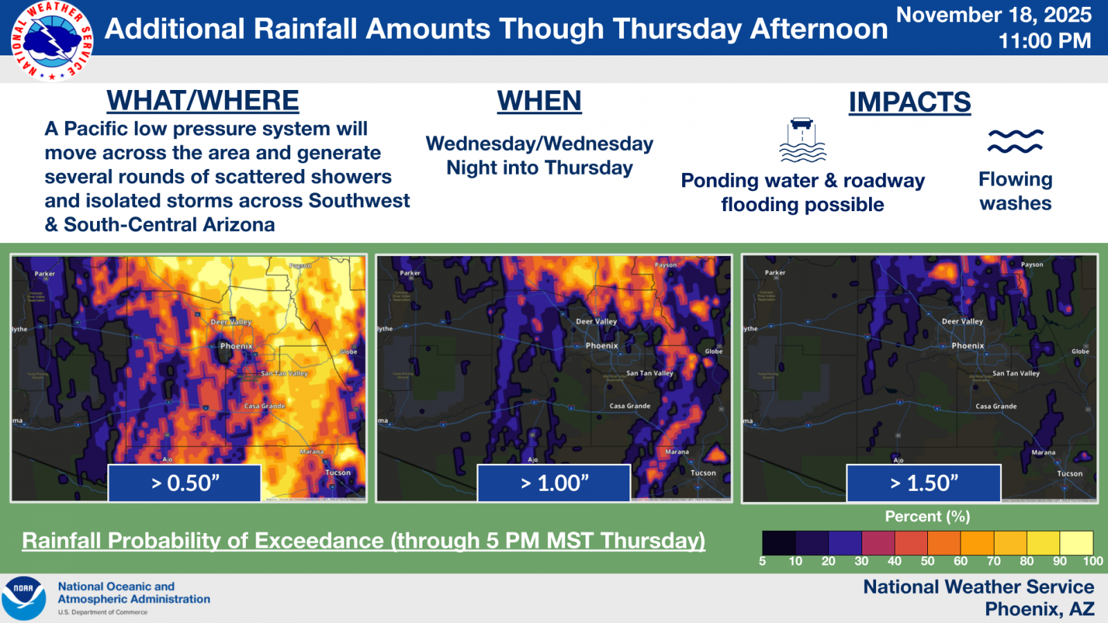 |
| Outlook graphic including probabilistic rainfall forecasts for Nov 18th through the 19th. Posted on Nov 17th. | Graphic for the issuance of a Flood Watch for Wednesday the 19th. The Flood Watch covered areas that had already received high rainfall totals on Tuesday the 18th. Posted on Nov 18th. | Outlook graphic including probabilistic rainfall forecasts for Nov 19th into the 20th. Posted on Nov 18th. |
Storm Report Summary
Local storm reports (LSR) are PRELIMINARY. Final/official storm reports for November will be posted to the Storm Events Database at NCEI by the end of January 2026.
LSR Summary:
..TIME... ...EVENT... ...CITY LOCATION... ...LAT.LON...
..DATE... ....MAG.... ..COUNTY LOCATION..ST.. ...SOURCE....
..REMARKS..
1211 PM Funnel Cloud 2 ESE Mesa 33.41N 111.80W
11/20/2025 Maricopa AZ Public
A couple videos showed a roped-out cold air
funnel over Mesa.
0730 PM Flash Flood 6 SSE New River 33.84N 112.10W
11/19/2025 Maricopa AZ County Official
***Delayed Report*** Maricopa County
Department of Transportation reported
portions of Desert Hills Drive and 19th
Avenue were closed where there are unbridged
crossings with Skunk Creek. Timing based on
stream gauges along Skunk Creek.
0730 PM Hail 2 N Fountain Hills 33.64N 111.75W
11/19/2025 M0.25 Inch Maricopa AZ Public
0728 PM Rain 3 W Fountain Hills 33.59N 111.80W
11/19/2025 M0.50 Inch Maricopa AZ Public
0.5 inches of rain in approximately 15
minutes.
0727 PM Flash Flood 6 WSW Cave Creek 33.79N 112.05W
11/19/2025 Maricopa AZ Fire Dept/Rescue
Water rescue reported near Paint Your Wagon
Trail and 14th St.
0700 PM Flash Flood 3 ENE Ahwatukee Foothil 33.32N 112.01W
11/19/2025 Maricopa AZ Public
***Delayed Report*** Video shows inundated
concrete wash with rapidly flowing water,
making the Tere Street low water crossing
impassable.
0655 PM Hail 2 ESE Arizona State Uni 33.41N 111.91W
11/19/2025 E0.88 Inch Maricopa AZ Public
Photo of an estimated nickel-sized hail
stone.
0655 PM Hail 1 NE Tempe 33.40N 111.91W
11/19/2025 M0.50 Inch Maricopa AZ Public
0651 PM Hail 2 E Tempe 33.39N 111.89W
11/19/2025 M1.00 Inch Maricopa AZ NWS Employee
Corrects previous hail report from 2 E
Tempe. A photo shows a few of the largest
hail stones found, measuring up to 1.00
inches in diameter. There was also a lot of
0.5 inch diameter hail.
0650 PM Flash Flood 6 N Deer Valley 33.76N 112.11W
11/19/2025 Maricopa AZ Fire Dept/Rescue
Water rescue reported along North Valley
Parkway. A nearby streamflow gauge on
Sonoran Wash has exceeded bank full.
0650 PM Hail 2 ENE Tempe 33.40N 111.90W
11/19/2025 E0.75 Inch Maricopa AZ Public
Photos of accumulated hail with sizes up to
0.75 inches in diameter.
0645 PM Hail 2 SW Guadalupe 33.35N 111.99W
11/19/2025 E0.25 Inch Maricopa AZ Public
Accumulated small hail around 1 to 3 inches
in depth.
0645 PM Rain 2 SW Guadalupe 33.34N 111.99W
11/19/2025 M0.75 Inch Maricopa AZ Public
Rainfall of 0.75 inches in 15 minutes.
0639 PM Hail 2 SE Ahwatukee Foothill 33.29N 112.03W
11/19/2025 E0.25 Inch Maricopa AZ Dept of Highways
ADOT traffic cam shows accumulated small
hail on SR-202.
0634 PM Hail 4 E Ahwatukee Foothills 33.31N 111.99W
11/19/2025 E0.25 Inch Maricopa AZ Public
A couple of reports of small hail.
0625 PM Hail 3 ESE Ahwatukee Foothil 33.29N 112.01W
11/19/2025 E1.75 Inch Maricopa AZ Public
***Delayed Report*** Two reports of ping
pong to golf ball sized hail along 202 WB
between 24th and 40th street, with video
evidence of hail dents on vehicle.
0605 PM Flash Flood 2 ENE Tolleson 33.46N 112.23W
11/19/2025 Maricopa AZ Broadcast Media
Video showing multiple lanes of I-10
impassable, near 75th Ave, due to flooding.
0550 PM Tstm Wnd Gst 3 ESE Deer Valley 33.65N 112.07W
11/19/2025 E40 MPH Maricopa AZ Public
Photo of a toppled large dead tree. Wind
gusts estimated at 40 mph.
0545 PM Hail 3 W Deer Valley 33.67N 112.17W
11/19/2025 E0.25 Inch Maricopa AZ Public
0520 PM Hail 2 WSW Glendale 33.52N 112.22W
11/19/2025 E0.25 Inch Maricopa AZ Public
Images show accumulated small hail in the
area.
0510 PM Hail 1 NNE Tolleson 33.46N 112.25W
11/19/2025 E0.25 Inch Maricopa AZ Public
Video shows all lanes of I-10 covered in a
layer of small hail.
0510 PM Hail 3 NE Tolleson 33.48N 112.22W
11/19/2025 E0.25 Inch Maricopa AZ Fire Dept/Rescue
Report of a roof collapse at the Desert Sky
Mall, likely due to the weight of the rain
and accumulated small hail. A trained
spotter reported the ground was covered in
hail and people were having hail-ball
fights.
0507 PM Hail 1 NE Tolleson 33.46N 112.24W
11/19/2025 E0.25 Inch Maricopa AZ Trained Spotter
Report of accumulating small hail.
0504 PM Hail 2 SSE Tolleson 33.42N 112.25W
11/19/2025 E0.25 Inch Maricopa AZ Public
Video shows all surfaces, street and yards,
fully covered in accumulated small hail.
0504 PM Hail 2 SSE Tolleson 33.42N 112.25W
11/19/2025 E0.25 Inch Maricopa AZ Public
Video of accumulated small hail fully
covering the road and yards.
0430 PM Funnel Cloud 7 S Wittmann 33.69N 112.51W
11/19/2025 Maricopa AZ Public
Multiple photos and videos of a brief funnel
cloud as seen from Surprise and Wittmann
areas.
0641 PM Flash Flood 4 NE Centennial 33.61N 113.30W
11/18/2025 Maricopa AZ Fire Dept/Rescue
Water rescue reported in the area of Eagle
Eye Rd and Salome Rd.
0540 PM Flood 7 SW Palo Verde Ngs 33.32N 112.96W
11/18/2025 Maricopa AZ Fire Dept/Rescue
Water rescue reported in the area of 421st
Ave and Narramore Rd.
0510 PM Flash Flood 11 S Gladden 33.74N 113.28W
11/18/2025 Maricopa AZ County Official
***Delayed Report*** Eagle Eye Road closed
due to flooding likely due to several
inundated low water crossings. A stream
gauge along Tiger Wash exceeded alarm stage
and was used for timing.
0423 PM Tornado 10 E Aguila 33.94N 113.01W
11/18/2025 Maricopa AZ Public
***DELAYED REPORT*** Public sent a video of
a brief tornado near the intersection of HWY
60 and N 439th Avenue in Forepaugh, AZ. This
tornado crossed HWY 60 and produced EF-0
damage at a property on the north side of
the highway. Damage included a flipped RV
trailer, minor damage to other vehicles, and
loss of a garage roof. Wind speeds with this
tornado were estimated between 80-85 mph.
Time estimated by radar.
0342 PM Hail 10 SW Wittmann 33.66N 112.63W
11/18/2025 M1.00 Inch Maricopa AZ Trained Spotter
Report of hail between 0.5-1.0 inches in
diameter. Hail also accumulated to cover the
ground.
0325 PM Flash Flood 5 WNW Beardsley 33.71N 112.46W
11/18/2025 Maricopa AZ Trained Spotter
Report of a water rescue near at Happy
Valley Rd and 187th Ave. Water reportedly up
to the level of car headlights.
0316 PM Hail 3 N Buckeye 33.42N 112.59W
11/18/2025 E0.70 Inch Maricopa AZ Trained Spotter
0224 PM Hail 1 NE Tempe 33.40N 111.91W
11/18/2025 M0.25 Inch Maricopa AZ Public
0215 PM Hail 4 SE Guadalupe 33.34N 111.91W
11/18/2025 E0.25 Inch Maricopa AZ Public
0145 PM Hail 5 SW Deer Valley 33.60N 112.15W
11/18/2025 E0.50 Inch Maricopa AZ Public
0130 PM Flash Flood 4 SE Wittmann 33.74N 112.48W
11/18/2025 Maricopa AZ County Official
Patton Rd between 195th Ave and 203rd Ave
closed due to flooding.
1246 PM Flash Flood 3 WNW Wickenburg 33.98N 112.77W
11/18/2025 Maricopa AZ Local Official
Vulture Mine Rd low water crossing at Sols
Wash is closed due to flooding. Water rescue
reported in the wash.
1246 PM Flash Flood 1 NE Wickenburg 33.98N 112.72W
11/18/2025 Maricopa AZ Local Official
Constellation Rd at El Recreo Ct is closed
due to flooding.
1210 PM Flash Flood 4 E Tonopah 33.51N 112.86W
11/18/2025 Maricopa AZ Broadcast Media
A water rescue was reported near 377th Ave
and Orange Dr after getting stuck in a wash.
Two people were found stuck in the truck
with water halfway up the windows before
being safely rescued. Timing estimated from
radar.
1200 PM Flash Flood 15 N Tonopah 33.72N 112.88W
11/18/2025 Maricopa AZ Mesonet
FCDMC stream gage along Jackrabbit Wash
indicated increasing flow in the wash,
making the Vulture Mine Road low water
crossing impassable.
1100 AM Flash Flood 9 SSE Palo Verde Ngs 33.27N 112.80W
11/18/2025 Maricopa AZ County Official
Old US 80 closed between Agua Caliente Rd
and Desert Rose Rd due to flooding. Timing
based on travel time from upstream
streamflow gauge on Centennial Wash at the
UPR railroad crossing.
0520 AM Flash Flood 4 E Tonopah 33.49N 112.87W
11/18/2025 Maricopa AZ Law Enforcement
Wintersburg Road between Indian School Road
and Osborn Road is closed due to
approximately 3-4 feet of water over the
roadway. Timing estimated from radar.
 |
Media use of NWS Web News Stories is encouraged! Please acknowledge the NWS as the source of any news information accessed from this site. |
|

