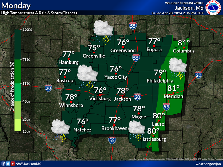
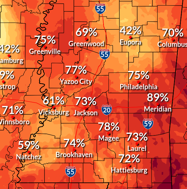
An isolated severe storm will be possible across northern portions of the area Thursday evening into Thursday night. Damaging wind gusts and hail up to the size of quarters will be possible with the most intense storms.
Areas of fog are expected to develop mainly over southeast portions of the area late tonight into early Thursday morning. Some of the fog could be dense at times.
Scattered to isolated showers and storms, with an isolated severe storm possible along the Highway 82 corridor, will be possible over areas mainly north of Interstate 20 today. Look for highs to warm into the low and middle 80s.
Scattered showers and storms will remain possible into tonight, over mainly northern portions of the area. Otherwise, look for mostly cloudy skies tonight with lows in the mid 60s.
An isolated shower or storm will be possible across Northwest & North Central Mississippi Friday. Under mostly to partly cloudy skies, highs will range from the middle 70s to upper 80s.