National Weather Service United States Department of Commerce
Click a location below for detailed forecast.

Last Map Update: Tue, Jun 9, 2026 at 2:28:28 pm CDT


An early Summer heatwave will present itself this week. Heat indices in excess of 105F are anticipated through the end of the week
A damaging wind threat may emerge this afternoon across northwest Tennessee in any strong to severe thunderstorms. Overall, confidence is low, but remain weather aware.
Heat idices in excess of 105F are anticipated across much of the Mid-South today.
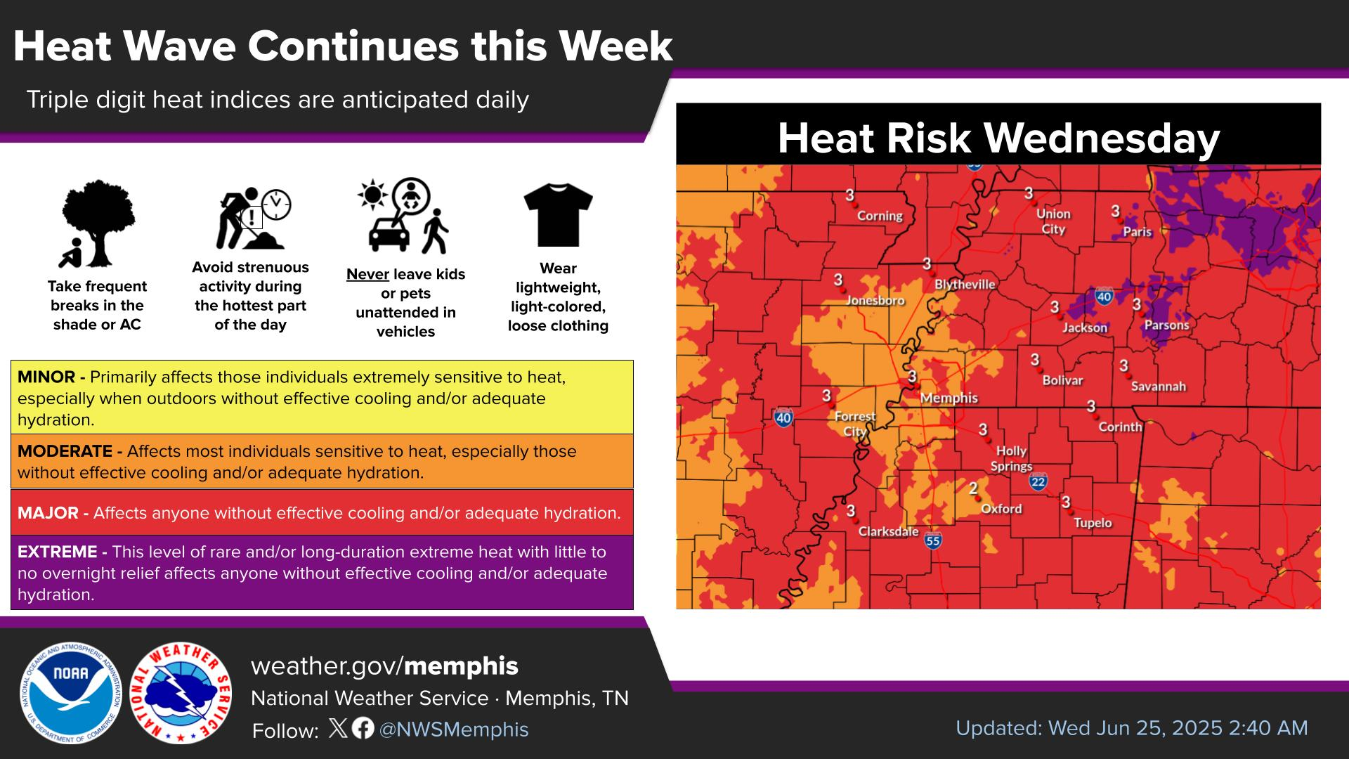
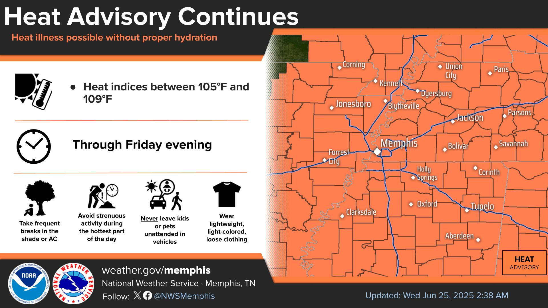
Heat indices in excess of 100F are anticipated each day through at least Friday. A Heat Advisory is in effect through 8 PM. Heat products will likely be warranted each day.

graphical hazard
Graphical Hazards
probabilistic
Probabilistic
current weather
Current Weather
be prepard
Being Prepared
estar preparado
Estar Preparado
safety
Weather Safety

Text Product Selector (Selected product opens in current window)

Hourly Weather Roundup ( )
Location Sky/Weather Temp Dewpt RH Wind Baro Remarks
Memphis, TN
N/A
N/A
N/A
N/A
N/A
N/A
N/A
Jackson, TN
N/A
N/A
N/A
N/A
N/A
N/A
N/A
Jonesboro, AR
N/A
N/A
N/A
N/A
N/A
N/A
N/A
Tupelo, MS
N/A
N/A
N/A
N/A
N/A
N/A
N/A
West Memphis, AR
N/A
N/A
N/A
N/A
N/A
N/A
N/A
Blytheville, AR
N/A
N/A
N/A
N/A
N/A
N/A
N/A
Dyersburg, TN
N/A
N/A
N/A
N/A
N/A
N/A
N/A
Oxford, MS
N/A
N/A
N/A
N/A
N/A
N/A
N/A
Note: "N/A" or "MISG" will be displayed if values are not available. In the LOCATION column, click on links for a list of recent observations at sites of interest. In the WIND column, VRB is "variable" and G is "gust". Wind speeds are in MPH. In the BARO (pressure) column, values are in inches. In the REMARKS column, HX is "heat index", WCI is "wind chill index", and VSB is "visibility" (if shown).