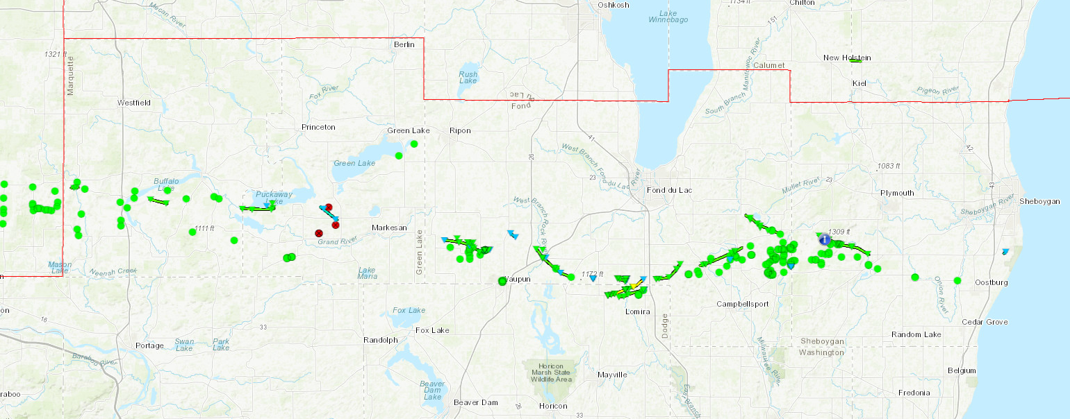
A potent line of severe thunderstorms moved through central Wisconsin on Tuesday, August 28th, 2018. 19 tornadoes were confirmed, stretching from Marquette county, east through Sheboygan county. There was 1 EF2 tornado, 13 EF1 and 5 EF0 tornadoes (1 of those EF1s occurred in NWS Green Bay's area). The amount of damage to trees and agricultural was staggering.
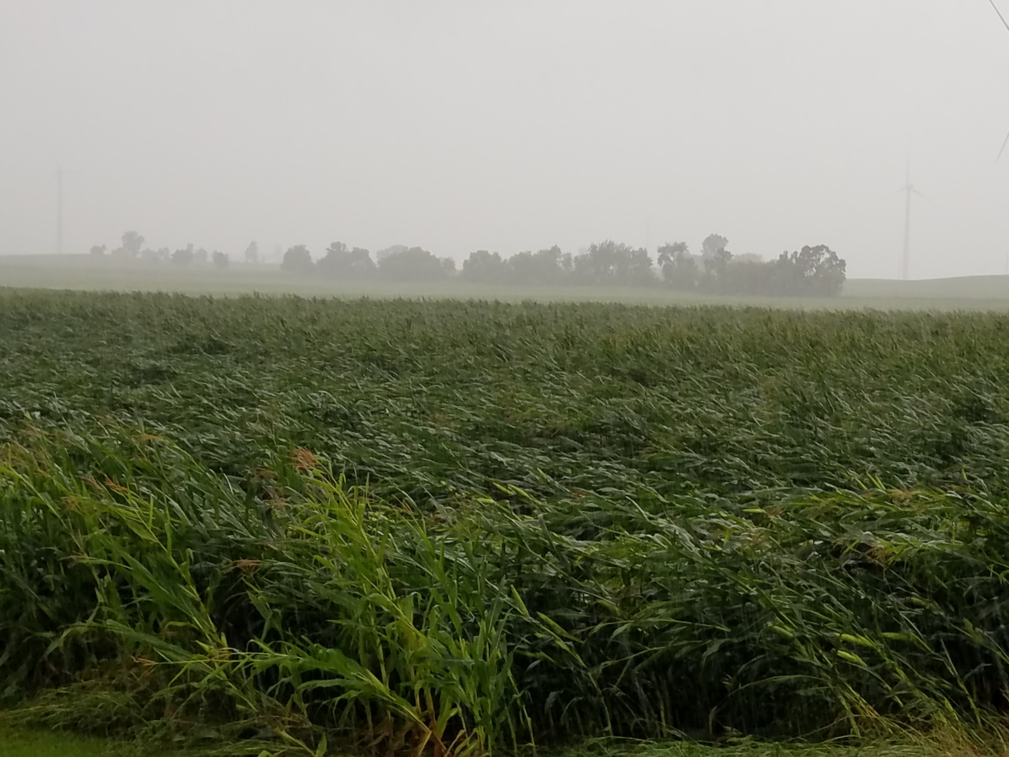
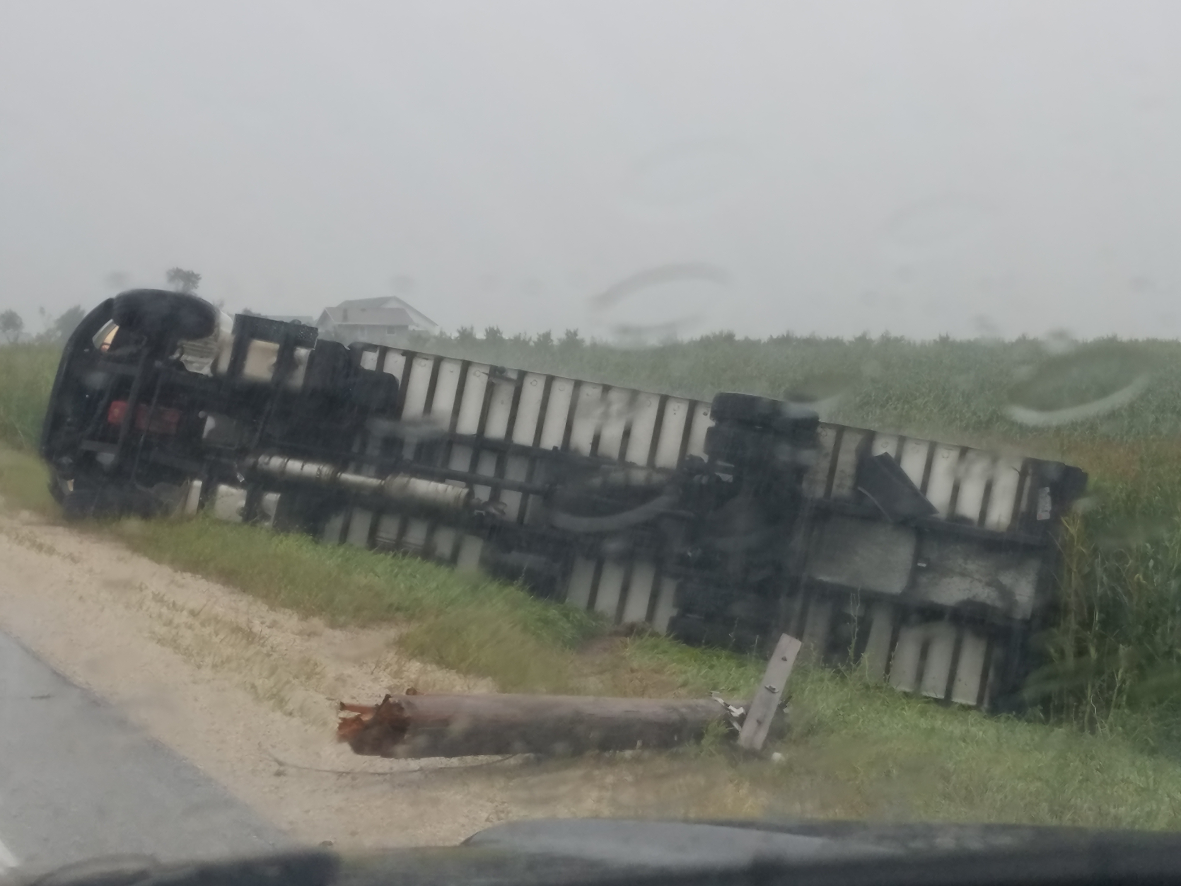
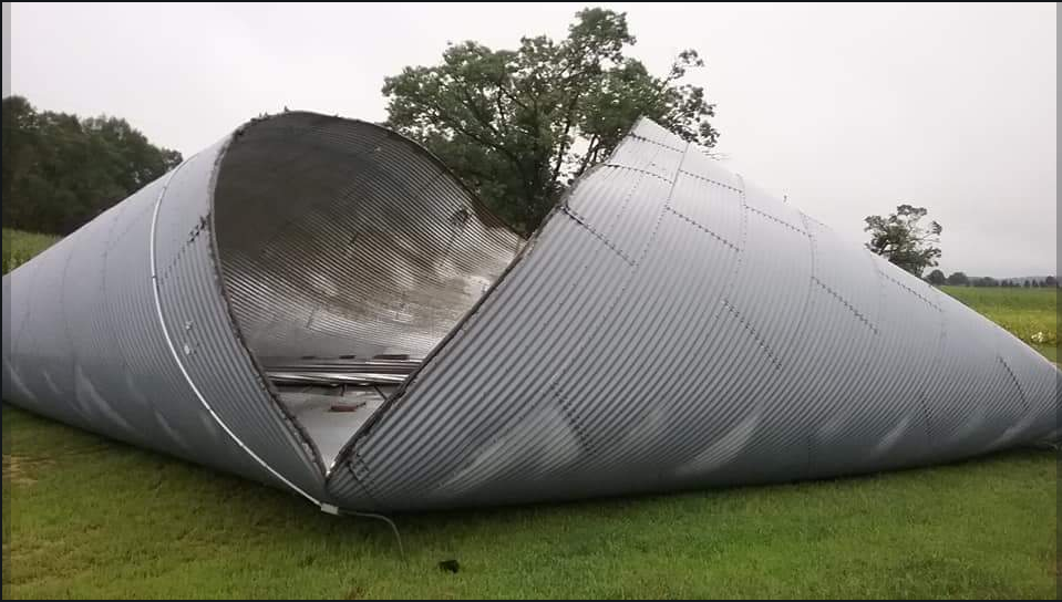
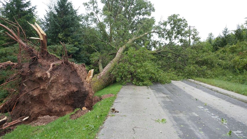
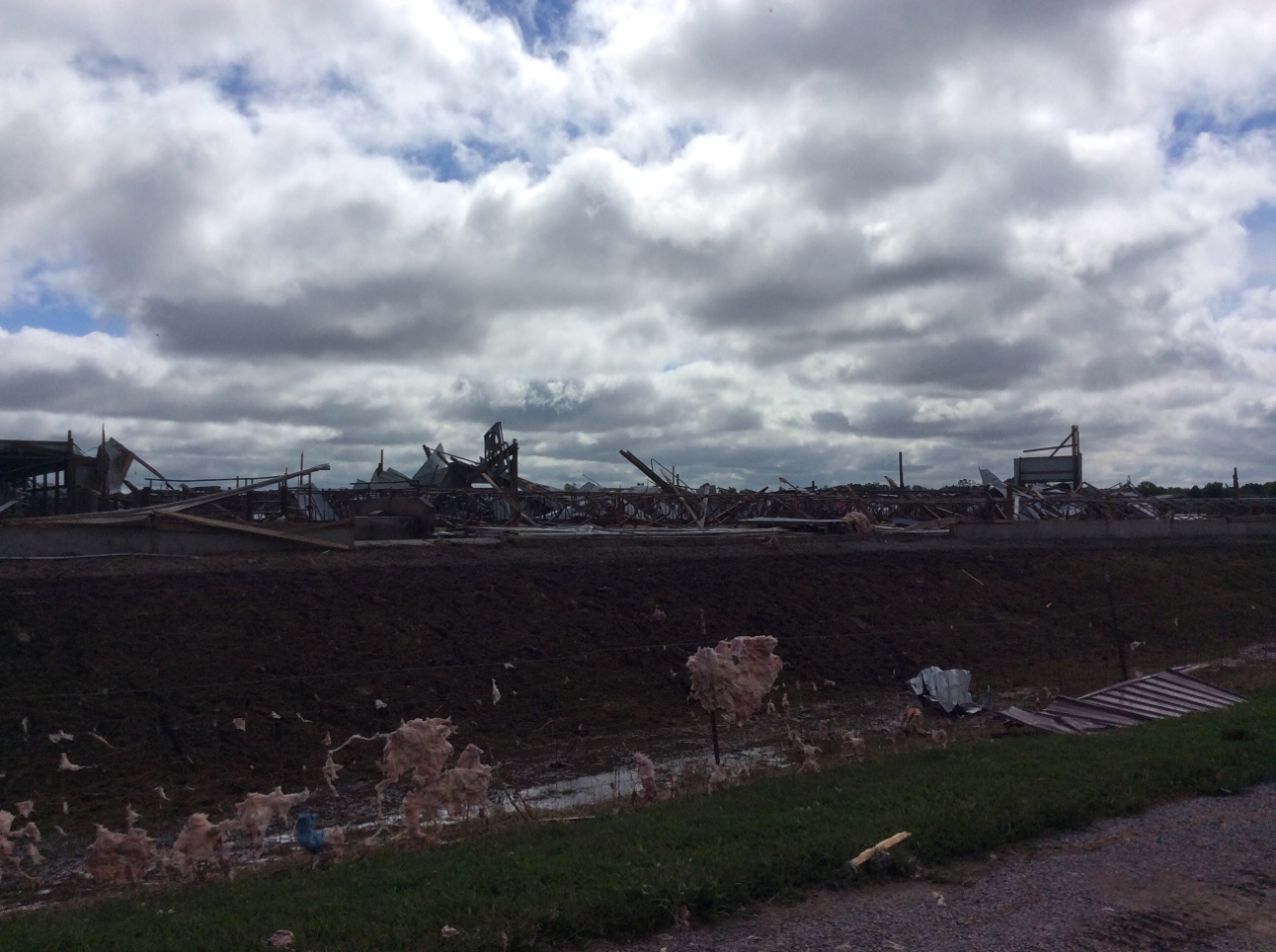
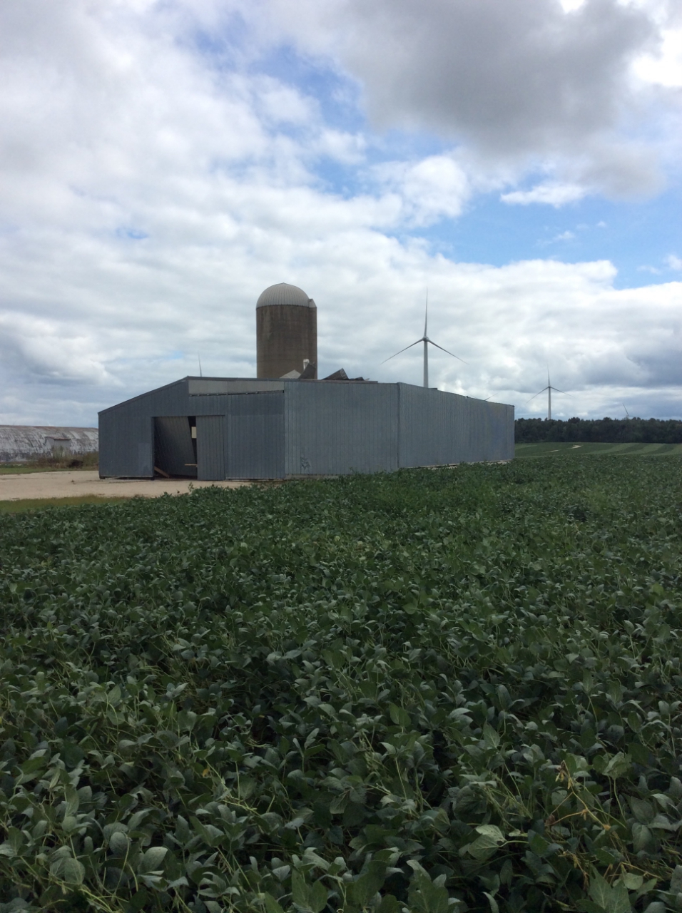
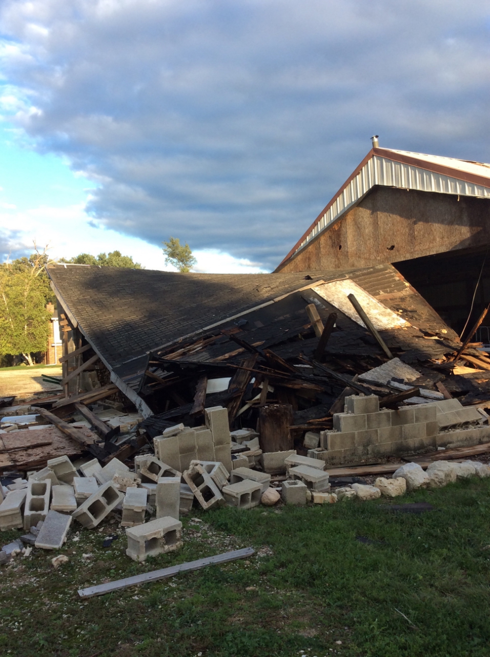
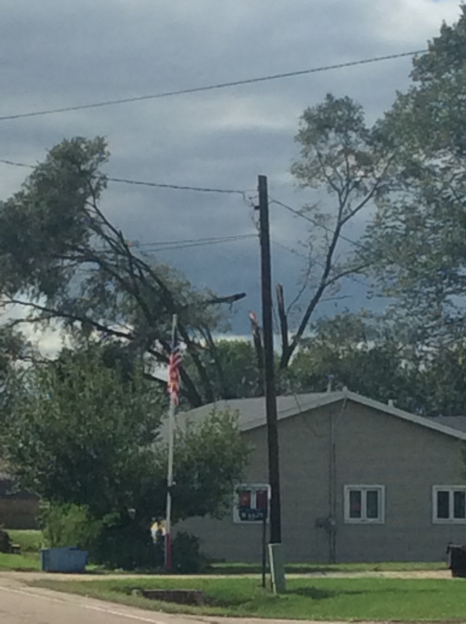
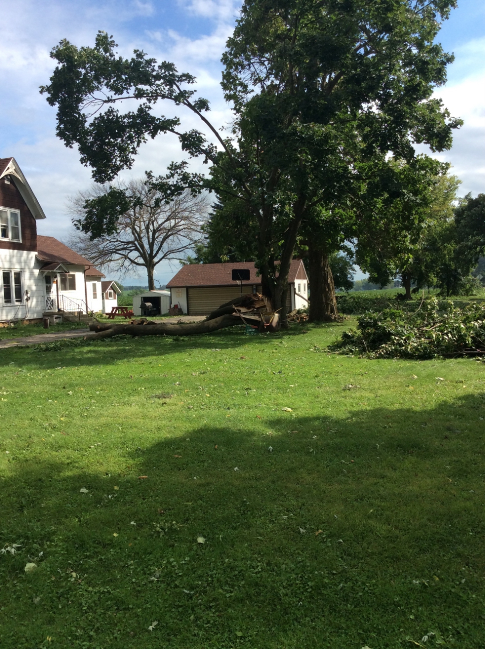
Several trees uprooted, two houses with trees on them. A few trees toppled. Large swath of corn flattened. Large farm buildings and sheds damaged, one destroyed. Power poles leaning to the south along Hemp Rd.
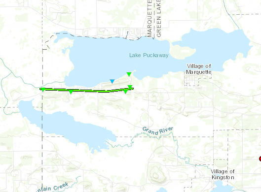
Track Map
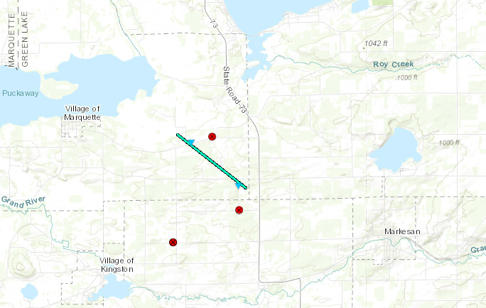
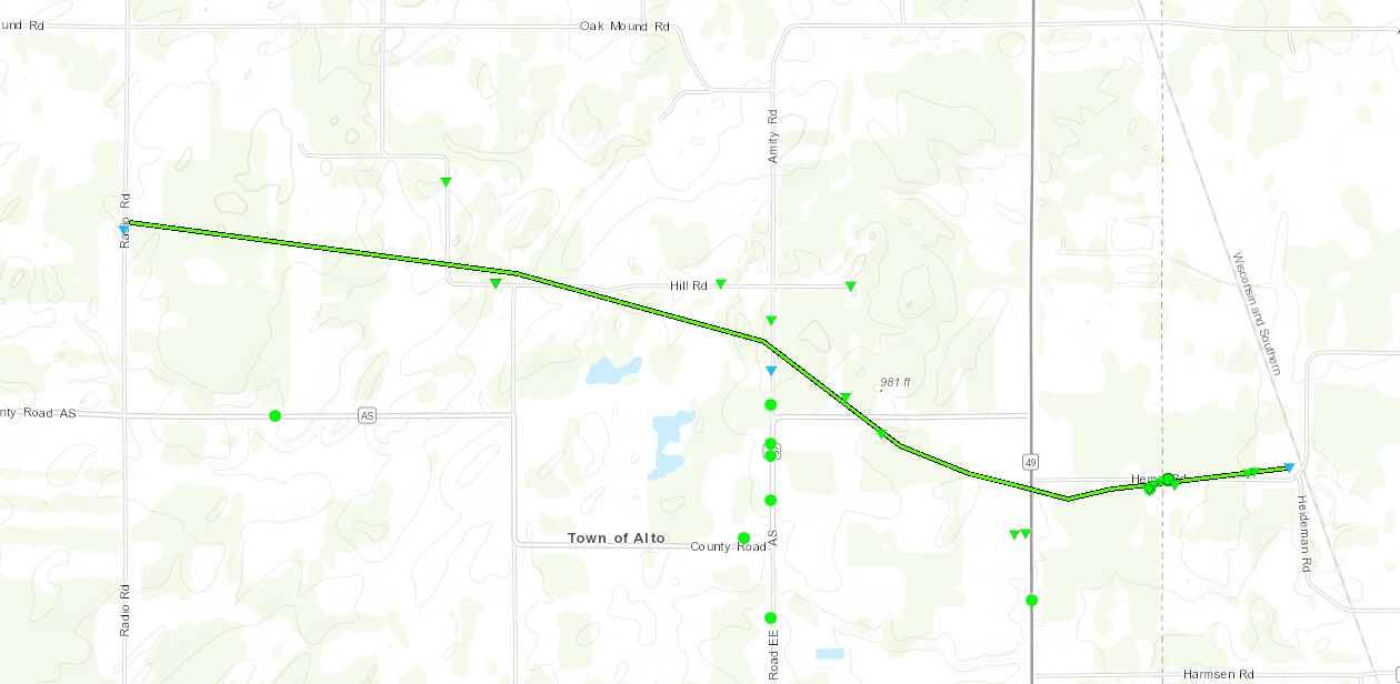
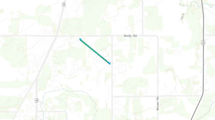
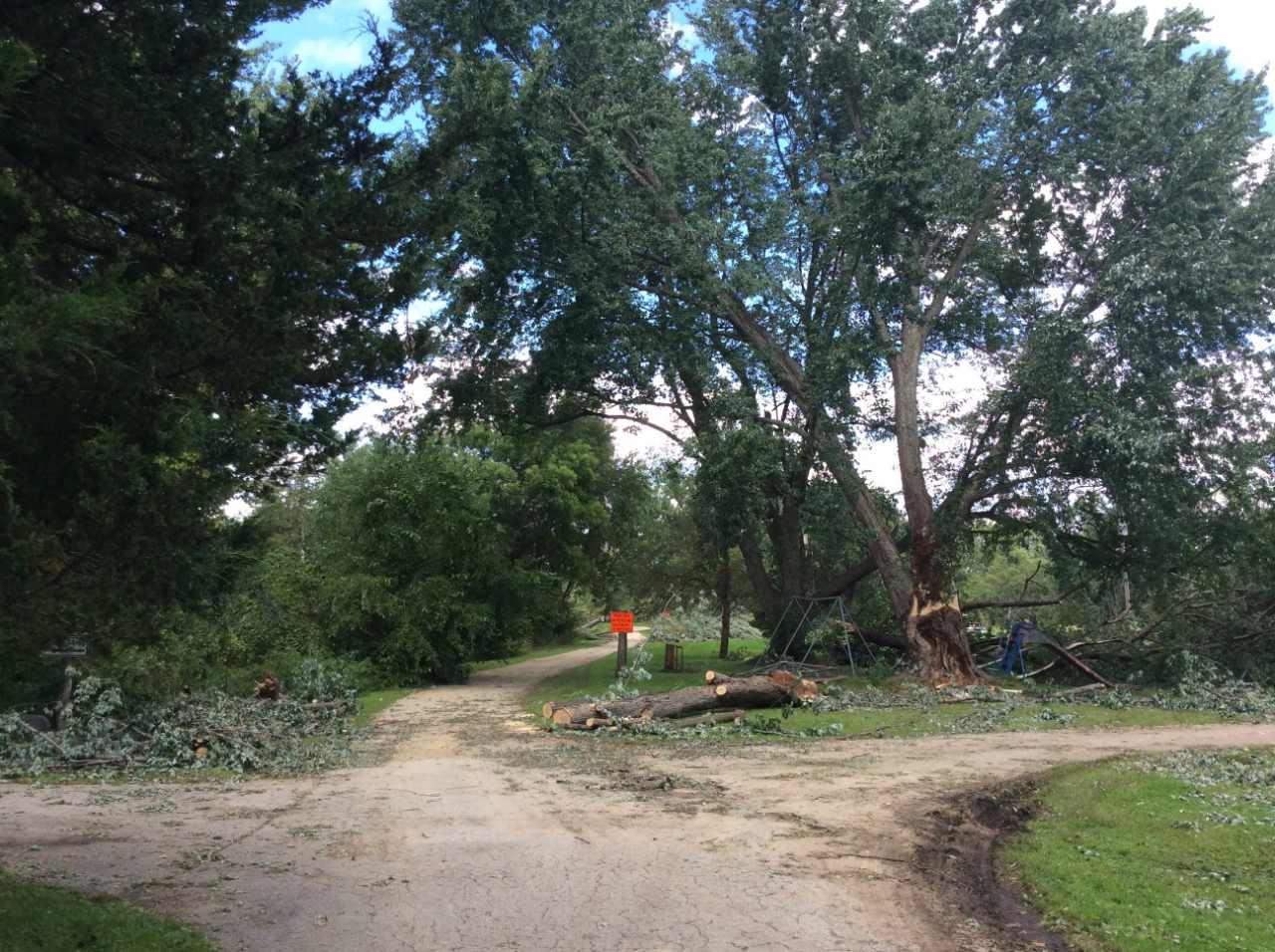
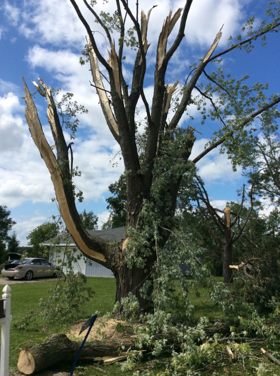
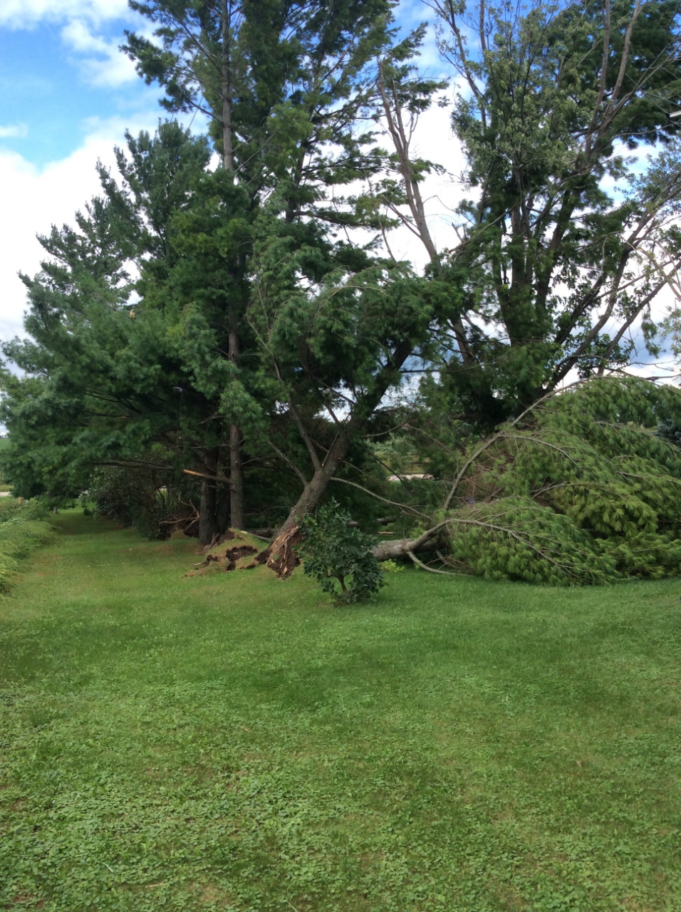
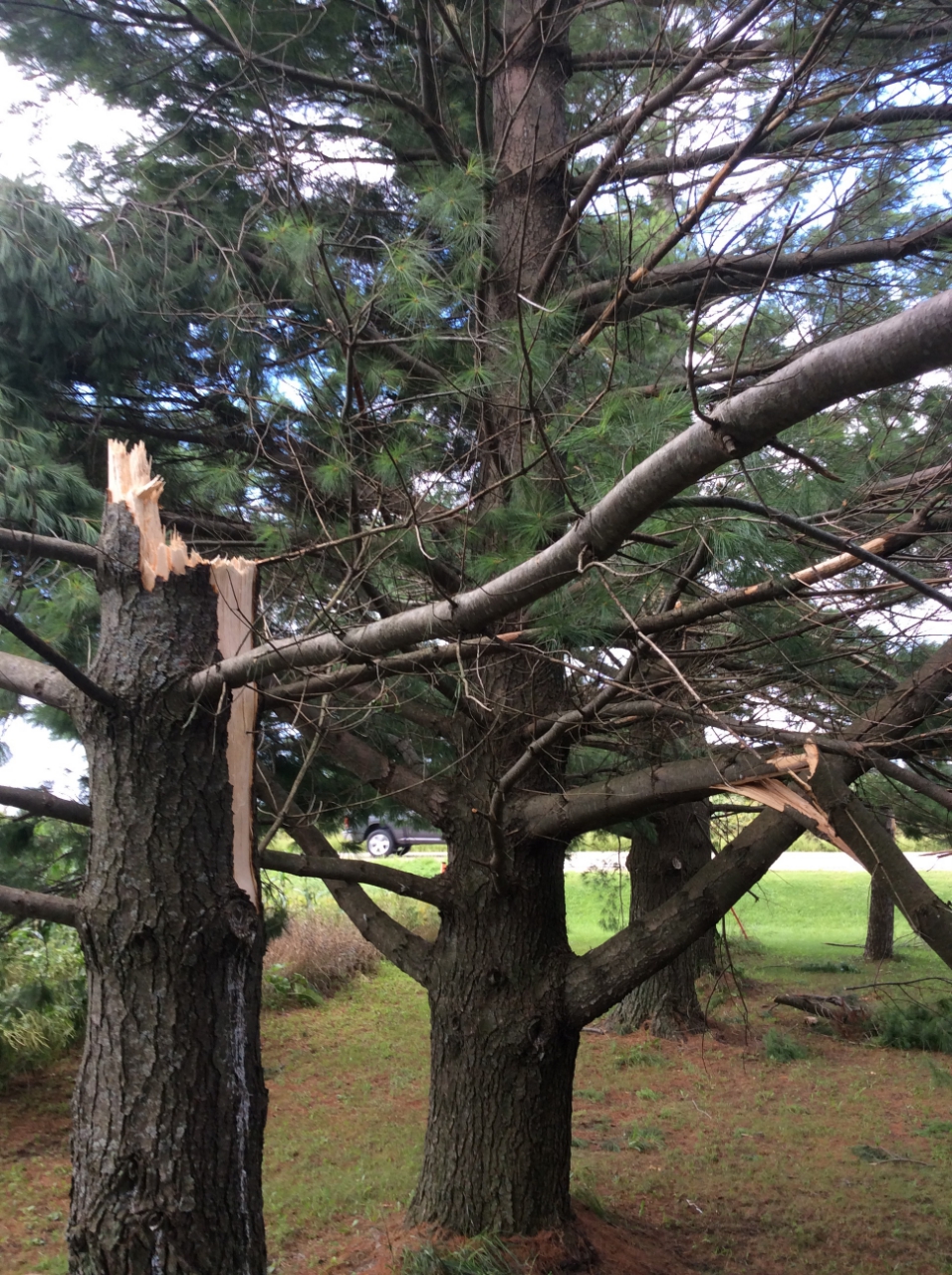
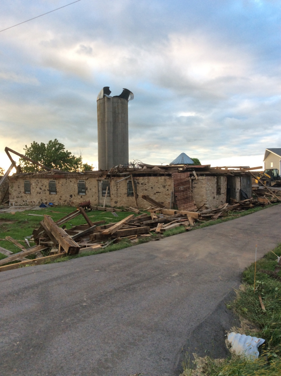
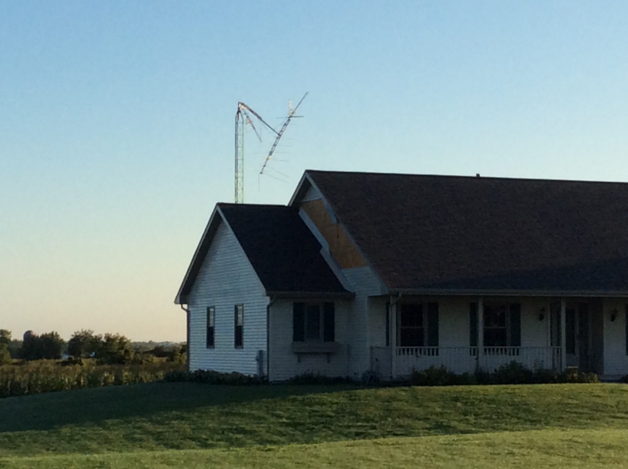
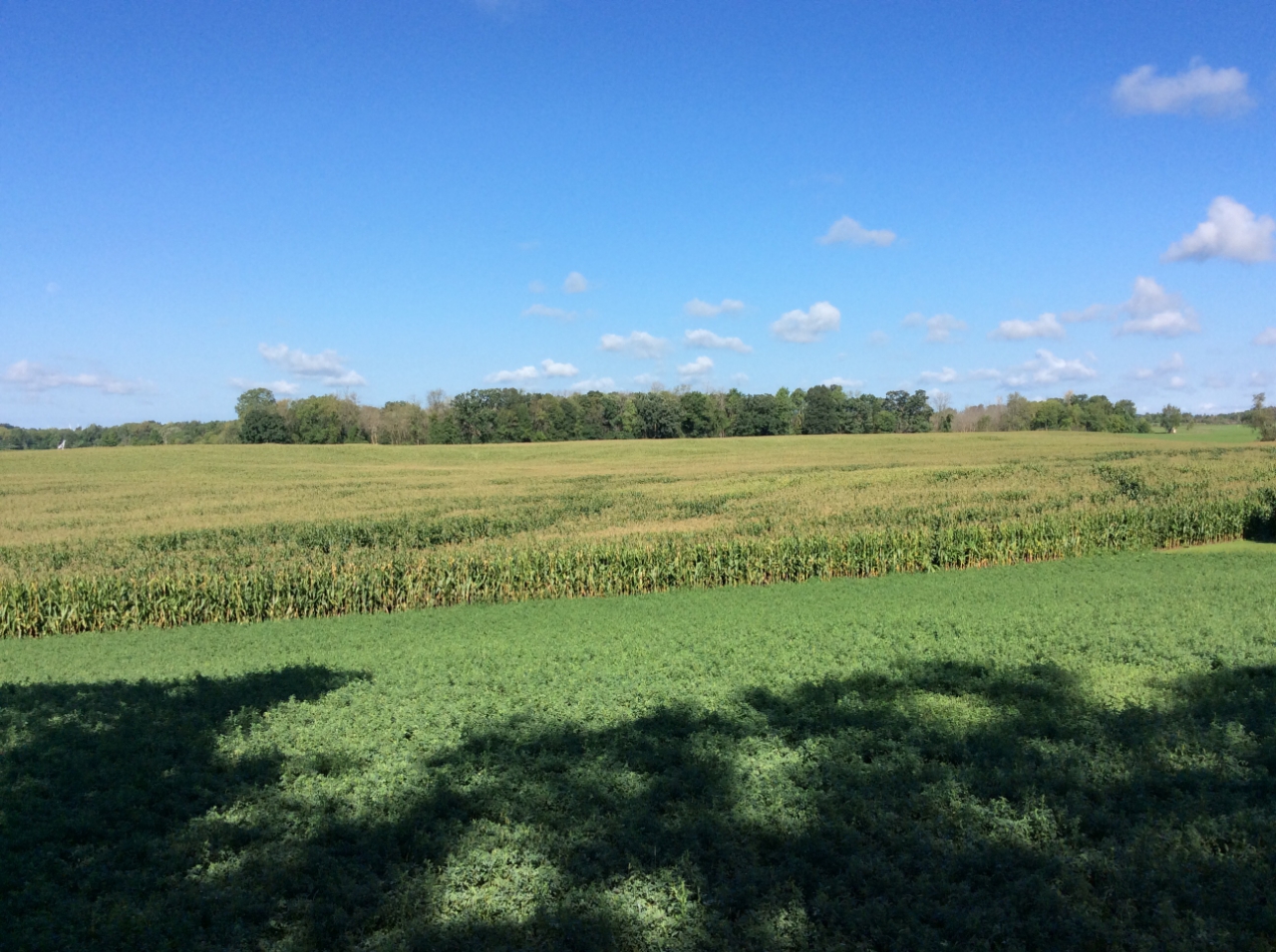
Near Alto
Near Alto
Near Alto
Near Alto
Tornado #6 - Brandon, WI FOND DU LAC COUNTY
Date
Tue, Aug 28, 2018
Time (Local)
4:00 pm CDT
EF Rating
EF-0
Est. Peak Winds
70 mph
Path Length
0.63 miles
Max Width
50 yards
Injuries/Deaths
0/0
Summary:
Video of the tornado via FDL County Sheriff.
Track Map
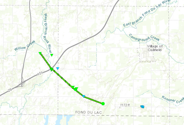
Tornado #7 - Southwest of Oakfield Fond du Lac County
Date
Tue, Aug 28, 2018
Time (Local)
4:04 PM CDT
EF Rating
EF-1
Est. Peak Winds
94 mph
Path Length
4.54 mi
Max Width
100 yeards
Injuries/Deaths
0/0
Summary:
None at the moment
Track Map
Southwest of Oakfield
Southwest of Oakfield
Southwest of Oakfield
Southwest of Oakfield
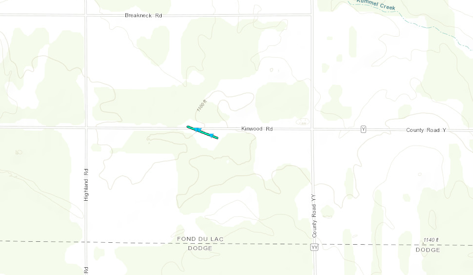
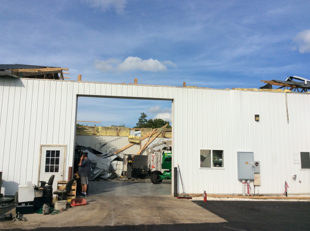
Tornado #8 - South of Oakfield FOND DU LAC COUNTY
Date
Tue, Aug 28, 2018
Time (Local)
4:08pm CDT
EF Rating
EF-0
Est. Peak Winds
80mph
Path Length
0.14 miles
Max Width
50 yards
Injuries/Deaths
0/0
Summary:
Two large farm buildings sustained roof damage. A few uprooted trees. Minor siding and roof damage to a home.
Track Map
South of Oakfield
South of Oakfield
South of Oakfield
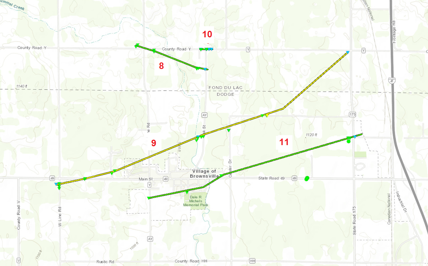
Tornado #9 - Southwest of South Byron FOND DU LAC COUNTY
Date
Tue, Aug 28, 2018
Time (Local)
4:09pm CDT
EF Rating
EF-1
Est. Peak Winds
100mph
Path Length
0.92 miles
Max Width
100 yards
Injuries/Deaths
0/0
Summary:
None at the moment.
Track Map (#8 ON THE MAP)
WSW of South Byron
WSW of South Byron
WSW of South Byron
WSW of South Byron
Tornado #10 - West of Brownsville DODGE AND FOND DU LAC COUNTY
Date
Tue, Aug 28, 2018
Time (Local)
4:11pm CDT
EF Rating
EF-2
Est. Peak Winds
125mph
Path Length
3.95 miles
Max Width
150 yards
Injuries/Deaths
0/0
Summary:
None at the moment.
Track Map (#9 ON THE MAP)
West of Brownsville
West of Brownsville
West of Brownsville
West of Brownsville
Tornado #11 - South Byron FOND DU LAC COUNTY
Date
Tue, Aug 28, 2018
Time (Local)
4:11pm CDT
EF Rating
EF-1
Est. Peak Winds
94mph
Path Length
0.15 miles
Max Width
80 yards
Injuries/Deaths
0/0
Summary:
None at the moment.
Track Map (#10 ON THE MAP)
South Byron
South Byron
South Byron
Tornado #12 - Brownsville DODGE COUNTY
Date
Tue, Aug 28, 2018
Time (Local)
4:12pm CDT
EF Rating
EF-1
Est. Peak Winds
107mph
Path Length
2.7 miles
Max Width
100 yards
Injuries/Deaths
0/0
Summary:
None at the moment.
Track Map (#11 ON THE MAP)
Brownsville
Brownsville
Brownsville
Tornado #13 - South Byron FOND DU LAC COUNTY
Date
Tue, Aug 28, 2018
Time (Local)
4:16pm CDT
EF Rating
EF-1
Est. Peak Winds
90mph
Path Length
3.05 miles
Max Width
100 yards
Injuries/Deaths
0/0
Summary:
None at the moment.
Track Map
South Byron
South Byron
South Byron
South Byron
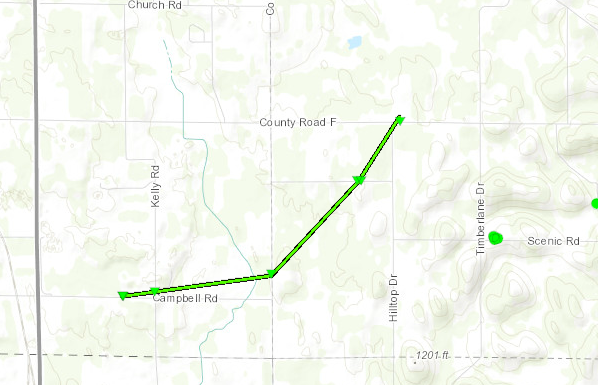
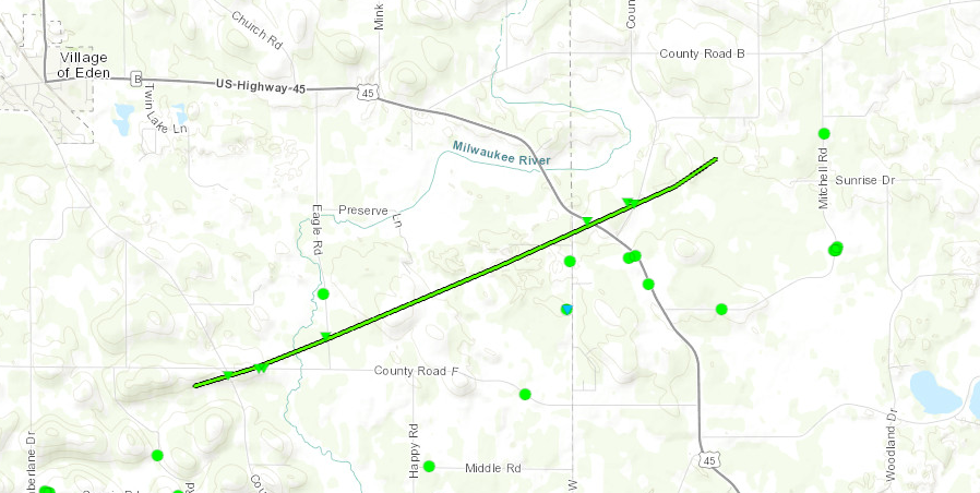
Tornado #14 - Eden Fond du Lac County
Date
Tue, Aug 28, 2018
Time (Local)
4:22 PM CDT
EF Rating
EF-1
Est. Peak Winds
90 mph
Path Length
4.48 miles
Max Width
90 yards
Injuries/Deaths
0/0
Summary:
None at the moment
Track Map
Eden
Eden
Eden
Eden
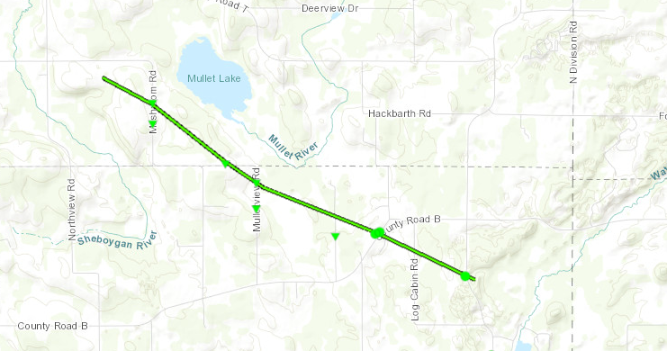
Tornado #15 - 6mi ENE Eden Fond du Lac County
Date
Tue, Aug 28, 2018
Time (Local)
4:27 PM CDT
EF Rating
EF-1
Est. Peak Winds
100 mph
Path Length
4.05 miles
Max Width
100 yards
Injuries/Deaths
0/0
Summary:
None at the moment
Track Map
6 ENE of Eden
6 ENE Eden
6 ENE Eden
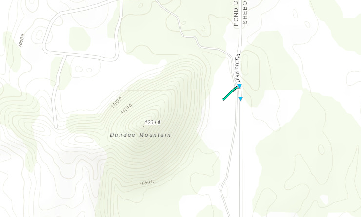
Tornado #16 - Dundee Fond du Lac County
Date
Tue, Aug 28, 2018
Time (Local)
4:30 PM CDT
EF Rating
EF-0
Est. Peak Winds
80 mph
Path Length
0.04
Max Width
80
Injuries/Deaths
0/0
Summary:
None at the moment
Track Map
Dundee
Dundee
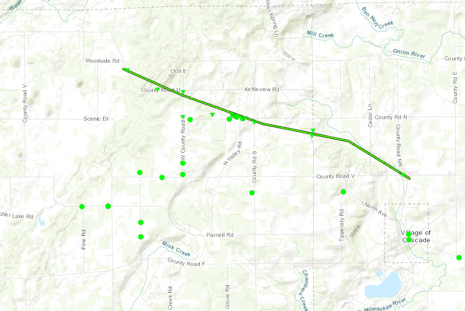
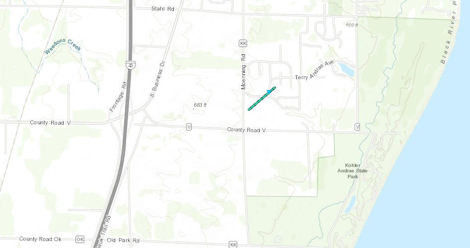
Tornado #17 - 3mi N of Cascade Sheboygan County
Date
Tue, Aug 28, 2018
Time (Local)
4:36 PM CDT
EF Rating
EF-1
Est. Peak Winds
100 mph
Path Length
5.38 miles
Max Width
100 yards
Injuries/Deaths
0/0
Summary:
None at the moment
Track Map
3N Cascade
3N Cascade
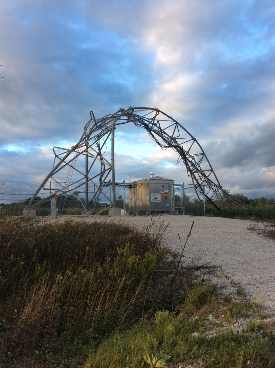
3N Cascade (Shed lifted away)
3N Cascade
Tornado #18 - 5 NE Oostburg Sheboygan County
Date
Tue, Aug 28, 2018
Time (Local)
4:57 PM CDT
EF Rating
EF-0
Est. Peak Winds
80 mph
Path Length
0.3
Max Width
75 yards
Injuries/Deaths
0/0
Summary:
(Town of Wilson)
Track Map
Caption
Caption
The Enhanced Fujita (EF) Scale classifies tornadoes into the following categories:
EF0
Weak
65-85 mph
EF1 Moderate
86-110 mph
EF2 Significant
111-135 mph
EF3 Severe
136-165 mph
EF4 Extreme
166-200 mph
EF5 Catastrophic
200+ mph
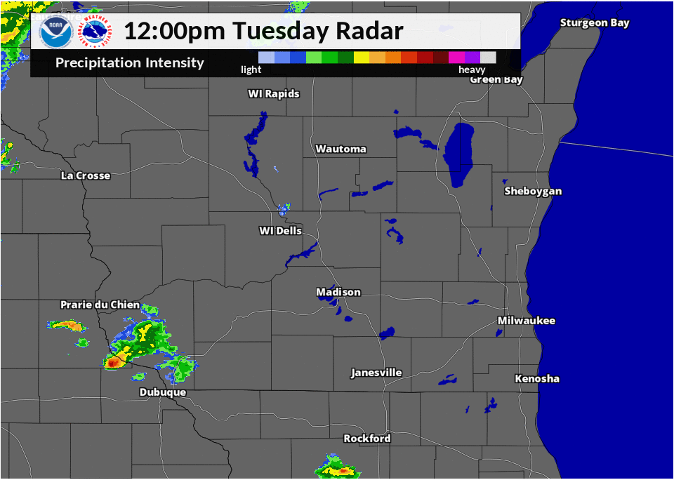
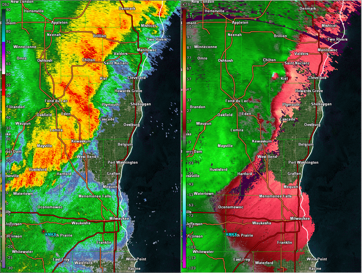
Radar / Rainfall:
Heavy rain fell over the past two days, creating serious flooding in west central Wisconsin.
Radar Loop
Estimated Rainfall Sunday-Tuesday
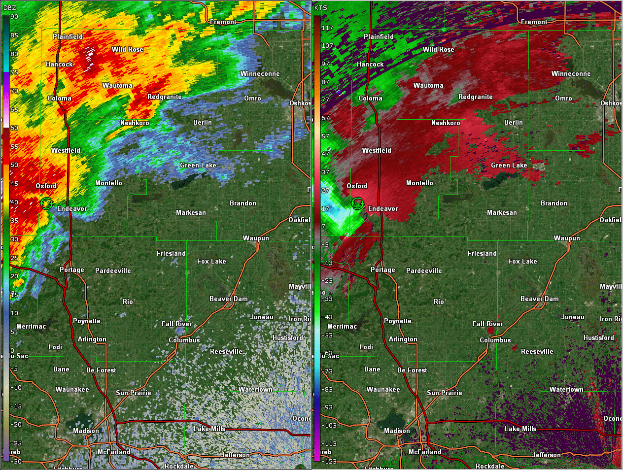
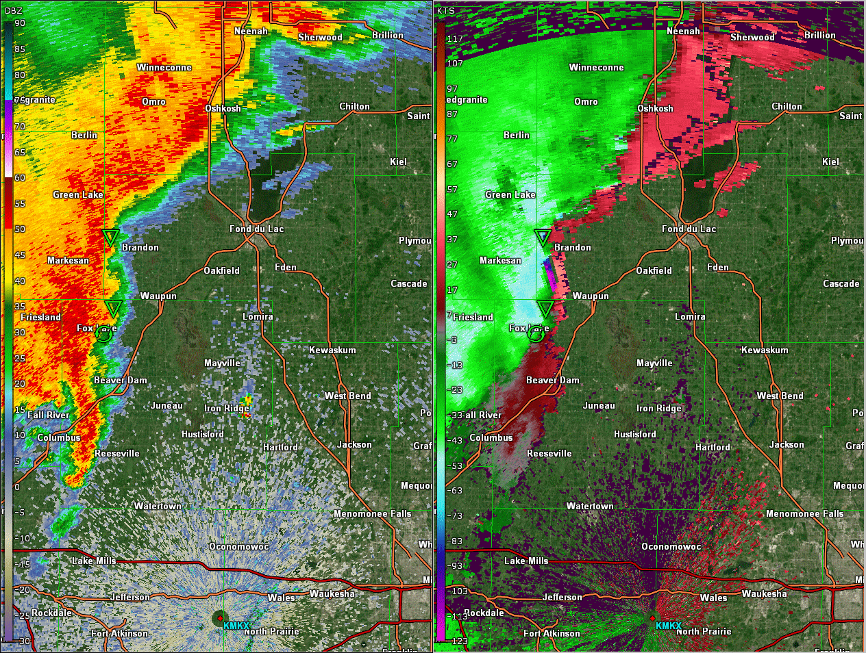
Below are radar loops depicting Reflectivity and Base Velocity from the KMKX WSR-88D for the labeled areas.
Marquette/Green Lake
Fond du Lac/Dodge
Sheboygan
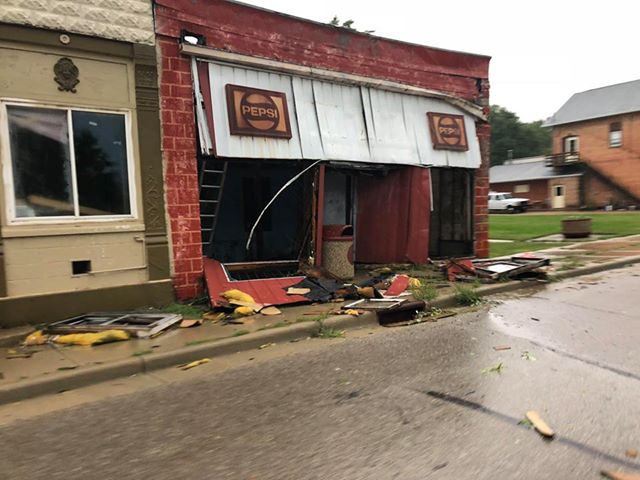
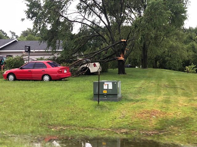
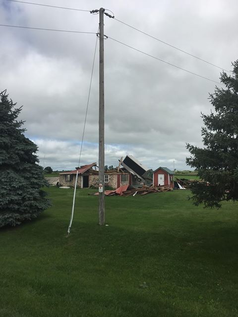
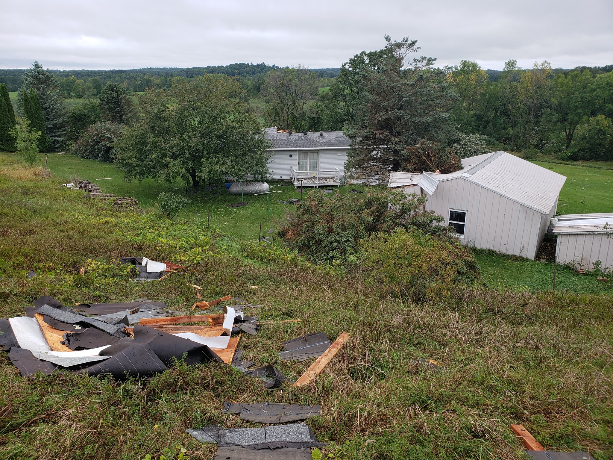
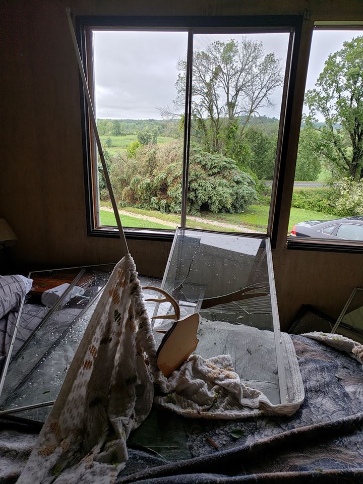
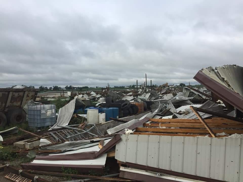
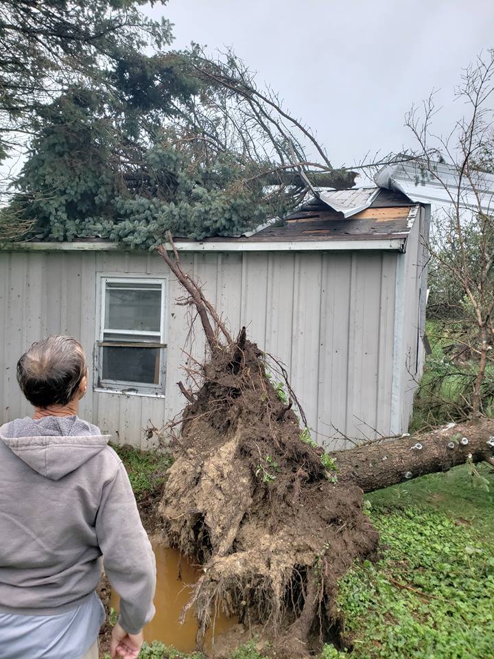
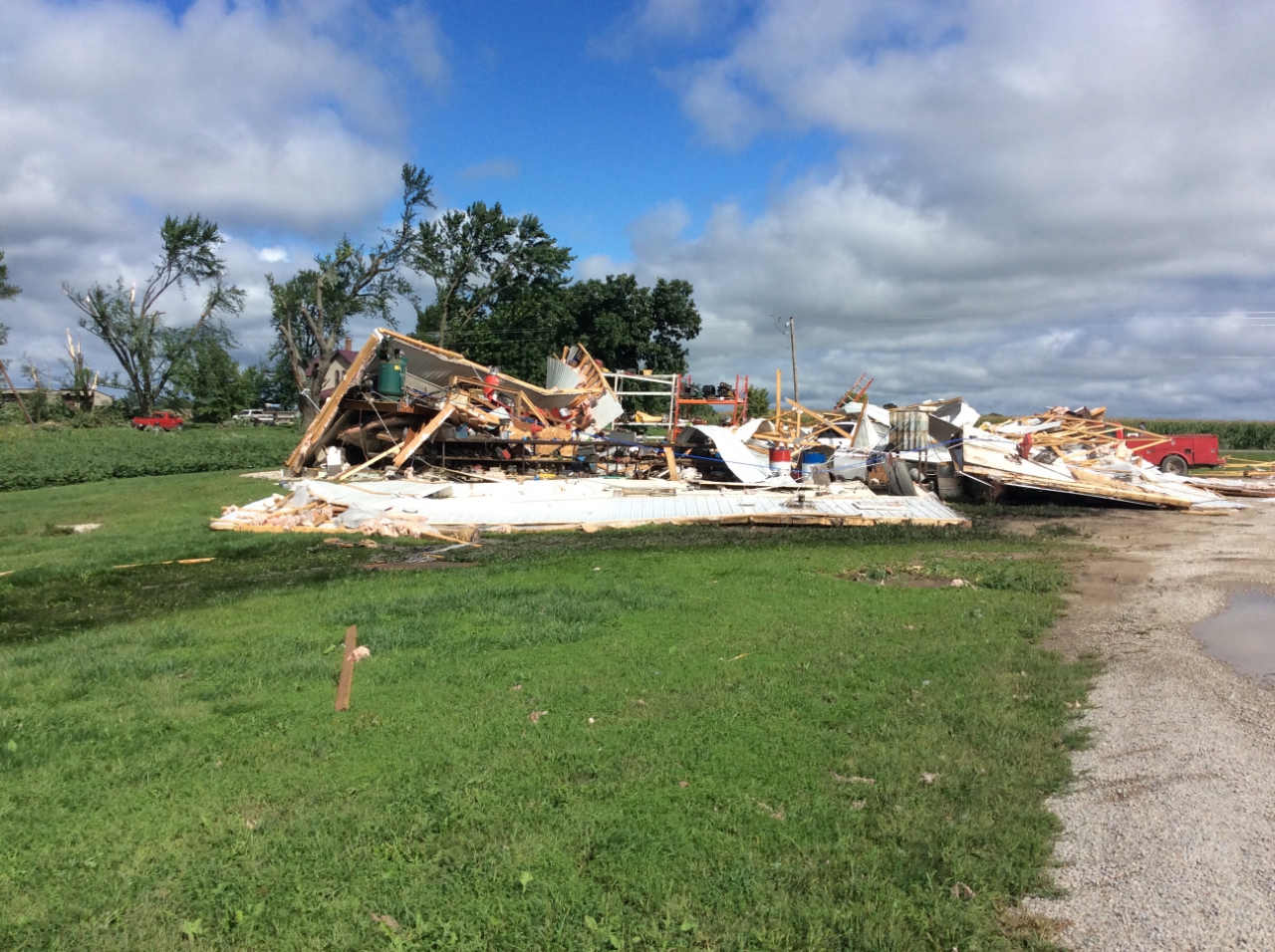
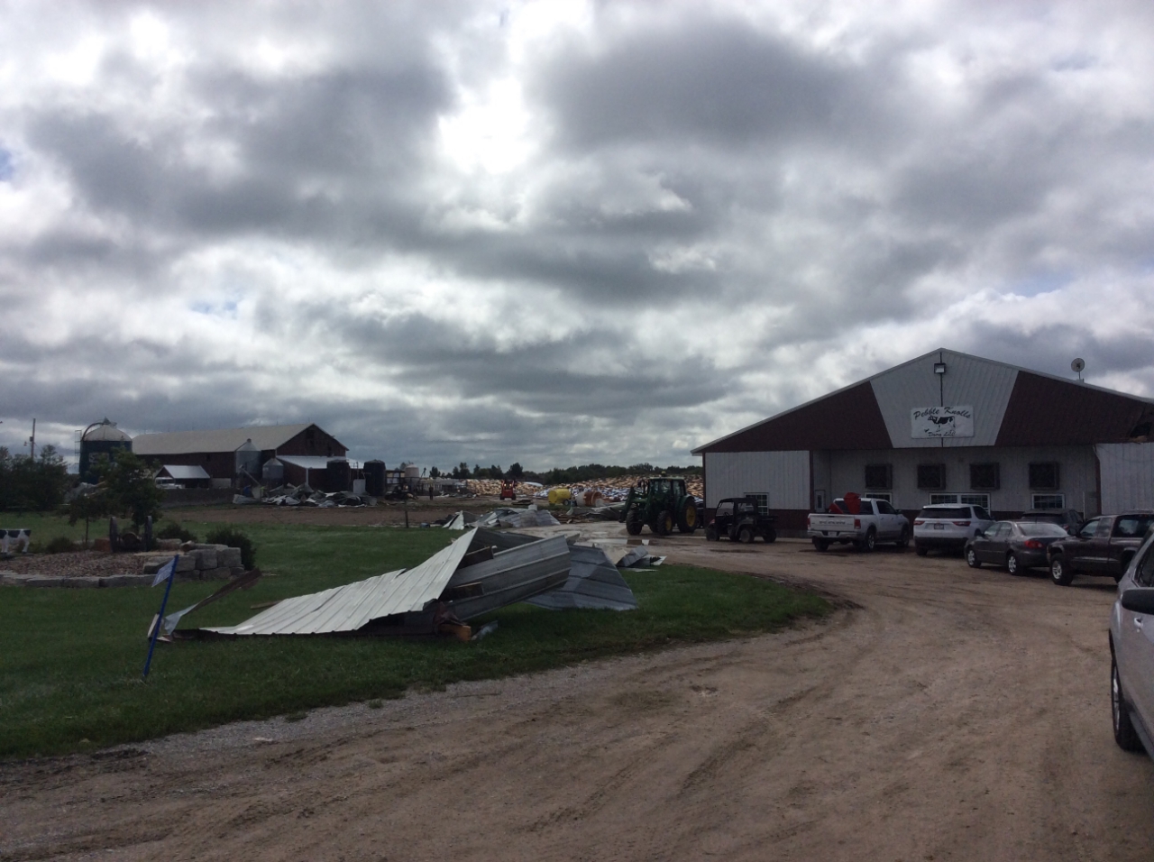
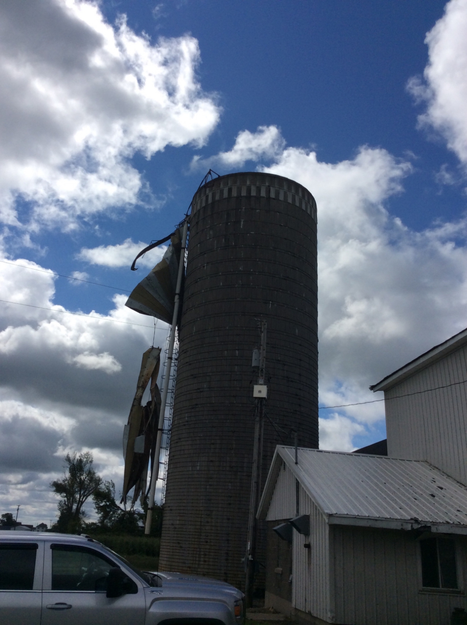
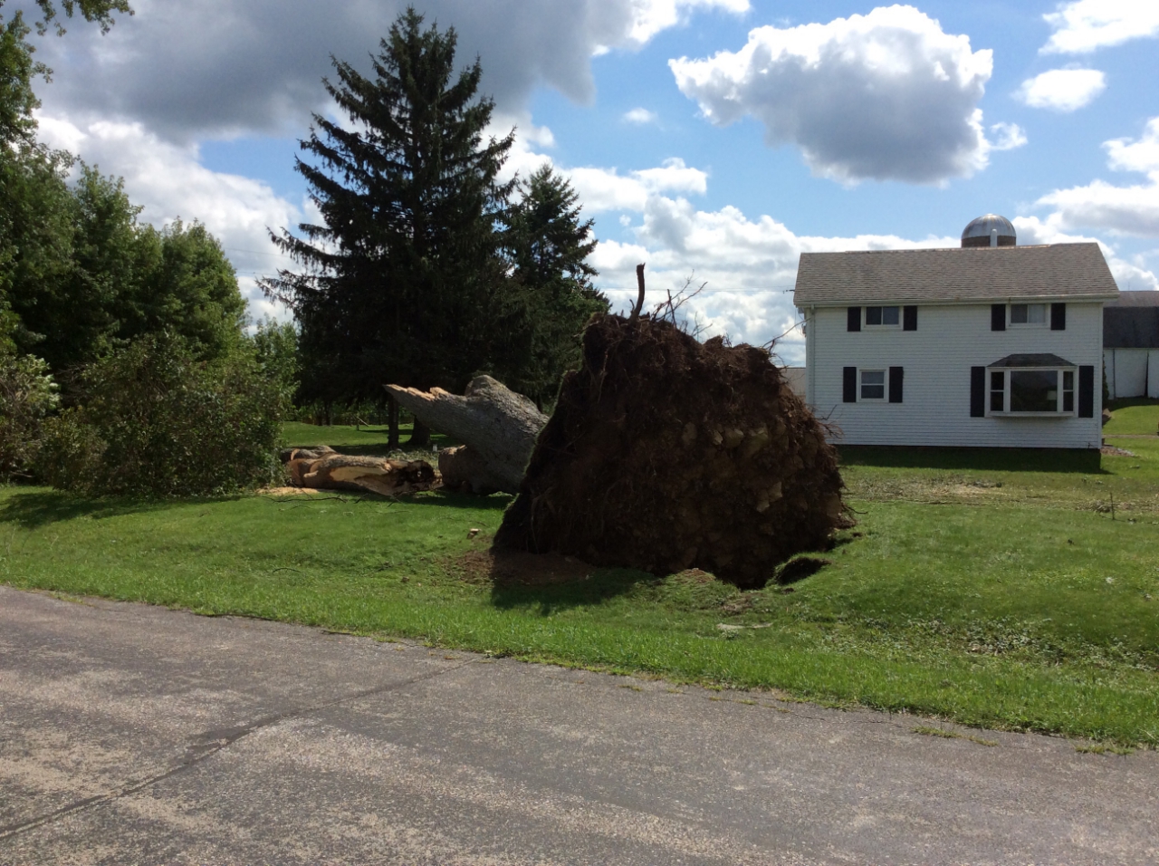
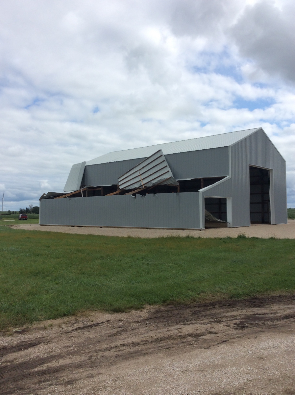
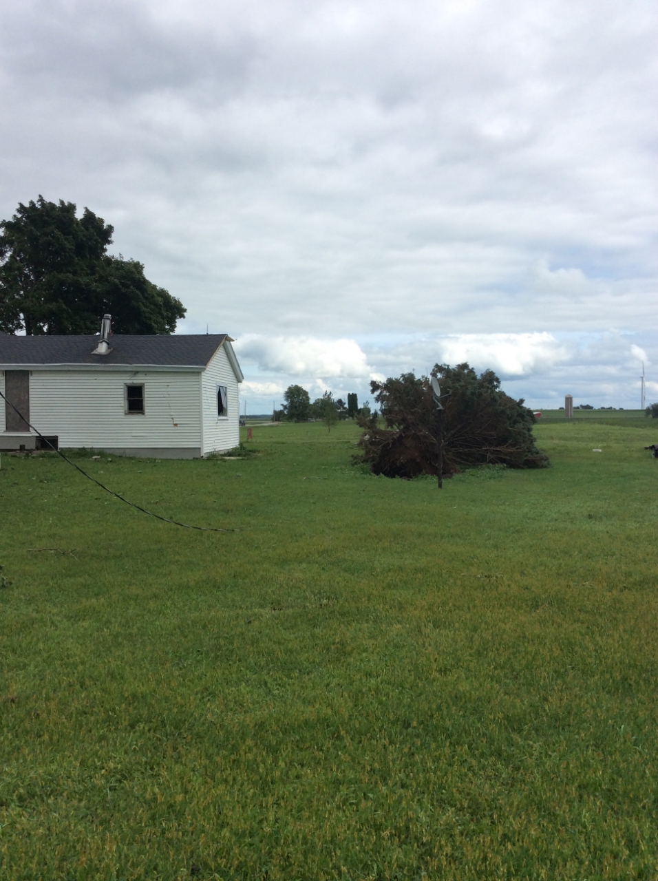
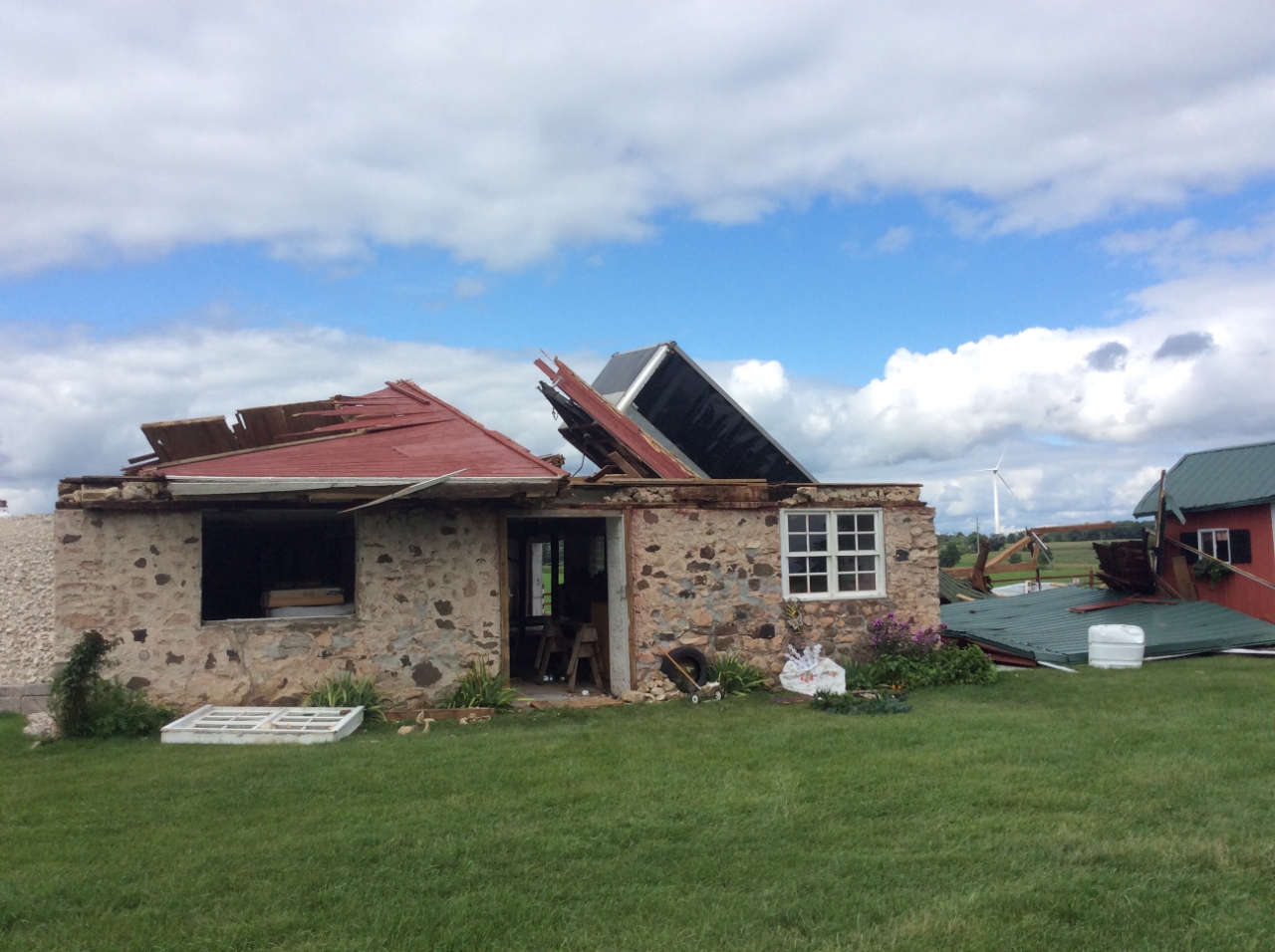
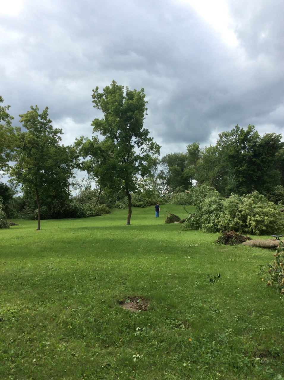
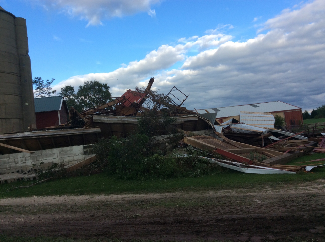
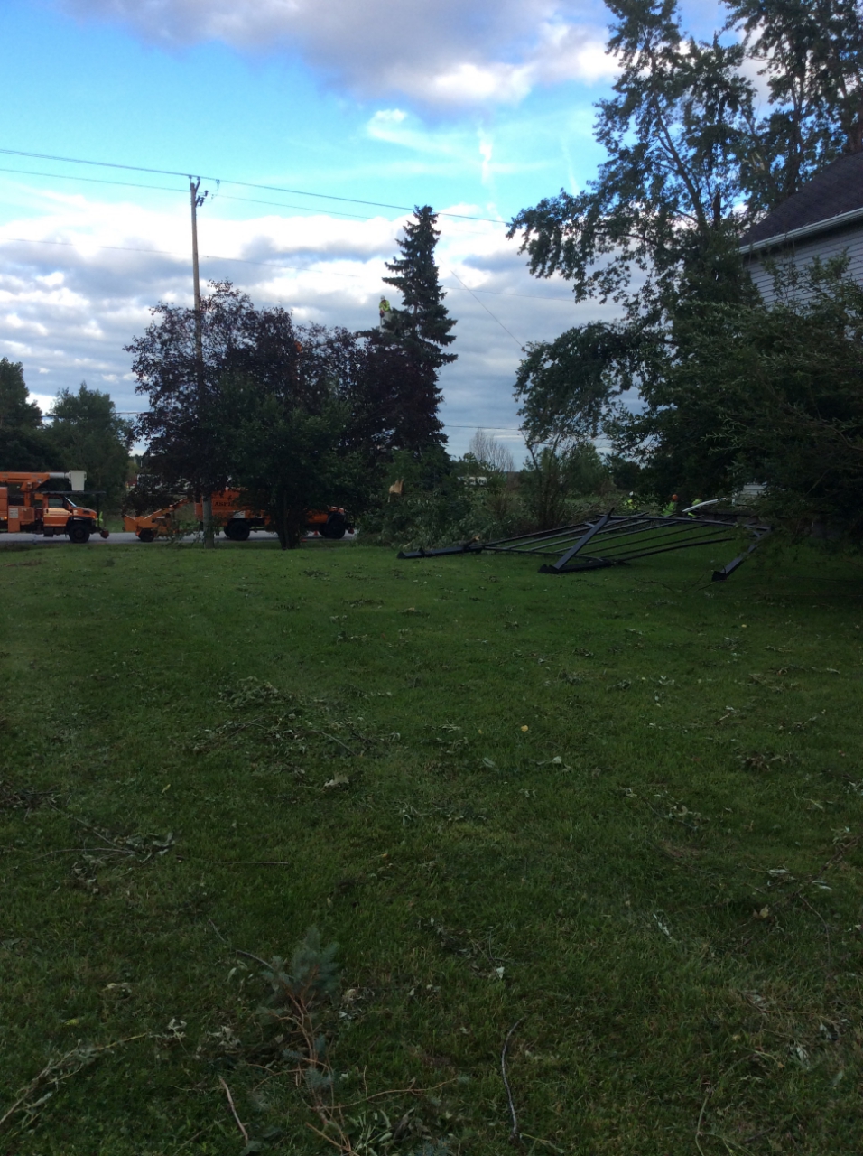
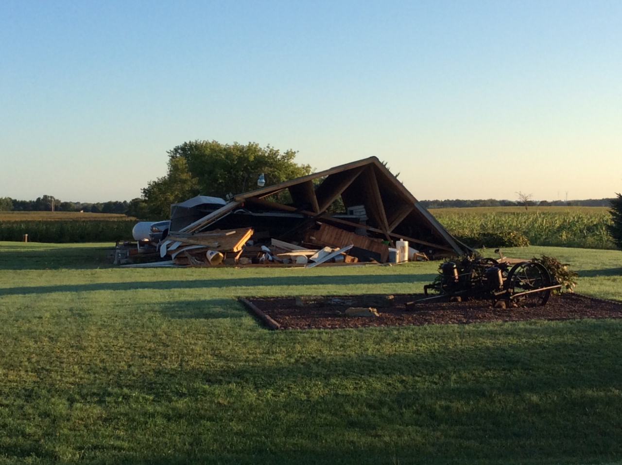
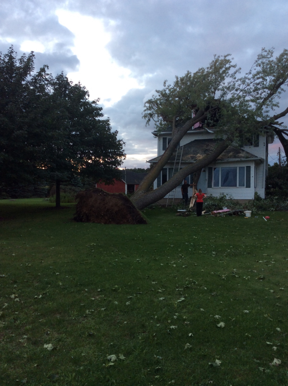
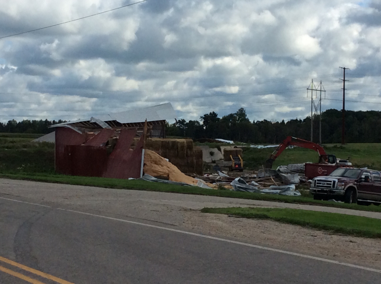
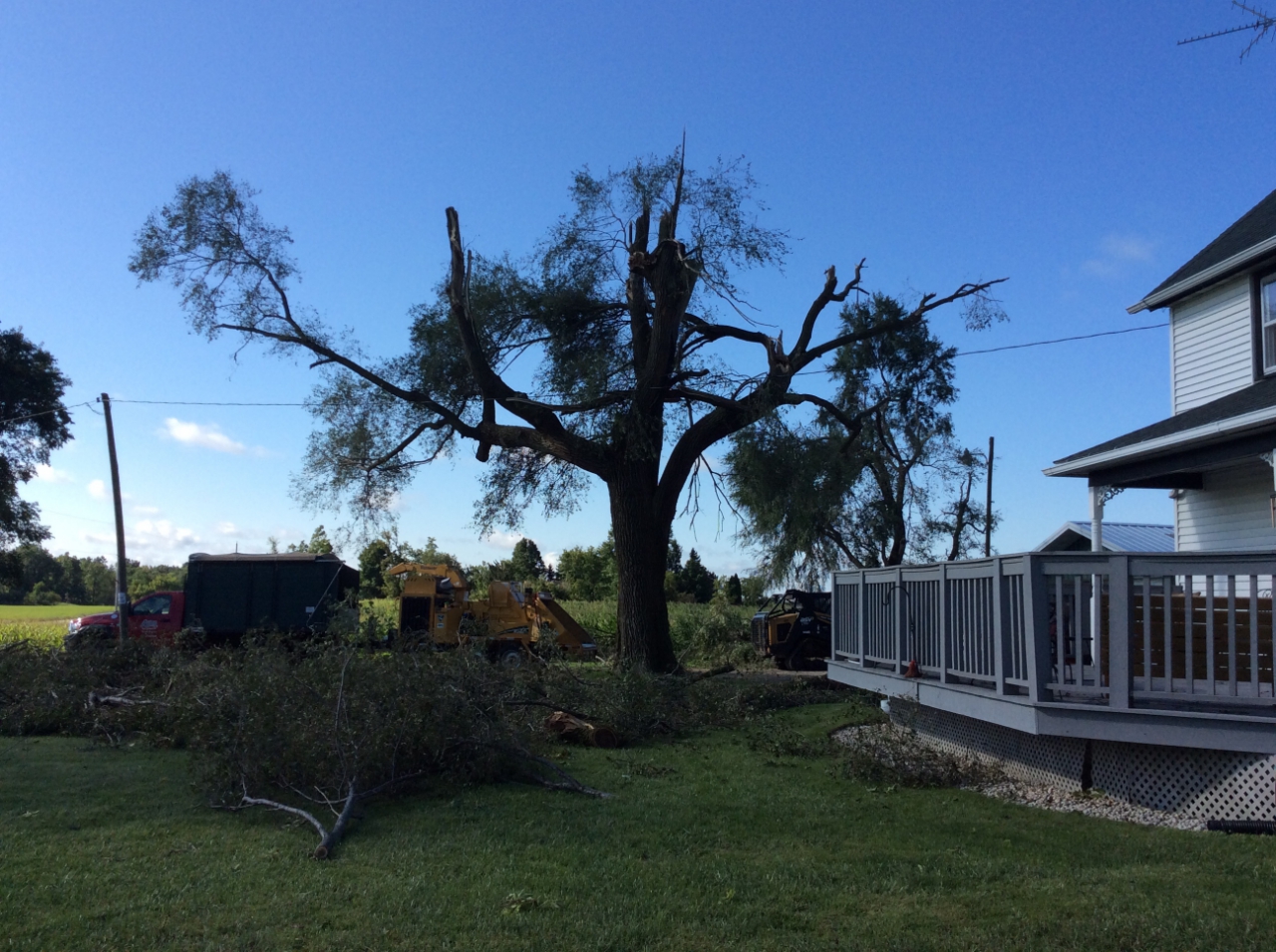
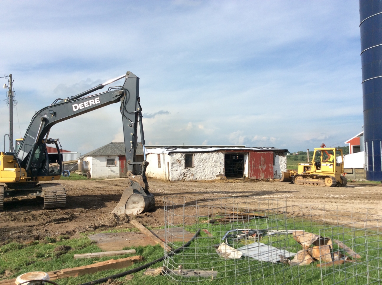
Pictures
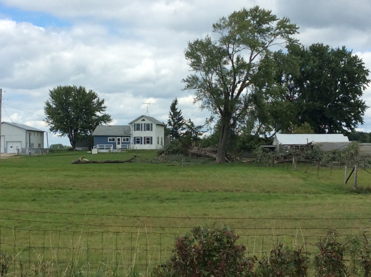
Brownsville/Lomira
Brownsville/Lomira
2 mi N Lomira
2 mi N Lomira
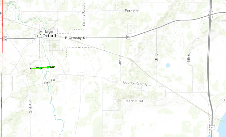
Oxford
Oxford
Oxford
Oxford
Hingham
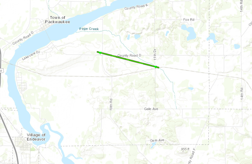
Endeavor
Endeavor
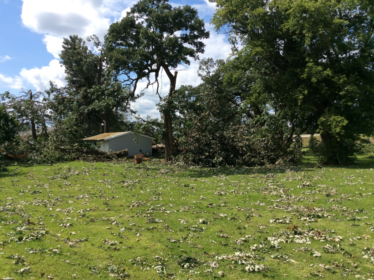
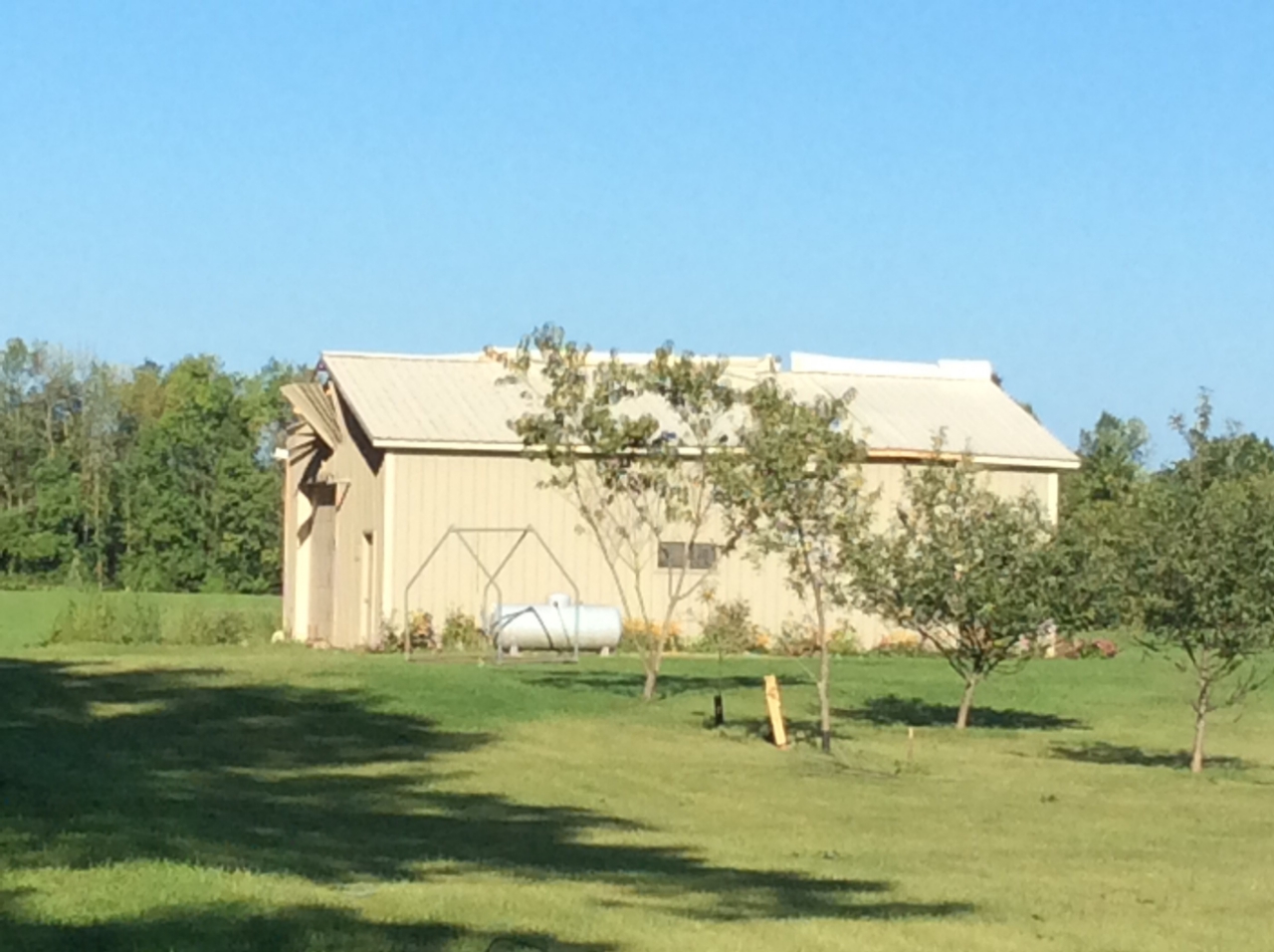
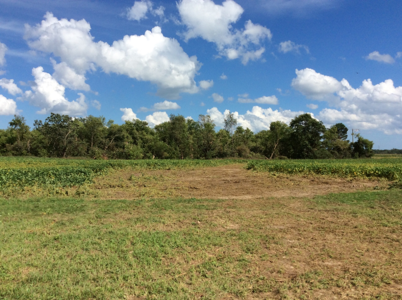
Oakfield
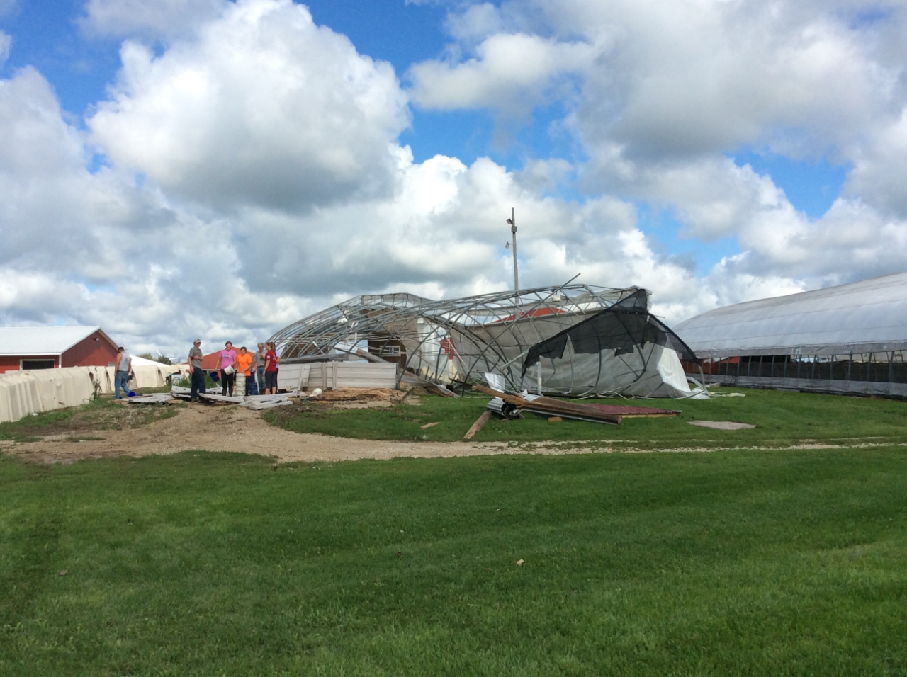
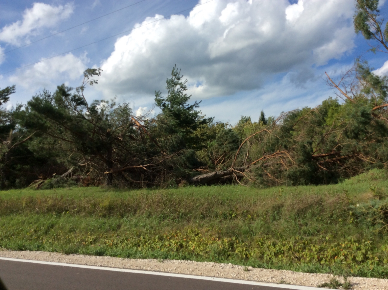
Cascade
Cascade
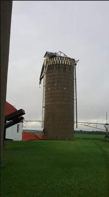
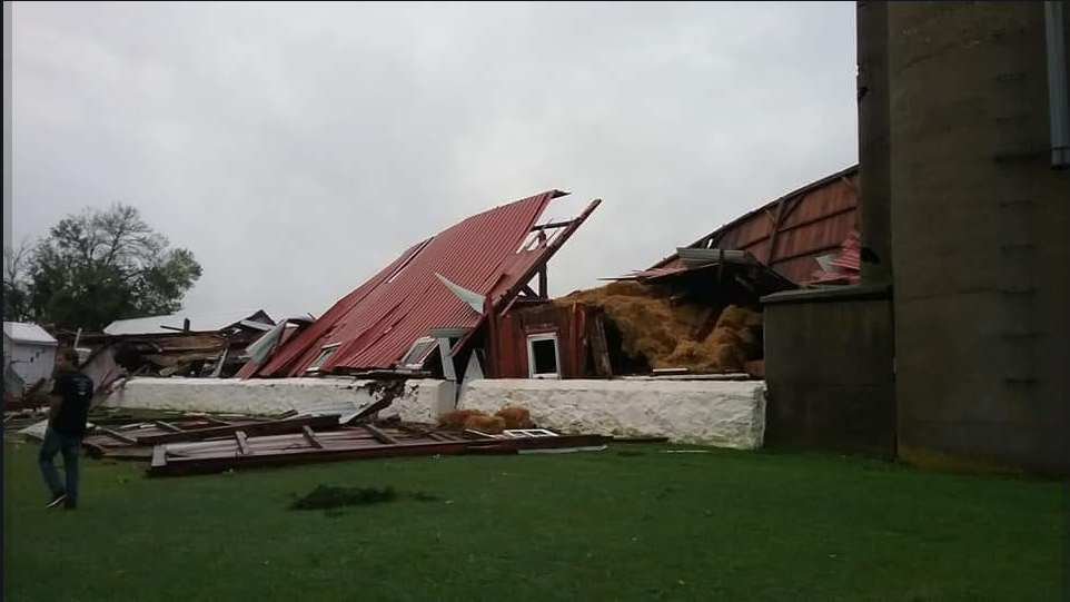
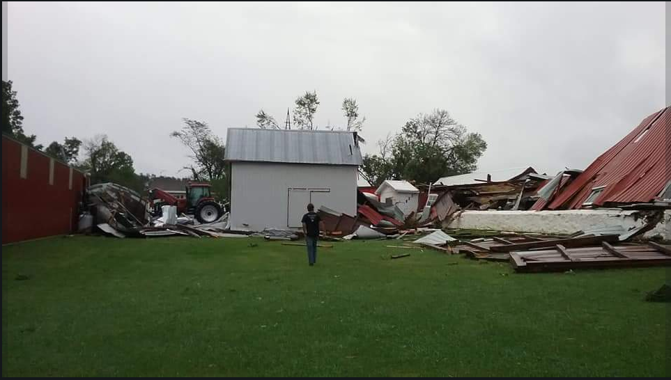
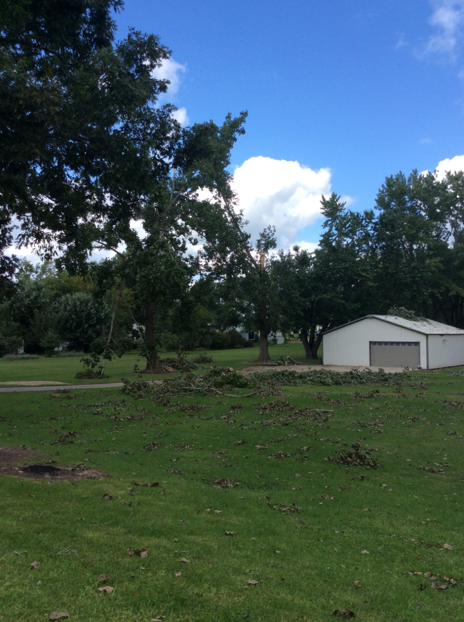
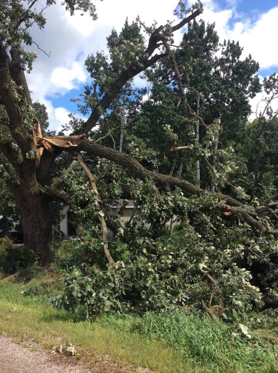
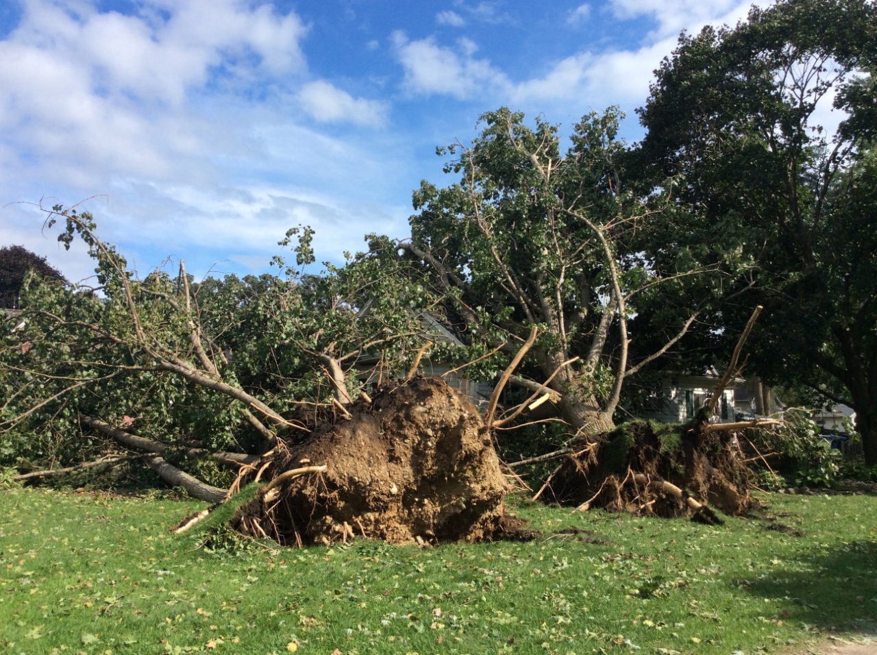
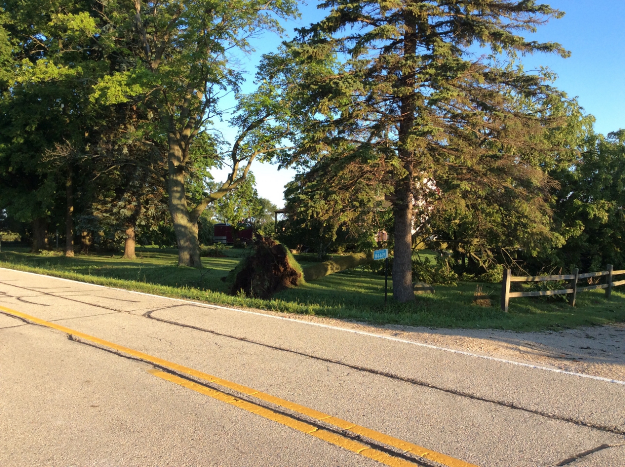
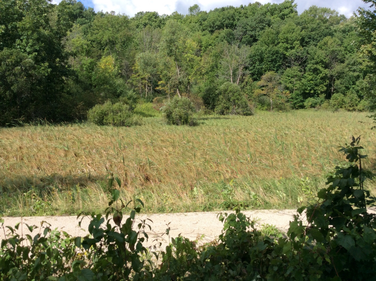
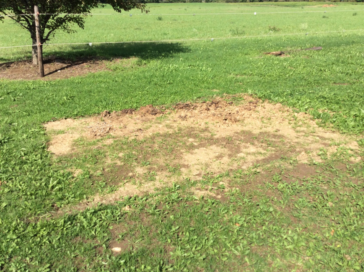
Alto
Cascade
Caption
Caption
Caption
Caption
Caption
Caption
Caption
Caption
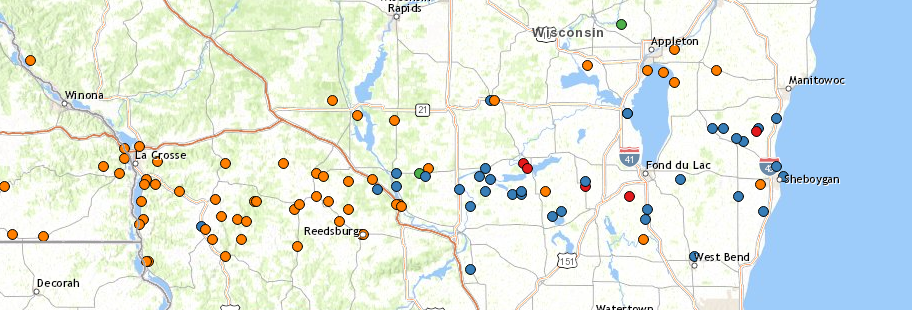
Storm Reports
Orange Dots: Flood Reports, Blue Dots: Wind damage/reports, Red Dots: Tornado reports
Media use of NWS Web News Stories is encouraged!
Please acknowledge the NWS as the source of any news information accessed from this site.
Click to toggle damage path/points
Path: Points:
Select from the drop down list below to zoom to individual survey results
Click the icons on the map to view damage photos/info


-Ziggy.PNG)
3-Ziggy.PNG)


 Follow us on YouTube