Critical Fire Weather
Purpose: New Mexico experiences varying degrees of critical fire weather. The Critical Fire Weather graphic will highlight weather regimes that are most suitable for significant and sometimes extreme fire growth. The threats are based on three broad categories or patterns: wind-low humidity, lightning induced large fire outbreaks and hot-dry-unstable. General fuel dryness is considered although fuel and terrain influences can vary significantly over time and space and cannot be accounted for in this graphic.
Weather and fuel element thresholds have been produced to determine threat levels across northern and central New Mexico. Some of the element outputs are based on weather model data while other values are manipulated by forecasters. There will be times when the fire weather threats overlap.
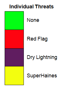
None: Significant fire weather threats which include various combinations of wind-humidity and instability are not forecast. It should be noted that occasional breeziness combined with a very dry airmass (see RH/Temp tab) and high mixing heights (see Ventilation tab) can create periods of robust fire spread and activity. Don't totally let your guard down just because "None" is in the graphic.
Red Flag (red): Sustained 20-foot wind >= 20 mph and Relative Humidity <= 15%.
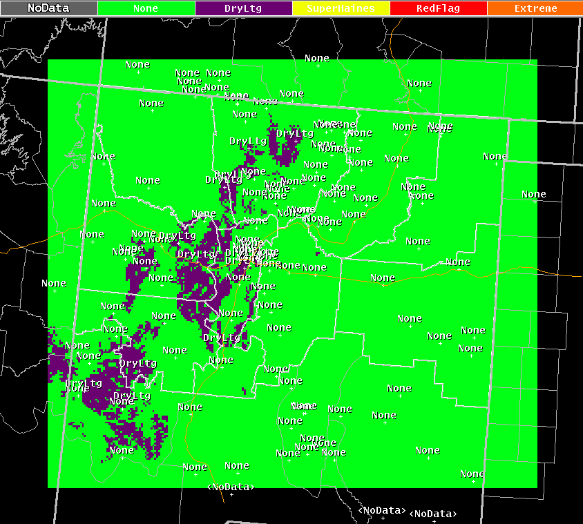
Dry lightning (purple): When 25 out of 28 weather-fuel dryness thresholds are met. Of the 25 thresholds being met, SWCC fuel dryness needs to be "very dry" and Lightning Activity Level (LAL) needs to be 3 or 6 (scattered thunderstorm coverage).
Super Haines (yellow): Mid levels of the atmosphere are very unstable and dry coupled with above normal temperature anomalies (departures from normal both day and nighttime), low humidity (day and nighttime) and very dry fuel conditions.
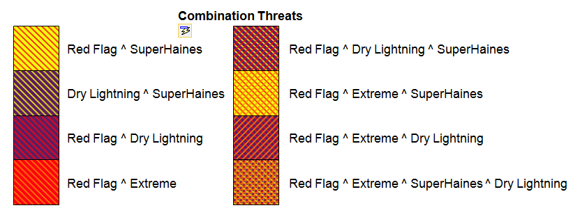
Extreme (red hashed with orange): Above normal temperatures (10 F° east and 6 F° west), low maximum humidity recovery during the morning (55% east and 35% west), wind gust >= 45 mph, daytime hourly humidity <= 10%, mid levels of the atmosphere very dry and unstable and SWCC fuel dryness needs to be "very dry".
Combination (hashed with various colors): Several threat combinations exist. The most likely combination are Red Flag-Super Haines and Red Flag-Extreme. Most of the threat combinations (i.e. Red Flag-Extreme-Dry Lightning) will not be observed in the graphics but have to be accounted for due to computer programming logic.
Threat examples found below:
Example 1: The follow Threat graphic forecast was valid 6pm June 11th, 2013. A combination of Super Haines and Red Flag conditions were forecasted for the north central mountains of New Mexico. The Jaroso wildfire exhibited explosive fire behavior on this day. This is evident in the picture below.
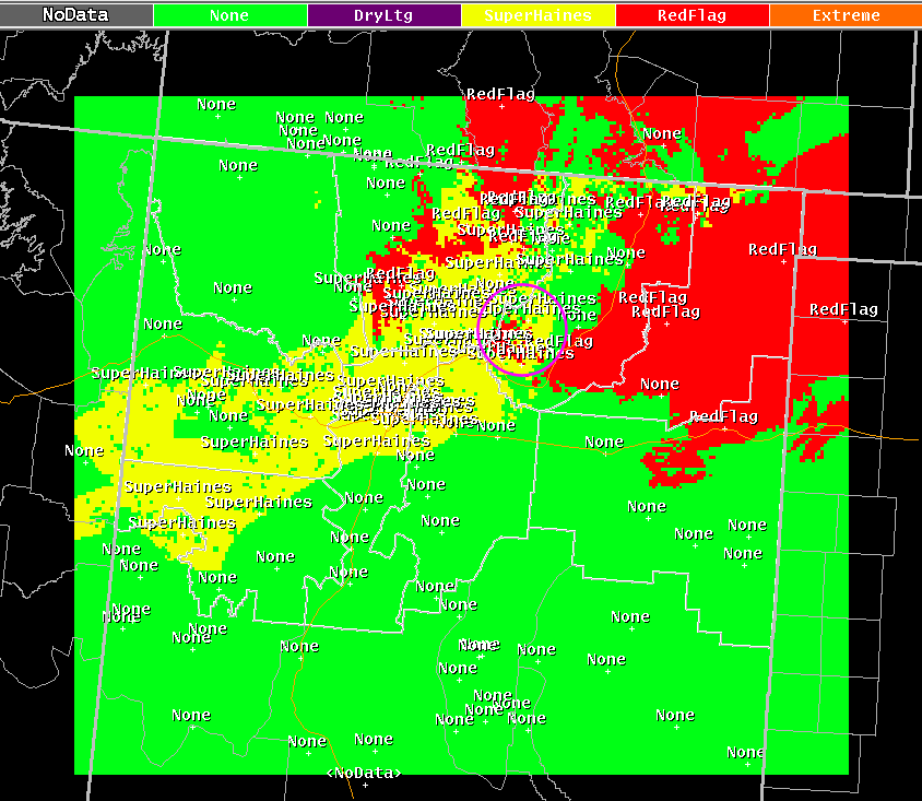
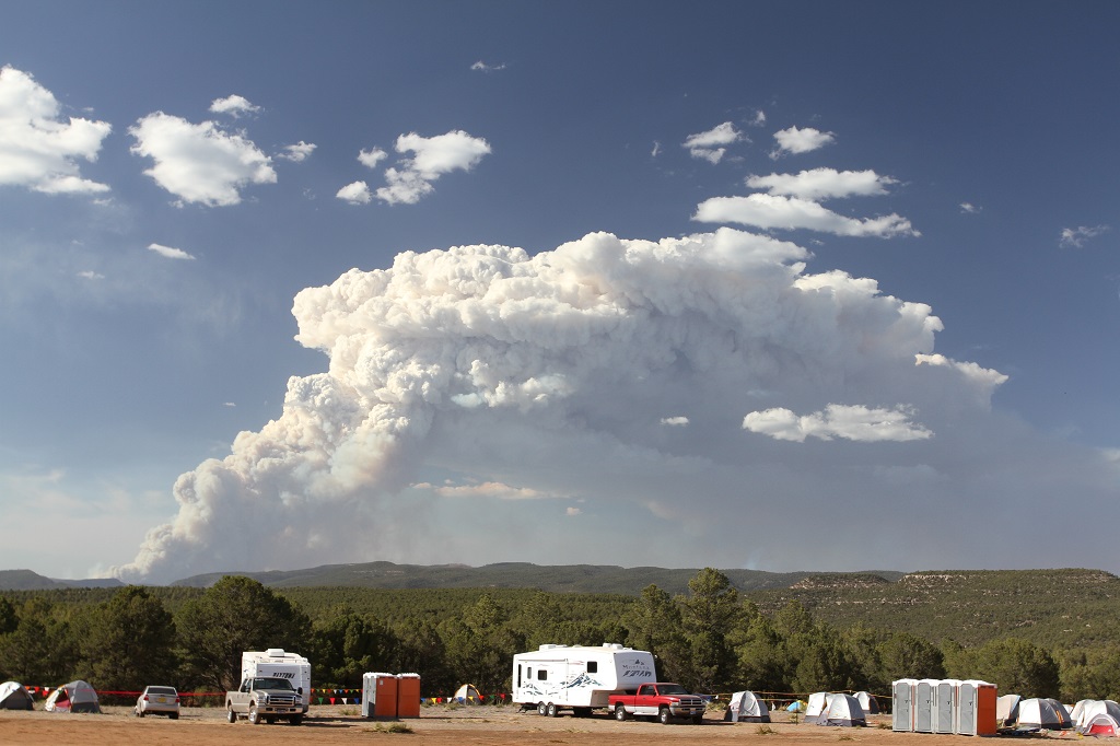
Photo courtesy of Brent Wachter
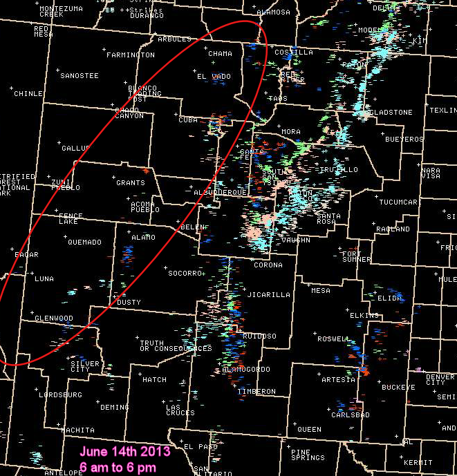
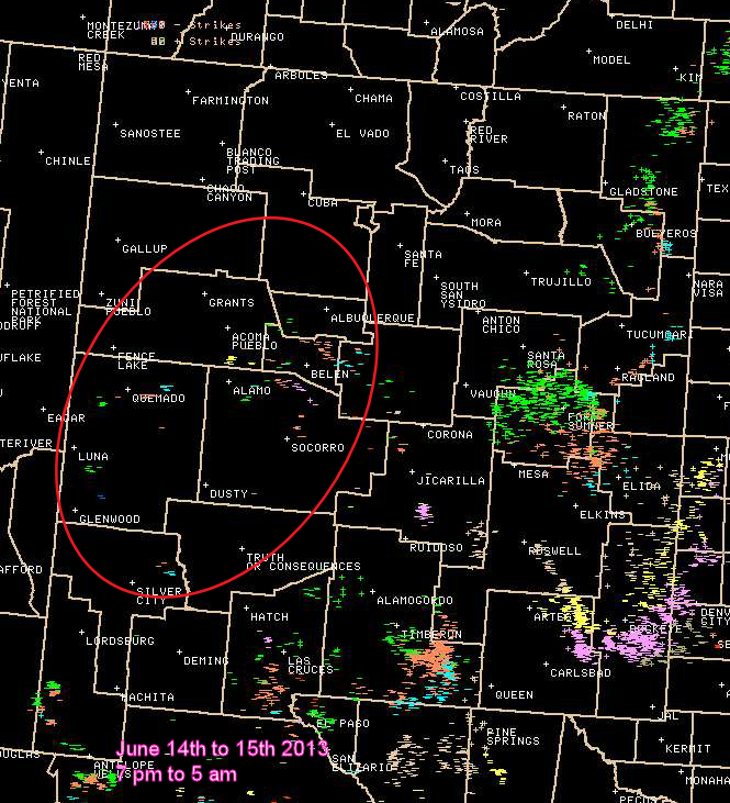
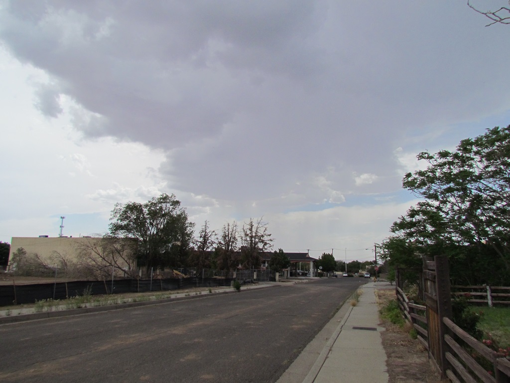
Example 2: The following Threat graphic forecast was valid 3 pm June 14th, 2013. A significant dry lightning fire outbreak event was possible on this day between the continental divide to the Rio Grande Valley of New Mexico. Several cloud to ground lightning strikes did occur within the threat area. This is shown in the two lightning maps found below. A picture was taken from Albuquerque during the early evening indicating the drier nature to the storms.
Super Haines
Purpose: The Haines Index is derived by calculating dryness at 10000 feet MSL and stability between 10000 to 18000 feet MSL. An unstable and dry atmosphere will be represented by Haines 6 values. The Southwest area observes Haines 6 values routinely during the main portion of the fire season (May through early July). The National Weather Service in Albuquerque has established another Haines threshold called "Super Haines". Other names include "Super 6" and "Enhanced high haines". Think of it as a 90th to 99th percentile Haines 6 value. The mid-levels of the atmosphere during Super Haines situations will be super unstable and very dry.
A hot-dry-unstable fire growth event encompasses Super Haines values as well as anomously warm temperatures (both day/night), low surface humidity (both day/night) and very dry fuels (SWCC dryness level). The Super Haines graphic will encapsulate a hot-dry-unstable fire growth event. There are some limitations to its use. The main limitation occurs with preexisting fires located in tight canyons. Due to poor humidity recoveries and warm overnight temperatures, the fire will remain active and produce abundant smoke. This abundant low level smoke will increase stability in the lower atmosphere by reducing the amount of solar radiation reaching the ground. There are days when Super Haines is forecasted but the fire is not able to tap into those conditions due to low level stability.
Super Haines effects on wildfires is most apparent within timber/shrub fuel types combined with slope. Plume dominated fires will be possible under such conditions.
Example
The following Super Haines graphic was valid 6 pm June 2nd, 2012. Super Haines values are forecasted for western New Mexico.
Dry Lightning
Purpose: There are various types of lightning fire outbreak events that impact New Mexico. The dry lightning graphic will be used to capture the higher end or significant events. These events typically occur between May through mid July but can occur as early as April and sometimes happen in the fall period. The event is preceded by above normal temperatures and low humidity. This type of weather preps the fuel bed. The event itself contains marginally low humidity, above normal temperatures, very dry fuels and sufficient numbers of cloud to ground lightning. This type of weather promotes ignition and some growth from a lightning strike . Weather following the actual event day includes above normal temperatures, low humidity and either high Haines Index values or breezy conditions. This type of weather allows the wildfire to grow and become large. The graphic encapsulates the classic dry lightning fire outbreak event in the southwest.
The graphic is based on looking at 27 weather and 1 fuel element. Thresholds have been developed for temperature anomalies, humidity (hourly, recoveries/minimum's), haines index, SWCC fuel dryness and Lightning Activity Level's (LAL). Several querries are made based on NWS-ABQ gridded forecast including the preceding 3 days, event day itself and the following 3 days. The number of thresholds met or exceeded is displayed in the graphic. The graphic oftentimes mimics Energy Release Component (ERC) trends. Cooler and more moist periods lower numbers and warmer, drier periods raise the numbers.
This graphic has some limitations. Fuel continuity and loading is a huge component to lightning fire outbreaks. This is especially important in the lowland areas. There are years when the grass crop is discontinuous and the fuel loading is light. Fire outbreak events due to lightning will be less common during those situations. This graphic will not take fuel continuity-loading into account. Wind following the event is also not taken into account. Research will be ongoing due to the sensitive nature of lightning fire outbreak events. Adjustments to current weather element thresholds and changes to element type will be further studied.
Example
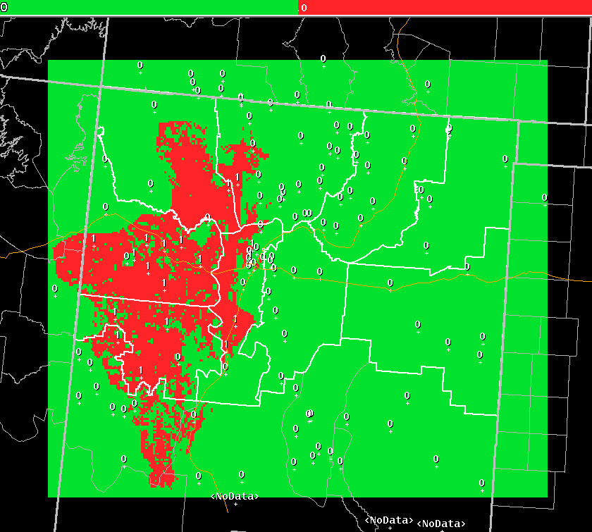
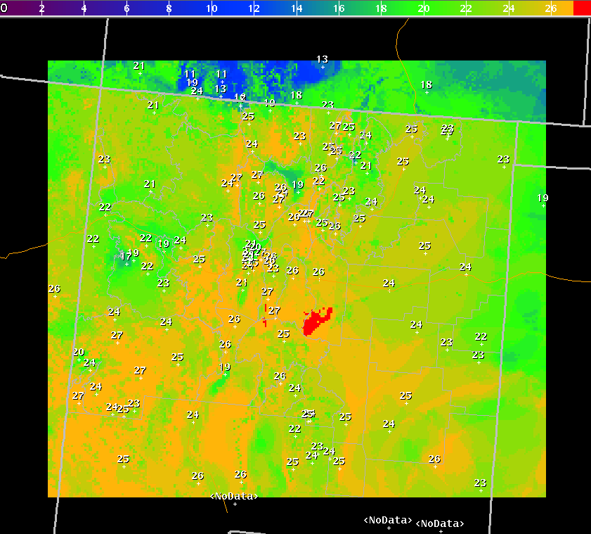
The following Dry Lightning graphic was valid 3 pm June 27th, 2011. Conditions were anomously warm and dry leading up to the 27th. Conditions were forecasted to be warm, dry and unstable following the 27th. The 27th included forecasts of marginally low humidity, very dry fuels and LAL of 3 or 6. The Las Conchas fire started near Los Alamos on the 26th. The timber fire had grown to nearly 45,000 acres between early afternoon 26th to early morning 27th. Abundant high plains moisture flowed from east to west across New Mexico during the 27th. Threshold values colored red indicated 28 out of 28 thresholds were met or exceeded. Pictures and a radar image provided below.
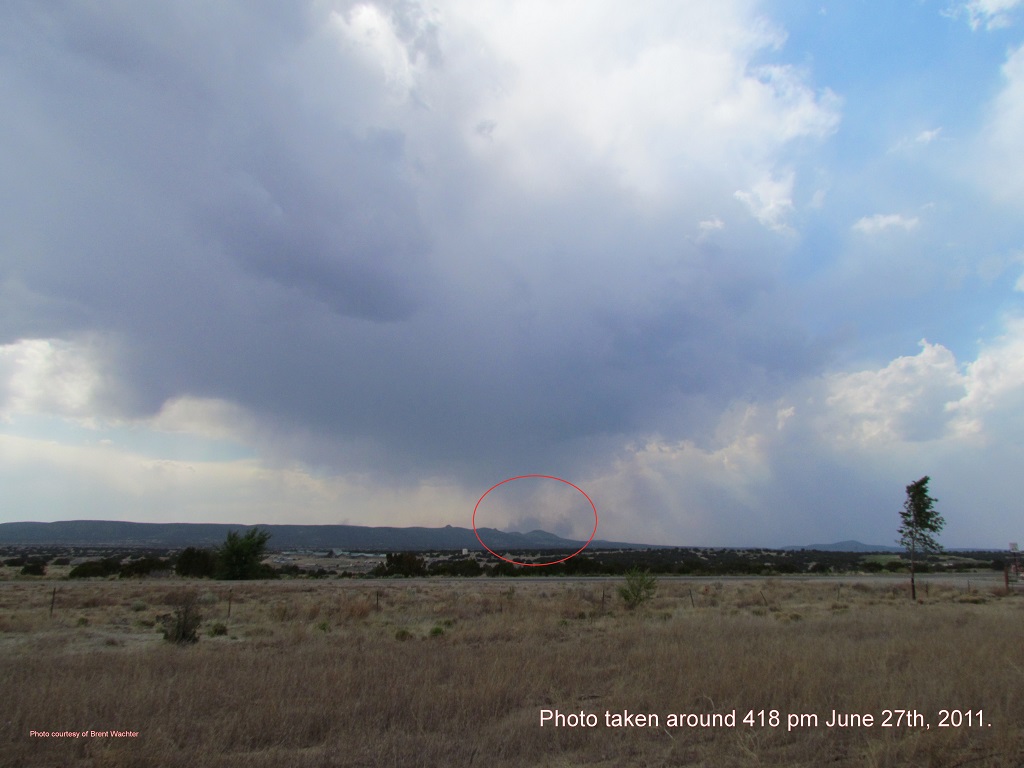
Drier thunderstorm approaching the east end of the Las Conchas wildfire.
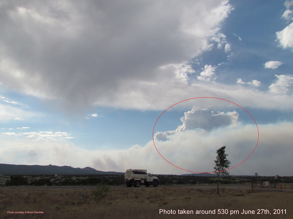
Las Conchas smoke plume circled in red. Residual virga found in the upper left side of the picture. Another, less intense Las Conchas smoke plume in the foreground and impacted by outflow wind.
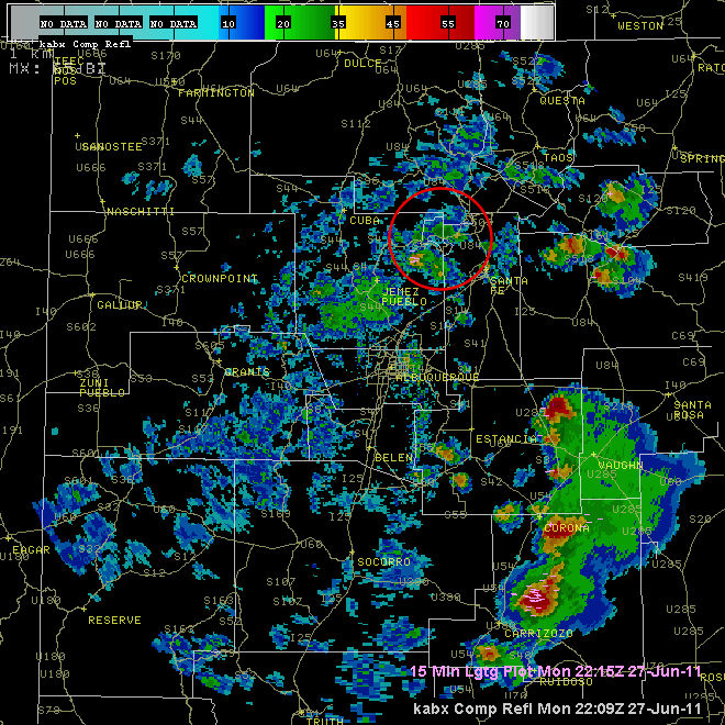
Composite Albuquerque (ABX) radar image overlaid with cloud-ground lightning valid between 409 to 415 pm June 27th, 2011