National Weather Service Honolulu Radiofax Charts Mobile Page
* Not transmitted via Honolulu radiofax but listed here for convenience
* Not transmitted via Honolulu radiofax but listed here for convenience
* Not transmitted via Honolulu radiofax but listed here for convenience
$ These charts will no longer be available sometime after June 20, 2006
* Not transmitted via Honolulu radiofax but listed here for convenience
* Not transmitted via Honolulu radiofax but listed here for convenience
* Not transmitted via Honolulu radiofax but listed here for convenience
* Not transmitted via Honolulu radiofax but listed here for convenience
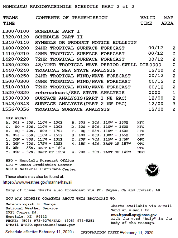
These charts also available via E-mail
Many of these charts also broadcast from Pt. Reyes, CA and Kodiak, AK
Always check date/time
Questions/comments
www.weather.gov/marine
marine.weather@noaa.gov