National Weather Service United States Department of Commerce

Critical Fire Weather Conditions Continue Across the Plains

Locally critical fire weather conditions continue for portions of the Northern/Central Plains and much of northern lower Michigan Monday evening. Red Flag Warnings are currently in effect. Dry conditions and gusty winds will persist across southern Colorado Tuesday. Read More >

Click a location below for detailed forecast.

Last Map Update: Tue, Apr. 23, 2024 at 3:44:22 am CDT
National Weather Service Goodland, KSNational Weather Service Wichita, KansasNational Weather Service Springfield, MO
National Weather Service Norman, OKZoom
Out

National Weather Service Little Rock, AR
National Weather Service Fort Worth/Dallas, TXNational Weather Service Fort Worth/Dallas, TXNational Weather Service Shreveport, LA
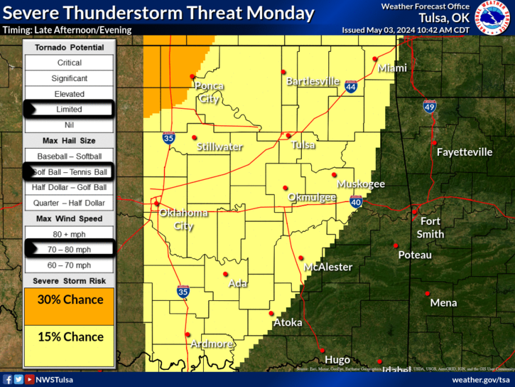
Thunderstorm chances return Tuesday and Tuesday night as a cold front moves into the region. The higher thunderstorm chances are forecast Tuesday night and continuing into the day Wednesday. A limited risk of severe weather will be possible along with potential for locally heavy rainfall amounts through Wednesday.
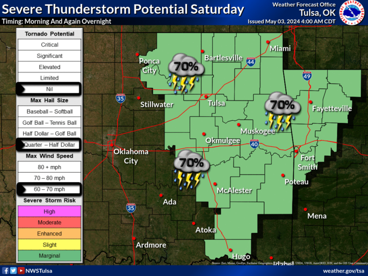
An active spring weather pattern develops for the second half of the week and continues through the weekend with multiple rounds of showers and storms likely, including the potential for severe weather. Storm Prediction Center has an outlook for E OK & NW AR Friday and Saturday for severe weather with all modes of severe weather possible each day.
.Tonight...Mostly cloudy. Chance of showers and thunderstorms. Lows 48 to 65.
Latest Text Product Selector (Selected product opens in a new window)

Decision Support Hazards Models Observations Climate Hydrology
 
 
Social Media Satellite Fire Weather Weather Radio Spotter Training Text Products