
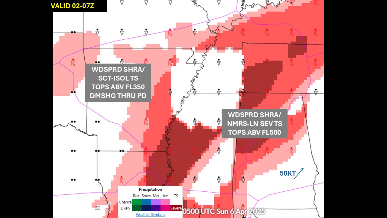
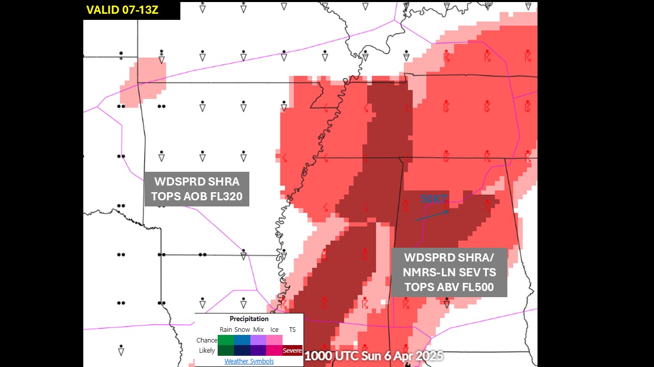
Strong to severe thunderstorms capable of damaging wind gusts, large hail, and perhaps a couple tornadoes, are likely Thursday from parts of the lower Ohio Valley into the southern Plains. An Enhanced Risk (Level 3 of 5) outlook has been issued. Further north, a warm front will bring areas of rain showers to portions of the Great Lakes and Northeast U.S. Read More >
Memphis
Center Weather Service Unit
| Hover over or click station to get METAR and TAF (if available). | Flight Categories: |
 |
 |
|
 |
 |
 |
|
|
|
|
|
|
|


 Weather Briefing
 Radar Mosaic
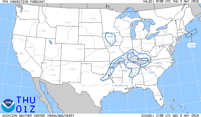 TCF Convective Forecast
 Sigmets and CWAs
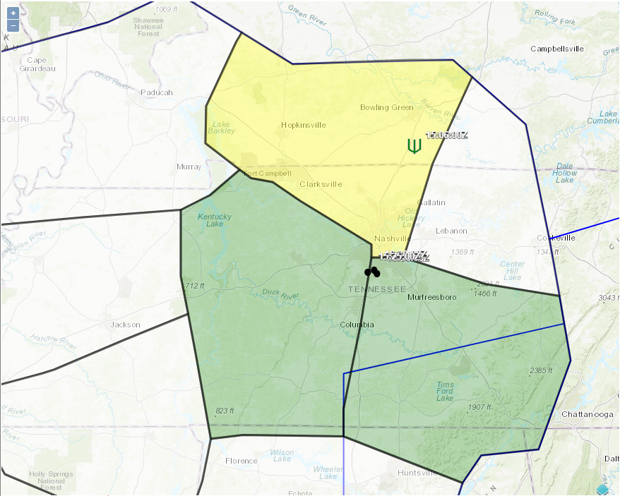 Area Hazard Pages
 Aviation Safety