
Severe thunderstorms capable of producing large hail, damaging winds and tornadoes are expected to develop this afternoon from western Oklahoma into west-central Texas. An Enhanced Risk (level 3 of 5) of severe thunderstorms in effect. Heavy to excessive rainfall is also likely for central and eastern Texas. Multiple rounds of heavy rainfall will lead to flash, urban and river flooding. Read More >
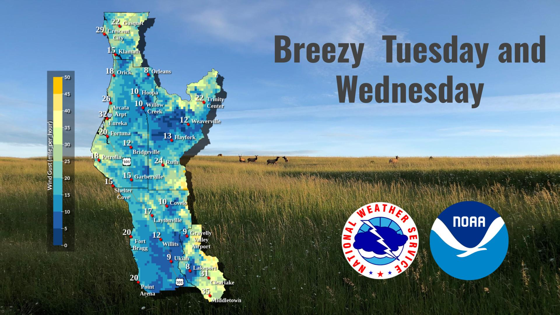
Last Map Update: Wed, May. 1, 2024 at 4:32:13 pm PDT
|
Text Product Selector (Selected product opens in current window)
|
|


 KBHX Radar
 Social Media
 Satellite
 Weather Map
 Forecast Weather Tables
 Climate Graphs
 Become A Rain/Snow/Hail Observer
 TsunamiReady
 Water Temperatures for NW California
 NW CA Mtn Pass Forecasts
 NW CA Daily Graphicast
 Subscribe to our Newsletter
 Area Smoke Forecast
 Drought Monitor
 Air Quality
 Follow us on YouTube