
Heavy to excessive rainfall is forecast for eastern Louisiana into central Alabama which could bring flash, urban, and riverine flooding Friday. Scattered severe thunderstorms with a few tornadoes, very large hail, and damaging winds are possible across parts of the Gulf Coast States Friday and Friday night. Read More >
Drought Information
El Niño-buoyed precipitation amounts during the cold season, followed by a wet spring, erased drought conditions across the region.
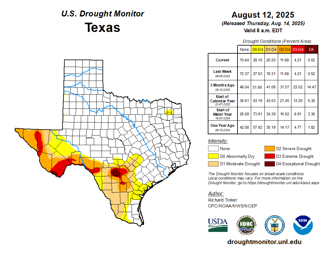
Current Drought Conditions

Fire Danger
The spring growing season is in full swing, and above normal rainfall should keep fire weather concerns at bay. However, a prolonged dry spell would cure this vegetation, which could serve as fuel for wildfires. The days of greatest concern for fire initiation and spread would be those that are sunny and warm with low humidity and breezy winds.
Even if a formal burn ban is not in effect for your area, it is still important to be vigilant about fire usage. Avoid open flames near dry vegetation, and assure all coals and embers are fully extinguished.

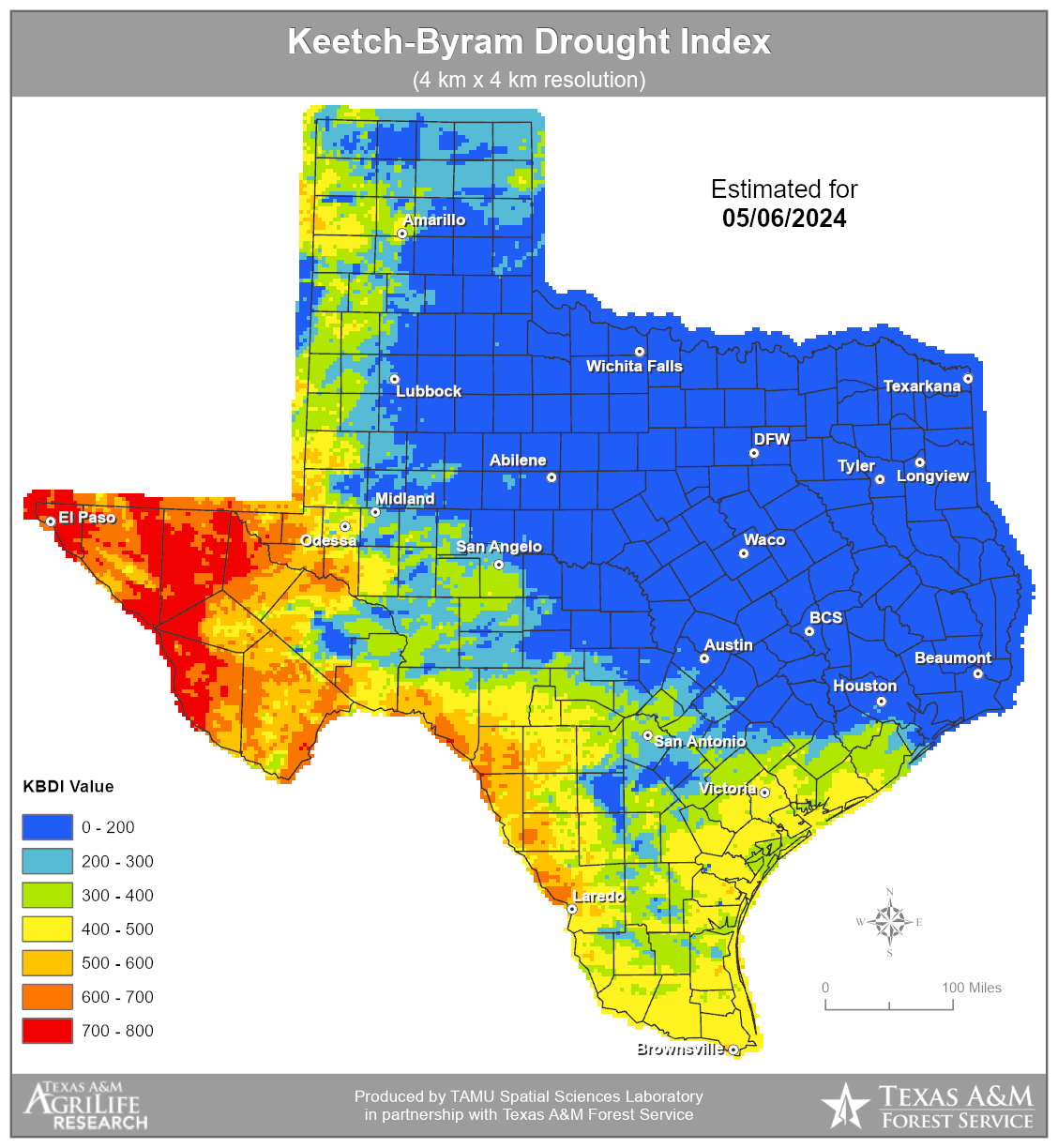
The Keetch-Byram Drought Index is a drought statistic specifically designed to assess fire danger.
Drought Links
![]() National Integrated Drought Information System
National Integrated Drought Information System
![]() National Drought Mitigation Center
National Drought Mitigation Center


 Follow us on YouTube