
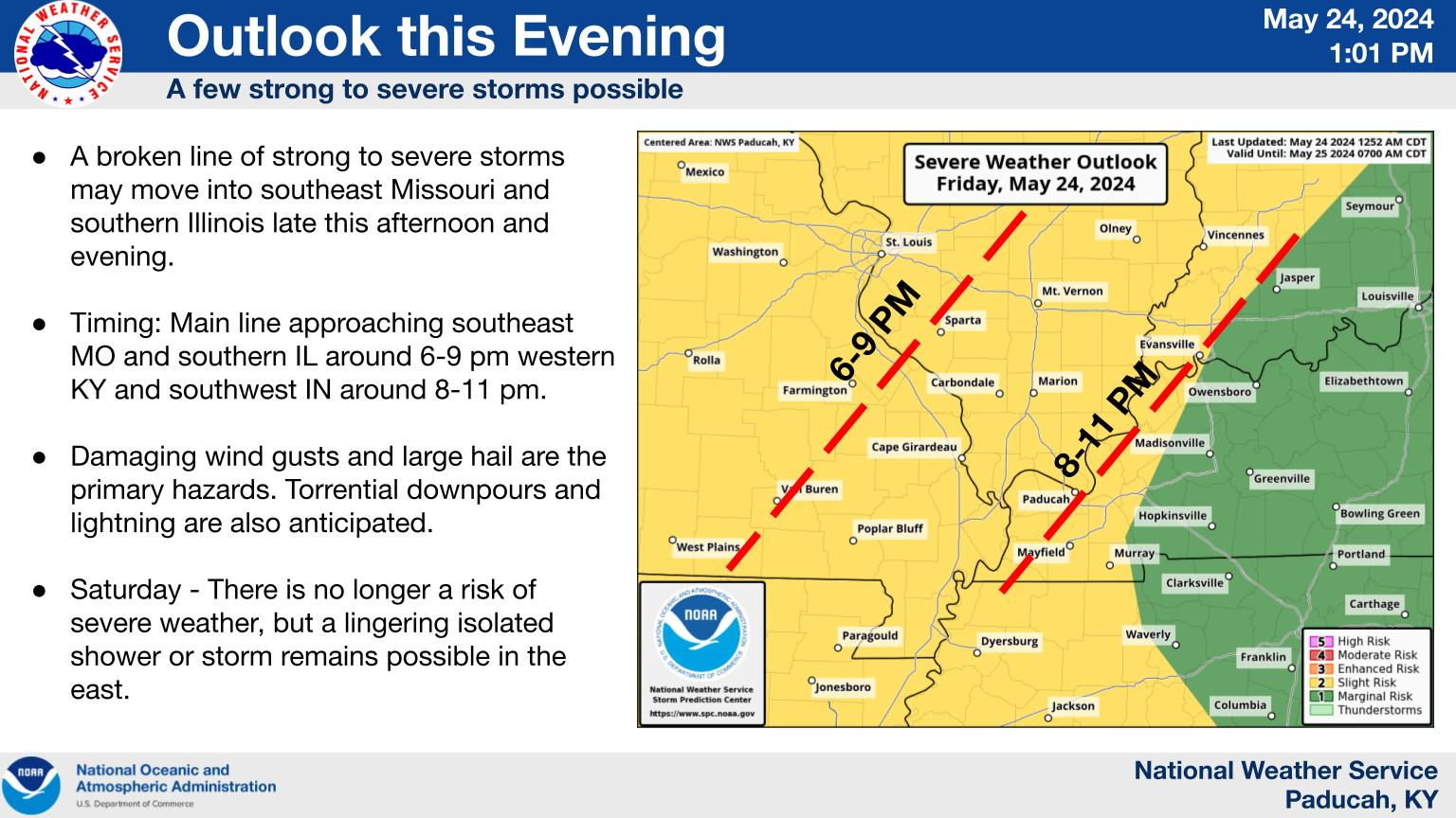
A High Risk (level 4 of 4) of Excessive Rainfall is in effect for portions of South Florida today. Rainfall rates between 2-5 inches per hour will likely lead to considerable flash and urban flooding. Across the Midwest, scattered severe thunderstorms capable of producing very large hail, severe wind gusts and tornadoes are possible this afternoon into the early evening hours. Read More >
Paducah, KY
Weather Forecast Office
Last Map Update: Thu, Jun 13, 2024 at 10:40:39 am CDT
FORECASTS
Forecast Discussion
User Defined Area Forecast
Hourly Forecasts
Fire Weather
Activity Planner
LOCAL INFORMATION
NWS Paducah KY Weekly Partner Briefing
Aviation Weather
Our Office
SKYWARN
Items of Interest
Hazardous Weather Support
WFO Paducah Navigator
Local Observations
Weather History
US Dept of Commerce
National Oceanic and Atmospheric Administration
National Weather Service
Paducah, KY
8250 Kentucky Highway 3520
West Paducah, KY 42086-9762
270-744-6440
Comments? Questions? Please Contact Us.


 Weather Story
 Weather Map
 Local Radar