Federal Agency Partners
The Tsunami Warning, Education, and Research Act of 2017 (P.L. 115-25, Title V) identifies NOAA as the lead agency for the NTHMP. In this role, NOAA serves as the chair of the NTHMP Coordinating Committee, co-chair of the Mapping and Modeling and Warning Coordination Subcommittees, and program administrator. Additionally, NOAA contributes to the NTHMP by administering the NOAA/NWS Tsunami Activities Grants, setting standards for NTHMP-developed inundation models, promoting community outreach and education networks to ensure community tsunami readiness, encouraging the adoption of tsunami warning and mitigation measures, conducting tsunami research, providing tsunami public outreach, and operating the U.S. Tsunami Warning System. NOAA’s NTHMP activities are led by the National Weather Service, which administers the NOAA Tsunami Program, a cross-NOAA cooperative effort that leverages the capabilities of other NOAA operational line offices: the Office of Oceanic and Atmospheric Research, the National Ocean Service, and the National Environmental Satellite, Data and Information Service.

FEMA is a member of the NTHMP Coordinating Committee and serves as co-chair of the Mitigation and Education Subcommittee. FEMA is responsible for coordinating government-wide relief efforts for natural disasters, including tsunamis. FEMA also works with tribal, state, territory, and local governments to build a culture of preparedness, ready the nation for catastrophic disasters, and reduce the complexity of disaster response. FEMA works with its stakeholders to develop and promote tsunami risk-reduction tools, provide disaster-resilient design and construction guidance, support development of disaster-resistant building codes and standards, administer the National Flood Insurance Program, and operate the nation’s alert and warning infrastructure (the Integrated Public Alert and Warning System).

The USGS is a member of the NTHMP Coordinating Committee. The USGS operates the Advanced National Seismic System and, along with other partners, supports the Global Seismic Network, which provides seismic data to NOAA’s tsunami warning centers. The agency also assists the centers by conducting independent seismic analyses of earthquakes that may generate tsunamis. In addition, the USGS conducts targeted research on tsunami sources and societal impacts and provides technical assistance to NTHMP partners on tsunami sources, hazard modeling, vulnerability assessments, and evacuation modeling.
State Partners
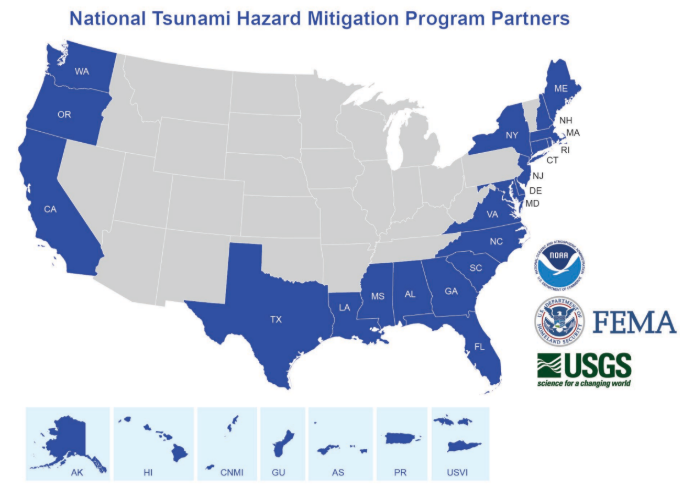
The following states and territories actively participate on the NTHMP Coordinating Committee and its subcommittees.
The following states do not actively participate in the NTHMP, but their interests are served through regional representation on the NTHMP Coordinating Committee and subcommittees. Information about the tsunami hazard and tsunami preparedness and mitigation activities in these states is typically available from state emergency management offices and/or geological surveys.
NTHMP Representatives:
Represented States
NTHMP Representative:
Represented States


