Alaska Aviation Weather Unit
Aviation Weather Unit
Turbulence Forecasts
Weather.gov
>
Alaska Aviation Weather Unit
> Turbulence Forecasts
Hazards
AIRMET Bulletins
SIGMETs
Special Hazards
Current Conditions
Satellite (GOES)
Satellite (POES)
Radar
Hourly Obs Charts
Surface Observations (Text)
Surface Observations (Map)
Lightning
FAA Webcams
Forecasts
Area Forecasts
Sfc Chart & Flight Cat
Icing
Turbulence
SIGWX Graphics (24-60 hr)
Convection
Winds Aloft
Surface Analysis (NCEP)
3-7 Day Outlook
Soaring Index
Model Graphics (NCEP)
Cold Air Aloft
High Altimeter
Volcano Info
Anchorage VAAC
VAAs
Alaska Volcano Observatory (AVO)
Local Info
Area Fax Sheets
Forecast Discussions
Station Listing
Anchorage CWSU
Anchorage WFO
Fairbanks WFO
Juneau WFO
Alaska River Forecast Center
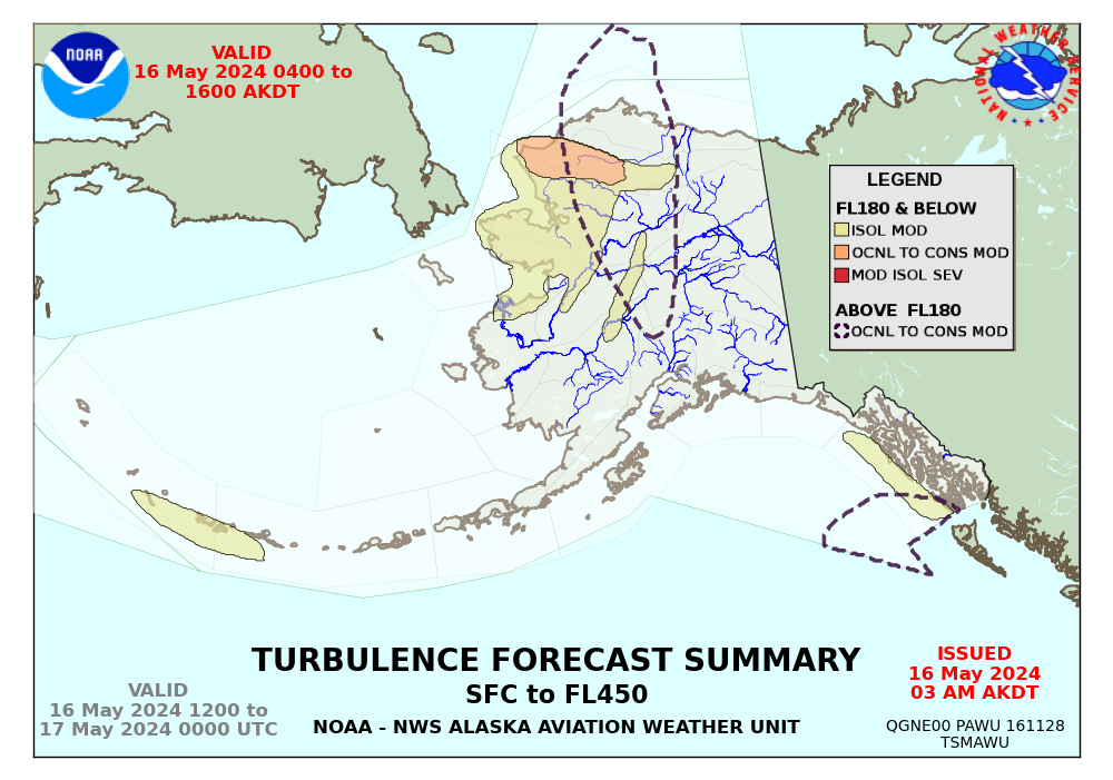
Turbulence
12 Hour Summary
High Level: |
0900 AKDT
|
1200 AKDT
|
1500 AKDT
Low Level: |
0900 AKDT
|
1200 AKDT
|
1500 AKDT