
Severe thunderstorms are expected across portions of the Southeast and Carolinas today where a Slight Risk (Level 2 of 5) has been issued. A Slight Risk Excessive Rainfall Outlook (Level 2 of 4) has been issued for part of the northern Gulf Coast today due to the threat of flash, urban, and riverine flooding. Read More >
|
|
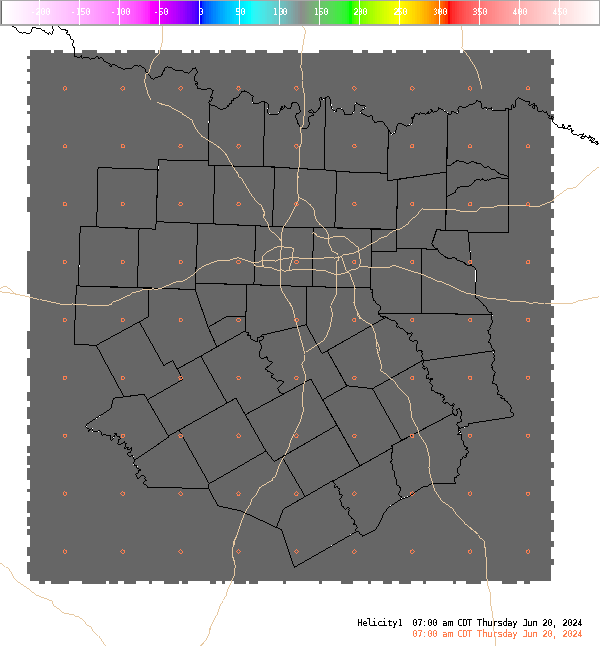
4 Panel Display | Animated Loop Helicity (0-1 Km) This is the 0-1 km (approximately 0-3,000 Ft. AGL) storm relative helicity which is a measure of the amount of low level wind shear available for tornadogenesis. This is not a good indicator of supercell potential which is related more strongly to 0-6 KM vertical shear. Values greater than 100 m**2/s**2, do suggest an increased threat of tornadoes provided a supercell is present. Larger values are generally better, but there are no clear "boundaries" between non-tornadic and significant tornadic supercells. The arrows indicate the approximate right supercell storm motion using the Bunkers technique. |


 Follow us on YouTube