
Severe thunderstorms are expected across portions of the Southeast and Carolinas today where a Slight Risk (Level 2 of 5) has been issued. A Slight Risk Excessive Rainfall Outlook (Level 2 of 4) has been issued for part of the northern Gulf Coast today due to the threat of flash, urban, and riverine flooding. Read More >
Fort Worth/Dallas, TX
Weather Forecast Office
|
|
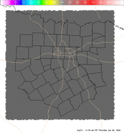
4 Panel Display | Animated Loop Significant Tornado (SigTor) A composite index that includes 0-6 km bulk wind shear, 0-1 km storm-relative helicity, surface based CAPE, surface parcel CIN, and surface parcel LCL height. Values greater than 1 are indicative of increased potential of significant tornadoes. The contours are the Lifted Condensation Level or LCL. A lower LCL typically increases tornadic risk because it is indicative of air parcel acceleration occurring closer to the surface.
|
Current Hazards
Severe Thunderstorm Warnings
Storm Reports (Graphical)
National Outlooks
Flash Flood Warnings
Submit Storm Report
Tropical
Tornado Warnings
Local Storm Reports
Hazardous Weather Outlook
Forecasts
N. Texas Convective Parameters
Aviation Forecasts
Air Quality (Waco)
Fire Weather
Forecast Discussion
Hazard Planner
Graphical Forecast
Air Quality (DFW)
US Dept of Commerce
National Oceanic and Atmospheric Administration
National Weather Service
Fort Worth/Dallas, TX
3401 Northern Cross Blvd.
Fort Worth, TX 76137
817.429.2631
Comments? Questions? Please Contact Us.


 Follow us on YouTube