
Severe thunderstorms are expected across portions of the Southeast and Carolinas today where a Slight Risk (Level 2 of 5) has been issued. A Slight Risk Excessive Rainfall Outlook (Level 2 of 4) has been issued for part of the northern Gulf Coast today due to the threat of flash, urban, and riverine flooding. Read More >
|
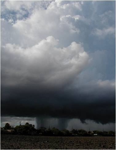
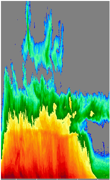
Over the last few decades, flash flooding has ranked as the leading cause of fatalities associated with convection in the United States (NOAA). Anticipating a flash flood event is different than forecasting the occurrence of other convective hazards such as tornadoes or large hail because it requires several non-meteorological factors to coincide with excessive rainfall rates. These non-meteorological factors include antecedent soil moisture, drainage basin characteristics, and the interaction of runoff with civil infrastructure. Non-meteorological factors are often unknown or approximated, but errors in estimation of the primary meteorological factor, precipitation rates, can also occur. A rainfall estimate which is higher than reality can result in flash flood warnings issued for events which do not occur. In contrast, a rainfall estimate that is too low can lead toward a flash flood event occurring with no warning. Unwarned flash flood events are especially counter to the core mission of the National Weather Service because they contribute toward a lack of awareness and may lead to fatalities or property damage that could have otherwise been prevented or mitigated. The deployment of the WSR-88D radar network across the United States in the 1990s has made substantial improvements in the ability to forecast flash floods (Polger et al. 1994). This occurred because the WSR-88D produces real-time rainfall estimates from computer algorithms that correlate reflectivity values to precipitation rates. A forecaster’s use of rainfall estimates in conjunction with short-term convective trends is often sufficient to anticipate a flash flood event. However, this method places heavy reliance upon the WSR-88D precipitation estimation algorithms, which unfortunately can be inaccurate for a number of reasons (Baeck and Smith 1998). This research will examine a specific cause of radar rainfall rate underestimation that occasionally occurs over continental regions of the United States. This systematic underestimation results from cloud microphysical properties typically associated with convection in tropical environments. An examination of several flash flood events over the Central and Southern Plains will identify common characteristics associated with this type of convection. The goal of this research is to provide the operational forecaster a more complete conceptual model to aid in better recognition in a real-time operational setting. |
|


 Follow us on YouTube