November 30, 2016 Severe Weather Event
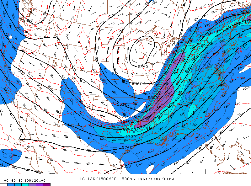
The first significant severe weather event to affect Georgia after a record-long period without rainfall occurred on November 30th. Thunderstorm development occurred within a warm sector ahead of a cold front. While instability was relatively limited, the environment was still favorable for damaging winds and isolated tornadoes given the strong southwest jet across the southeast U.S. (evident on the 500mb map below) providing enhanced bulk wind shear. Favorable low-level shear was also in place across the state as seen in the 0-1 km SRH map below. Six tornadoes in the EF0 and EF1 range resulted, with their surveyed damage details included below.
|
|
 |
|
| Surface map (1 pm) | Upper level (500 mb) map (1 pm) |
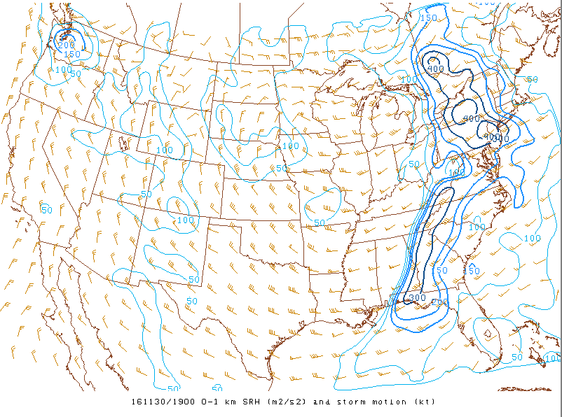 |
| 0-1 km storm relative helicity (SRH) map (2 pm) |
|
|
|
|
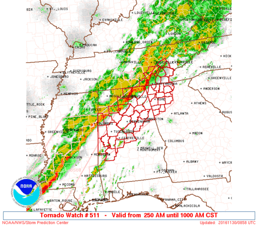
Initial tornado watch from the early morning of November 30 |
Tornado watch from the afternoon of November 30 |
|
|
| Storm Reports from November 30, 2016 |
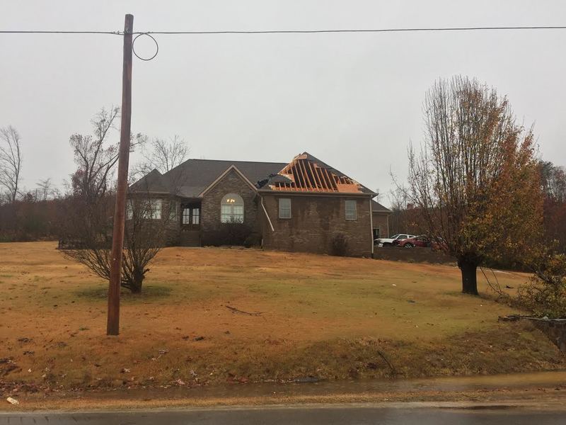
A tornado associated with a discrete supercell produced a small area of damage northeast of Ringgold. The initial damage path showed several trees snapped or uprooted just east of Ooltewah-Ringgold Road (Highway 151) between Sleepy Lane and Mountain Lane. The tornado then traveled up and over a ridge, doing additional damage along Cherokee Valley Road and Swallow Lane, where several homes sustained varying levels of damage. The worst of the damage occurred to a home where both garage doors collapsed inward and a portion of the roof was blown off. Debris from this roof was thrown more than 500 yards downstream. This damage supports maximum winds of 85 MPH (a high end EF-0 tornado). Siding was pulled off another home, and several small trees were snapped around the properties. Additional damage has not been reported; however, very rural areas exist on either side of this location, making it difficult to conduct ground surveys. *Of note: The area on Cherokee Valley Road with damaged homes was devastated by a deadly EF-4 tornado during the infamous April 27, 2011 tornado outbreak.*
|
|
|
|
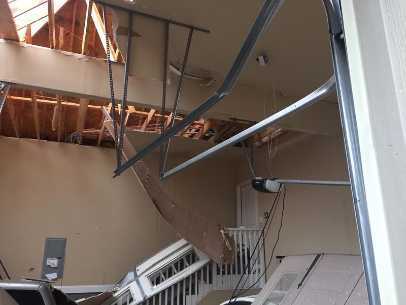 |
| This home off of Cherokee Valley Rd sustained the most significant damage with a portion of the garage roof being removed and the garage doors being blown inward. | Here is the interior of the garage with the garage doors blown into the garage and part of the roof removed. |
|
|
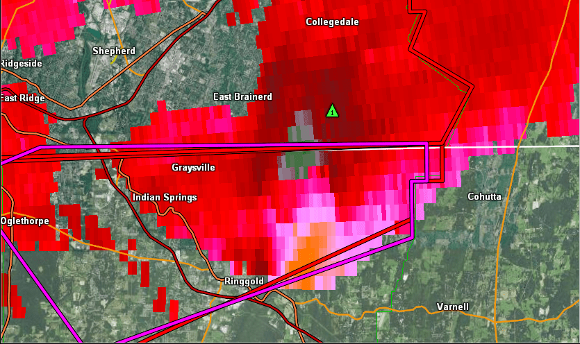 |
| Reflectivity (1:58 AM EST). | Velocity (1:58 AM EST). |
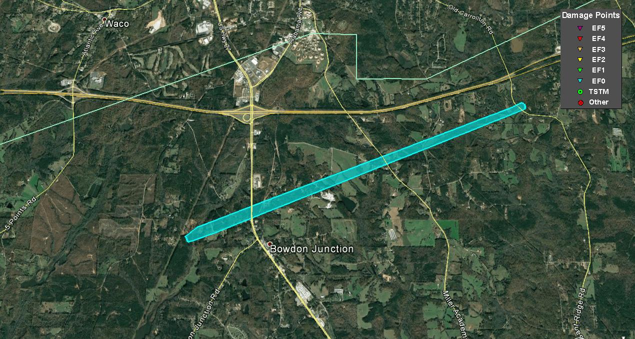
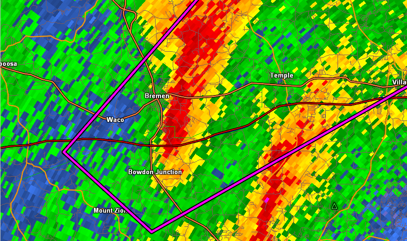
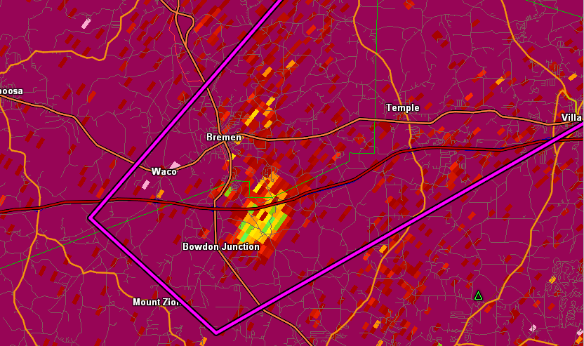
A weak tornado embedded within a line of thunderstorms, touched down just north of the Mount Zion community, along Lee Williams Road. Several large tree branches were snapped at this location. Additional trees were snapped or uprooted along a path toward Pleasant Ridge Road, just south of I-20. Maximum winds of 75 MPH were noted around the Bell Road and Pleasant Ridge Road area. No additional damage was seen northeast of this location.
|
|
|
|
|
|
|
 |
| Reflectivity (12:56 PM EST). | Velocity (12:56 PM EST). |
|
(12:56 PM EST). |
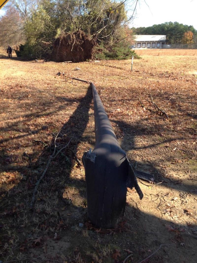
#3: Cobb County Tornado:
A tornado touched down along Delta Circle in Cobb County, affecting several large industrial metal buildings/warehouses. The southern corner of one warehouse was ripped apart with metal siding and roofing twisted and thrown nearly a quarter mile away into an open field. Also at this location, a large tractor trailer (18-wheeler) was flipped over on its side. Around the perimeter, several trees were snapped or uprooted. Based on these damage indicators, maximum winds of 100 MPH have been confirmed (EF-1). Just northeast of this area, at the intersection of Mableton Parkway and Lee Industrial Blvd., additional large trees were snapped or uprooted and part of a wooden power pole was ripped out of the ground. An aluminum-composite light pole was snapped near its base with several more trees uprooted along Discovery Blvd. just before the tornado appeared to lift.
|
|
 |
 |
| The most significant EF-1 tornado damage occurred to this industrial facility on Delta Circle. | This metal light pole and several large trees were downed along Discovery Boulevard. |
|
|
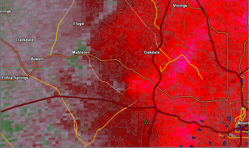 |
| Reflectivity (1:40 PM EST). | Velocity (1:40 PM EST). |
|
(1:40 PM EST). |
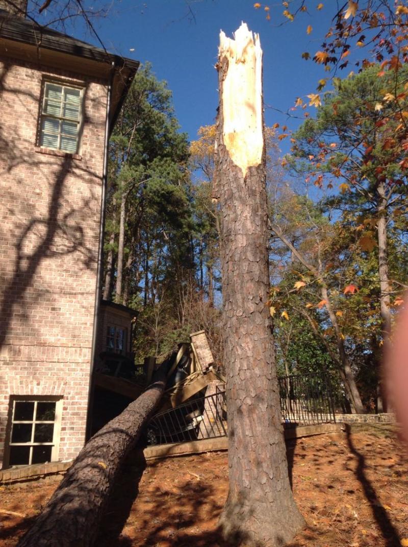
#4: North Atlanta Tornado:
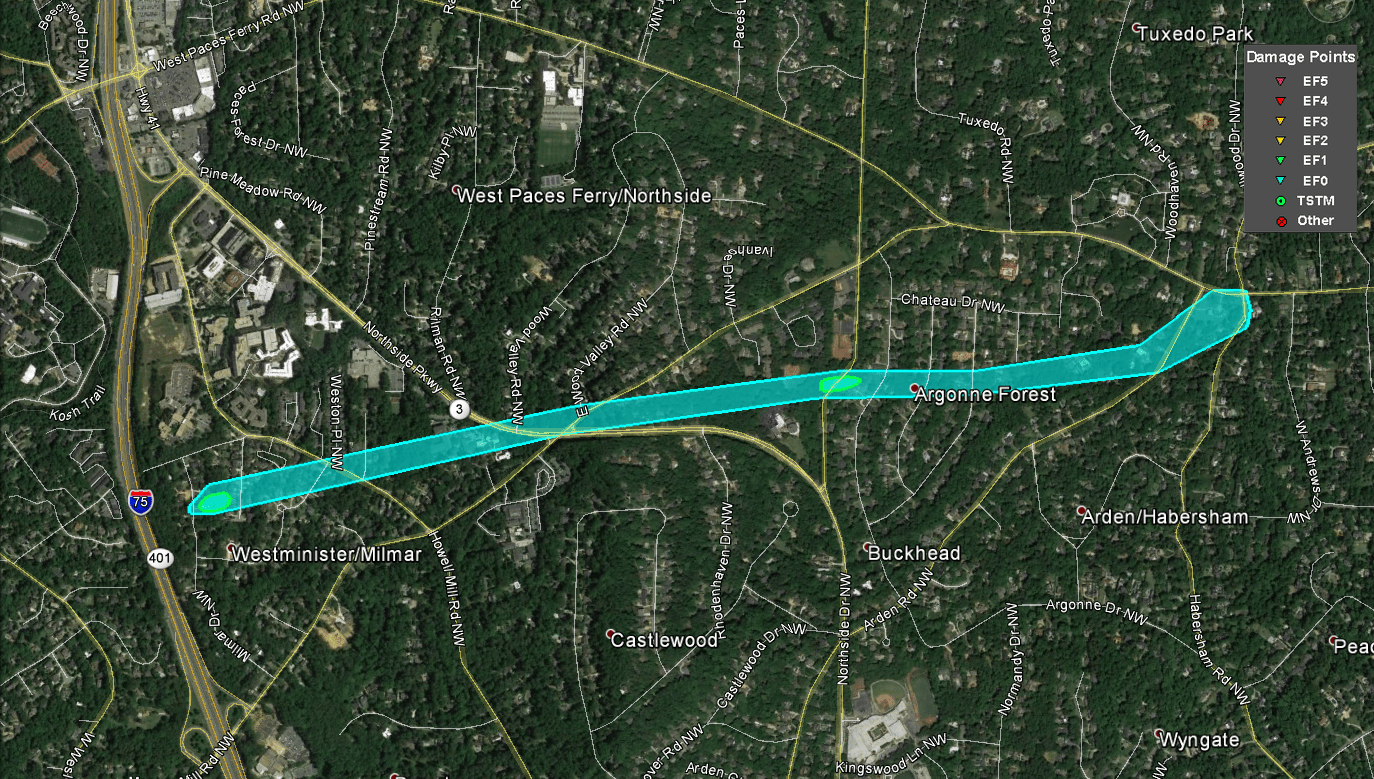
In North Atlanta, just east of I-75, a tornado snapped several large pine trees in a residential area along Margaret Mitchell Court. The tornado tracked east-northeast, snapping and uprooting additional large pine trees at the intersection of Northside Parkway (Hwy 41) and Moores Mill Road NW. Numerous large trees were snapped, several at their bases, along Northside Drive NW. This area of destroyed trees supports maximum winds reaching 90 MPH (EF-1). The tornado then jogged slightly east, doing additional tree damage along Marne Drive and Arden Road NW before lifting around the West Paces Ferry Road and Habersham Road NW intersection where several large tree branches were downed.
|
|
 |
 |
| This massive pine tree was snapped near the base, doing significant damage to a nearby home on Margaret Mitchell Court NW. |
Large pine trees such as this one were snapped on Northside Drive NW. |
|
|
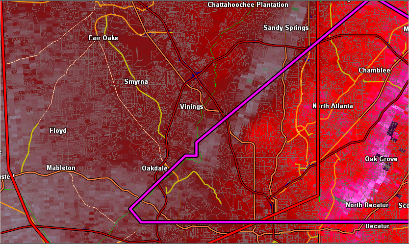 |
| Reflectivity (1:52 PM EST). | Velocity (1:52 PM EST). |
|
(1:54 PM EST). |
#5: North Fulton County / South Forsyth County Tornado:
A weak tornado initially touched down in extreme northern Fulton County where two pine trees were uprooted on Windward Parkway. The tornado continued moving northeast where it crossed into southern Forsyth County. Several trees were snapped on McGinnis Ferry Road, and a traffic light was damaged at the intersection of McGinnis Ferry Road and Curie Drive. Additional trees and tree limbs were downed along the path before the tornado lifted along Ridgefield Drive.
|
|
 |
 |
| Some trees were uprooted by this weak EF-0 tornado. | Tree damage was the primary noticeable damage from this weak EF-0 tornado. |
|
|
 |
| Reflectivity (2:11 PM EST). | Velocity (2:11 PM EST). |
|
(2:11 PM EST). |
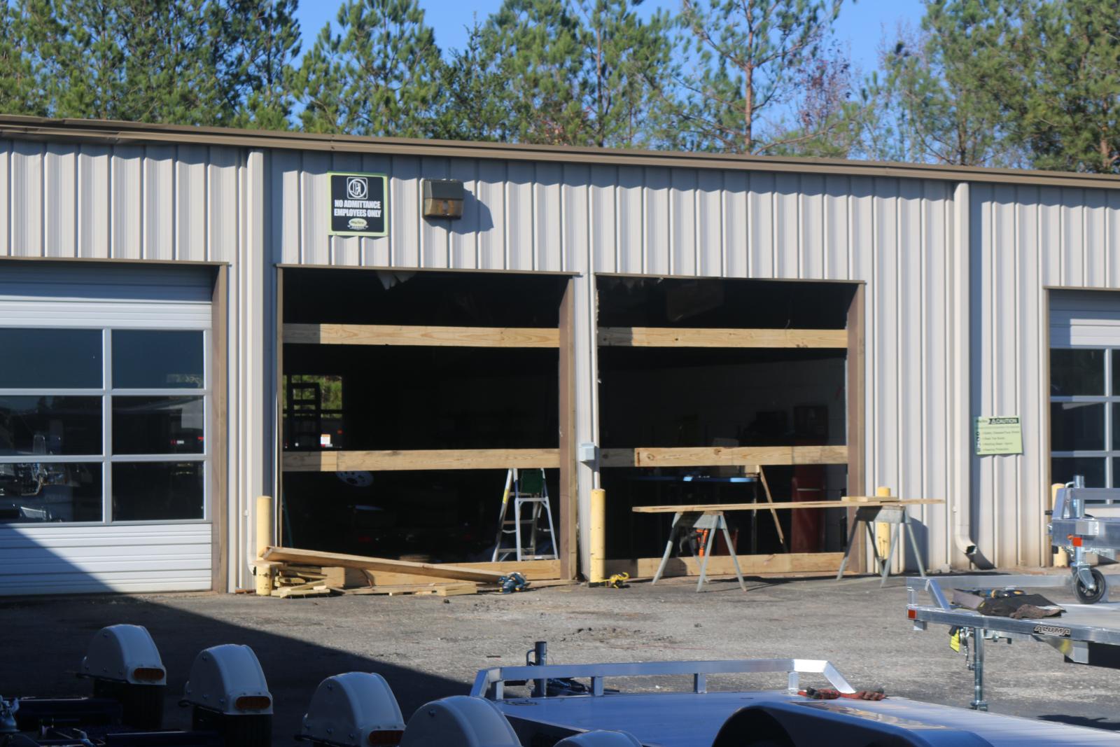
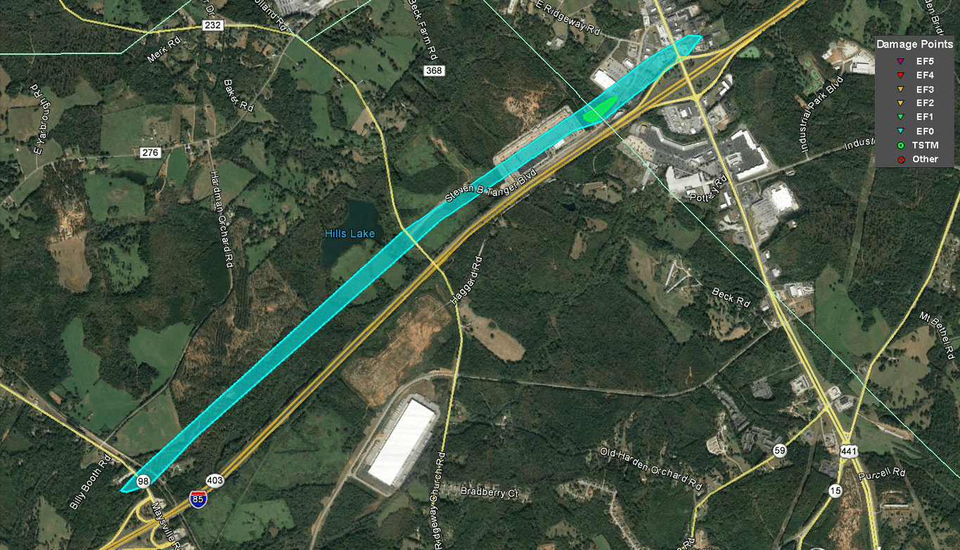
#6: Commerce Area Tornado:
A tornado touched down near a poultry supply store on Maysville Road just north of I-85. At this location, the tornado produced EF-0 damage, blowing over five 1000lb unsecured poultry feed bins and downing some large tree branches. The tornado continued moving northeast, paralleling I-85. Two street signs were bent over on Ridgeway Church Road. The tornado then produced EF-1 damage at an automotive trailer sales business where two large overhead garage doors were blown in, the front business door was blown off, and the roof was damaged. Several automotive trailers were also rolled about 50 feet. The tornado then blew out a couple of large business signs before lifting near the intersection of Highway 441 and East Ridgeway Road.
|
|
 |
 |
| This trailer sales business on Steven B Tanger Blvd had two of it's garage doors blown in. | Several trailers at the trailer sales business on Steven B Tanger Blvd were blown around the parking lot. |
|
|
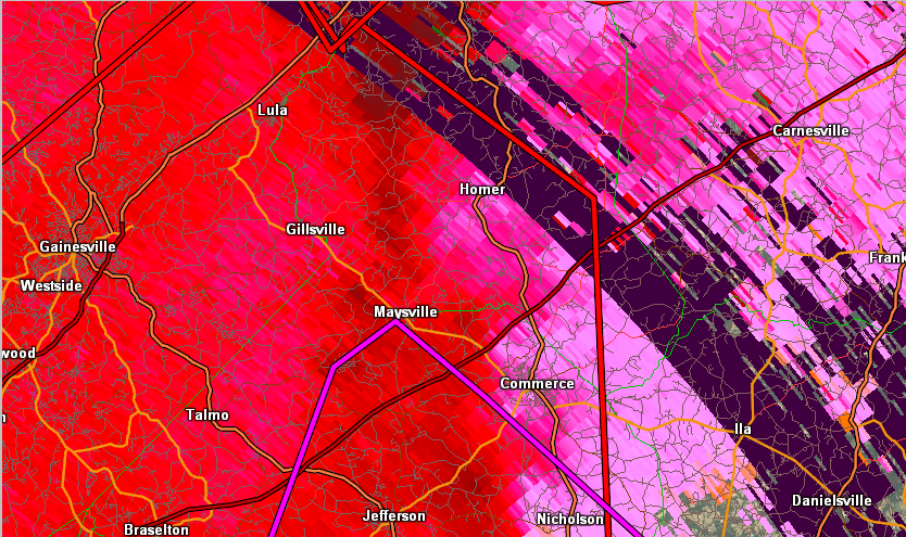 |
| Reflectivity (3:05 PM EST). | Velocity (3:05 PM EST). |
|
(3:13 PM EST). |


 Follow us on YouTube