
A High Risk (Level 4 of 4) of Excessive Rainfall has been issued for portions of east Texas into western Louisiana today. For weeks, heavy rainfall has fallen across the Gulf coast states so any additional rainfall today will likely lead to life threatening flash flooding. Severe thunderstorms capable of producing large hail, severe winds and tornadoes will also be possible in central Texas. Read More >
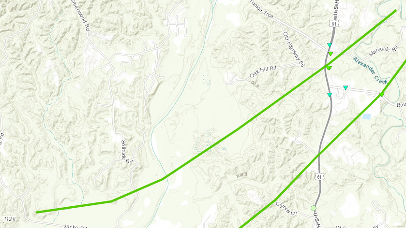
Bains, LA Tornado - April 10, 2024
|
Rating:
|
EF-1
|
|
Estimated Maximum Wind:
|
100 mph
|
|
Injuries/Fatalities:
|
None
|
|
Damage Path Length:
|
4.43 miles
|
|
Maximum Path Width:
|
350 yards
|
|
Approximate Start Point/Time:
|
4 miles WNW of St. Francisville, LA at 808 AM CDT
|
|
Approximate End Point/Time:
|
3 miles SSW of Wakefield, LA at 812 AM CDT
|
|
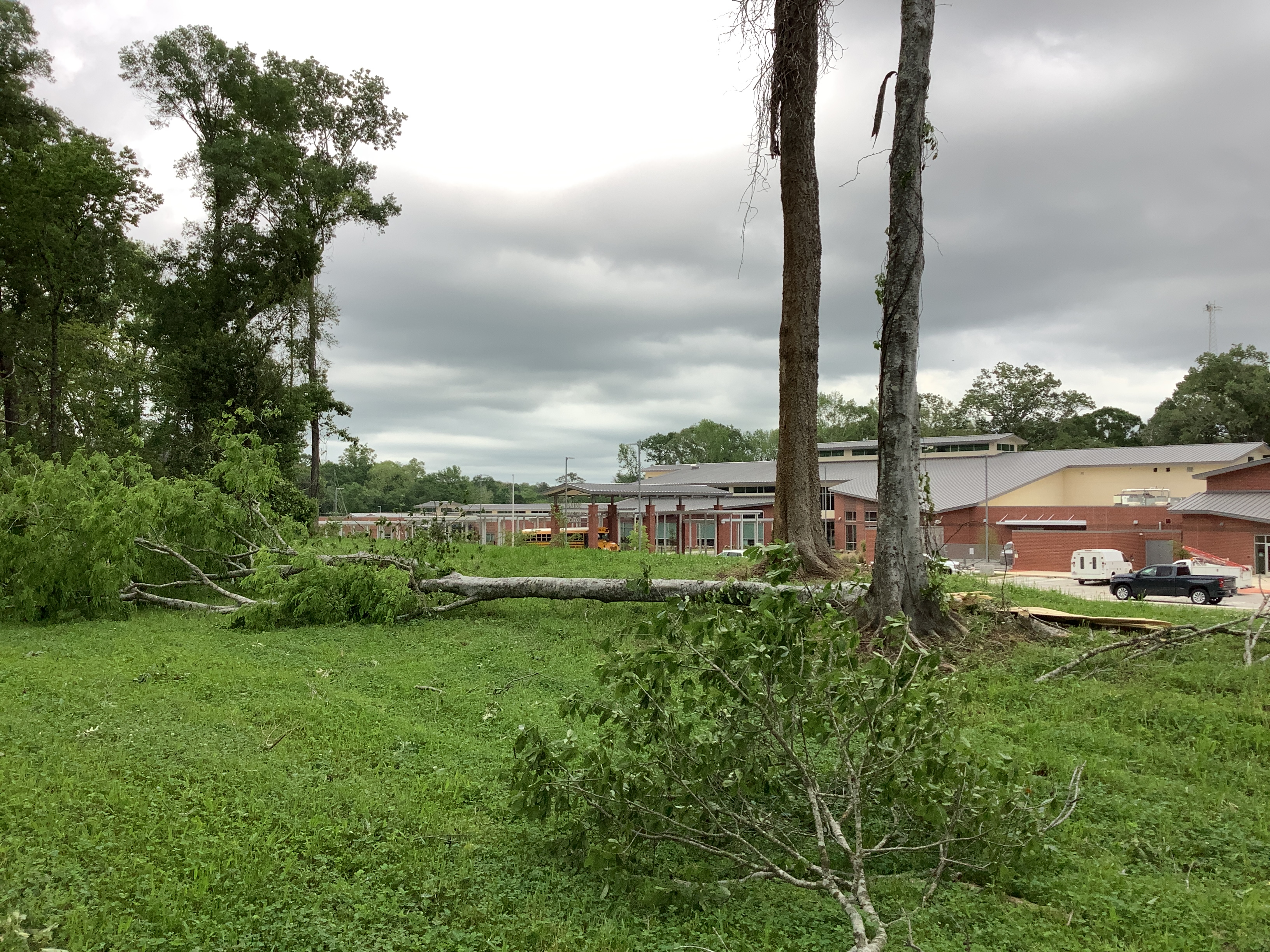
A National Weather Service Damage Assessment Team has surveyed the storm damage near Bains, LA. It has been determined the damage was the result of a tornado. The tornado has been rated an EF-1 on the Enhanced Fujita Scale. Damage estimates were consistent with winds of 100 mph. High resolution satellite analysis in conjunction with radar imagery and ground survey aided in the confirmation of another tornado that impacted Bains, LA. NDVI difference mapping helped to identify the starting point of this tornado along the bend of Bayou Sara. The tornado then quickly tracked northeast into Bains where it crossed US Highway 61 causing primarily tree damage near an elementary school. Additional damage was not accessible due to Marydale Road being closed, but high resolution satellite imagery did identify a localized swath of tree damage near Alexander Creek tracking just west of the larger tornado that occurred in this area. |
|
|
|
|
|||||||||


 Follow us on YouTube