
A High Risk (Level 4 of 4) of Excessive Rainfall has been issued for portions of east Texas into western Louisiana today. For weeks, heavy rainfall has fallen across the Gulf coast states so any additional rainfall today will likely lead to life threatening flash flooding. Severe thunderstorms capable of producing large hail, severe winds and tornadoes will also be possible in central Texas. Read More >
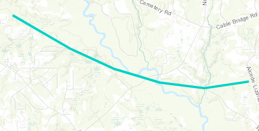
Dedeaux, MS Tornado - April 10, 2024
|
Rating:
|
EF-0
|
|
Estimated Maximum Wind:
|
85 mph
|
|
Injuries/Fatalities:
|
None
|
|
Damage Path Length:
|
5.07 miles
|
|
Maximum Path Width:
|
150 yards
|
|
Approximate Start Point/Time:
|
8 miles NNE of Diamondhead, MS at 1040 AM CDT
|
|
Approximate End Point/Time:
|
7 miles WSW of Lyman, MS at 1046 AM CDT
|
|
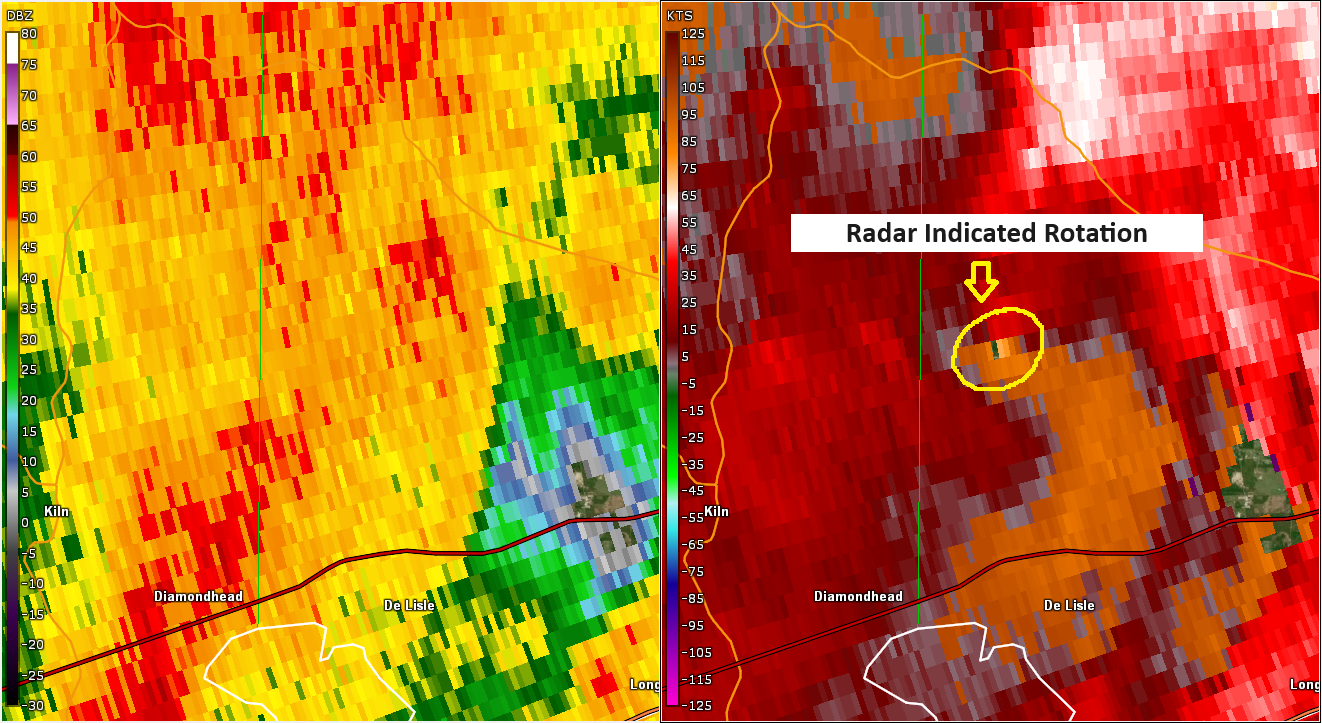
A National Weather Service Damage Assessment Team has surveyed the storm damage in Harrison County, MS. It has been determined the damage was the result of a tornado. The tornado has been rated an EF-0 on the Enhanced Fujita Scale. Damage estimates were consistent with winds of 85 mph. As the mesovortex tracked east into Harrison County, another tornado developed on the trailing flank of it and tracked east- southeast over primarily inaccessible rural land near the Wolf River. High resolution satellite imagery NDVI differencing identified a scalloped path that starts near F Malley Road in Dedeaux, MS and continues east-southeast where a ground survey identified snapped trees as well as a mobile home that had slid off its blocks. The tornado crossed River Road with minimal damage evident although the track remained visible on NDVI differencing as it crossed the Wolf River. The apparent track of the tornado continues east across Wolf River Road and appears to conclude just short of Alcede Lizana Road. |
|
|
|
|
|||||||||||


 Follow us on YouTube