
A High Risk (Level 4 of 4) of Excessive Rainfall has been issued for portions of east Texas into western Louisiana today. For weeks, heavy rainfall has fallen across the Gulf coast states so any additional rainfall today will likely lead to life threatening flash flooding. Severe thunderstorms capable of producing large hail, severe winds and tornadoes will also be possible in central Texas. Read More >
Rural Hancock County, MS Tornado - April 10, 2024
|
Rating:
|
EF-Unknown
|
|
Estimated Maximum Wind:
|
Unknown
|
|
Injuries/Fatalities:
|
None
|
|
Damage Path Length:
|
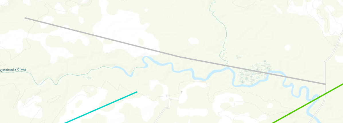
2.76 miles
|
|
Maximum Path Width:
|
150 yards
|
|
Approximate Start Point/Time:
|
6 miles W of Kiln, MS at 1023 AM CDT
|
|
Approximate End Point/Time:
|
3 miles WSW of Kiln, MS at 1027 AM CDT
|
|
A National Weather Service Damage Assessment Team has surveyed the storm damage in Rural Hancock County, MS. It has been determined the damage was the result of a tornado. The tornado has been rated an EF-U on the Enhanced Fujita Scale. No damage estimate was made due to lack of road access, and no wind speed determination can be made. A short-tracked tornado was identified using high resolution satellite imagery NDVI differencing. This tornado tracked over inaccessible rural lands north of Texas Flat Road along Catahoula Creek and Jourdan River before eventually dissipating as it interacted with the parent mesovortex to its east. No damage could be identified and thus the rating for this tornado is unknown. |
|
|


 Follow us on YouTube