
A High Risk (Level 4 of 4) of Excessive Rainfall has been issued for portions of east Texas into western Louisiana today. For weeks, heavy rainfall has fallen across the Gulf coast states so any additional rainfall today will likely lead to life threatening flash flooding. Severe thunderstorms capable of producing large hail, severe winds and tornadoes will also be possible in central Texas. Read More >
Liziana, MS Tornado - April 10, 2024
|
Rating:
|
EF-1
|
|
Estimated Maximum Wind:
|
100 mph
|
|
Injuries/Fatalities:
|
None
|
|
Damage Path Length:
|
1.48 miles
|
|
Maximum Path Width:
|
100 yards
|
|
Approximate Start Point/Time:
|
8 miles W of Lyman, MS at 1044 AM CDT
|
|
Approximate End Point/Time:
|
7 miles W of Lyman, MS at 1046 AM CDT
|
|
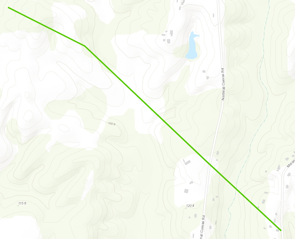
A National Weather Service Damage Assessment Team has surveyed the storm damage in Liziana, MS. It has been determined the damage was the result of a tornado. The tornado has been rated an EF-1 on the Enhanced Fujita Scale. Damage estimates were consistent with winds of 100 mph. NDVI differencing has helped to identify a tornado damage path that aligned with ground survey of a rolled manufactured home in Harrison County. This brief tornado quickly raced southeast also causing tree damage across Northrup Cuevas Road, just north of a longer-lived tornado that tracked near Wolf River. |
|
|


 Follow us on YouTube