
Dangerous severe weather will continue overnight in the nation’s heartland with potentially intense tornadoes and very large hail. The threat for severe weather will shift eastward into the Ohio Valley and mid-South on Tuesday. Farther west on the back side of this large storm system, strong winds and critical fire weather will affect the southern and central High Plains through midweek. Read More >
During the afternoon of June 10, 2016, a line of severe thunderstorms developed as a cold front moving across MN moved into a very unstable airmass from south central MN into western WI, where temperatures were in the mid 90s with dewpoints in the lower 70s. Numerous reports of wind damage were recieved with this line of storms, with peak measured wind gusts of 75 mph recorded by MNDOT sensors along I-35 at the Iowa border and along US-52 south of Cannon Falls. This line of storms eventually produced wind damage across WI and into northern lower Michigan before diminishing.
Below is radar imagery of the line from the MPX radar taken at 430 pm and a regional mosaic of the line later in the evening as it stretched from northern Lake Michigan back into northern Iowa.
You can view a complete loop of this line of storm from the MPX radar at youtu.be/UMHO08vp-m0.
 |
 |
As the line was gaining strength, the MPX radar captured the early stages of a developing downburst over Le Sueur county. In the image from 330 pm, the greens denote air moving toward the radar, while reds are moving away from the radar. Just south of the town of Montgomery, you can see the first signs of the severe downburst that would go on to produce the 75 mph wind gust south of Cannon Falls.
You can view a loop of velocity data as this downburst evolved over Le Sueur county at youtu.be/NJnj0uW2JIs

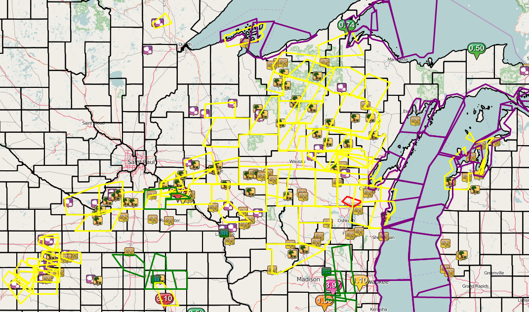
The map below shows preliminary damage reports recieved June 10th along with warnings issued by all NWS offices.
Here is a list of preliminary severe weather reports received within our area of responsibility:


 Follow us on YouTube