
Critical fire weather conditions, severe thunderstorms capable of producing severe wind gusts, large hail, strong tornadoes and heavy rainfall remain on tap for the central U.S. this evening. Flash flooding is also possible for portions of the Plains and Mississippi Valley. Very large hail up to 3 inches in diameter will be possible this evening across western Kansas. Read More >
|
May 10, 2008 Severe Weather Outbreak
|
|
Haywood Tornado
|
|
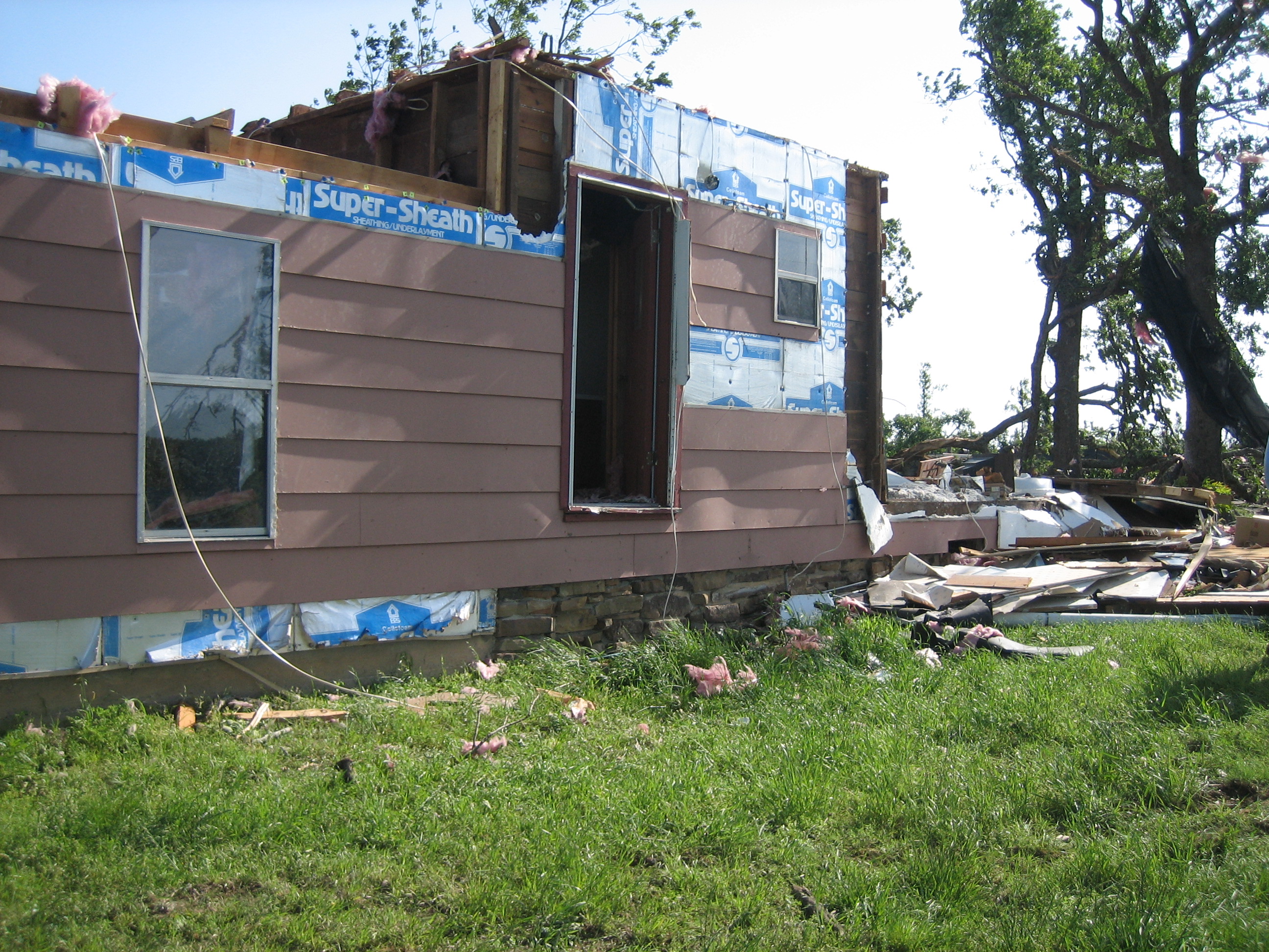
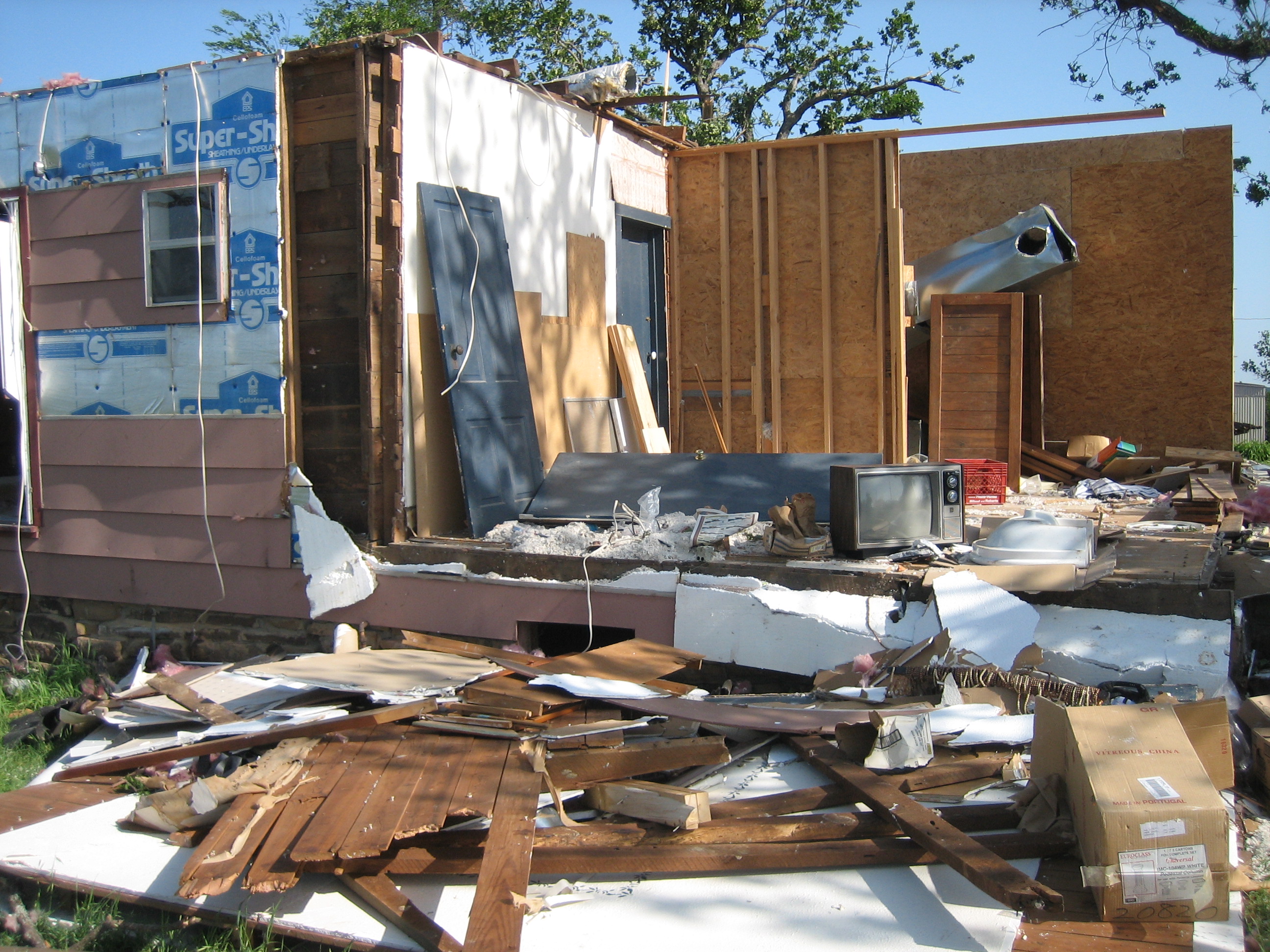
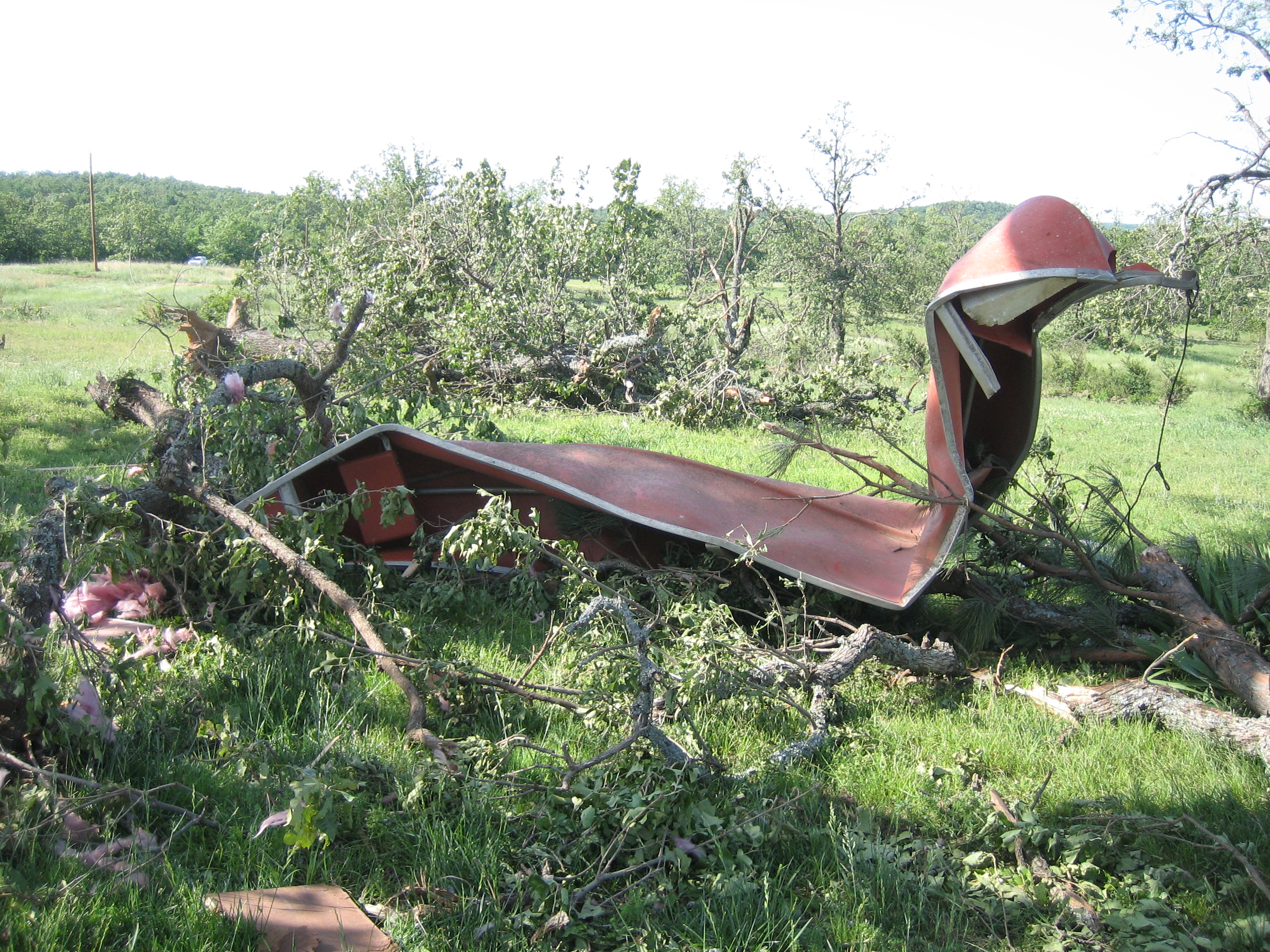
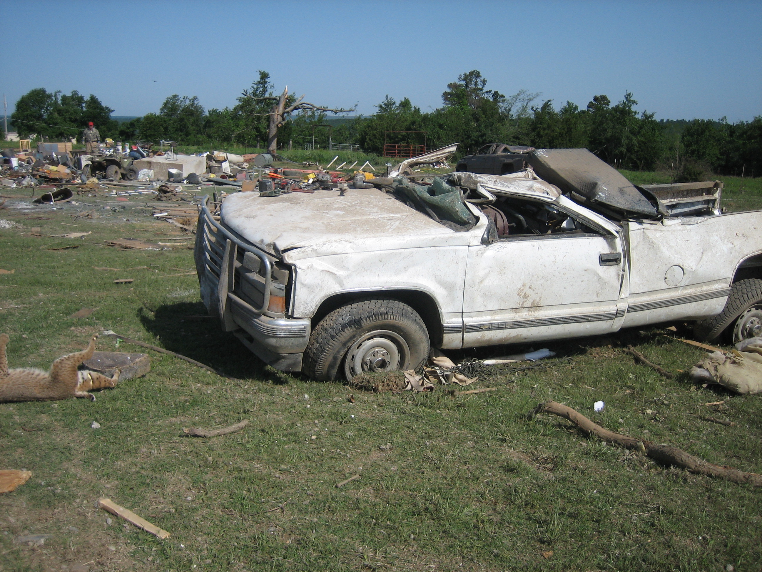
A tornado touched down 4 miles west northwest of Haywood in Pittsburg County and lifted 6 miles east northeast of Haywood. The tornado was rated an EF2 on the Enhanced Fujita Scale with winds between 120 and 130 mph. The tornado track was 10 miles long and 200 yards wide at its widest point. |
|
May 10, 2008 Pittsburg County (Haywood) Tornado
|
 Number below corresponds to damage at that location. Click image to enlarge. |
| 1: 1 mile north of Haywood. House built in 1918 with a portion added on. (looking northeast) | 2: 1 mile north of Haywood. House built in 1918 with a portion added on. (looking west southwest) | 3: 1 mile north of Haywood. Twisted canoe. (looking south) |
 |
 |
 |
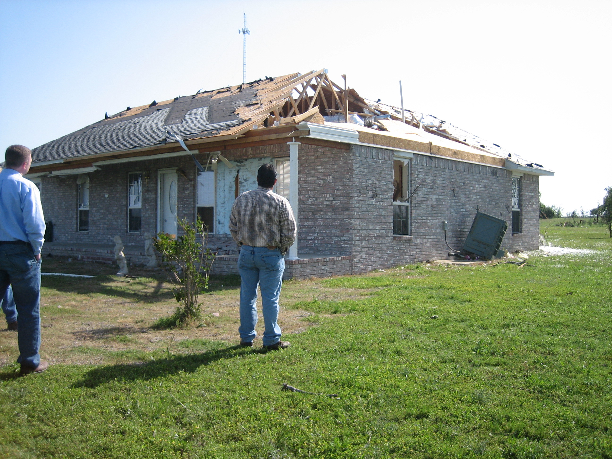
| 4: 1 mile north of Haywood. Rolled truck. Destroyed barn in the background. Small tractors has also been rolled. (looking east) | 5: 1 mile north of Haywood. House missing a portion of its roof. Garage (not shown) also failed. (looking northeast) | 6: Northeast of Haywood. Carport destroyed. Three vehicles parked under the carport were moved. Arrows show where the vehicles had been parked. The lightest weight SUV was rolled over the 1-ton pickup truck. (looking northeast) |
 |
 |
 |
|
Radar Images
|
 |
 |


 Follow us on YouTube