
Critical fire weather conditions, severe thunderstorms capable of producing severe wind gusts, large hail, strong tornadoes and heavy rainfall remain on tap for the central U.S. this evening. Flash flooding is also possible for portions of the Plains and Mississippi Valley. Very large hail up to 3 inches in diameter will be possible this evening across western Kansas. Read More >
Atlanta
Center Weather Service Unit
| Hover over or click station to get METAR and TAF (if available). | VFR MVFR IFR LIFR |
 |
 |
 |
 |
 |
 |
|
|
|
|
|
|
|
US Dept of Commerce
National Oceanic and Atmospheric Administration
National Weather Service
Atlanta
299 Woolsey Road
Hampton, GA 30228
770.210.7693
Comments? Questions? Please Contact Us.


 PreDuty Weather Briefing
 Pirep TDA
 Daily Weather Briefing
 Convective Forecast
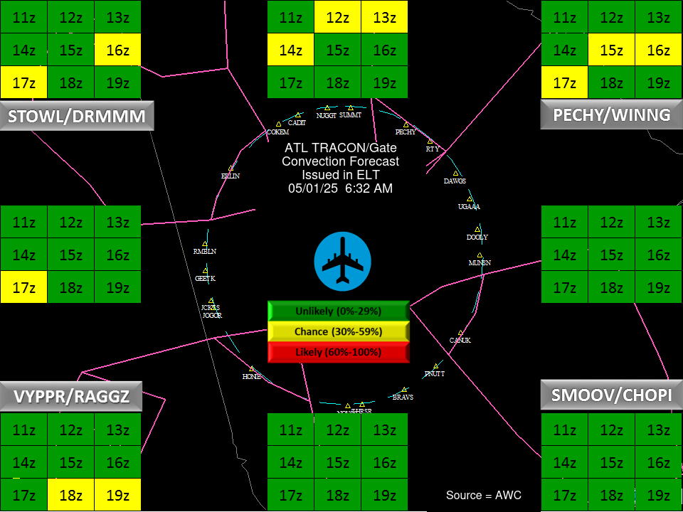
 ATL TRACON Briefing
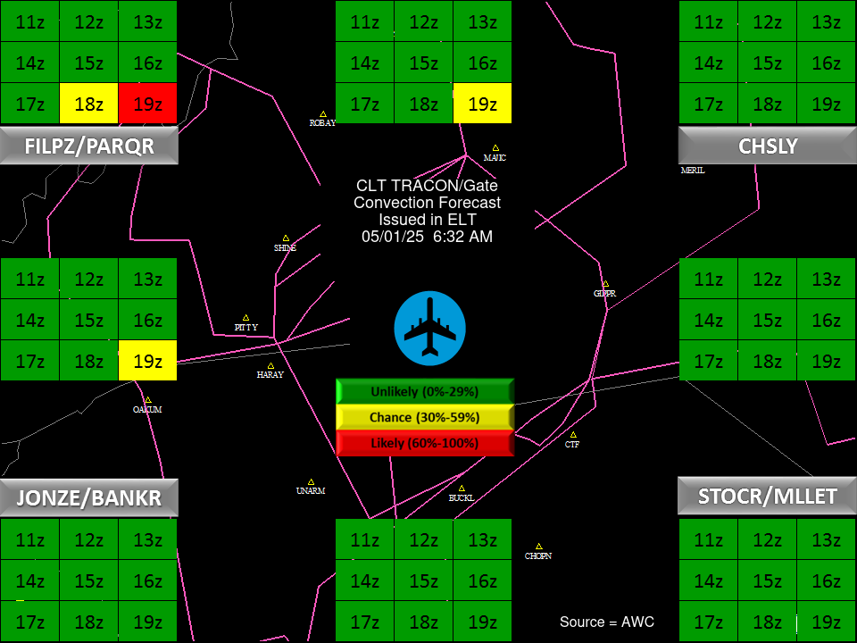
 CLT TRACON Briefing