
 Mobile EF-2 Tornado Track
|
During the afternoon of Christmas Day in 2012, a tornado developed just southwest of downtown Mobile, AL. This tornado developed and moved along a very similar path to an EF-1 tornado that developed only five days earlier on December 20, 2012.
The first Tornado Warning for the Mobile area was issued around 410 pm CST on Christmas afternoon. By 430 pm, the storm was steadily strengthening as it moved through the Irvington and Theodore areas in southern Mobile County. By 440 pm, there was confirmation from a storm spotter of a tornado touchdown in southern Mobile County heading toward I-10. By 450 pm, the storm continued to strengthen and was heading toward midtown and downtown Mobile (near the I-65 and I-10 interchange). By 453 pm, there was confirmation of a tornado moving northeast near Brookley Field and heading into downtown Mobile. By 459 pm, there was confirmation of a large tornado on several webcams and on live television heading into the midtown Mobile area. This confirmation of a large tornado heading into the metro area is what prompted the upgrade from the Tornado Warning to a Tornado Emergency. This continued as a debris ball developed on radar and as the storm moved northeast into the Prichard community. By 515 pm, the storm was weakening and likely roping out over the Mobile River Delta area between Mobile and Baldwin Counties.
This tornado was part of a large scale tornado outbreak that occurred over parts of east Texas, Louisiana, Mississippi and Alabama and northwest Florida on Christmas in 2012. The severe weather pushed further east during the overnight hours and went on to impact the Mid Atlantic States by midday on 26 December 2012.


Summary of all Local Storm Reports (LSRs) across the area and LSRs across the region during the Christmas Day Tornado Outbreak. Also, please see our webpage with a summary of most of the Local Storm Reports from the entire event. The above images show some of the tornado, hail and wind reports across the NWS Mobile-Pensacola Region that occurred ending at 11 PM CST Christmas night. More local and regional information on the tornado outbreak, including details on each NWS storm survey, can be found on our main event webpage.

The NSSL/NWS imagery to the right is radar composite showing strong low-level radar circulations. The black line denotes the strongest low-level radar circulation which directly passed over parts of midtown and downtown Mobile, AL before moving further northeast into the Prichard, AL community between approximately 450 and 505 PM CST on Christmas Day. NOTE: This image does not display the actual tornado path, only radar estimates.
The series of side-by-side radar imagery below show base reflectivity and base velocity for the severe thunderstorm that produced a supercell tornado as it moved over the city of Mobile on Christmas afternoon. The imagery begins at 449pm on the far left side and ends at 503pm on the far right side. Each image displays the lowest level of base reflectivity on the left side and base velocity on the right side. For the base velocity - the green colors denote air flowing toward the radar while the red colors indicate air flowing away from the radar, which is located out in West Mobile, AL.


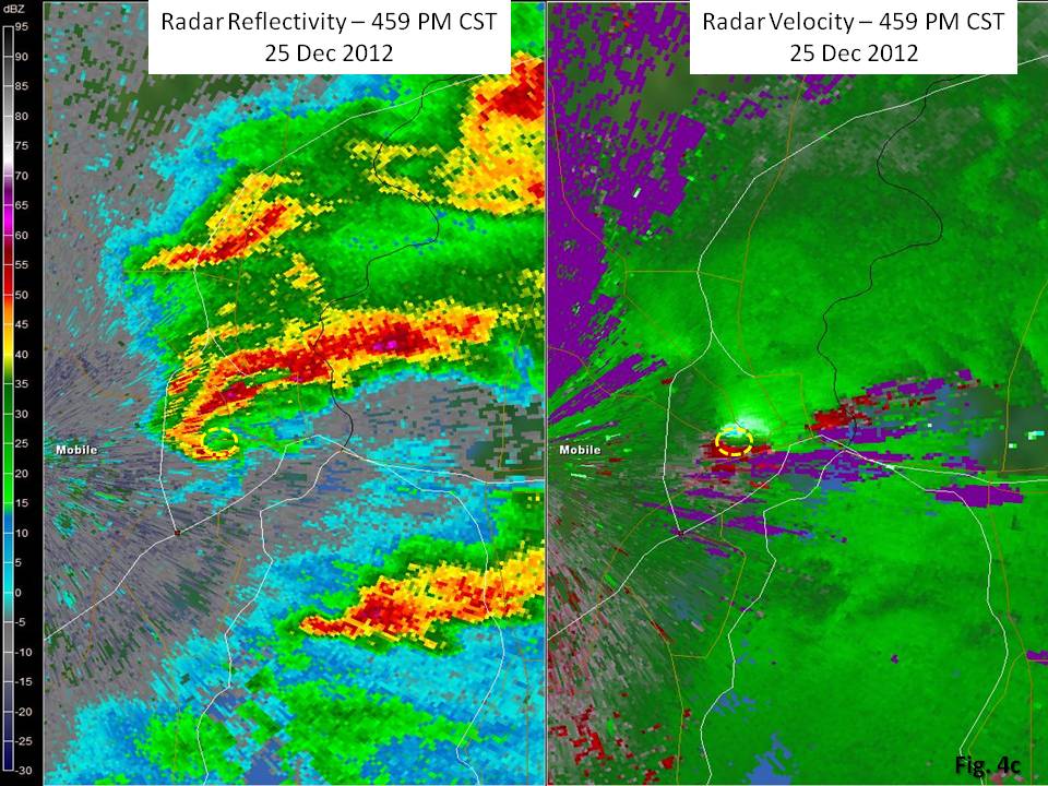


The last figure on the right is a zoomed version of the above radar imagery and captures the highest radar-observed circulation, which occurred around 501 pm CST. This was about the time when the tip of the radar hook was moving between midtown Mobile and the Prichard community. This circulation was located around 1,400 feet AGL (above ground level) with 45 knots (or 52 mph) of air flowing inbound and 72 knots (or 83 mph) of air flowing outbound, which results in 117 knots (or 135 mph). The circulation diameter at this time was approximately 7/10ths of a mile wide.
NOTE: This was not the actual tornado but was very close to being on the scale of the tornado. Although not shown in the low level imagery, only five minutes prior to this image, the strongest circulation of 107 knots was around 2,900 feet AGL. This means the strongest circulation tightened while it was descending to the ground, which is classic.
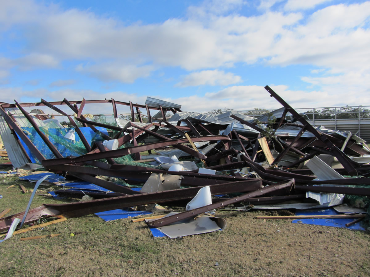
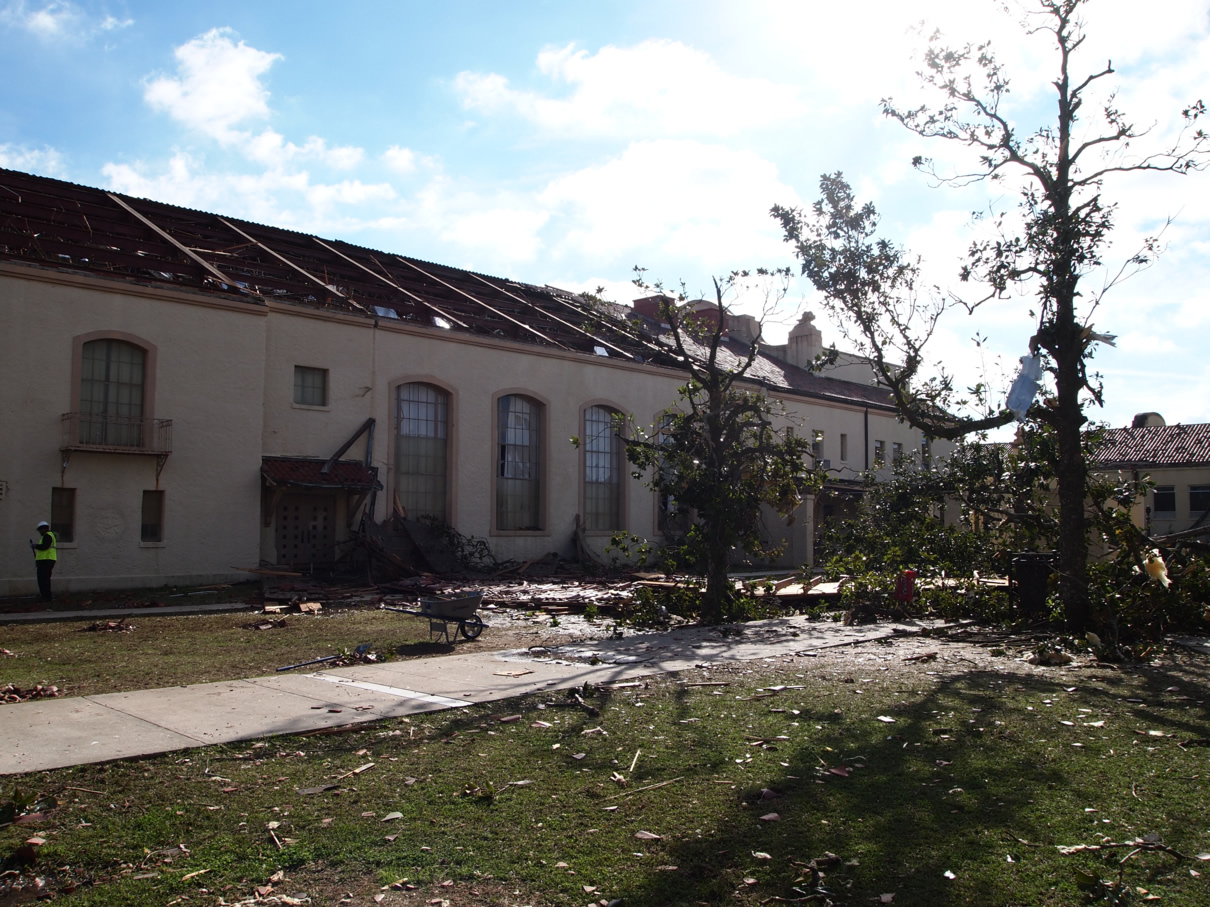
Mobile, AL Damage Photos
|
|
|
|
|
|
|
|
|
|
|
|
|
|
|
|
|
|
|
|
|
|
|
|
|
|
|
|
|
|
|
|
|
|
|
|
|
|
|
|
|
|
|
|
|
Jump to the NWS storm surveys for the following areas:
Southeast Mississippi:
Northwestern Stone County, MS
Southern Perry County, MS
Western Greene County, MS
Southwest Alabama:
Midtown Mobile, AL - Mobile County
Wilmer, AL - Mobile County
Deer Park, AL - Washington County
Riderwood, AL - Choctaw County
Luverne, AL- Crenshaw County
Patsburg, AL - Crenshaw County
Grove Hill, AL - Clarke County
Acknowledgements: Page initially created by Jeffrey Medlin (Meteorologist In Charge) and Ray Ball (Information Technology Officer). Page updated by Morgan Barry (forecaster).
LAST UPDATED: November 2018


 Follow us on YouTube