Overview
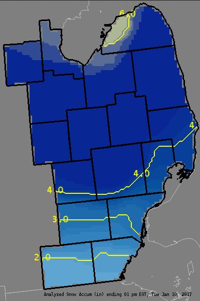
A low pressure system over the Central Plains on Monday, tracked through the Midwest on Tuesday bringing a period of snowfall to the region Monday night into Tuesday. Strong southern winds then brought warm air into the region which changed the snow over to rain from south to north. This created a fairly good gradient of snow amounts across the area with lowest amounts near the Ohio Border where the changeover occurred early in the morning, and highest amounts north of I69 where snow continued into the early afternoon hours. Snowfall totals ranged from 1-6" with most locations in the 3-4" range.Snowfall Map
**NOTE: The following graphic is a combination of actual snowfall reports (separate tab) and radar estimates instead of purely storm total snowfall reports like usual. Most of the reports came in between 7-9am, but the snowfall continued until 1pm in some locations north of M59 before changing to rain. By using the few reports we did get after 9am, we were able to estimate the additional snowfall across the region by using the radar.
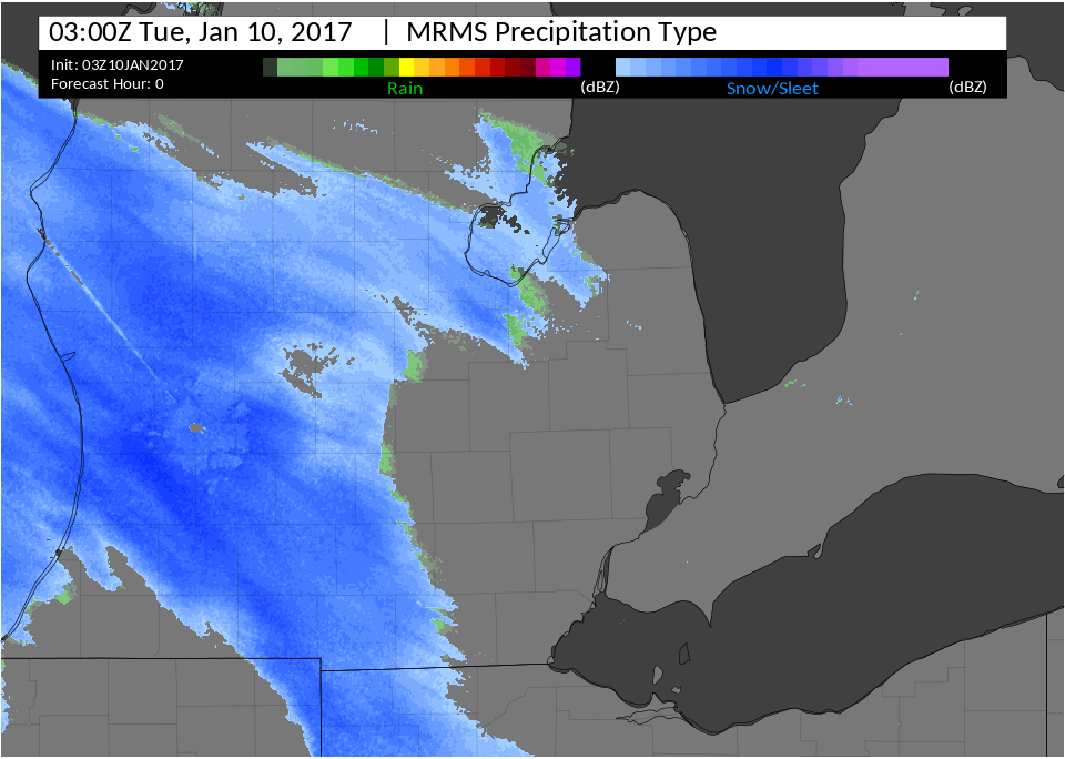
Radar:
Header
 |
|||
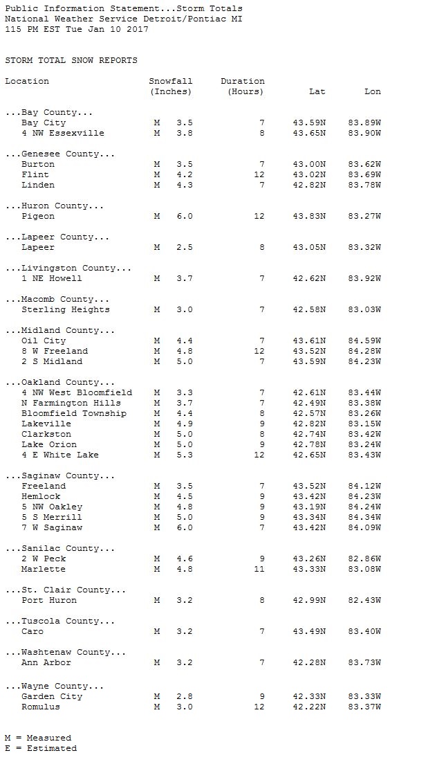
Storm Reports
**NOTE: Many of the measurements were taken around 7-9am, some before the snow ended at those locations (mainly north of M59). Though those totals may appear low, they were combined with radar estimates and other nearby measurements to generate the snowfall map (separate tab).
 |
Media use of NWS Web News Stories is encouraged! Please acknowledge the NWS as the source of any news information accessed from this site. |
|


 Follow us on YouTube