
Straight Line Wind and Tornado Event
February 7, 2017
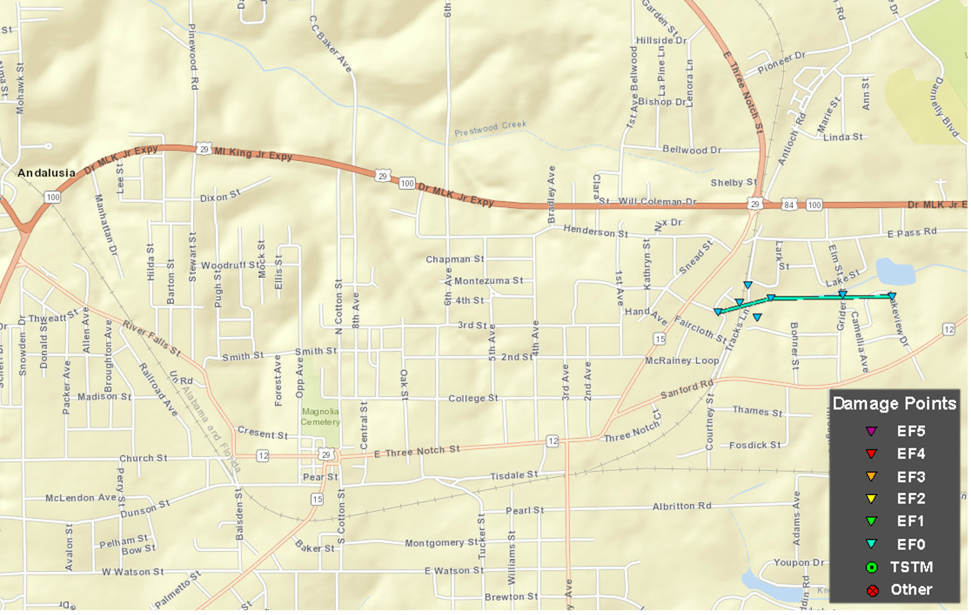
Summary of all Local Storm Reports (LSRs) across the area on February 7th and LSRs across the region for this severe weather event.
...NWS Damage Surveys For The 02/07/2017 Severe Weather Event...
|
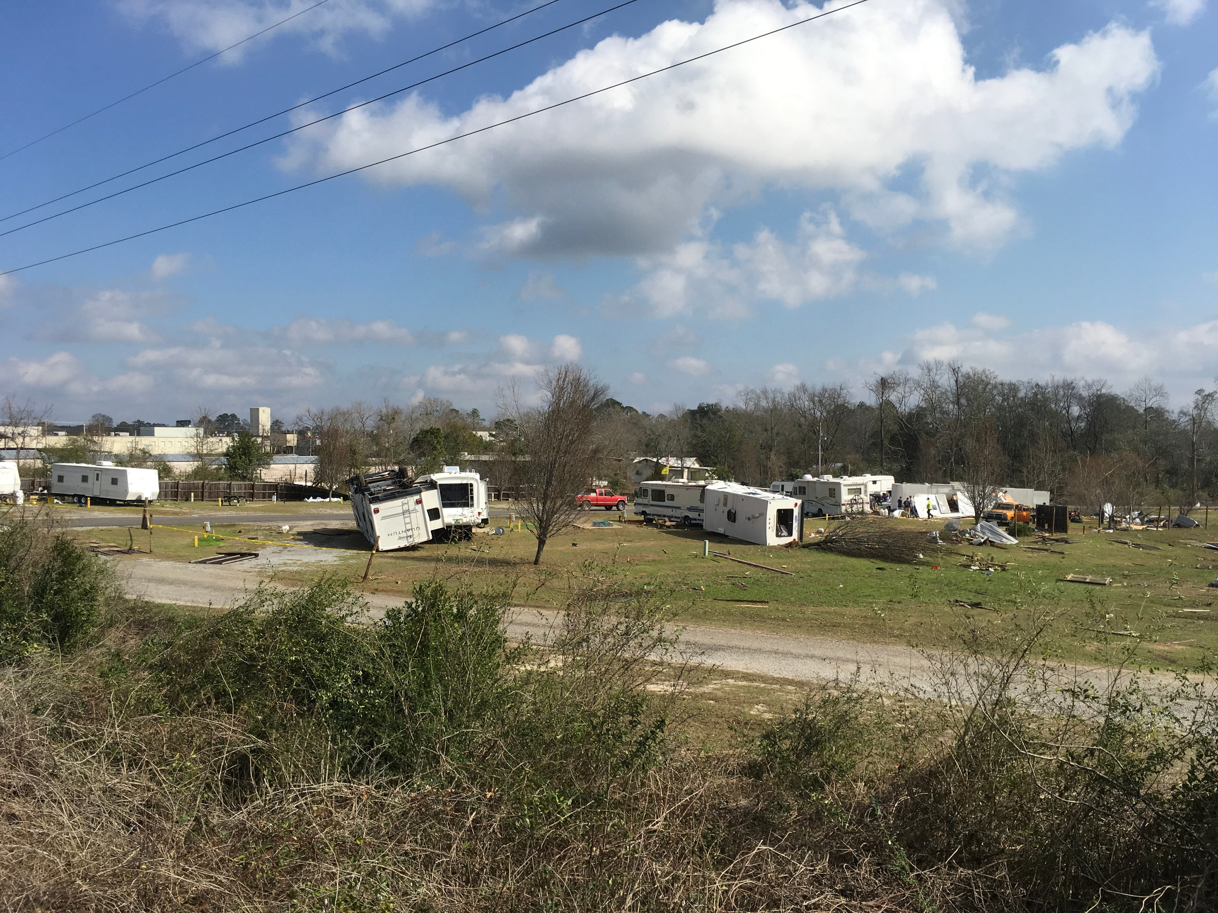
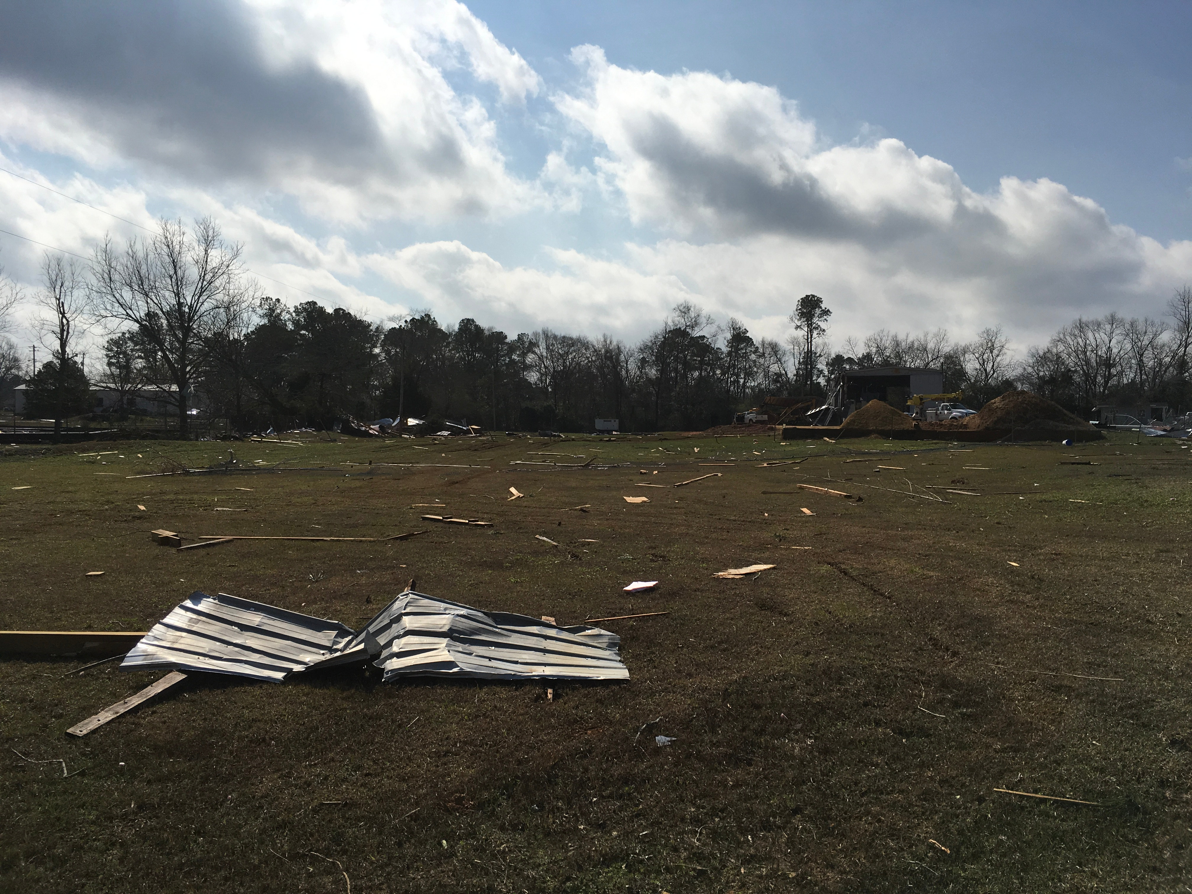
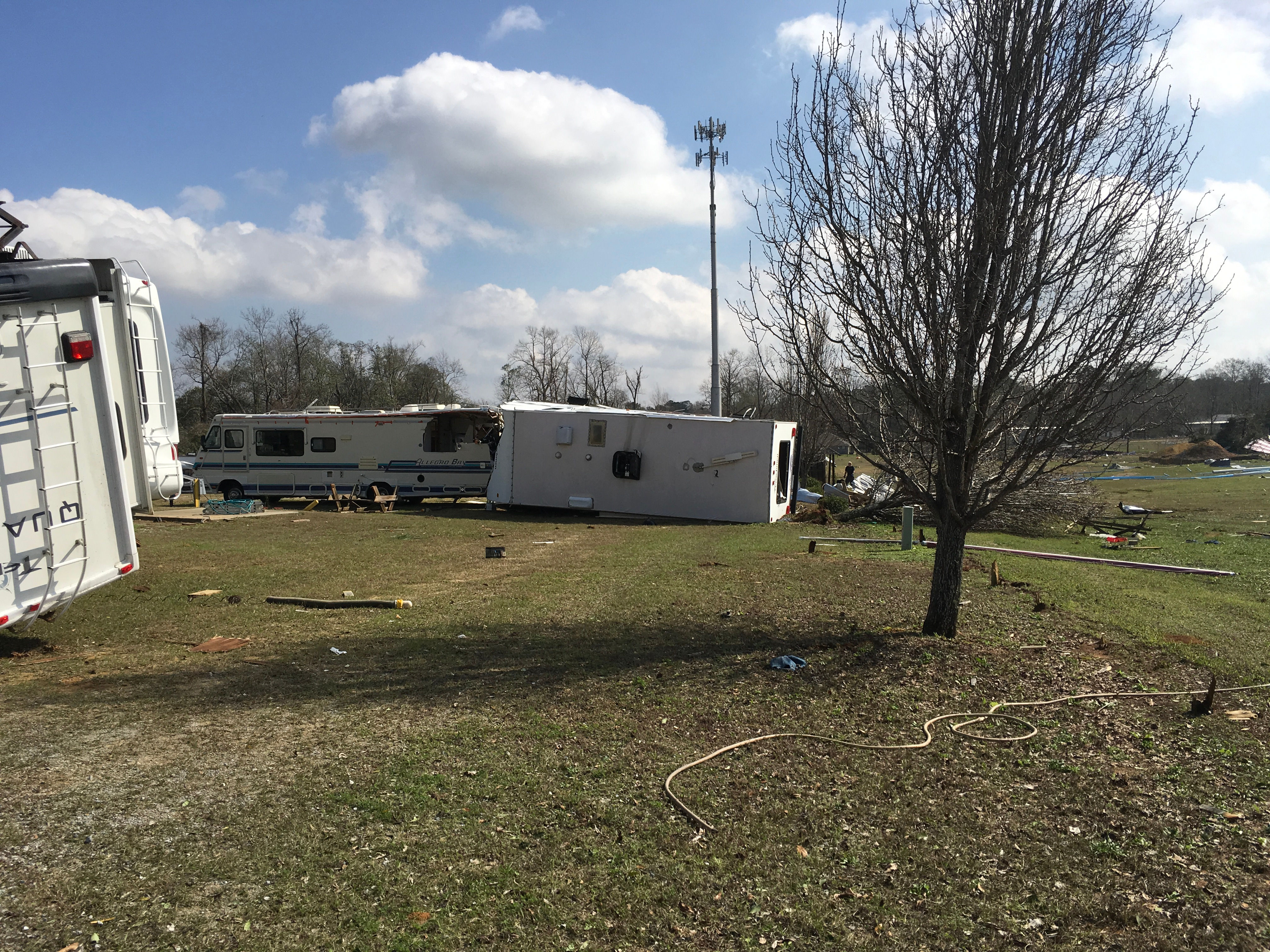
Andalusia, AL Tornado... Rating: EF-0 Start Date: February 7 2017 End Date: February 7 2017 Survey summary: A tornado moved across an area on the east side of Andalusia, Alabama which affected two residential areas and a campground. The tornado caused shingle damage to several roofs, downed several trees, and overturned several campers and RVs. One individual suffered minor injuries. Damage also occurred to a large metal storage building at the Covington County Water Authority. Numerous water pipes from the water facility were tossed by the tornado. |
||||||||||
|
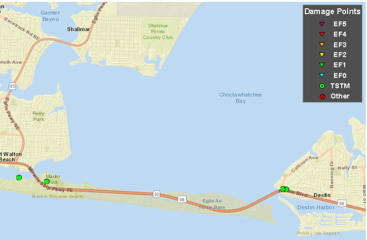
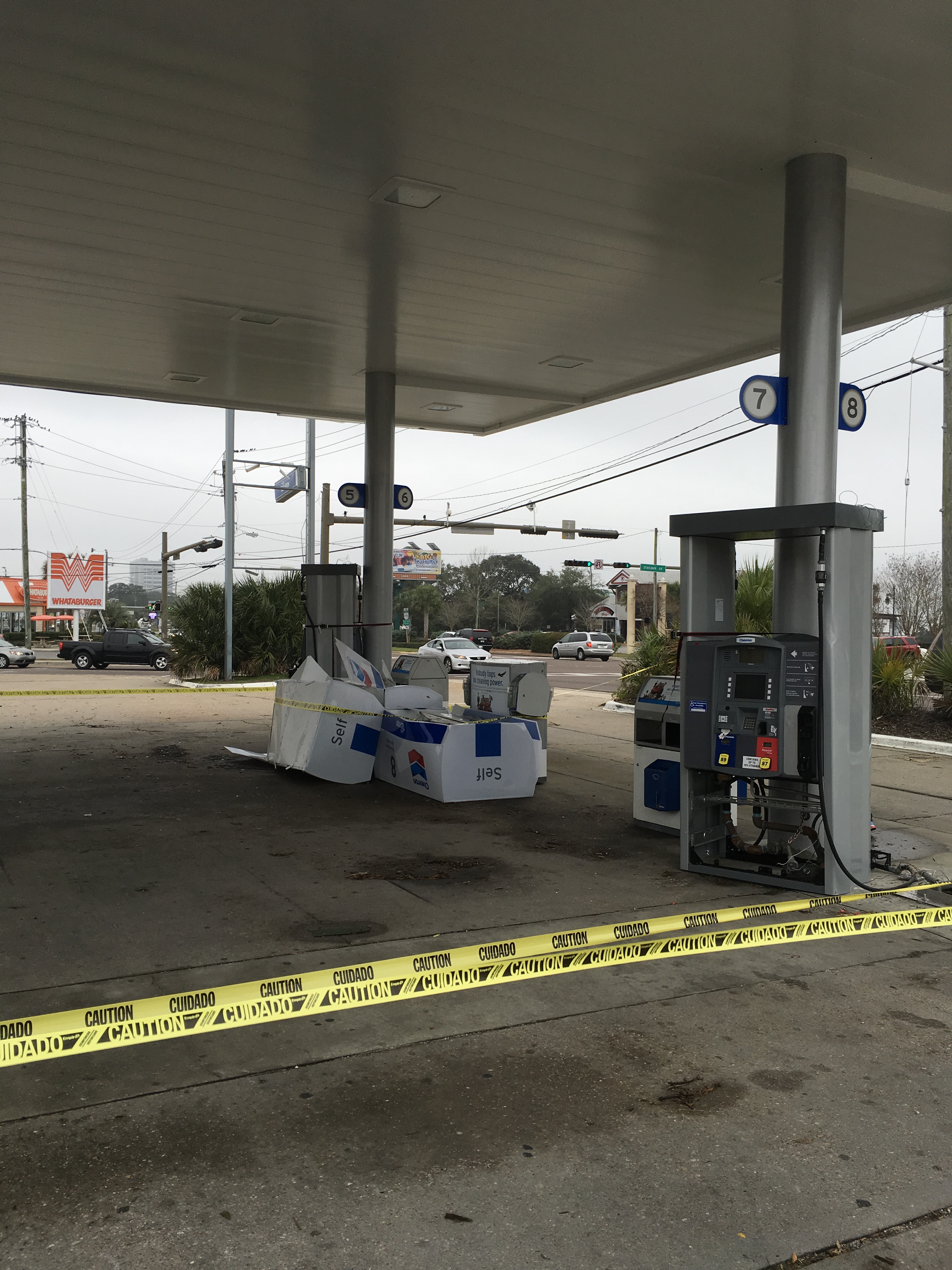
Okaloosa Island and Destin, FL Thunderstorm Straight Line Wind Event... Estimated Peak Wind: 70-90 mph Start Date: February 7 2017 End Date: February 7 2017 Survey summary: A severe thunderstorm moved across Okaloosa Island and Destin, Florida, which produced areas of straight line wind damage along and near U.S. Highway 98. Several buildings were damaged in and around Destin with significant roof damage to a few condos and businesses. An EMS vehicle was damaged on Okaloosa Island with one injury. Numerous trees and power lines were downed. Three gas station pumps were blown over at a gas station in Destin. There were two wind measurements at Okaloosa Pier and on Choctawhatchee Bay that recorded wind gusts of 87 mph. Several land based station recorded wind gusts in excess of 60 mph. |
||||||||
|
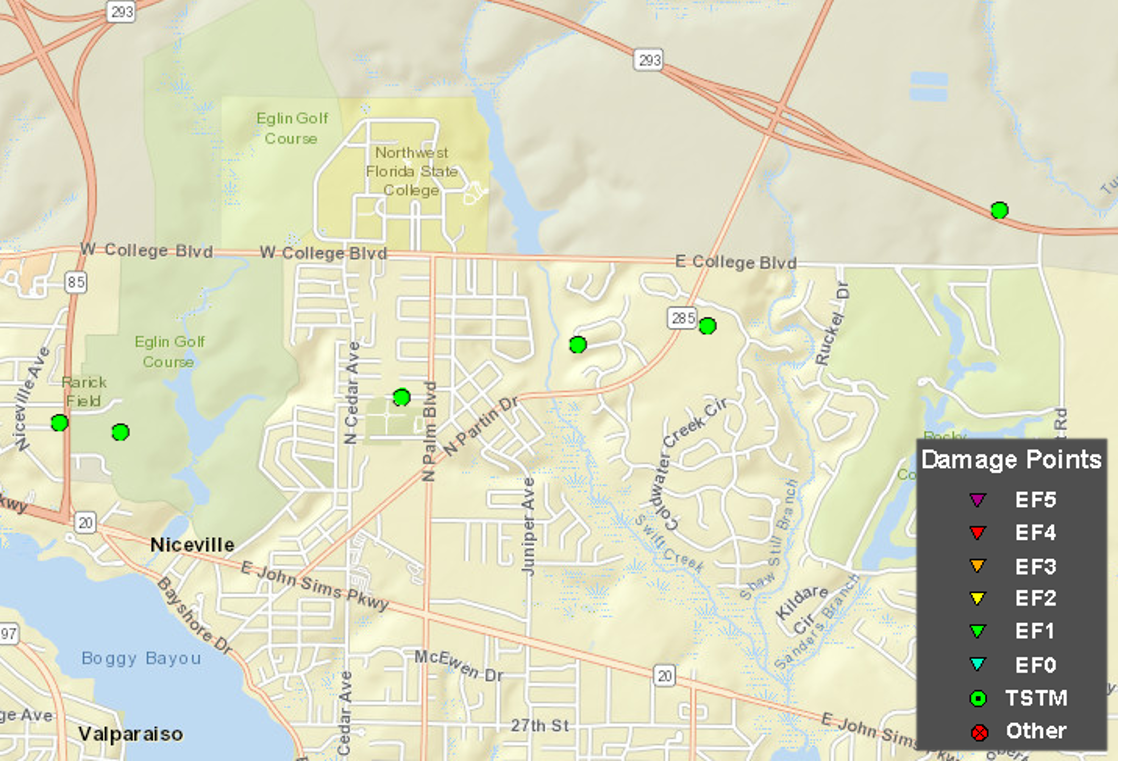
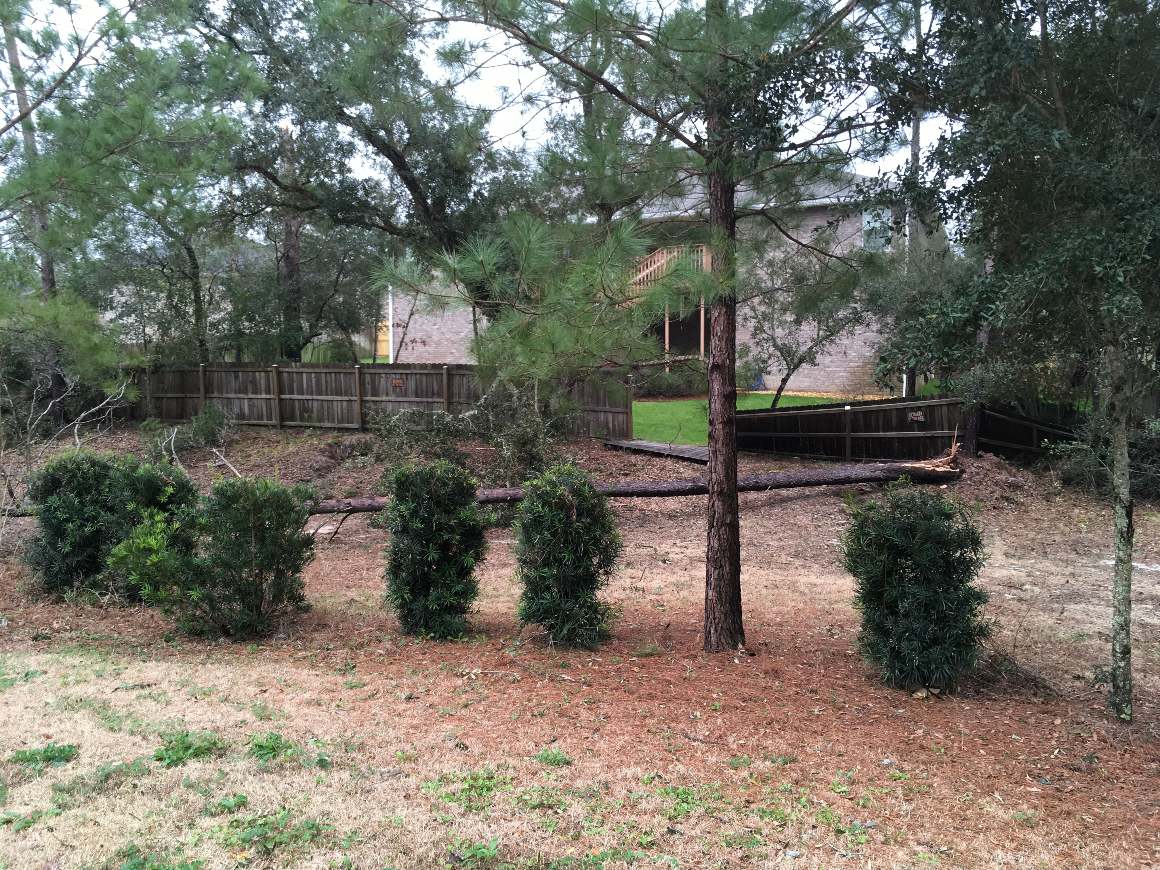
Niceville, FL Thunderstorm Straight Line Wind Event... Estimated Peak Wind: 70-90 mph Start Date: February 7 2017 End Date: February 7 2017 Survey summary: A severe thunderstorm moved across Niceville, FL and produced a corridor of straight line wind damage from near the intersection of Highway 85 and Lewis Street to near Mile Marker 12 on Highway 293. Numerous trees and power lines were downed along the path with some landing on vehicles. Several downed trees caused damage to homes in the area. A church suffered roof damage and some damage to the brick facade. |
||||||||
EF Scale: The Enhanced Fujita Scale classifies tornadoes into the following categories.
EF0...Weak......65 to 85 mph
EF1...Weak......86 to 110 mph
EF2...Strong....111 to 135 mph
EF3...Strong....136 to 165 mph
EF4...Violent...166 to 200 mph
EF5...Violent...>200 mph
Note: The information in this statement is preliminary and subject to change pending final review of the event and publication in NWS Storm Data.
Acknowledgements: Page created by Morgan Barry (Forecaster).
LAST UPDATED: December 2017


 Follow us on YouTube