March 12, 2012
Heavy Rain Event
Megan Stackhouse
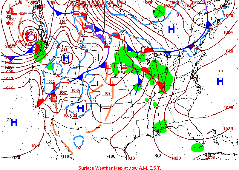
On the evening of March 11, 2012, a low pressure system continued to progress across the central United States, displacing an area of high pressure out of the southeast. A tight pressure gradient from this feature began to produce strong surface winds out of the south, helping to bring an abundance of warm, moist gulf air ashore. The National Weather Service in Lake Charles had a wind advisory in effect throughout that afternoon. A short wave feature in the southwest quickly began travelling towards the southeast. The short wave met with the unstable air mass, and would come to produce numerous showers and thunderstorms over southeast Texas. The line of storms pushed across the Sabine River into southwest Louisiana. Throughout the evening and through March 12, heavy rain associated with the stronger storms caused severe flooding in the area, particularly devastating Lafayette, Acadia, St. Landry, Evangeline, and St. Martin parishes.
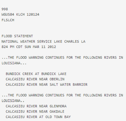
Convection developed early Sunday evening across southeast Texas, with the line of storms pushing into southwest Louisiana. At 8:24 PM on Sunday, March 11, the National Weather Service in Lake Charles issued a Flood Warning for various sites along the Calcasieu River, as well as a Marine Weather Statement at 8:44 PM indicating strong thunderstorms residing over the gulf waters with gusty winds up to 33 knots.
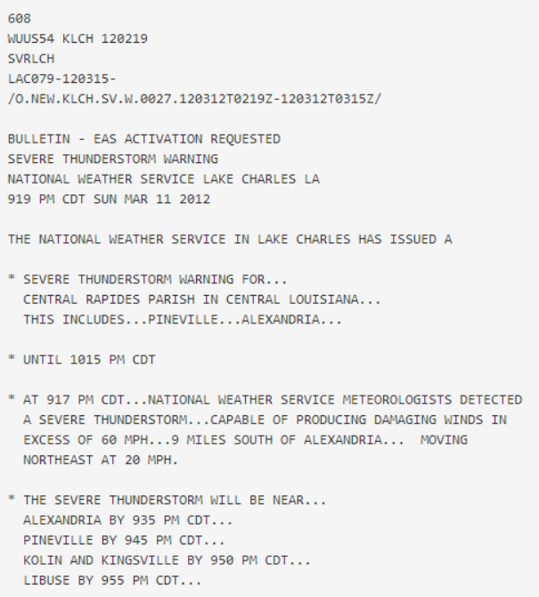
As the night continued, and the line of strong thunderstorms continued to move east, the National Weather Service issued a Severe Thunderstorm Warning at 9:19 PM for Central Rapides Parish in Central Louisiana.
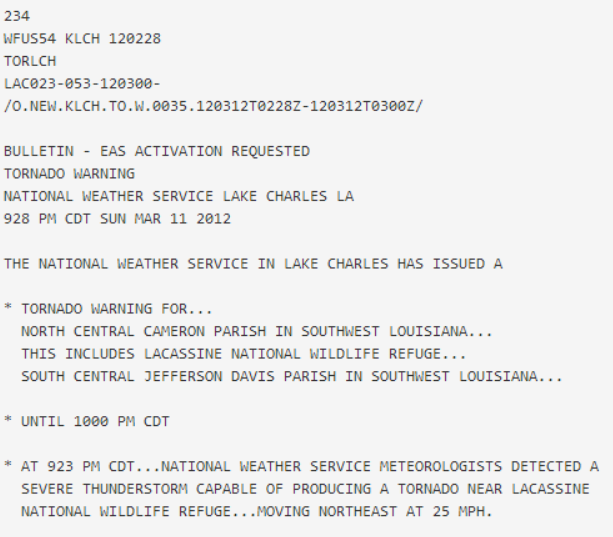
Shortly after, a Tornado Warning was issued at 9:28 PM for North Central Cameron Parish, as National Weather Service Meteorologists detected a severe thunderstorm capable of producing a tornado near Lacassine National Wildlife Refuge.
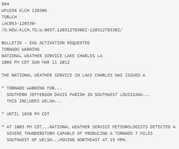
Another Tornado Warning shortly followed at 10:06 PM for Southern Jefferson Davis Parish.
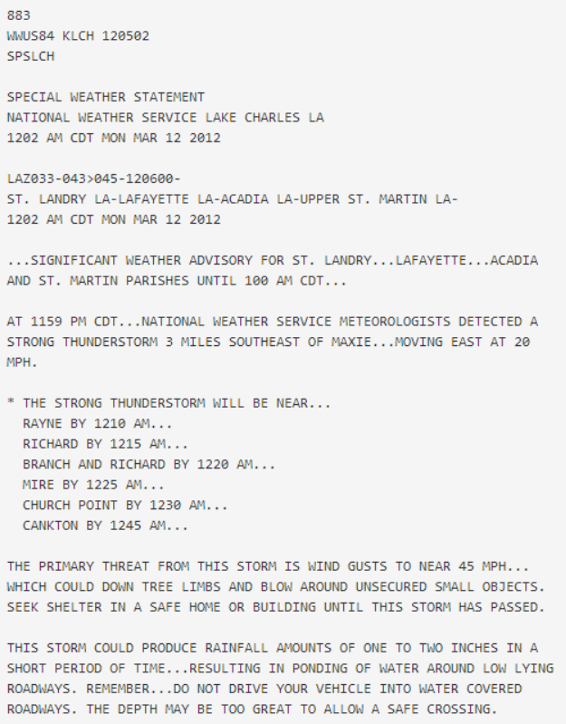
As March 12 began, a Special Weather Statement was issued at 12:02 AM by the National Weather Service for St. Landry, Lafayette, Acadia, and St. Martin Parishes. A strong thunderstorm was located just southeast of Maxie, Louisiana, and was moving east at 20 mph. Strong winds were associated with the storm, as well as the potential for rainfall amounts of one to two inches in a short period of time.
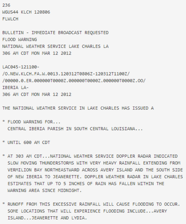
A Flood Advisory was issued shortly after at 12:50 AM March 12, including southwestern St. Landry Parish and northeastern Acadia Parish. Doppler radar continued to indicate heavy rains with the potential to produce minor bayou and stream flooding. As the morning continued, a Flood Warning was issued at 3:06 AM for central Iberia Parish. The line of slow moving thunderstorms extended from Vermilion Bay across Avery Island, with Doppler radar estimating that up to 5 inches of rain had fallen across the area over the past three hours. The Iberia Parish Sheriff’s Office began to report sporadic road closures across the central part of the parish.
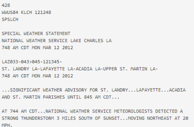
The line of scattered showers and thunderstorms continued to move east throughout the rest of the morning. At 7:48 AM, the National Weather Service issued a Special Weather Statement for St. Landry, Lafayette, Acadia, and St. Martin Parishes as a strong thunderstorm located just south of Sunset, Louisiana continued to move northeast at 20 mph.
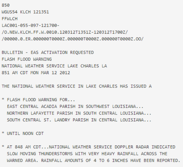
At 8:51 AM, the National Weather Service issued a Flash Flood Warning for east central Acadia Parish, northern Lafayette Parish, and south central St. Landry Parish valid until noon that day. Radar continued to indicate slow moving thunderstorms producing heavy rainfall across the warned area. By that time, rainfall amounts of 4 to 6 inches had already been reported. Additional rainfall amounts of 1 to 2 inches were still possible for the warned area.
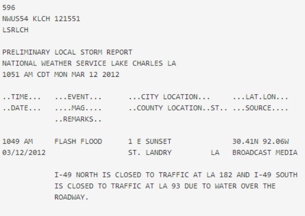
At 10:51 AM on March 12, the National Weather Service produced a Local Storm Report for St. Landry Parish. Broadcast media had reported I-49 North being closed to traffic at LA 182 and I-49 South at LA 93. Both were closed due to water over the roadway.
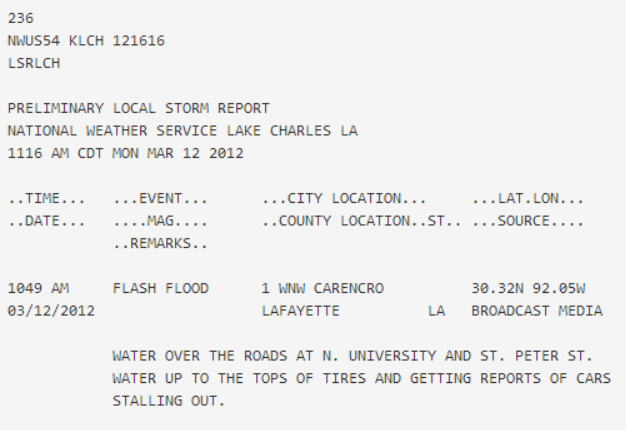
Several other storm reports began to follow of damages due to flooding. In Lafayette, Louisiana, broadcast media reported Carencro Catholic Church suffering from flood damage to the building. I-49 South at US 190 and I-49 North at Gloria Switch Road were also shut down due to water over the road. At 11:16 AM, the media reported flooding over N. University and St. Peter St. in Carencro, Louisiana, with reports of cars stalling out.
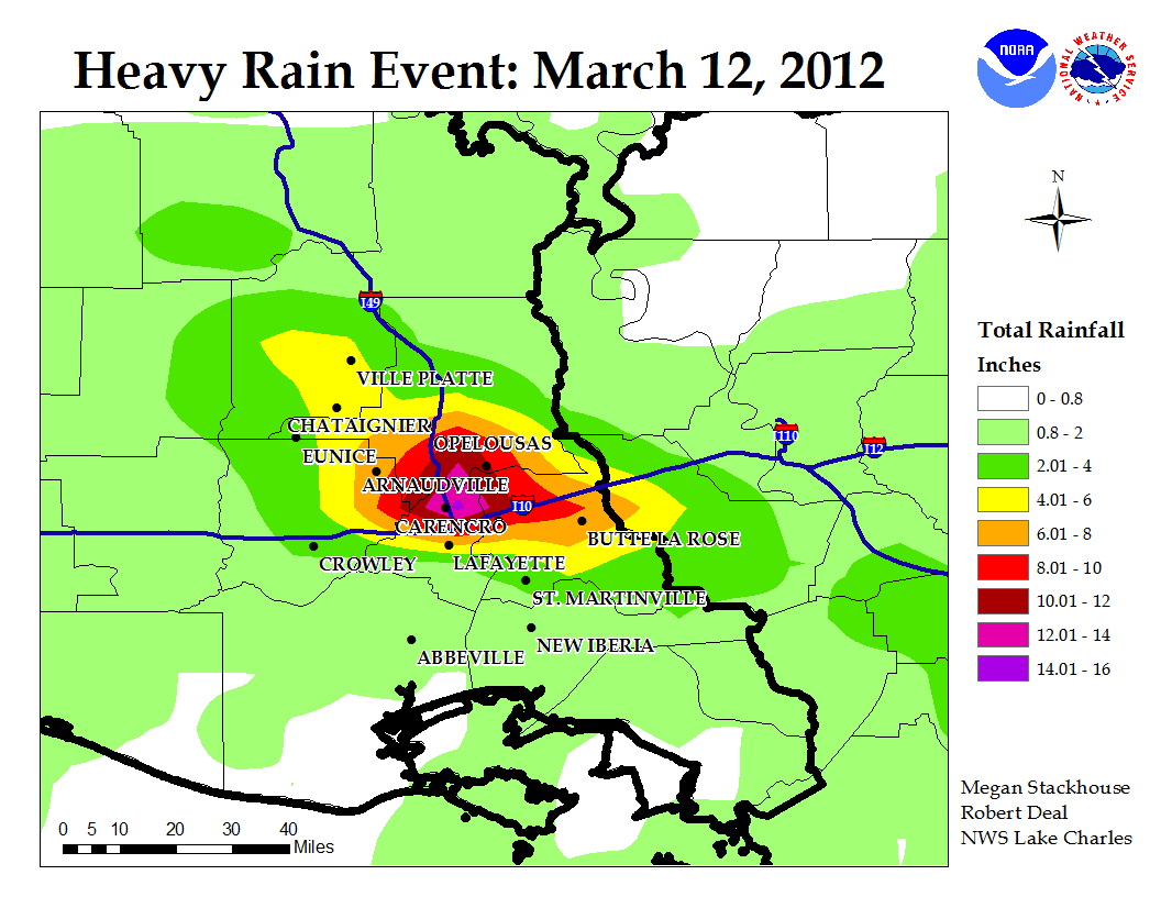
By the end of the event, several locations had received significant rainfall. The U.S. Geological Survey gauge near Carencro had recorded 11.61 inches of rain since roughly 6 AM Monday, March 12. A CO-OP observer at Carencro recorded 10.50 inches of rain from the event. A total rainfall map for the greatest accumulations follows below, as well as a compilation of all the local storm reports for the March 12 heavy rain event:


 Follow us on YouTube