| Late April/Early May Severe Weather and Flooding |
| Event Overview |
|
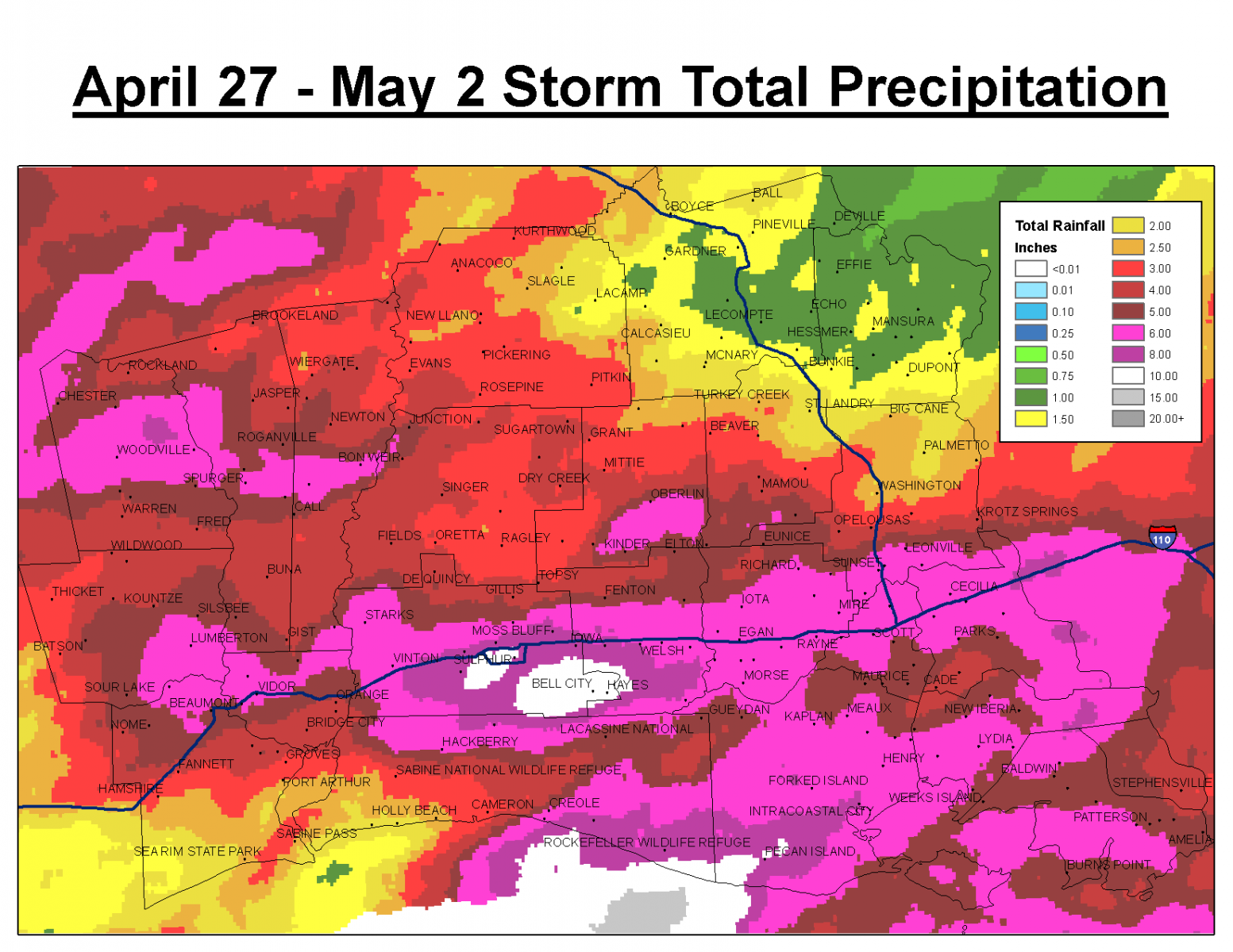
A slow moving storm system resulted in severe lines of thunderstorms moving across southeast Texas and southwest Louisiana between April 26th and May 2nd. This resulted in all forms severe weather including hail, damaging winds, and 4 tornadoes. The multiple rounds of thunderstorms brought heavy rainfall which culminated in flash flooding on May 1st along much of the Interstate 10 corridor. In addition to the flooding on many area roads, Interstate 49 was closed for several hours due to flash flooding. |
Tornado Table
| Time | Location | Strength | Killed | Injuries | Path Length | Max Path Width | Path |
| April 27 5:58 AM | Woodville, TX | EF-1 | 0 | 0 | 0.7 Miles | 50 Yards |  |
| April 27 6:22 AM | Magnolia Springs, TX | EF-1 | 0 | 0 | 2.7 Miles | 50 Yards |  |
| April 30 6:08 AM | Call, TX | EF-2 | 0 | 3 | 10.15 Miles | 500 Yards |  |
| April 30 11:25 AM | Big Cane, LA | UNK | 0 | 0 | UNK | UNK |  |

Lake Charles, KPLC |

Lake Charles, KPLC |

Cankton, KLFY |

Scott, KATC |


 Follow us on YouTube