Observations of the atmosphere are critical to every aspect of weather forecasting. Numerical weather models, critical to short- and long-term weather forecasting, utilize observations to initialize conditions fed into complex algorithms. The quality, timeliness, and density of observation information is critical to ensuring the best numerical model output possible. Observations can also provide forecasters real-time information that they are able to react to in order to accomplish things like issuing life-saving weather warnings, make critical adjustments to aviation forecasts, and much, much more. The collection of domestic and international observation systems add up to billions of observations of the Earth’s atmosphere measured each day.
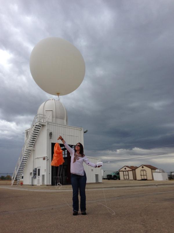
Twice every day, from nearly 100 locations in the United States, the National Weather Service launches weather balloons, carrying instrument packages called radiosondes. Radiosonde sensors measure upper-air conditions such as atmospheric pressure, temperature and humidity, wind speed and direction. The data are important for aviation safety and to identify the potential for severe weather, and provide valuable data for numerical weather models.
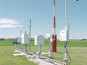
The Automated Surface Observing Systems (ASOS) program is a joint effort of the National Weather Service (NWS), the Federal Aviation Administration (FAA), and the Department of Defense (DOD). The ASOS system serves as the nation's primary surface weather observing network. ASOS is designed to support weather forecast activities and aviation operations and, at the same time, support the needs of the meteorological, hydrological, and climatological research communities. ASOS works non-stop, updating observations every minute, 24 hours a day, every day of the year.
Getting more information on the atmosphere; more frequently and from more locations is the key to improving forecasts and warnings. ASOS information helps the NWS to increase the accuracy and timeliness of its forecasts and warnings. In addition, a basic strength of ASOS is that critical aviation weather parameters are measured where they are needed most: within airport runway environments.
Automated weather reports from commercial aircraft have been an important data source for numerical weather prediction (NWP) models for decades, and have improved the forecasts from these models. Aircraft Meteorological Data Reports (AMDAR) is the generally-accepted worldwide term for automated weather reports from commercial aircraft. The contribution of the United States to AMDAR is called Meteorological Data Collection and Reporting System (MDCRS) - sometimes also referred to as Aircraft Communications Addressing and Reporting System (ACARS). MDCRS is funded jointly by the U.S. government and the seven participating airlines (American, Delta, Federal Express, Northwest, Southwest, United, and United Parcel Service). Data measured from these aircraft include static and total air pressure as measured by an electronic barometer in the aircraft's pitot static probe, air temperature as measured by an immersion thermometer probe, and wind speed as deduced from knowledge of the air speed (via the pitot static probe) and ground speed (usually from an inertial navigation system).
The NWS utilizes a broad variety of observation networks for surface observations on land. For observations across the expansive stretches of the world’s oceans and lakes, one method of observation collection is the use of buoys.
Buoys are deployed in the coastal and offshore waters from the western Atlantic to the Pacific Ocean around Hawaii, and from the Bering Sea to the South Pacific. Moored buoys measure and transmit barometric pressure; wind direction, speed, and gust; air and sea temperature; and wave energy spectra from which significant wave height, dominant wave period, and average wave period are derived. Even the direction of wave propagation is measured on many moored buoys. In addition to their use in operational forecasting, warnings, and atmospheric models, moored buoy data are used for scientific and research programs, emergency response to chemical spills, legal proceedings, and engineering design.
While many of the important instruments used by the NWS to collect observational data involve taking measurements of the atmosphere through direct contact, much of our most-important data comes from a method called “remote sensing.” Remote sensing is the science of obtaining information about a subject or object without actually being in contact with that subject or object.
In the NWS, remote sensing equipment is used in the detection and measurement of weather phenomena with devices sensitive to electromagnetic energy such as Light and heat (via weather satellites) and Radio Waves (via Doppler radar). Remote sensing provides a unique perspective from which to observe large regions. These sensors can measure energy at wavelengths which are beyond the range of human vision. For more detailed information click here {link to radar about section} for radar and here {link to satellite about section} for satellite.
 |
 |
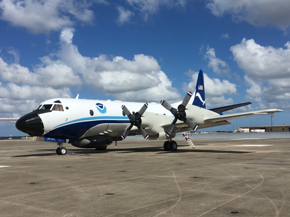 |
| The weather balloon was filled with hydrogen, the orange parachute (right hand) connected the balloon to the radiosonde instrument and GPS (left hand). | The Automated Surface Observation Systems (ASOS) provide the nation’s primary surface weather observations from airports across the U.S. | Aircraft are used to collect weather data over land and sea. |

