 |
|
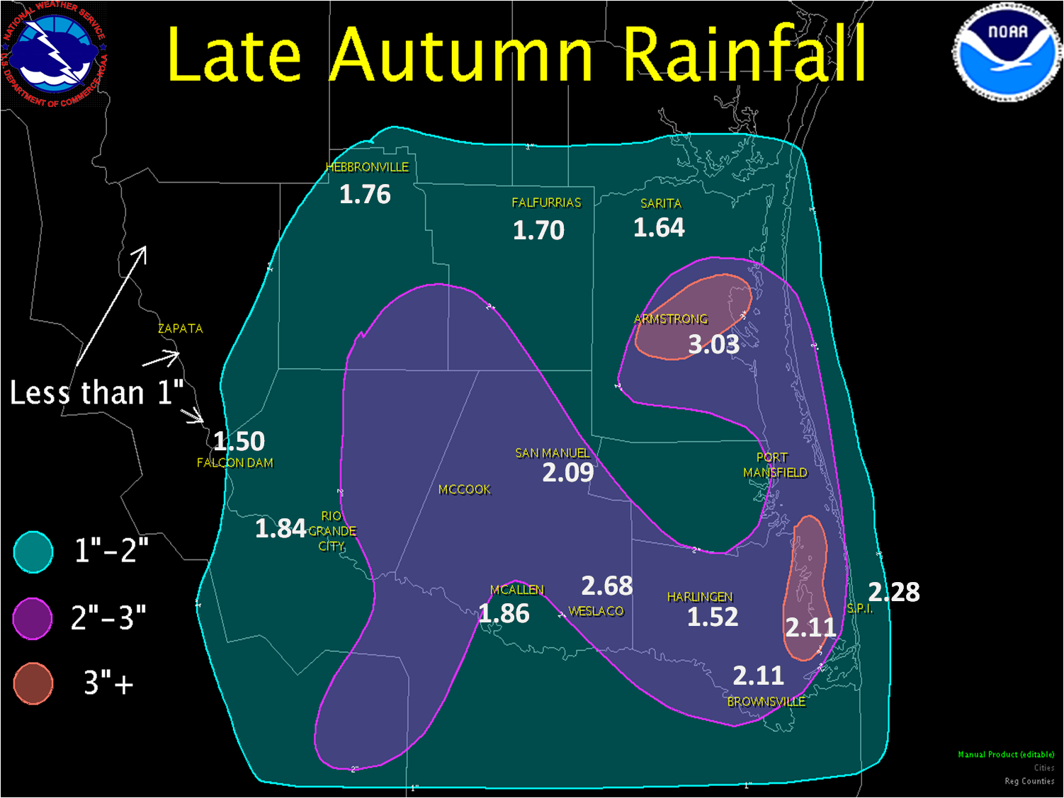
| A Full Serving of Winter, Valley Style Cold Rains Start It, Widespread Frost Finishes It, November 30–December 4, 2009 Into the Cool Rain: November 30–December 1 PUBLIC INFORMATION STATEMENT NATIONAL WEATHER SERVICE BROWNSVILLE TX 118 PM CST WED DEC 2 2009 ...PRELIMINARY RAINFALL TOTALS FOR NOVEMBER 30TH THROUGH DECEMBER 1ST... THE FOLLOWING ARE PRELIMINARY RAINFALL TOTALS FOR DEEP SOUTH TEXAS FOR NOVEMBER 30TH THROUGH DECEMBER 1ST. THESE VALUES WILL BE UPDATED AS NEEDED. AIRPORTS AMOUNT ==================================== BROWNSVILLE 2.11" PORT ISABEL-CAMERON CO 2.11" MCALLEN 1.86" HARLINGEN 1.52" NWS COOPERATIVE OBSERVERS AMOUNT ==================================== ARMSTRONG 3.03" WESLACO 2.68" SANTA ROSA 2.65" LA JOYA 2.35" ISALA BLANCA/S PADRE ISLAND 2.28" EDINBURG 2.24" PORT ISABEL 2.17" HARLINGEN 2.12" SAN MANUEL 2.09" MERCEDES 1.97" RIO GRANDE CITY 1.84" PORT MANSFIELD 1.78" HEBBRONVILLE 1.76" FALFURRIAS 1.70" SARITA 1.64" FALCON DAM 1.50" VOLUNTEER COCORAHS AMOUNT ==================================== BAYVIEW 2.9 N 3.09" HARLINGEN 4.7 WSW 2.62" BROWNSVILLE 2.2 W 2.59" RANCHO VIEJO 3.0 SE 2.47" HARLINGEN 4.3 WSW 2.46" LA JOYA 11.1 N 2.36" RANCHO VIEJO 0.7 E 2.35" LOS FRESNOS 0.3 NE 2.33" BROWNSVILLE 4.5 NNW 2.32" BROWNSVILLE 4.1 E 2.27" BROWNSVILLE 4.4 NE 2.22" BROWNSVILLE 4.2 NE 2.19" ALAMO 1.5 NNE 2.18" BROWNSVILLE 4.1 NNE 2.15" PALM VALLEY 2.2 SSW 2.15" BROWNSVILLE 3.5 N 2.10" PHARR 5.1 N 1.98" ALTON 4.7 N 1.92" MISSION 1.9 ENE 1.90" BROWNSVILLE 4.1 ENE 1.82" BROWNSVILLE 4.6 NNW 1.80" MCALLEN 2.6 NE 1.66" MCALLEN 1.7 SSE 1.62" SAN BENITO 5.0 SSE 0.53"* HARLINGEN 2.6 ESE 0.44"* *DENOTES INCOMPLETE DATA
|
|
 |
 |
|
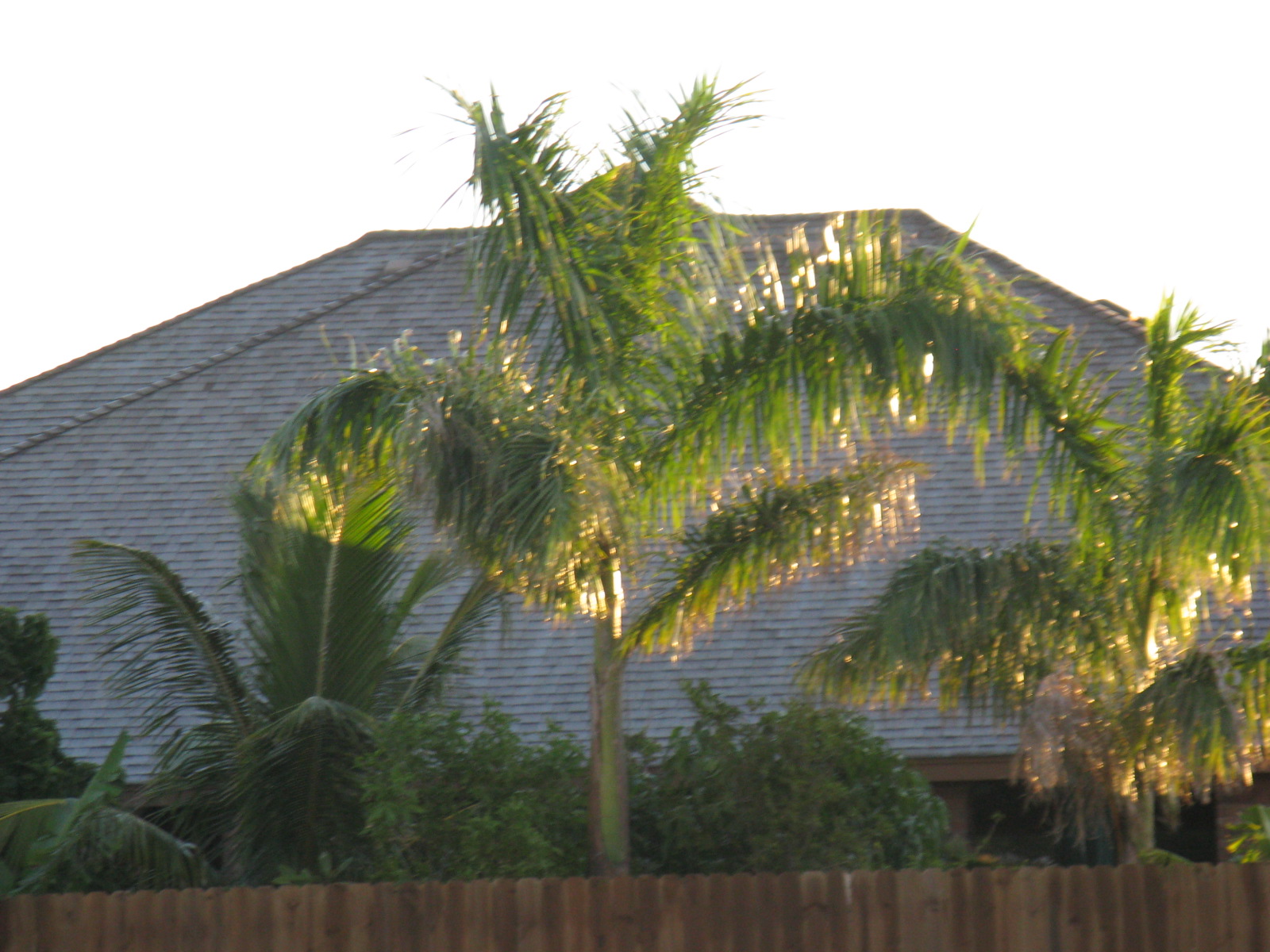
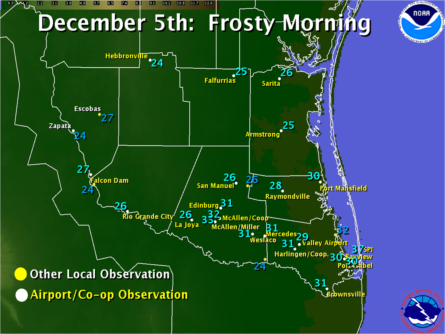
Winter’s Bluster, Then Frost: December 4–5 While a repeat of 2004’s White Christmas did not occur, some of the coldest feeling air in years invaded the region, as afternoon temperatures on the 4th plummeted into the upper 30s to lower 40s and, when combined with persistent 25 mph and gusty winds, left wind chill values in the upper 20s to lower 30s across the Lower Rio Grande Valley. Soon after nightfall, skies rapidly cleared and winds diminished quickly as the cold high pressure center built overhead, leading to a widespread frosty freeze across all of Deep South Texas. Low temperatures (below) ranged through the 20s in most areas, with rural areas of Deep South Texas seeing more than 6 hours of temperatures below freezing. In fact, these were the coldest temperatures to be recorded, area–wide, since the White Christmas event in 2004. Data on any crop and plant damage have not been received as of this writing. It is hoped that the light freeze and frost may actually benefit some crops, particularly citrus, where cool early winter temperatures help to eradicate pests and bring out sweetness in the fruit. Only time will tell. |
|
 |
|

