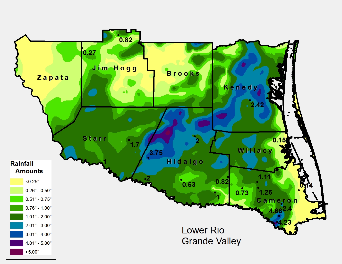
 Rainfall from the afternoon of November 6th through the morning of November 7th, 2013, across the Rio Grande Valley and Deep South Texas. |
||||||||||||||||||||||||||||||||||||||||||||||||||||||||||||||||||||||||||||||||||||||||||||||||||||||||||||||||||||||||||||
| Early November 2013 Cold Front Brings Welcome Rainfall, Some Flooding Some Valley Locations Received Several Inches While Others Had None |
||||||||||||||||||||||||||||||||||||||||||||||||||||||||||||||||||||||||||||||||||||||||||||||||||||||||||||||||||||||||||||
|
Event Summary In general, a band of 2 to 4+ inches fell along and just ahead of the front from the King Ranch through the ranches and farms of northern and western Hidalgo County filled several fields with water and likely caused nuisance flooding of local ranch roads. Most of this rain fell from mid to late afternoon through the late evening on the 6th, with lighter amounts following the front into the early morning of the 7th. The band slowly dissolved as it oozed into the Lower Valley, but was still able to drop up to an inch around Harlingen during a couple hours either side of midnight. Steady rains along the behind the front dropped a healthy 1 to 2 or so inches in Starr County; heaviest rainfall for the event (not shown) fell with thunderstorm clusters southwest of Reynosa (Tamaulipas, Mexico). 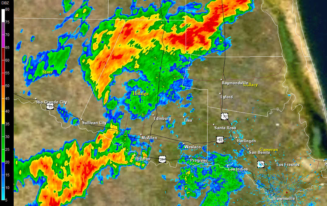 Loop of locally heavy rainfall across ranchlands from the King Ranch (southern Kenedy County) southwest to western and northern Hidalgo County between 6 and 730 PM, November 6th 2013. Click to enlarge. |
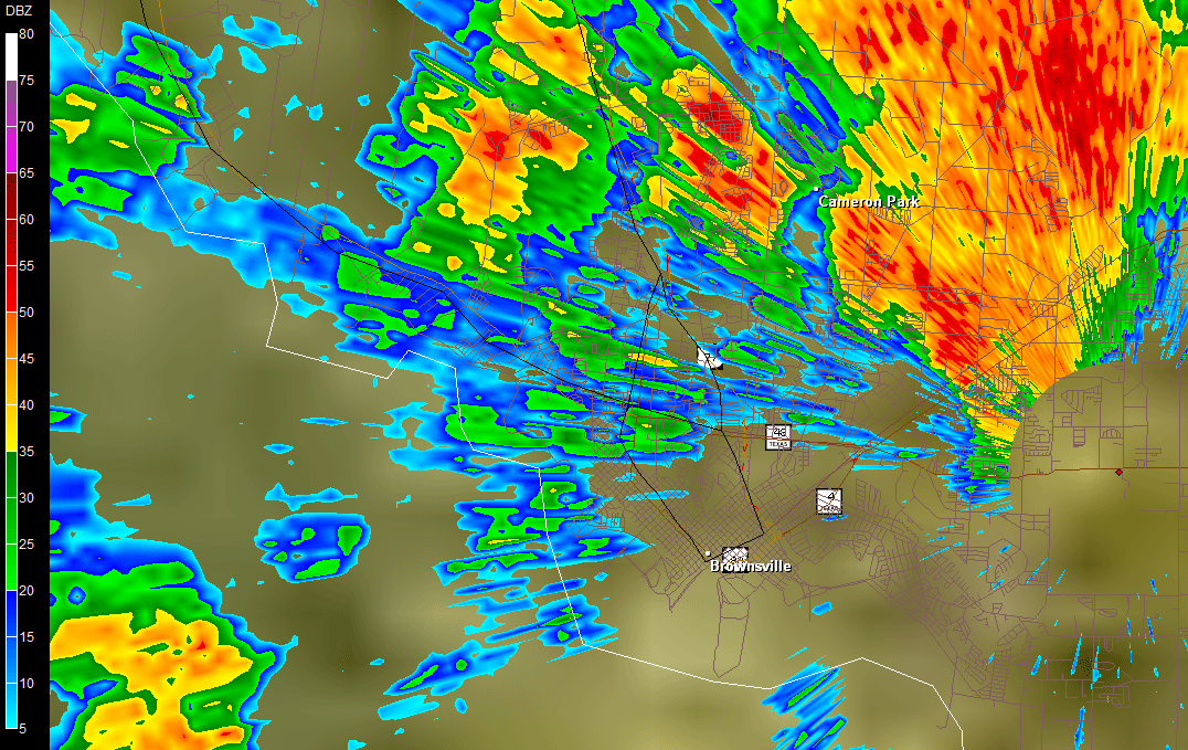 Loop of locally torrential rains across southern Cameron County between 230 and 345 PM November 6th 2013. Nearly five inches of rain fell in West Brownsville during this time, causing local flash flooding. Prior to significant development of the pre frontal band across the mid Valley and King Ranch area, a weak sea breeze enhanced lift along and east of the Highway 77/Interstate 69E corridor between San Benito and Brownsville a little after 2 PM. By 230 PM, blinding rain engulfed Farm to Market 511, State Route 100, and other locations between Los Fresnos and north Brownsville. The storm developed/crept slowly, edging into the core of Brownsville for more than an hour before gradually drifting southwest into northeastern Tamaulipas (above). In 90 minutes or less, between 2 and just under 5 inches fell from Los Fresnos through west Brownsville. Numerous instances of flooding, some life threatening, quickly ensued:
As the core of Brownsville and the extended frontage business district experienced flooding, locations less than 10 miles to the east, including Brownsville/South Padre International Airport (0.12 inches), had minimal rain; farther east, Port Isabel and South Padre Island were dry.
|
|||||||||||||||||||||||||||||||||||||||||||||||||||||||||||||||||||||||||||||||||||||||||||||||||||||||||||||||||||||||||||
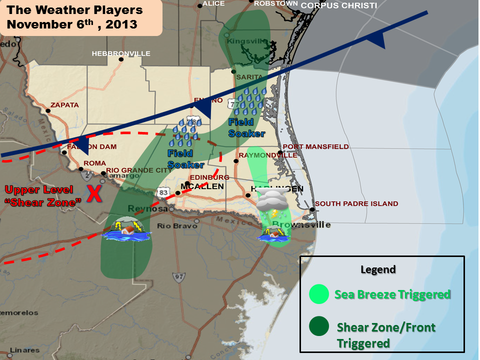 The weather setup for the locally heavy rainfall on November 6th. Cold front drifting south combined with atmospheric moisture in place and a upper level disturbance (shear zone) to produce primary rain area (dark green band) from mid afternoon through late evening; in Cameron County, a weak early afternoon sea breeze aided rapid development of torrential rains near Brownsville (light green). |
||||||||||||||||||||||||||||||||||||||||||||||||||||||||||||||||||||||||||||||||||||||||||||||||||||||||||||||||||||||||||||
 Point rainfall totals in the City of Brownsville (from Community Collaborative Rain Hail and Snow Network, CoCoRaHS). Green shaded area depicts area of heaviest rainfall and worst flooding. |
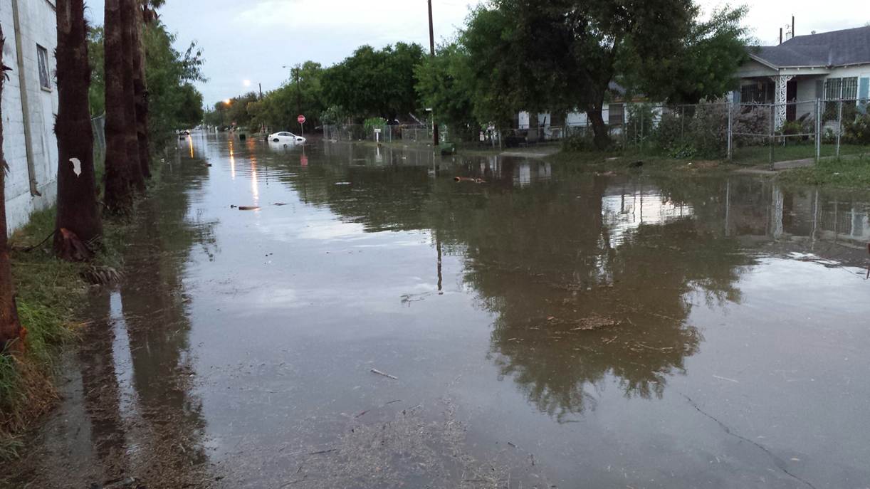 Photo of street flooding just after rains ended near downtown Brownsville, between 4 and 5 PM on November 6, 2013. Courtesy of the City of Brownsville. |
|||||||||||||||||||||||||||||||||||||||||||||||||||||||||||||||||||||||||||||||||||||||||||||||||||||||||||||||||||||||||||
|
||||||||||||||||||||||||||||||||||||||||||||||||||||||||||||||||||||||||||||||||||||||||||||||||||||||||||||||||||||||||||||

