 Uprooted tree in Bayview. Winds at nearby Cameron County Airport were clocked at 67 mph when the storm arrived there at 410 PM on May 28th. |
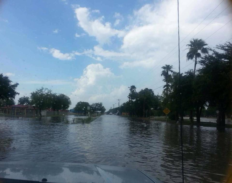 Standing water one to two feet deep in La Joya, taken at 430 PM on May 28th. Rainfall had ended a little after 4 PM. |
| 2014 RGV Severe Weather "Season" Ends With a Local Bang Microbursts Strike Falfurrias May 27th; Cameron County May 28th |
|
|
May 27th: Falfurrias 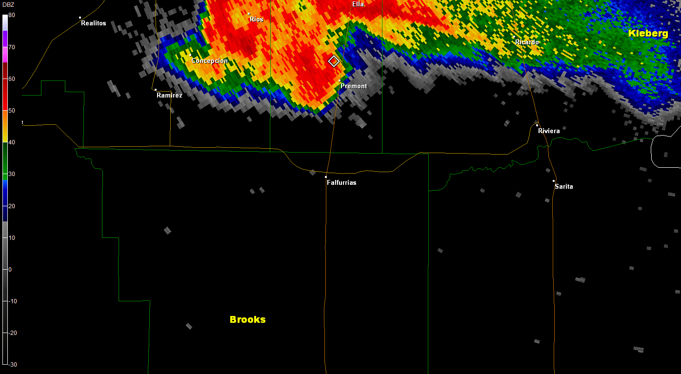 Loop of 0.5° base reflectivity as seen from NWS Corpus Christi radar as severe thunderstorm and a possible tornado raced through northern Brooks County around 8 PM, May 27th 2014. 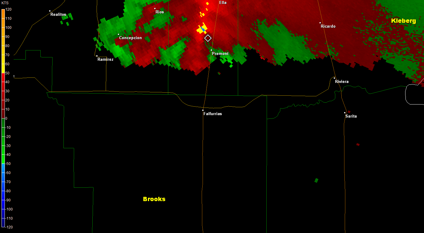 Loop of 0.5° base velocity as seen from NWS Corpus Christi radar as severe thunderstorm and a possible tornado raced through northern Brooks County around 8 PM, May 27th 2014. The widening mesocyclone suggests straight line winds may have dominated near Falfurrias, but a secondary tighter circulation to the northwest may have produced a tornado. |
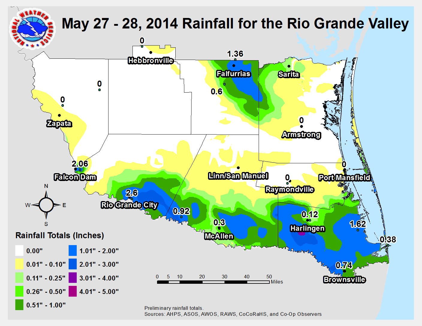
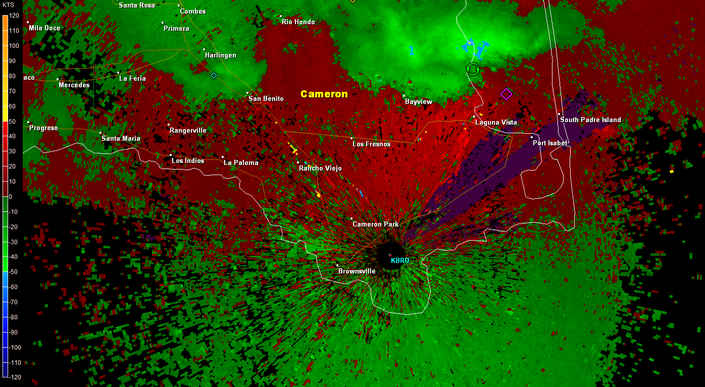 Loop of 0.5° base velocity as a severe thunderstorm in a line echo wave pattern sliced across eastern and southern Cameron County during the late afternoon of May 28th, 2014. May 28th: Action Moves to RGV The last surge of intense storms occurred just before sunset, as remnant boundaries fired in a small area of southern Starr County, around and just north of Rio Grande City. An intense but brief updraft surged into the storm and resulted in reports of quarter sized hail or larger, some shown in this video (views best with Quicktime) taken just northeast of Rio Grande City. Estimated rainfall of more than 4 inches in the same area created field flooding; Rio Grande City officially had 2.6 inches of rain, nearly doubling their May average in a little less than an hour.  3–D view of hail and heavy rain core during peak of the Rio Grande City thunderstorm, at 730 PM May 28th. Note the height of the pink area (65 dBZ), above the freezing layer (estimated at around 14.5 thousand feet) with 50+ dBZ well above 20 thousand feet. |
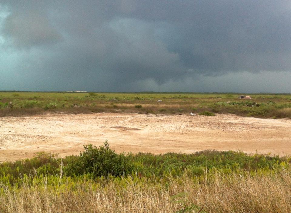 Photo taken from along State Highway 48, near the Port of Brownsville Shrimp Basin, looking northeast. Rotation was hard to determine; if there was a funnel, it lasted less than a minute and was soon overwhelmed by the downdraft. |
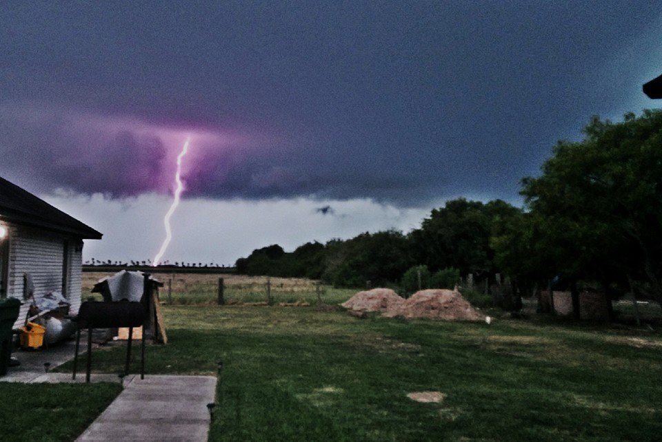 Cloud to ground lightning strike, one of hundreds that crashed from the storm, looking north from Brownsville. |
000
NWUS54 KBRO 290151
LSRBRO

PRELIMINARY LOCAL STORM REPORT...SUMMARY
NATIONAL WEATHER SERVICE BROWNSVILLE TX
851 PM CDT WED MAY 28 2014

..TIME...   ...EVENT...      ...CITY LOCATION...     ...LAT.LON...
..DATE...   ....MAG....      ..COUNTY LOCATION..ST.. ...SOURCE....
            ..REMARKS..

0752 PM     TSTM WND DMG     FALFURRIAS              27.22N  98.14W
05/27/2014                   BROOKS             TX   EMERGENCY MNGR

            OAK TREES DOWN AT LASATER STREET AND RICE STREET

0752 PM     TSTM WND DMG     FALFURRIAS              27.23N  98.15W
05/27/2014                   BROOKS             TX   EMERGENCY MNGR

            REPORTS OF STRUCTURAL DAMAGE TO BUSINESS SIGNS ON
            CENTER STREET

0801 PM     TSTM WND GST     FALFURRIAS              27.22N  98.14W
05/27/2014  M61 MPH          BROOKS             TX   AWOS

            OBSERVING SYSTEM REPORTED A 53 KNOT GUST.

0802 PM     TSTM WND DMG     FALFURRIAS              27.22N  98.15W
05/27/2014                   BROOKS             TX   LAW ENFORCEMENT

            REPORTS OF NUMEROUS TREES DOWN ON ST. MARYS STREET

0805 PM     HAIL             FALFURRIAS              27.22N  98.14W
05/27/2014  E1.75 INCH       BROOKS             TX   PUBLIC

            GOLF BALL SIZE HAIL REPORTED

0830 PM     FLOOD            1 S FALFURRIAS          27.21N  98.15W
05/27/2014                   BROOKS             TX   AMATEUR RADIO

            MINOR FLOODING AT CALDWELL STREET AND TERRELL STREET

            **************************************

0410 PM     TSTM WND GST     BAYVIEW                 26.12N  97.40W
05/28/2014  M67 MPH          CAMERON            TX   ASOS

            ASOS REPORTED AT 58 KNOT WIND GUSTS.

0413 PM     HAIL             PORT ISABEL             26.07N  97.22W
05/28/2014  E0.75 INCH       CAMERON            TX   PUBLIC

            PUBLIC REPORTED PENNY SIZED HAIL IN PORT ISABEL.

0437 PM     TSTM WND DMG     1 ENE BROWNSVILLE       25.93N  97.47W
05/28/2014                   CAMERON            TX   NWS EMPLOYEE

            SEVERAL ONE TO TWO FOOT DIAMETER TREES SNAPPED. WINDS
            ESTIMATED AT 60 MPH.

0516 PM     FLOOD            BROWNSVILLE             25.93N  97.48W
05/28/2014  E2.00 INCH       CAMERON            TX   BROADCAST MEDIA

            TWO FEET OF STANDING WATER REPORTED IN BROWNSVILLE VIA
            POLICE SCANNER.

0622 PM     FLOOD            BROWNSVILLE             25.93N  97.48W
05/28/2014                   CAMERON            TX   EMERGENCY MNGR

            STREETS AROUND PALM BLVD IN DOWNTOWN BROWNSVILLE WITH
            AS MUCH AS 18 INCHES OF RUNNING WATER. TRASH CANS
            FLOATING DOWN THE ROADWAY. WATER WAS RECEEDING QUICKLY
            AS OF 620 PM.

0730 PM     HAIL             3 N RIO GRANDE CITY     26.42N  98.83W
05/28/2014  E1.25 INCH       STARR              TX   TRAINED SPOTTER

            VIDEO SUGGESTED HAIL UP TO HALF DOLLAR SIZE. SPOTTER
            REPORTED QUARTER SIZE HAIL.

0730 PM     TSTM WND GST     3 N RIO GRANDE CITY     26.42N  98.83W
05/28/2014  E60 MPH          STARR              TX   TRAINED SPOTTER

            WIND GUSTS 50 TO 60 MPH.

0730 PM     HEAVY RAIN       3 N RIO GRANDE CITY     26.42N  98.83W
05/28/2014  E4.50 INCH       STARR              TX   TRAINED SPOTTER

            POCKETS OF FIELD FLOODING REPORTED.
|
|

