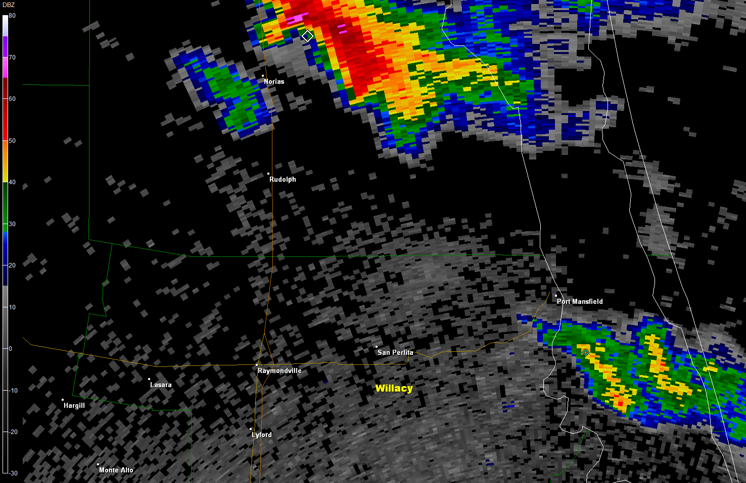
 Loop of 0.9° base reflectivity of supercell thunderstorm as it moved from the King and Yturria Ranches of southeast Kenedy County into eastern Willacy County, 537 to 729 PM April 24th, 2016 Hail...Yes! Single Supercell Drops Golfballs in Kenedy, Willacy Apr. 24, 2016 |
|
|
Just enough moisture and instability were lifted by the backside of a departing upper level disturbance (below, top) during the late afternoon and early evening of April 24th to produce several small supercell thunderstorms from the southern Coastal Bend through the King Ranch. One of the cells would continue to recycle (above) as it moved through the southern King Ranch, Yturria ranch, and finally the San Perlita/Willamar area of Willacy County before slowly weakening in southern Willacy. The storm would run into the enemies of sunset and stable air (below, bottomn and dissipate before reaching the larger populations of Harlingen and Brownsville. 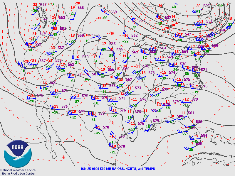 500 mb (~18,000 foot) flow across the U.S. at 7 PM Sunday, April 24, 2016. Northwest flow immediately behind departing trough ("dip") in southeast Texas worked on just enough residual moisture to create several supercell thunderstorms, including a long–lasting event from Kenedy through Willacy County. 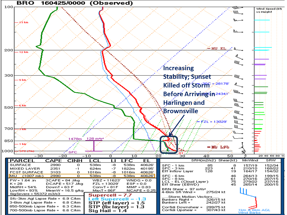 Atmospheric sounding taken between 6 and 7 PM at Brownsville/South Padre Island International Airport on April 24, 2016. Enougn stable air (blue circled area) and sunset combined to kill off the hailstorm. |
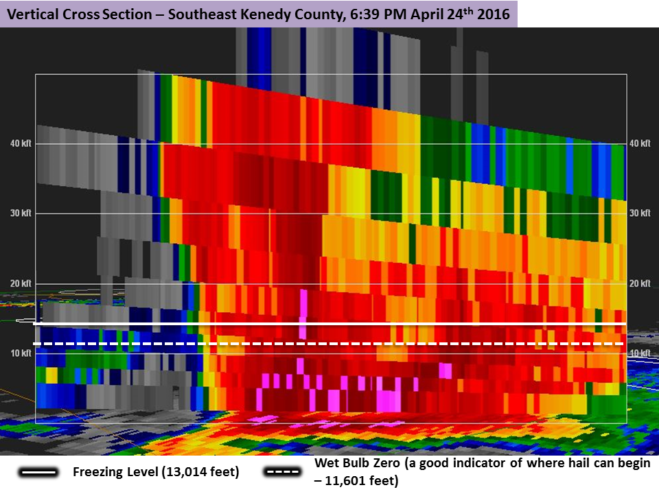 Cross section from radar reflectivity, southeast Kenedy County, at 639 PM April 24th. Note the amount of reflectivity, more than 65 dbZ to near 20,000 feet, and 50 dbZ to 40,000 feet – a clear indication of a lot of ice (hail) formation. 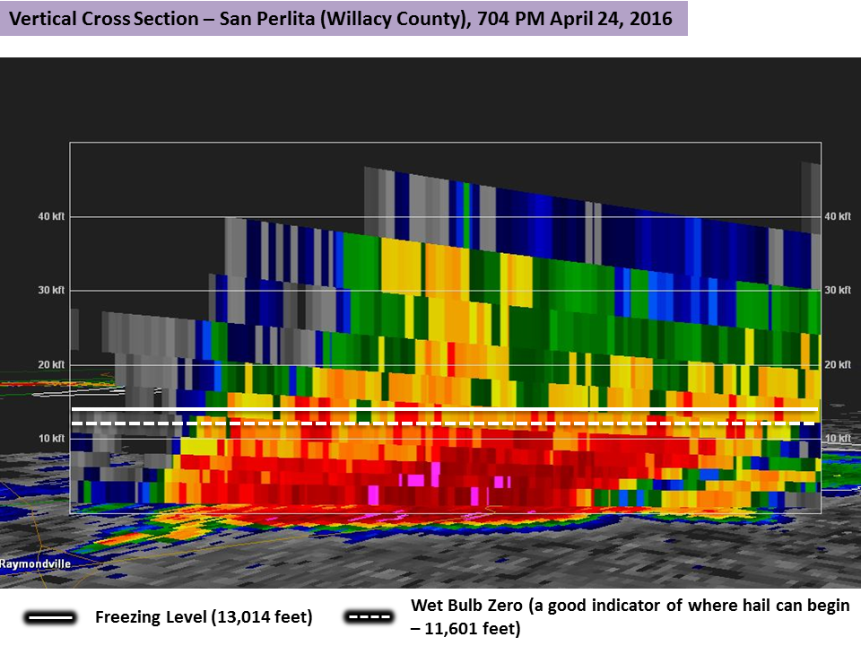 Cross section from radar reflectivity, San Perlita (Willacy County), at 704 PM April 24th. Note the amount of reflectivity, more than 65 dbZ, now below the freezing level and wet bulb zero level. This correlated to significant hail fall in and near San Perlita. The supercell would recycle for near two hours, and ultimately drop a swath of large hail from east of Rudolph/Norias in south central Kenedy County through San Perlita/Willamar in Willacy. According to an off–duty police officer in San Perlita, "golfball sized hail blanketed the ground", and the cooperative (long term climate) observer in Kenedy County near Armstrong reported golfball sized hail at a hunting camp five miles northeast of the outpost of Norias. Damage from the hail was unknown as of this writing. The solo storm, backlit by sunset, provided a great photo opportunity, shown below. |
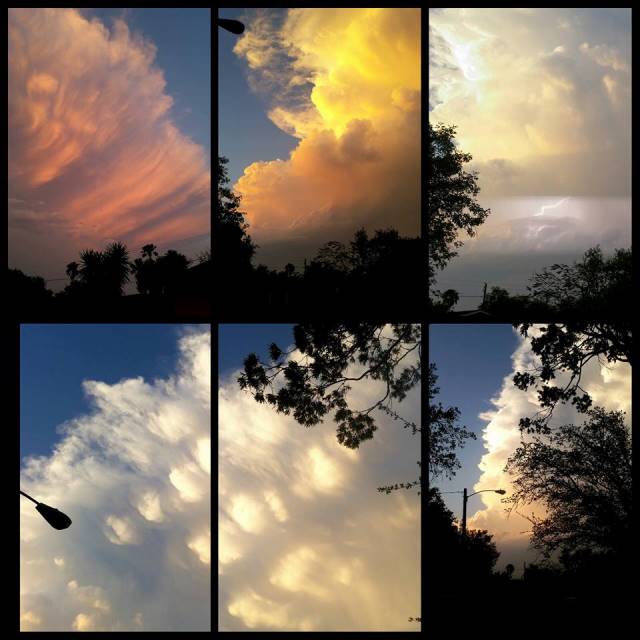 Photo collage provided via social media to NWS Brownsville of the supercell just prior to collapse in Willacy/northern Cameron County, taken from San Benito. |
|

