Rapidly Developing Pulse-Severe Storm Strikes Sullivan City Colonia, June 18, 2020
Overview
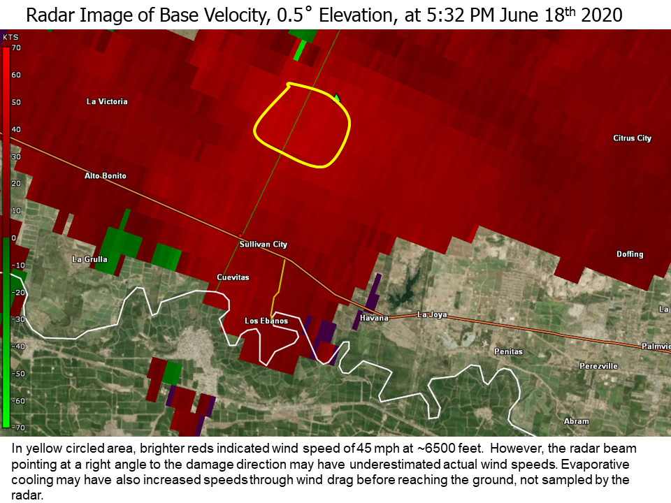
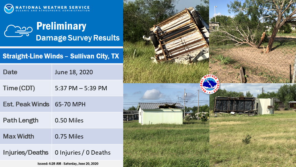
A quick-developing severe thunderstorm formed in the farm and ranchlands of extreme southwestern Hidalgo County along the Starr County line around 530 PM on June 18th, then raced through Sullivan City before crossing the Rio Grande into northern Tamaulipas, Mexico. The storm produced damaging straight-line winds at a colonia in unincorporated Hidalgo County just north of the city limits. Nine residences had partial or total roof damage, three recreational vehicles were flipped, and at least three dozen mesquite trees had a combination of large limbs blown down or were broken/cracked at the base. All damage was facing to the south or south-southwest, in the direction of the storm motion. Each residence was a manufactured home or "mobile" trailer; one was uninhabited, and one was tilted after being blown off of its pier/block foundation with no visible anchorage. All of the damaged buildings had poor to very poor roof connections.
Each of the recreational vehicles was not anchored properly to the ground. Two were older and rusted, but a third was newer but only sitting on jack pallets. The third vehicle weighed more than three tons, and was a key reason for the top wind speed estimate of 70 mph. A nearby older construction manufactured single-wide home was undamaged, and nearby power lines/poles and mesquite trees had no visible damage.
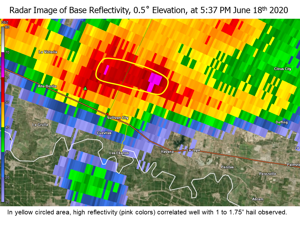
Several residents recorded a brief shot of large hail, ranging from 1 to 1.75 inches (golf ball sized) in diameter. There was no visible damage from the hail.
A preliminary summary of estimated wind speed, path length, and path width, follows:
PEAK WIND /E/:          65-70 MPH
PATH LENGTH /STATUTE/:  0.5 MILES
PATH WIDTH /MAXIMUM/:   1320 YARDS
FATALITIES:             0
INJURIES:               0

START DATE:             JUN_18_2020
START TIME:             0537_PM_CDT
START LOCATION:         3.0 MILES NNE SULLIVAN CITY_/_HIDALGO_/_TX
START LAT/LON:          26.3211_/_-98.5542

END DATE:               JUN_18_2020
END TIME:               0539_PM_CDT
END LOCATION:           2.5 MILES NNE SULLIVAN CITY_/_HIDALGO_/_TX
END LAT/LON:            26.3140_/_-98.5555
Additional photos will be added to this page as time permits. For now, you can view them through the NOAA/NWS Storm Damage Viewer. To do so, you'll need to install and activate Adobe Flash Player. Then, zoom the map into Zapata City, and click on one of fifty small green dots to get individual damage reports and on-site damage photos.

