

Storm Prediction Center's Fire Weather Outlook
Current Large Wildfire Map |
Incident Management Situation Report Map |

Wildfires and poor air quality continue for the Pacific Northwest, Rockies and extended into the Plains. Severe thunderstorms possible for the northern Plains and upper Midwest on Monday along a frontal boundary. Another boundary will focus showers and thunderstorms for the eastern seaboard with localized heavy rainfall possible. For Alaska, a strong Bering Sea storm will bring winds and rainfall. Read More >
Fire Weather
National Program
Current Large Wildfire Map |
Incident Management Situation Report Map |
US Dept of Commerce
National Oceanic and Atmospheric Administration
National Weather Service
Fire Weather
3833 S. Development Ave
Boise, ID 83705
Comments? Questions? Please Contact Us.
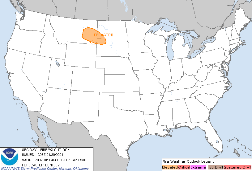
 Today's SPC Outlook
 Tomorrow's SPC Outlook
 Day 3-8 SPC Outlook
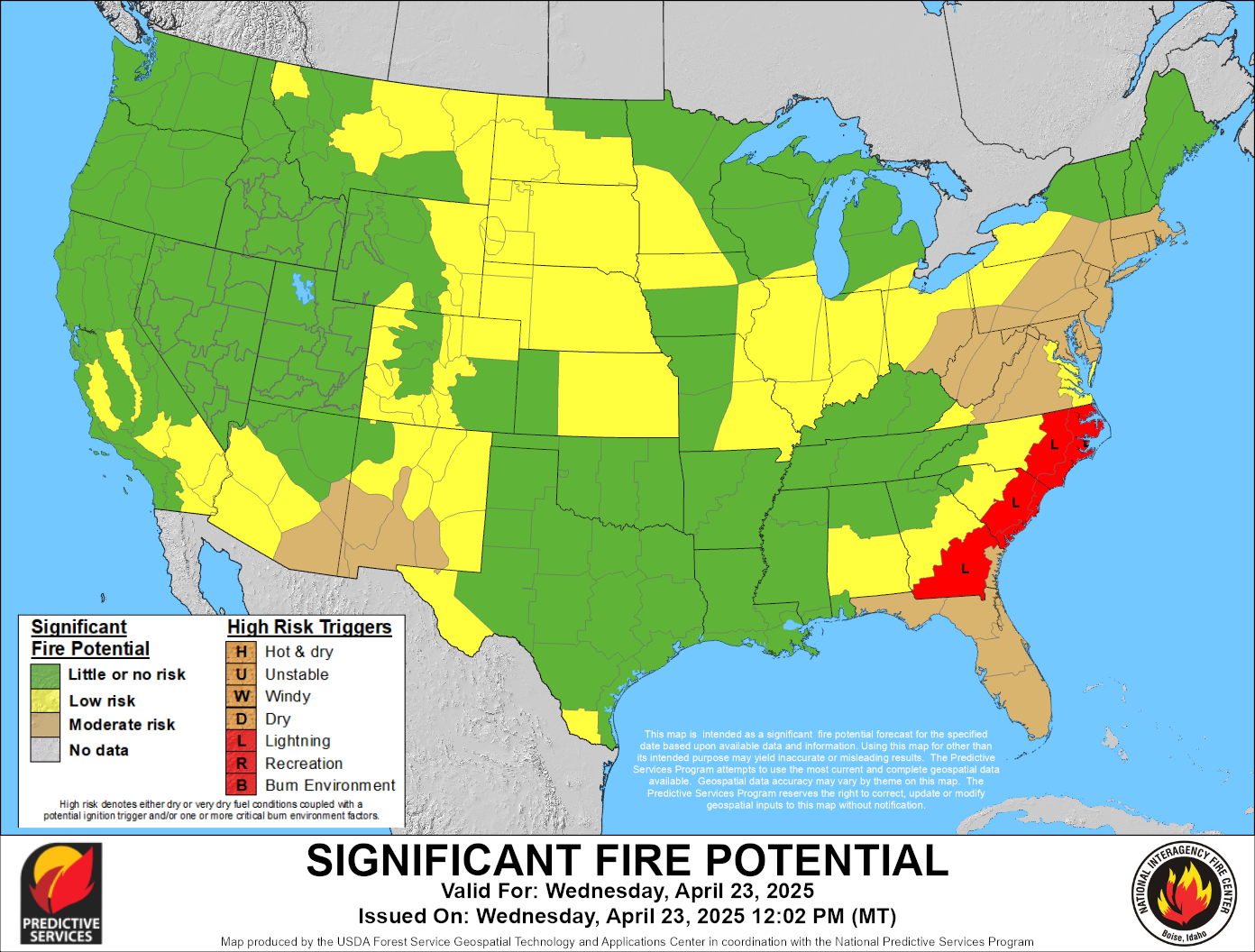
 Current Wildland Fire Potential Outlook
 Next Month's Wildland Fire Potential Outlook
 Extended Wildland Fire Potential Outlook
 Day 3-7 Hazards Outlook
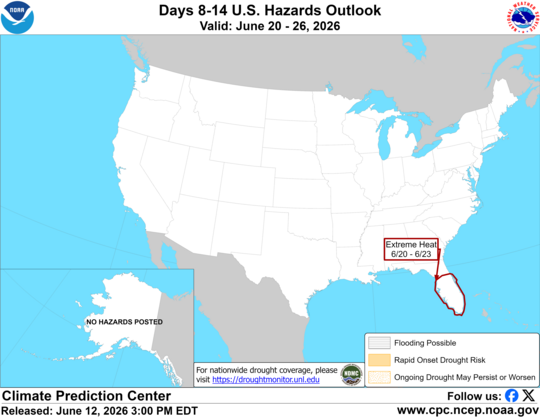 Day 8-14 Hazards Outlook
 Hot-Dry-Windy Index
 U.S. Drought Monitor
 U.S. Monthly Drought Outlook
 U.S. Seasonal Drought Outlook