

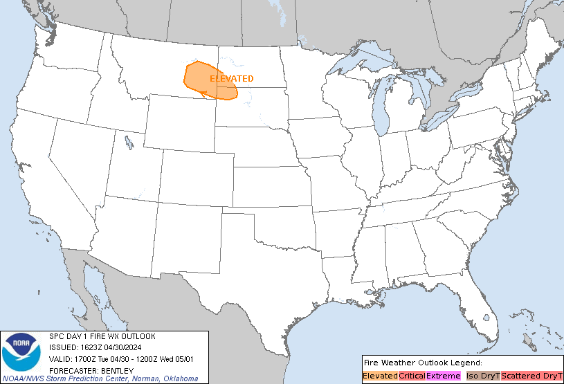
Storm Prediction Center's Fire Weather Outlook
Current Large Wildfire Map |
Incident Management Situation Report Map |

A prolonged atmospheric river will continue to bring gusty winds, heavy rainfall which may lead to urban and river flooding with possible landslides, and heavy inter-mountain snow over the Pacific Northwest into the northern Rockies through Thursday. A clipper will cross the Great Lakes and Northeast U.S. into Thursday with areas of moderate to heavy snow and mixed wintry precipitation. Read More >
Fire Weather
National Program
Current Large Wildfire Map |
Incident Management Situation Report Map |
US Dept of Commerce
National Oceanic and Atmospheric Administration
National Weather Service
Fire Weather
3833 S. Development Ave
Boise, ID 83705
Comments? Questions? Please Contact Us.
 Today's SPC Outlook
 Tomorrow's SPC Outlook
 Day 3-8 SPC Outlook
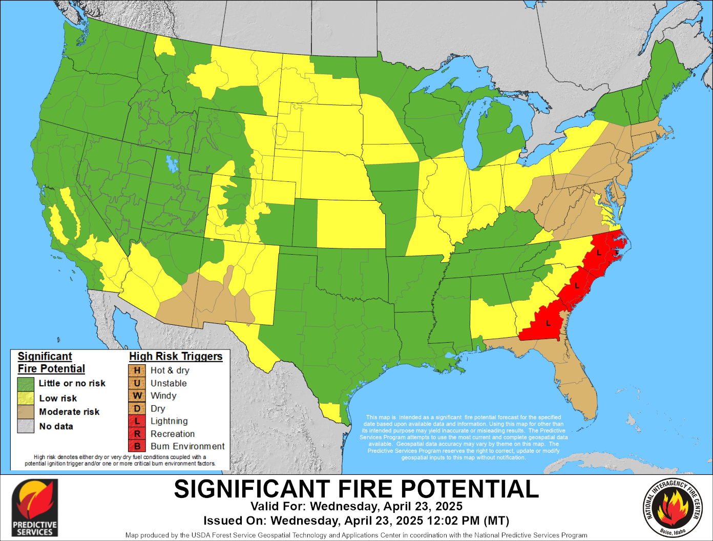
 Current Wildland Fire Potential Outlook
 Next Month's Wildland Fire Potential Outlook
 Extended Wildland Fire Potential Outlook
 Day 3-7 Hazards Outlook
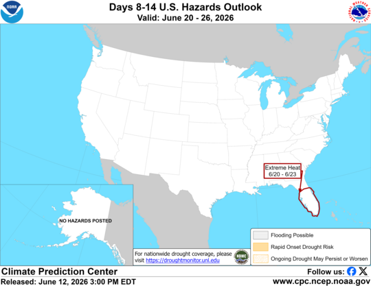 Day 8-14 Hazards Outlook
 Hot-Dry-Windy Index
 U.S. Drought Monitor
 U.S. Monthly Drought Outlook
 U.S. Seasonal Drought Outlook