Nashville, TN
Weather Forecast Office
| October 13, 2014 Tornado Statistics | ||||||||
| # | Counties | Rating | Time (CST) | Length (miles) | Width (yards) | Fatalities | Injuries | |
| 1 | Montgomery | EF1 | 1809 | 4.18 | 75 | 0 | 0 | |
| Reports & Radar Data | |||
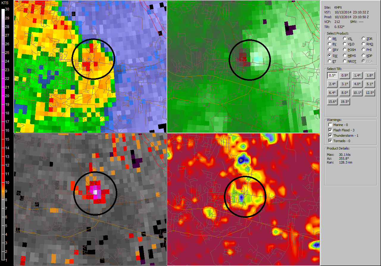
| SPC Outlooks | SPC Storm Reports | HPX Radar Tornado Debris Signature (TDS) | |
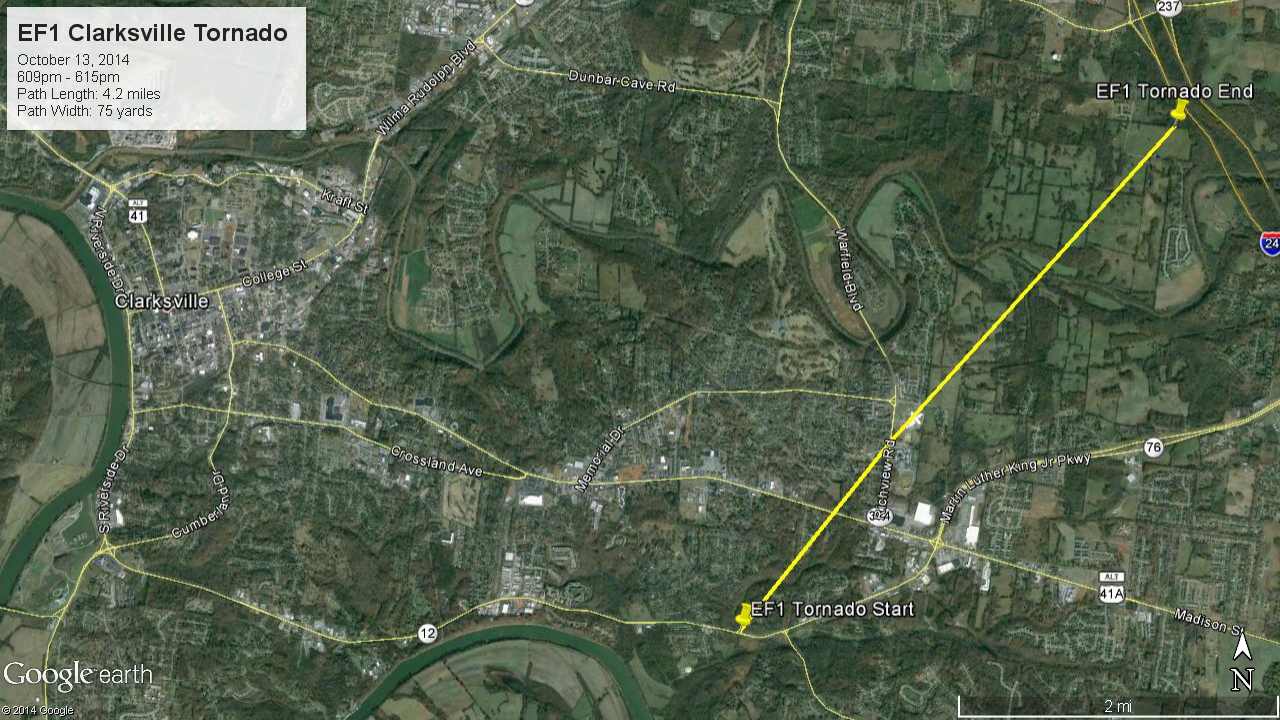
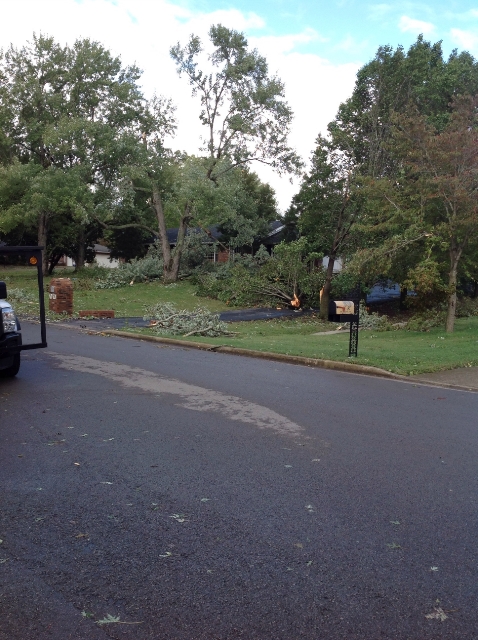
| EF1 Clarksville Tornado | |
| Counties: | Montgomery |
| Time: | 6:09 PM CST |
| EF Scale: | EF1 |
| Wind Speed Estimate: | 90 MPH |
| Damage Path Length: | 4.18 Miles |
| Damage Path Width: | 75 Yards |
| Fatalities: | 0 |
| Injuries | 0 |
|
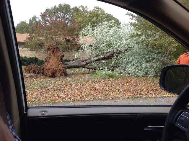
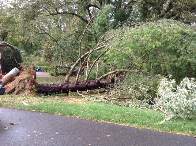
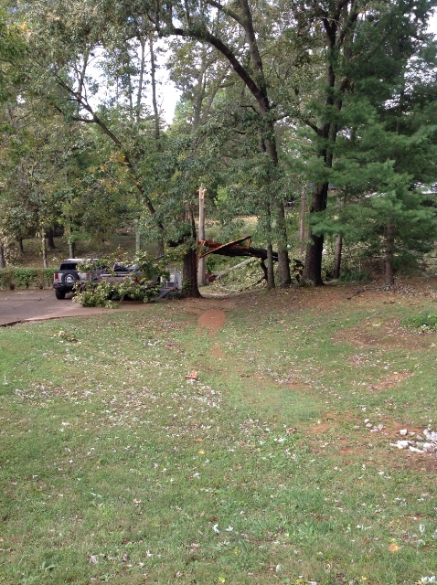
Damage: |
|
|
NWS Storm Survey Photos:
|
|
US Dept of Commerce
National Oceanic and Atmospheric Administration
National Weather Service
Nashville, TN
500 Weather Station Road
Old Hickory, TN 37138
615-754-8500
Comments? Questions? Please Contact Us.


