Nashville, TN
Weather Forecast Office

| Overview | |
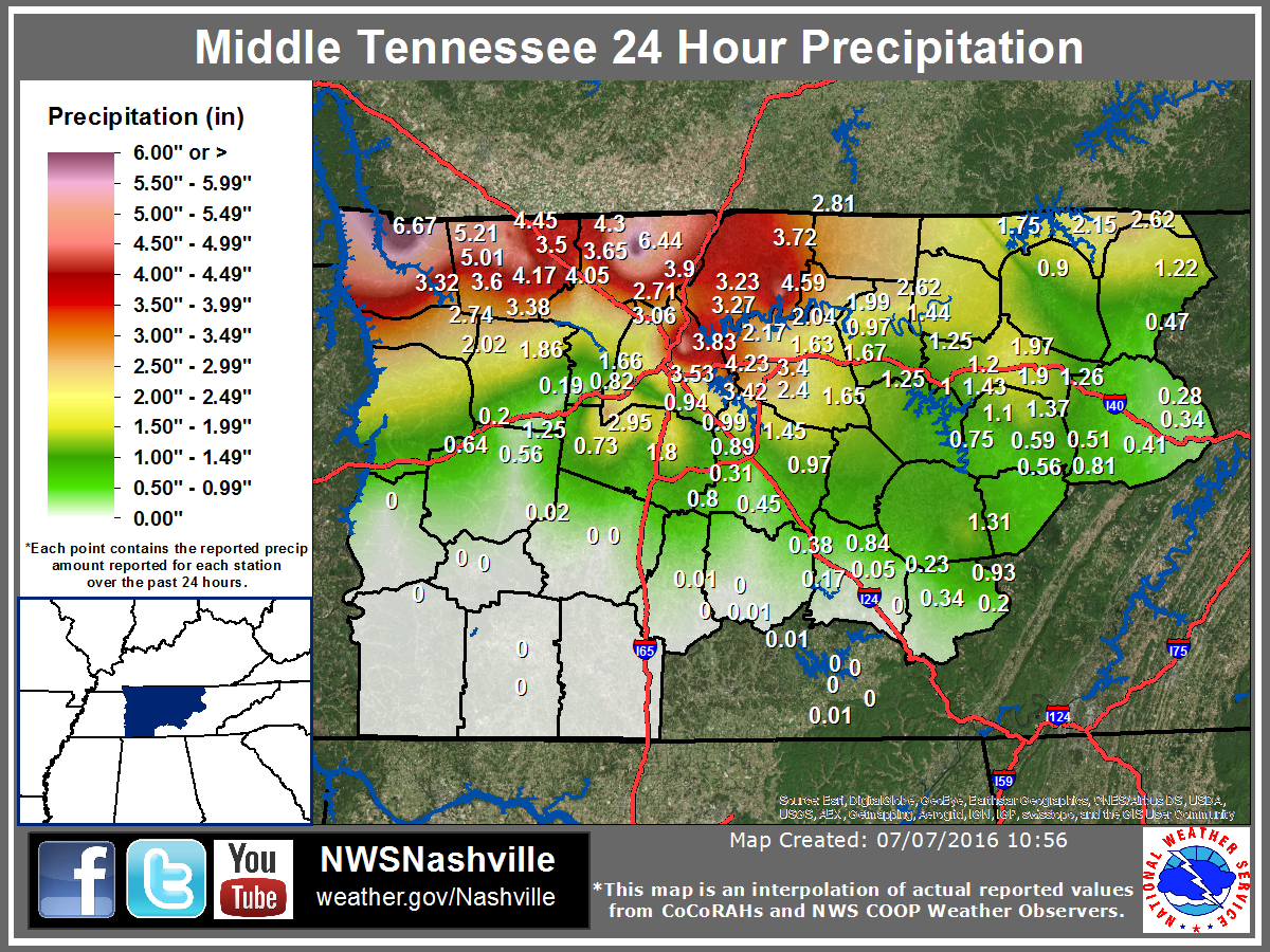
| A major severe thunderstorm and flash flood event affected Middle Tennessee from Wednesday, July 6, 2016 into Thursday, July 7, 2016. Three rounds of thunderstorms called Mesoscale Convective Systems (MCS) moved across the area over these two days, with the first MCS occurring on Wednesday afternoon July 6, the second MCS from Wednesday night into Thursday morning July 6-7, and the third MCS during the afternoon of July 7. The first MCS produced several reports of wind damage across northern parts of Middle Tennessee, while the second MCS produced scattered wind damage and dropped 3" to 8" of rain, which caused major flash flooding over northern Middle Tennessee. The final MCS on Thursday afternoon July 7 brought another round of more widespread wind damage. Based on reports from the Tennessee Emergency Management Agency and local media, the flash flooding damaged or destroyed over 65 homes, businesses, and other buildings across Stewart, Montgomery, Robertson, Sumner, and Cheatham Counties, as well as washed out numerous roads and bridges. Amazingly, no injuries or fatalities were reported despite the widespread damage. |
| July 6-7, 2016 Reports | |||
| SPC Storm Reports | SPC Event Archive | ||
| Local Storm Reports | TEMA Situation Report | ||
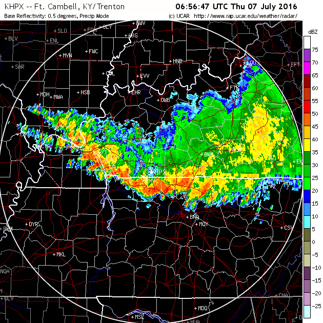
| July 6-7, 2016 Rainfall & Radar | |
|
|
|
 |
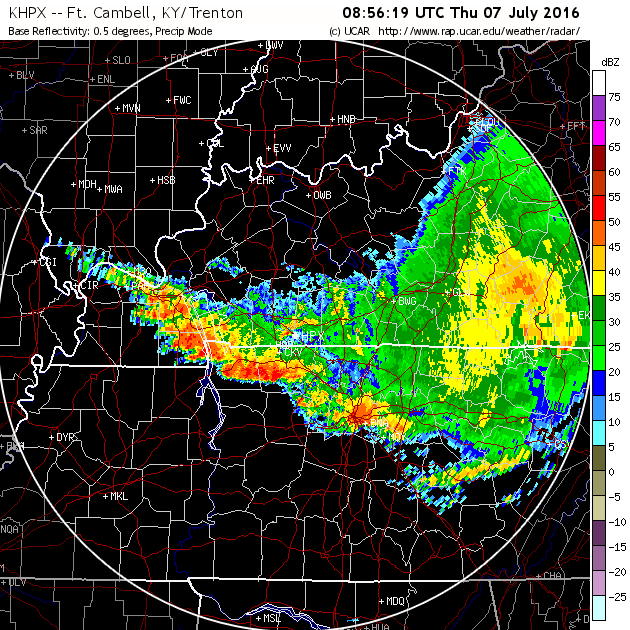 |
| Radar Imagery at 156 AM CDT and 356 AM CDT showing the slow moving thunderstorms that produced the major flash flooding across northern Middle Tennessee | |
| Photos | |
 |
 |
| Flash Flooding in Big Rock, TN (Stewart County) Photo via Stewart County Emergency Management |
Flash flooding on Highway 79 east of Dover, TN (Stewart County) Photo via Stewart County Emergency Management |
US Dept of Commerce
National Oceanic and Atmospheric Administration
National Weather Service
Nashville, TN
500 Weather Station Road
Old Hickory, TN 37138
615-754-8500
Comments? Questions? Please Contact Us.