| Overview | |||
|
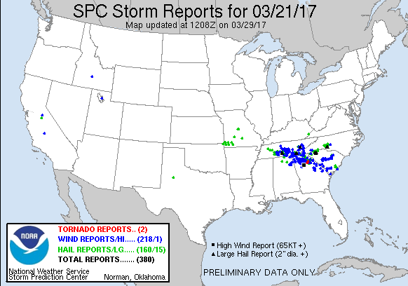
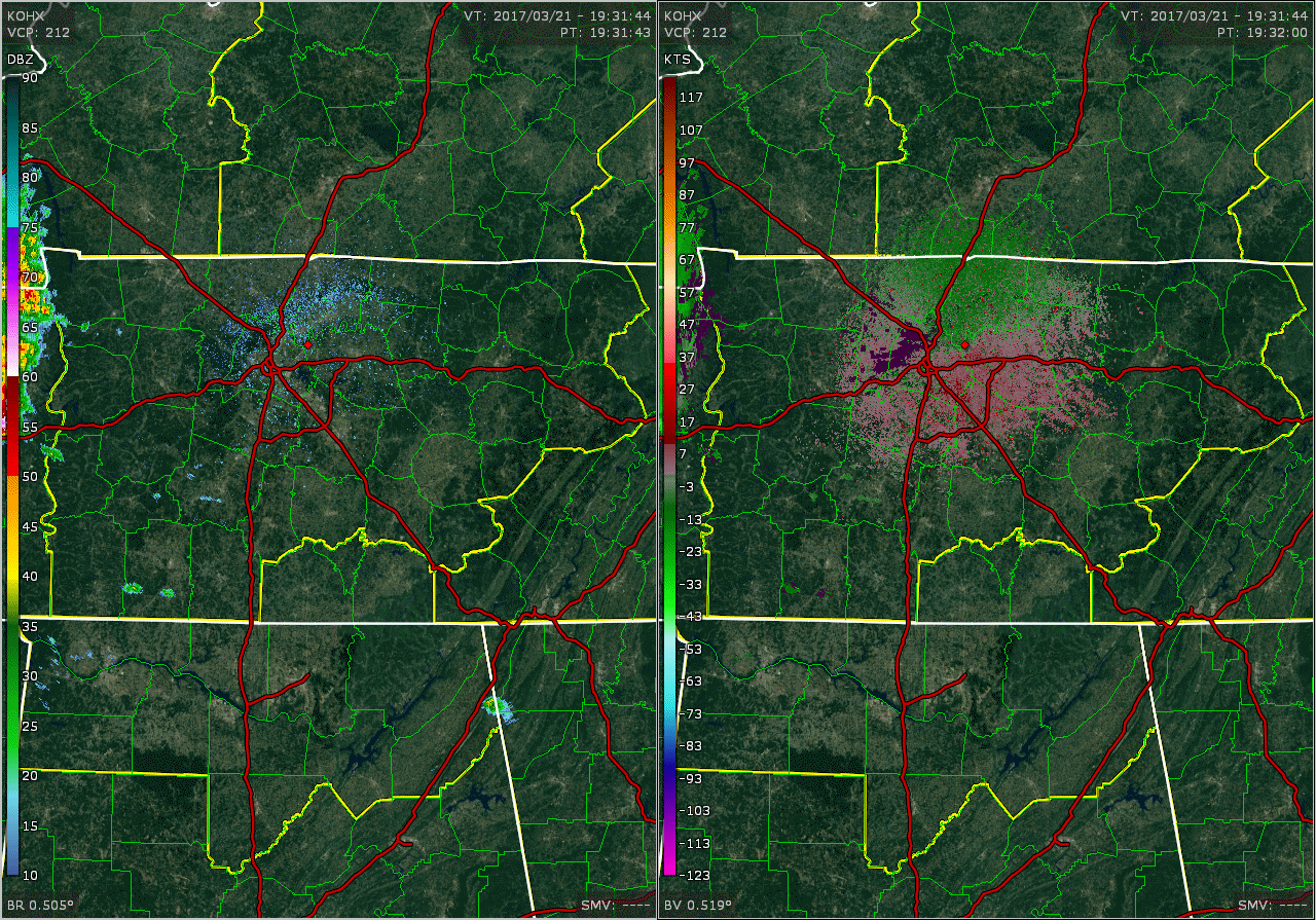
A line of severe thunderstorms called a Mesoscale Convective System (MCS) moved across Middle Tennessee on Tuesday, March 21, 2017, impacting areas mainly south of Interstate 40. This MCS moved into Middle Tennessee around 230 PM CDT, and additional scattered thunderstorms also developed out ahead of the MCS. Numerous reports of large hail and damaging winds were received with these storms before all of the storms exited the area by early evening.
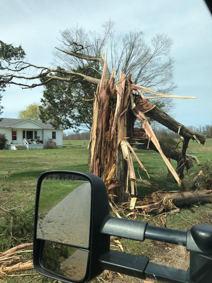
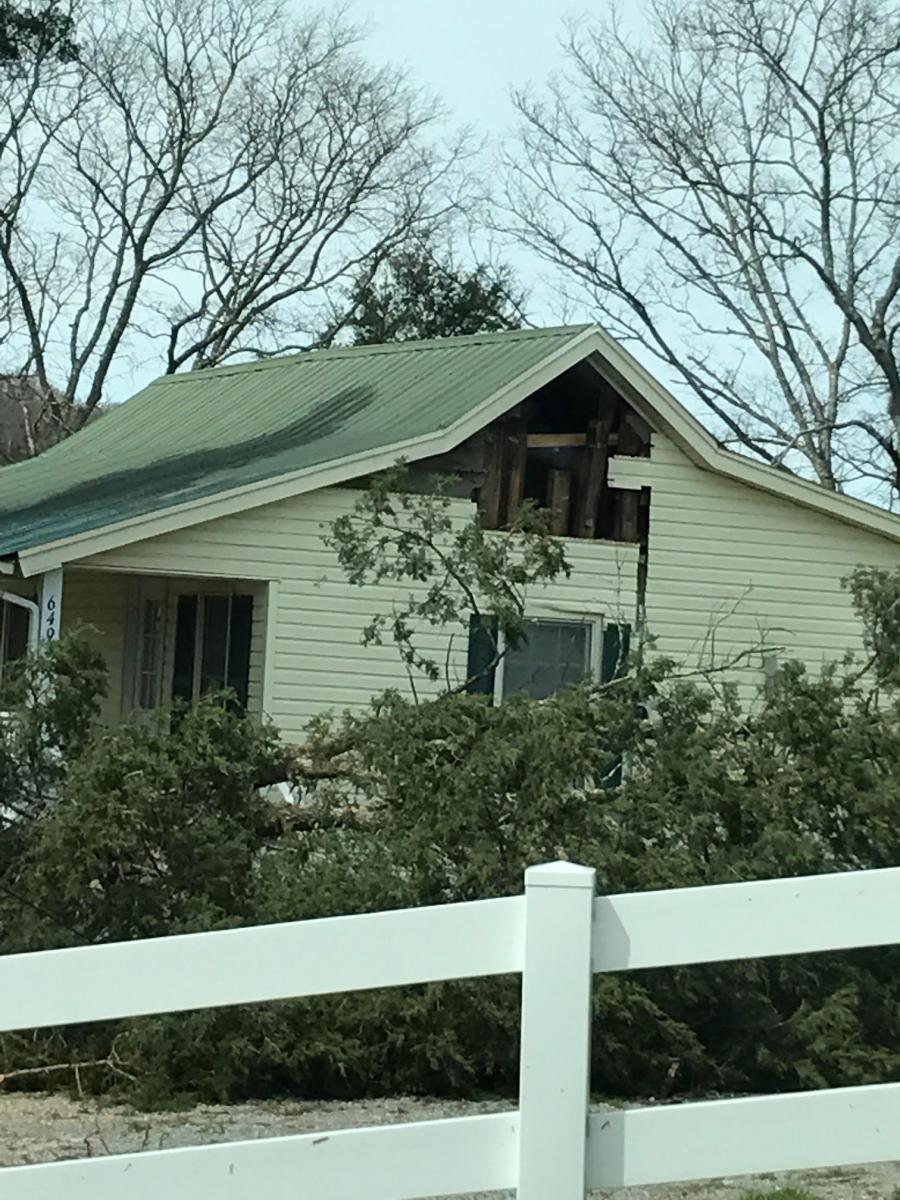
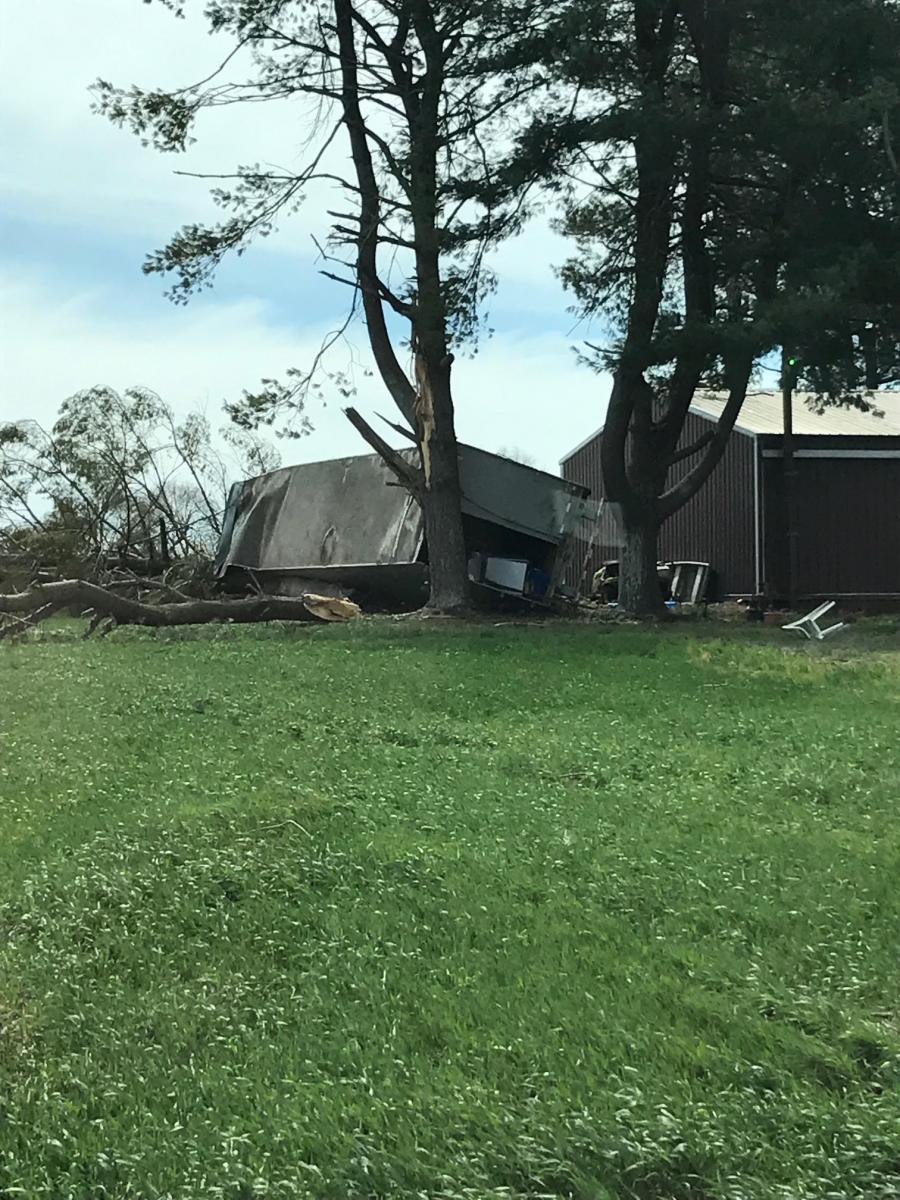
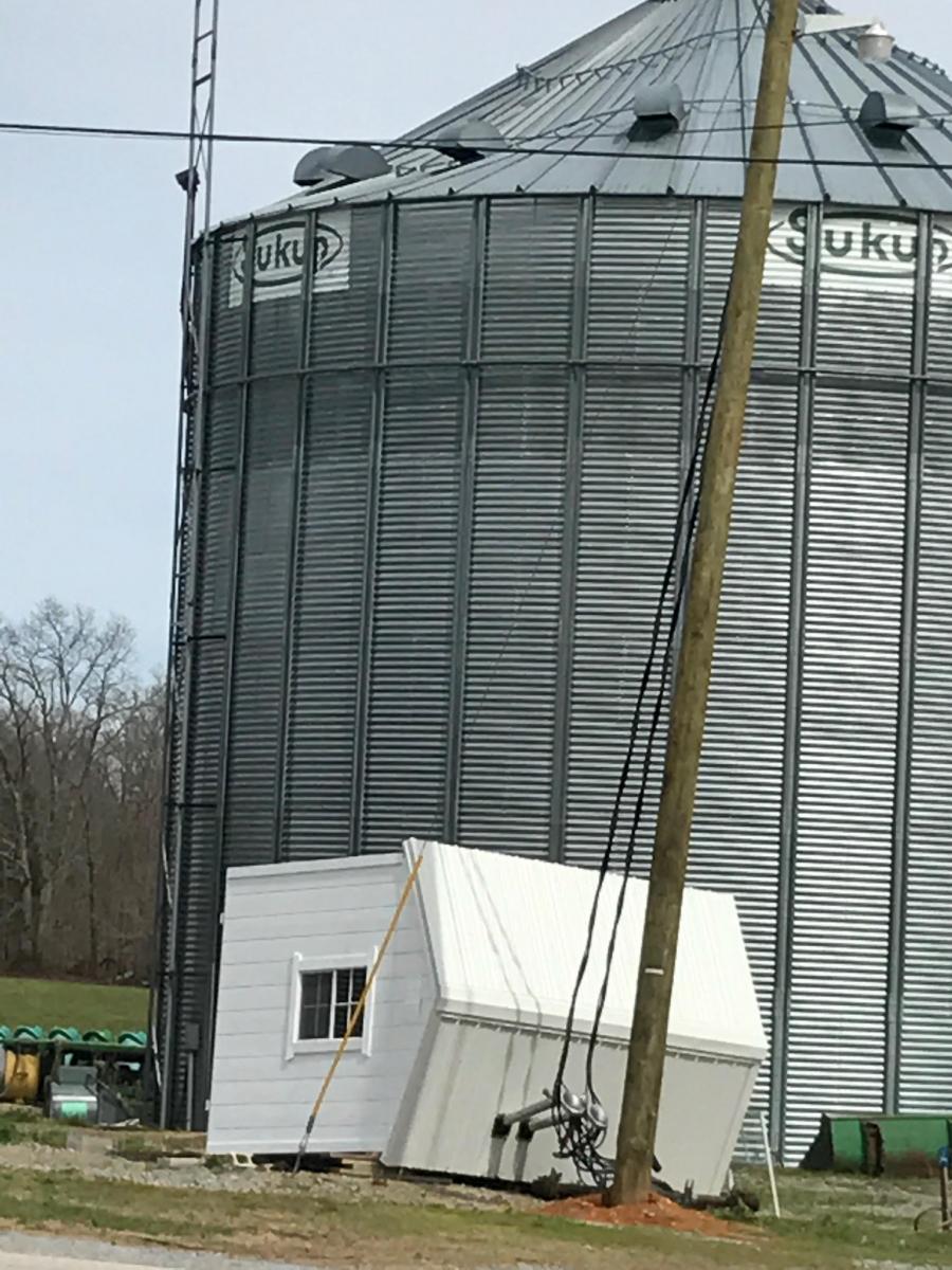
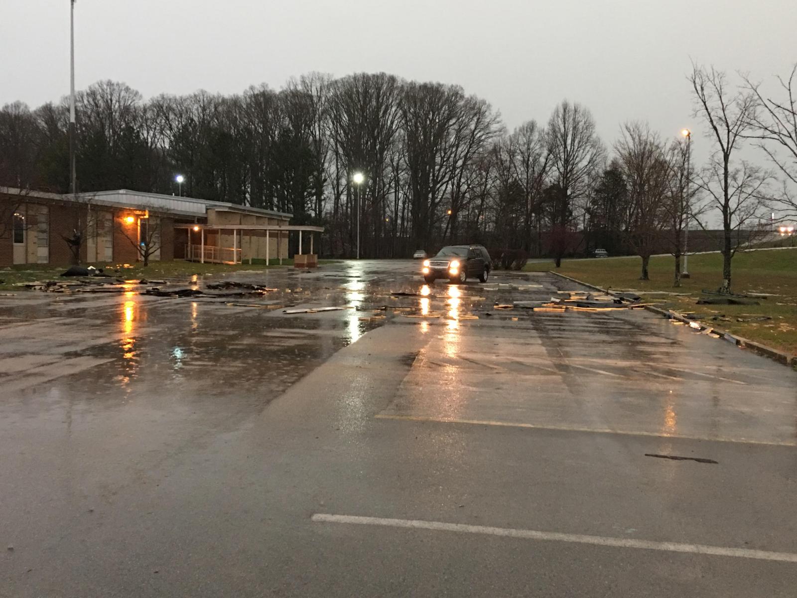
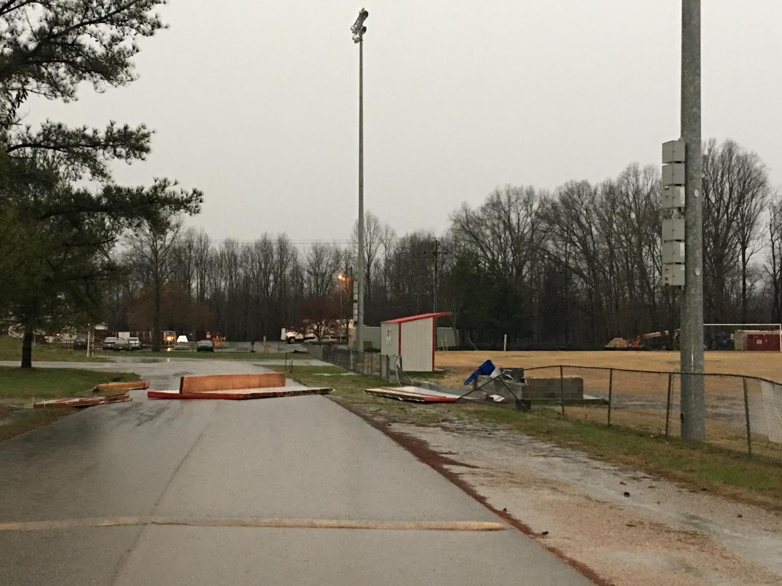
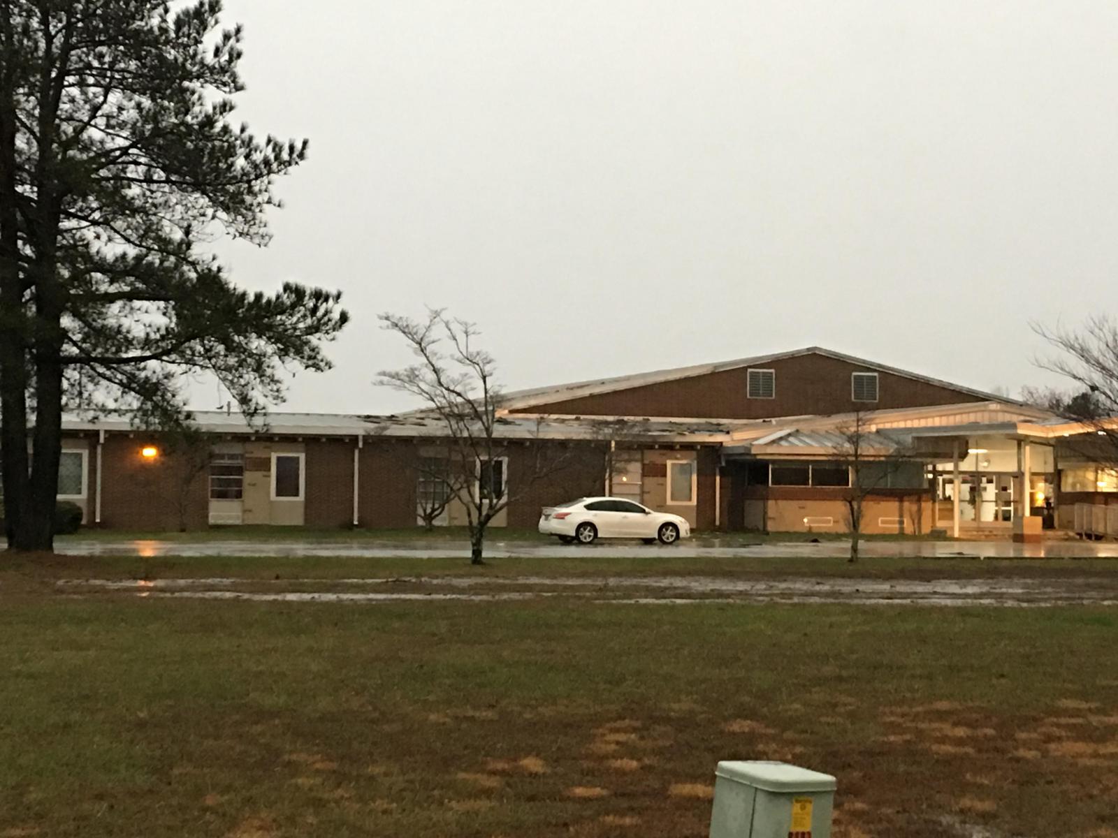
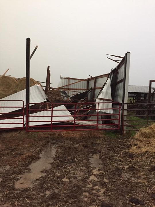
Some of the worst wind damage occurred along a segment of the MCS called a bow echo, which is commonly associated with damaging winds. This bow echo moved from Williamson and Rutherford Counties across Cannon, Coffee, Warren, Van Buren, and Grundy Counties during the late afternoon hours. Based on damage reports, photos, and radar data, winds are estimated to have reached over 90 mph in parts of these counties. Damage included a roof blown off a school in Christiana (Rutherford County); numerous trees and power poles snapped, a tractor trailer blown over onto a car, and structural damage to a few homes in Murfreesboro (Rutherford County); structural damage to homes and barns being destroyed near the Iconium community (Cannon County); numerous trees falling on campers and RVs in Fall Creek Falls State Park (Van Buren County); and numerous trees, power lines, and power poles knocked down in Manchester (Coffee County). |
| Radar | |
| OHX BR/BV Radar Loop - 230 PM CDT to 600 PM CDT |
| Reports & Outlooks | ||
| SPC Storm Reports | SPC Event Archive | Local Storm Reports |
| Photos | |
 |
|
|
Truck blown over onto car in Murfreesboro (Rutherford County) |
|
 |
|
|
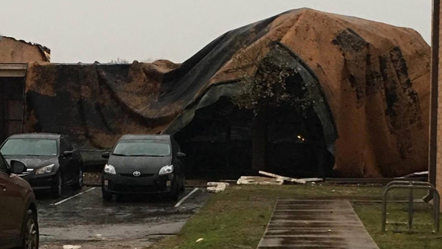
Wind Damage at Christiana Elementary School (Rutherford County) |
|
 |
 |
 |
 |
|
Wind Damage in Cannon County |
|
 |
|
|
Large hail in Lewisburg, TN (Marshall County) |
|
 |
 |
 |
 |
| Wind Damage in Coffee County Photos via Coffee County Emergency Management |
|

