| Tornado Statistics | ||||||||
| # | Counties | Rating | Time (CDT) | Length (miles) | Width (yards) | Fatalities | Injuries | |
| 1 | Bedford | EF1 | 347 PM | 7.1 miles | 150 yards | 0 | 0 | |
| 2 | Warren | EF1 | 459 PM | 3.4 miles | 125 yards | 0 | 1 | |
| Overview | |
|
A powerful spring storm system moved across the eastern US on Wednesday, April 5, 2017. This system brought numerous severe thunderstorms to many states from the Midwest into the Southeast, with hundreds of reports of large hail, wind damage, and numerous tornadoes. Across Middle Tennessee, several supercell thunderstorms developed along and ahead of a cold front that moved west to east across the area, with dozens of reports of large hail up to golf ball size, wind damage, and two confirmed EF1 tornadoes. In addition, strong westerly gradient winds measured up to 50 mph behind the cold front caused wind damage in several areas. |
| Reports & Outlooks | ||||
| SPC Storm Reports | SPC Event Archive | Local Storm Reports | Storm Surveys | Peak Wind Gusts |
| EF1 Bedford County Tornado | |
| Counties: | Bedford |
| Time: | 347 PM CDT |
| EF Scale: | EF1 |
| Estimated Peak Winds: | 95 mph |
| Damage Path Length: | 7.1 miles |
| Damage Path Width: | 150 yards |
| Fatalities: | 0 |
| Injuries | 0 |
|
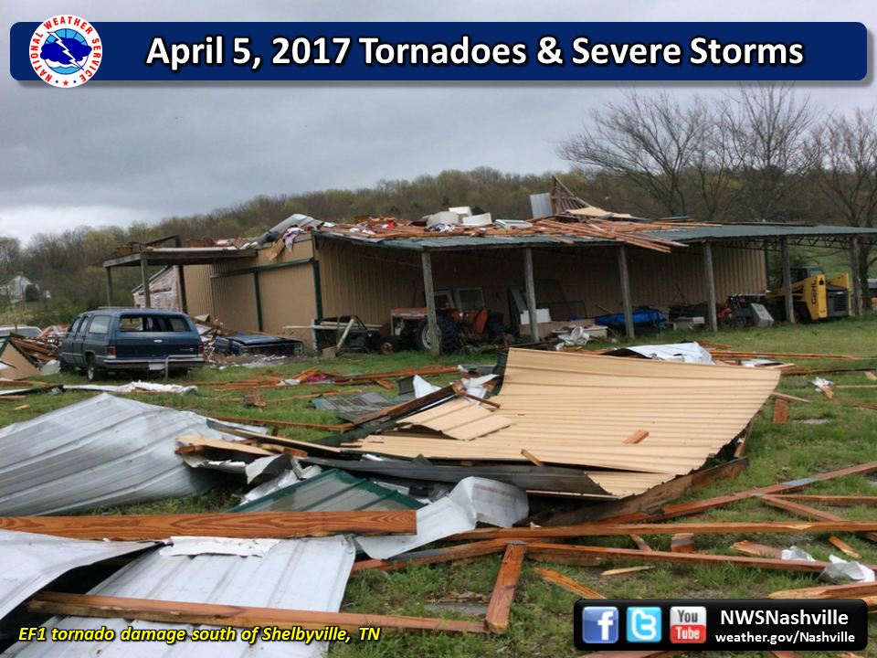
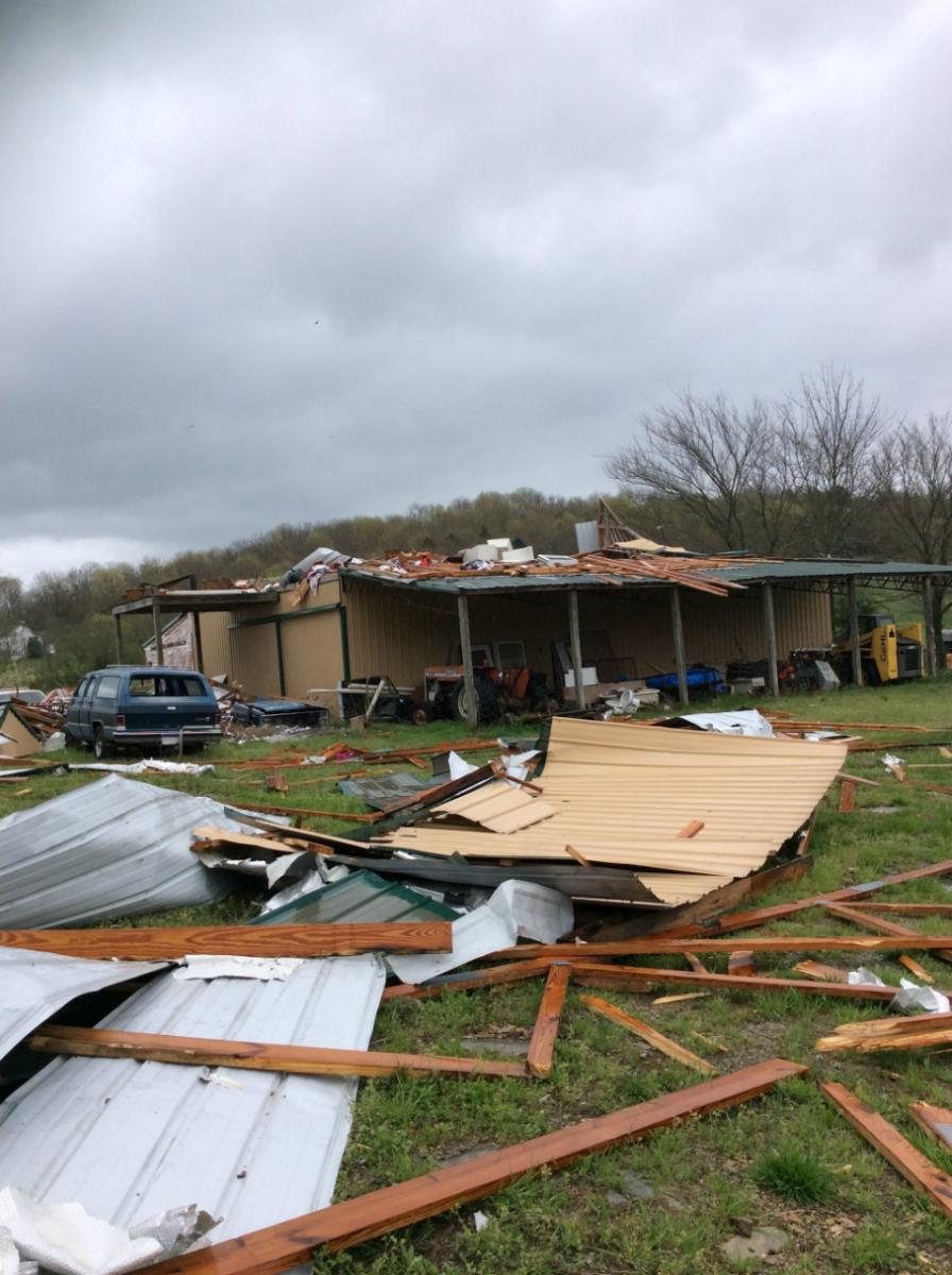
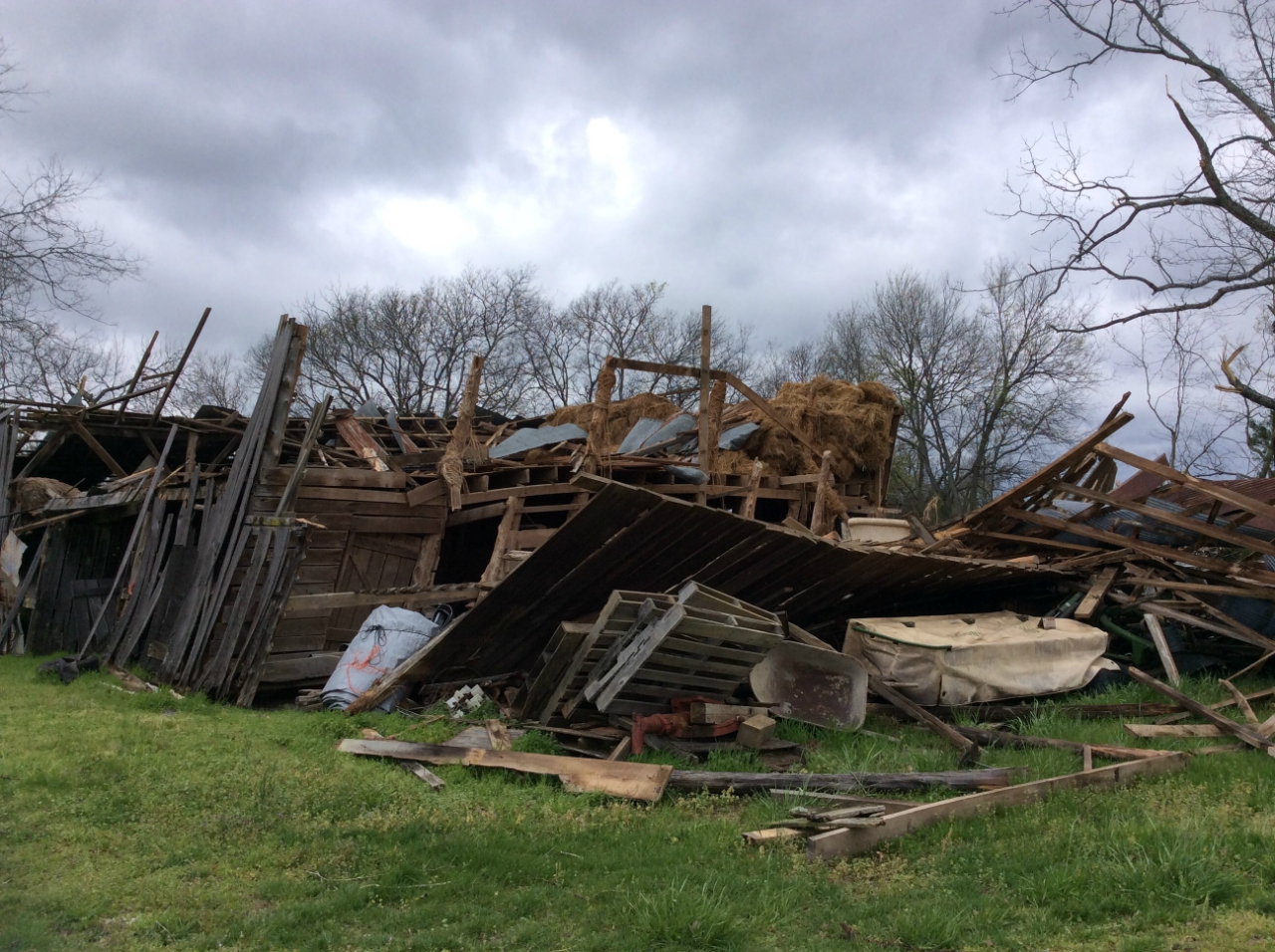
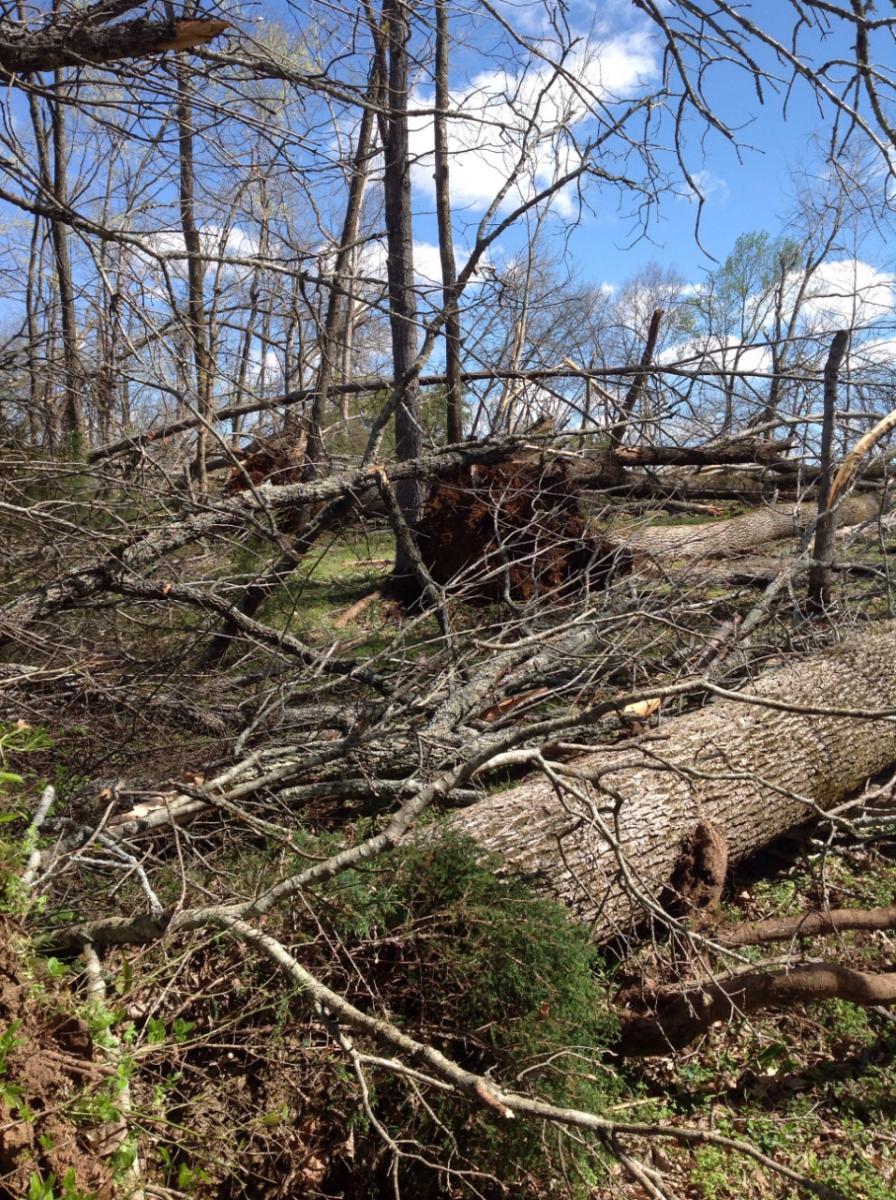
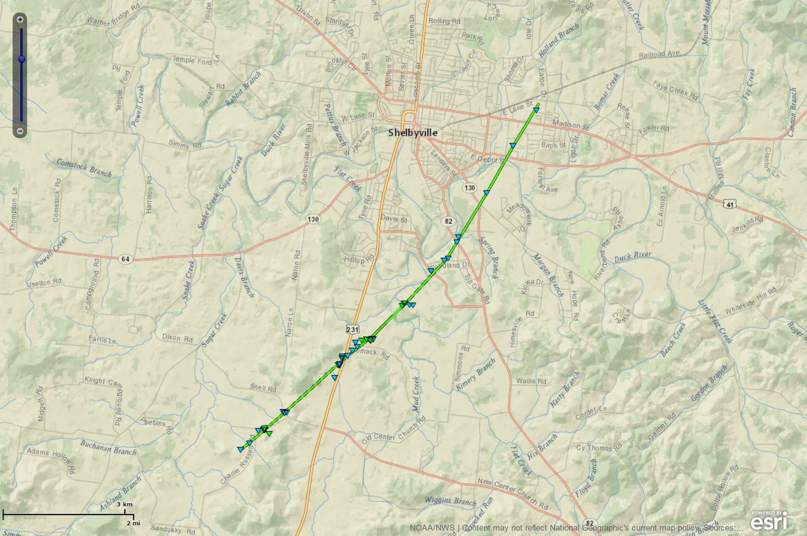
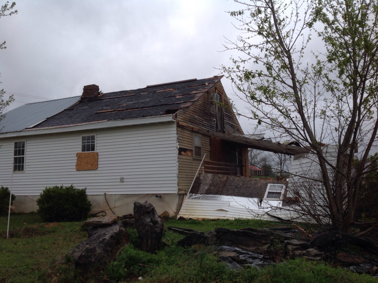
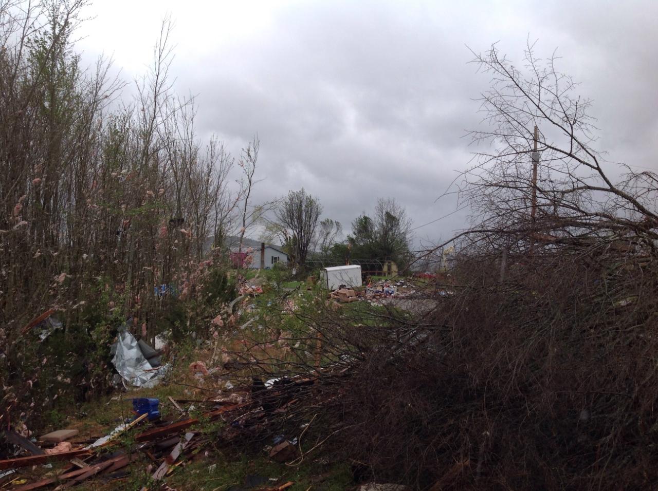
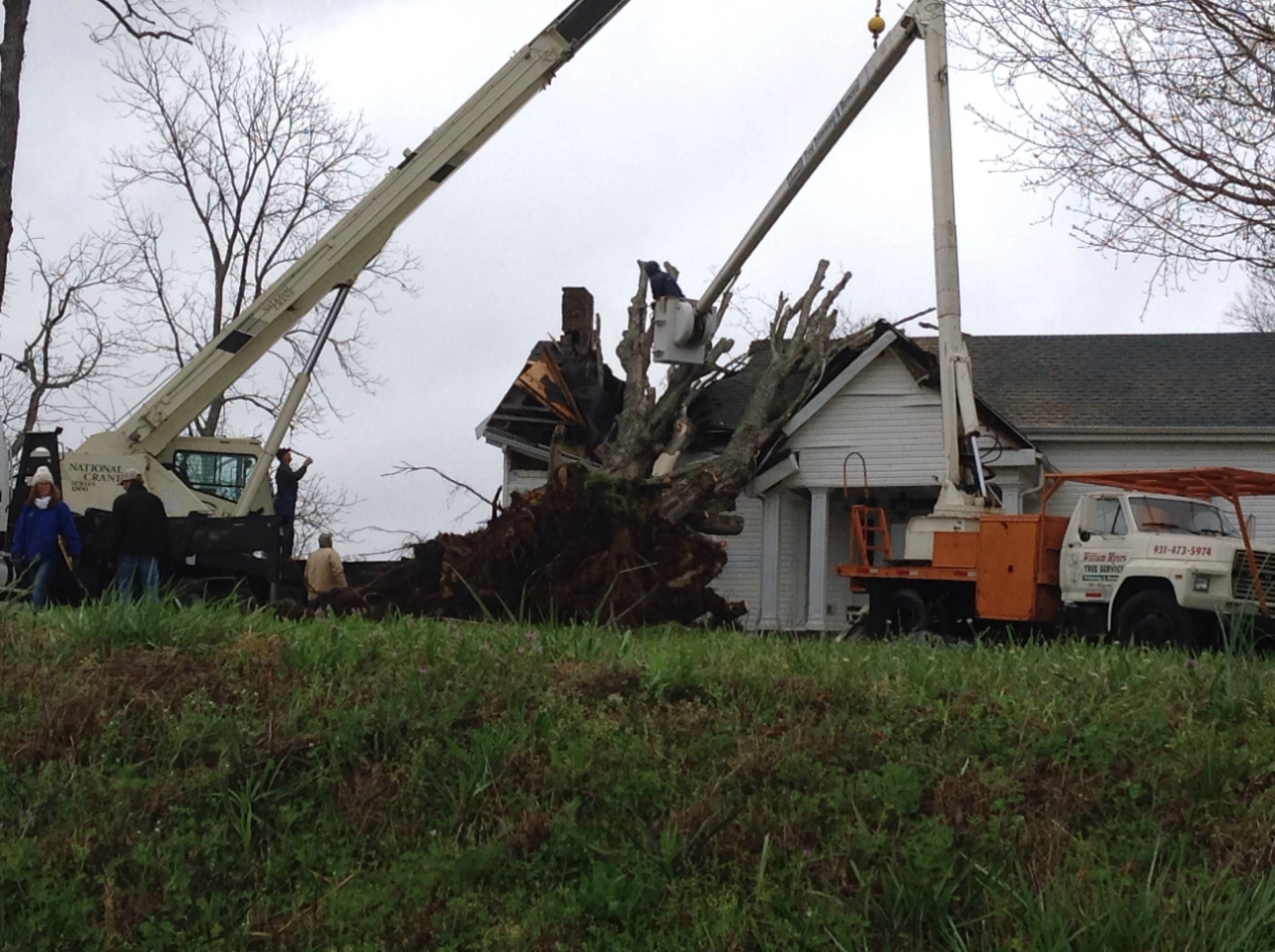
Storm Survey: A rare and unique anticyclonic landspout tornado touched down in southern Bedford County off a left splitting supercell and an anticyclonic rear flank downdraft coupled with strong southwesterly surface flow. The damage path started off of Charlie Russell Road consisting of uprooted and snapped trees as well as a barn sustaining significant damage from rear flank downdraft winds. The path continued northeast uprooting and snapping dozens of hardwood and softwood trees. Off of Highway 412, several homes sustained roof damage as well as loss of underpinning off of a couple of mobile homes. Additional barn damage was observed on Womack Road along with several more trees uprooted and snapped. Significant tree damage occurred off of Narrows Lane including a 4ft wide oak tree snapped at the base. The tornado then weakened and continued northeast across Highway 82 and Highway 130 blowing down more trees. Entering Shelbyville, the tornado weakened further, but still blew a boat across a parking lot, shifted a few cars, and tossed a dumpster at the Davis Estates Apartments on Anthony Lane, then blew down some playground equipment at Coopers Steel Manufacturing on Hillcrest Drive before lifting. The tornado was widely viewed and documented on video by numerous residents of the area, and based on the videos the path length was increased from the originally estimated 5.4 miles to 7.1 miles. NWS Nashville greatly appreciates the opinions and expertise from NWS Norman and NWS Huntsville in determining the characteristics of this very unique event. |
|
|
Bedford County Damage Survey Photos & Map: |
|
 |
 |
 |
 |
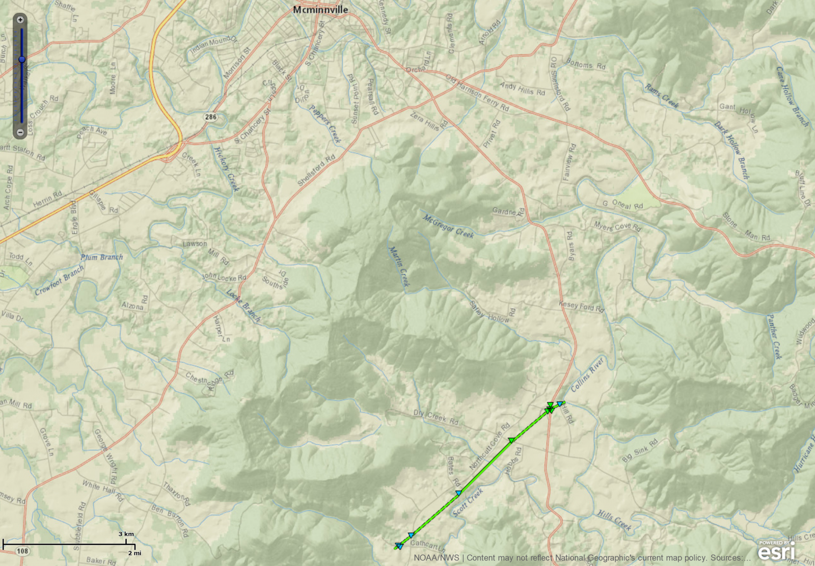
| EF1 Irving College Tornado | ||||||||
| Counties: | Warren | |||||||
| Time: | 459 PM CDT | |||||||
| EF Scale: | EF1 | |||||||
| Estimated Peak Winds: | 95 mph | |||||||
| Damage Path Length: | 3.4 miles | |||||||
| Damage Path Width: | 125 yards | |||||||
| Fatalities: | 0 | |||||||
| Injuries | 1 | |||||||
|
Storm Survey:
|
||||||||
|
Warren County Damage Survey Photos & Map: |
||||||||
 |
 |
|||||||
 |
 |
|||||||

