Nashville, TN
Weather Forecast Office

| Tornado Statistics | ||||||||
| # | Counties | Rating | Time (CDT) | Length (miles) | Width (yards) | Fatalities | Injuries | |
| 1 | Smith | EF0 | 1136 AM | 2.1 miles | 75 yards | 0 | 0 | |
| Overview | |
| A low pressure system traversing middle Tennessee brought rain and a couple severe thunderstorms on May 24, 2017. The Smith County storm ended up producing a brief EF-0 tornado near Mitchell Lane shortly before noon, where trees were uprooted/snapped. Two barns were also destroyed off of Hiwassee Road. |
| Radar | |
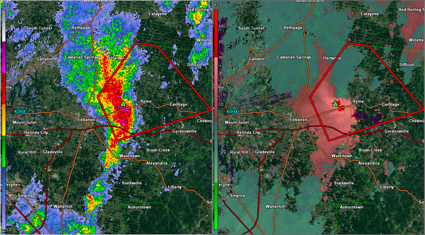 |
|
| OHX BR/SRV Radar Loop of Smith County Tornado |
|
| Reports & Outlooks | |||
| SPC Storm Reports | SPC Event Archive | Local Storm Reports | Public Information Statements |
| EF0 Smith County Tornado | |
| Counties: | Smith |
| Time: | 1136-1139 AM |
| EF Scale: | EF0 |
| Estimated Peak Winds: | 75-80 mph |
| Damage Path Length: | 2.1 miles |
| Damage Path Width: | 75 yards |
| Fatalities: | 0 |
| Injuries | 0 |
|
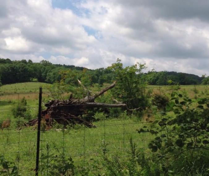
Storm Survey: A weak EF-0 tornado touched down in far western Smith County just east of the Wilson/Smith County line on Mitchell Lane. Damage was mostly confined to dozens of trees snapped or uprooted along the 2 mile path. Two barns were also uplifted and destroyed off of Hiwassee Road in western Smith County. |
|
|
Smith County Damage Survey Photos: |
|
 |
 |
 |
|
US Dept of Commerce
National Oceanic and Atmospheric Administration
National Weather Service
Nashville, TN
500 Weather Station Road
Old Hickory, TN 37138
615-754-8500
Comments? Questions? Please Contact Us.

